

Ward of Clett
Good walks are even better shared.
Overview
Ward of Clett
Introduction
Nestled in the untamed beauty of the Shetland Islands, the Ward of Clett stands as a Marilyn, captivating hikers and outdoor enthusiasts alike. Majestically rising to an elevation of 378 meters, this hill offers a charming blend of tranquillity and adventure.
Getting There
Access to Ward of Clett is relatively straightforward, particularly via Clett Road. It's a delightful breeze of a hike, making the summit achievable even on a busy day when you just want to stretch your legs.
Geology
The terrain showcases the typical Shetland mix of peat and silty soils atop ancient volcanic rock. Those with an interest in geology may appreciate the hidden stories told by ancient lava flows—who knew a hike could double as a history lesson?
The Hike
The route from Clett Road involves a distance of about 2.5 km, taking roughly 1.5 hours to complete. Despite the easy classification, keep an eye on the patches of boggy terrain that can catch the unwary. Good footwear is a wise investment for this journey.
Summit Experience
Upon reaching the summit, the modest cairn welcomes you like an old friend. Here, panoramic views of the Shetland countryside unfold before you, with delights for the eyes including Fair Isle in the distance.
Wildlife and Flora
Along the way, you'll likely encounter a variety of wildflowers and, if you’re lucky, some of the local wildlife. Watch for the beautiful Shetland ponies grazing nearby—fully equipped with adorable hairdos.
Facilities
Once you return to the ground, you might fancy a bite or a cuppa. Lerwick is not only the capital of Shetland but a hub of cafes and shops. A perfect reward after your triumph!
Conclusion
The Ward of Clett, with its gentle slopes and rewarding views, is a gem for those looking to experience the spirit of Shetland. So lace up those boots, keep your eyes peeled for wildlife, and enjoy what this beautiful corner of the UK has to offer. Just remember: if the weather changes, don’t say I didn’t warn you!
Final Thoughts
Happy hiking, and may your boots stay dry and your spirit adventurous!
Explore routes near Ward of Clett
Public walks starting within 80 km of this hill. Nearby does not mean a route reaches the summit; check its map and access before setting out.
No public routes are currently listed within 80 km of Ward of Clett on Walkmates. This does not mean there are no paths here. Explore the map and check local access information before planning a walk.
Route planning notes
These notes describe possible approaches, not verified navigable routes or permission to cross land. Check current paths, local access rules and conditions before setting out.
Clett Road Access
A straightforward approach from the nearby Clett Road, leading you directly to the summit without the need for a compass, unless you're trying to find your way back.
Make a day of it, together
Find someone to share the walk with, or organise a day out along a route you like.
Photo Gallery
View all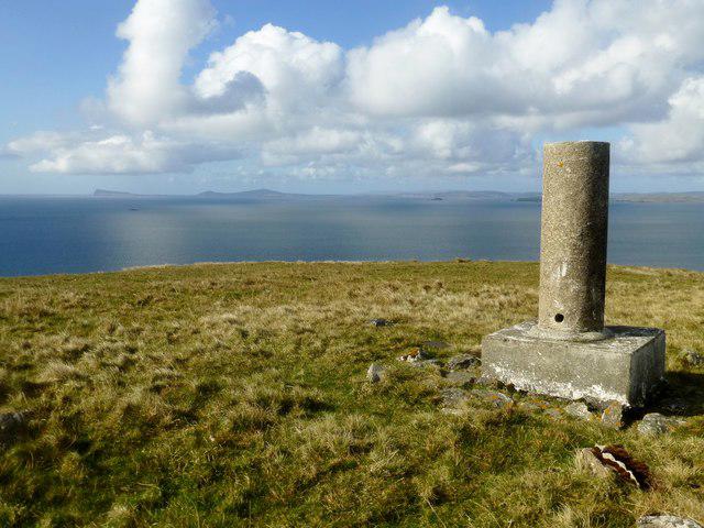 Photo could not load
HU5461 : Vanessa Trig On Ward of Clett
Rude Health
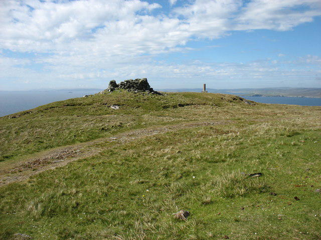 Photo could not load
HU5561 : The summit of Ward of Clett, Whalsay
David Purchase
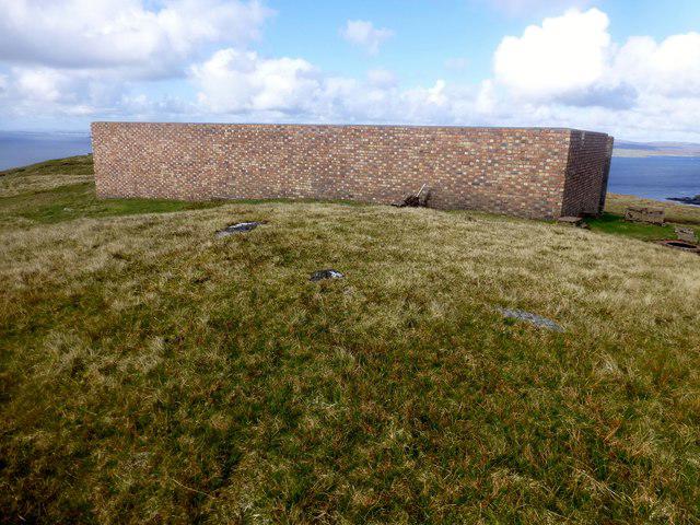 Photo could not load
HU5561 : Ward of Clett
Rude Health
Hill facts and local notes
Classifications
Elevation
122m
400 ft
Prominence
122m
Coordinates
60.3338, -1.0049
HU550614
OS Map
2
Explorer: 468
At the Summit
The summit is marked by a modest cairn and offers open views across the surrounding countryside, letting you know you've conquered yet another hill.
Terrain & Geology
Ward of Clett primarily consists of Peat and Silty soils overlying volcanic rock formations, typical of northern Scottish geology. The remnants of ancient lava flows can be spotted in certain areas.
Views & Scenery
From the summit, you can catch breathtaking views of the surrounding hills, as well as the picturesque Shetland coastline. On a clear day, Fair Isle and the Atlantic Ocean are stunning backdrops.
History & Heritage
Name Origin
The name 'Clett' is derived from Old Norse meaning 'cliff', aptly describing the area’s dramatic topography.
Historical Significance
The area around Ward of Clett is rich in Shetland's history, with evidence of early settlements and Viking activity still visible in the landscape.
Getting There & Facilities
Check current local access restrictions, parking rules and transport timetables before travelling. These notes do not confirm public access to the summit.
Parking
There is limited parking available near Clett Road, where you can leave your car—don’t forget to mind your manners and not block any locals!
Public Transport
Buses from Lerwick operate regularly to various points around Shetland. Check the local bus schedule for the best options.
Nearby Facilities
Lerwick offers a variety of facilities including cafes, shops, and public toilets. Perfect for a celebratory coffee after your hike.
Safety Information
Known Hazards
- Be wary of sudden changes in weather conditions, as Shetland is known for its capricious climate. Wet and boggy patches can be tricky, so good footwear is a must.
General Safety Tips
- Check weather conditions before setting out
- Carry appropriate clothing and equipment
- Let someone know your planned route
- Take a map, compass, and GPS device
- Carry emergency supplies: food, water, first aid kit, torch
Hills
Some common questions about the hills answered
Are there group walks up Ward of Clett?
Many walkers use Walkmates to join or organise walks with others. You can check for group walks around Ward of Clett through the maps
Are there other walkers around Ward of Clett?
Activity varies by location and time, but Walkmates lets you see whether others have shared walks or shown interest in this area. Find other people through the walking friends search walking friends for Ward of Clett search or of course create your own walk for Ward of Clett
Can I organise a walk to Ward of Clett?
Yes. If there aren’t any walks listed already, you can create a walk and make it available for others to join.
If you're signed up to Walkmates, you can create a walk to Ward of Clett.
How do I find a walk up this hill?
There are often multiple ways to walk this hill, depending on experience and route preference. Walkmates helps you explore walks and routes that others have shared.
Can I suggest a new route up Ward of Clett?
Yes. You can suggest or create routes to share with others. Walkmates focuses on the social side of walking, so routes are used to help people organise walks and explore areas together, rather than as detailed navigation tools or route libraries.
Other uses really appreciate knowledgeable walkers sharing their routes. Share your favourite route to Ward of Clett here
The is an error or something incorrect about this hill. How do I let you know?
We always strive to keep the information on Walkmates as accurate as possible. If you find an error, please let us know through the contact form and we'll aim to correct it as quickly as possible
Community Discussion
Comments
Location
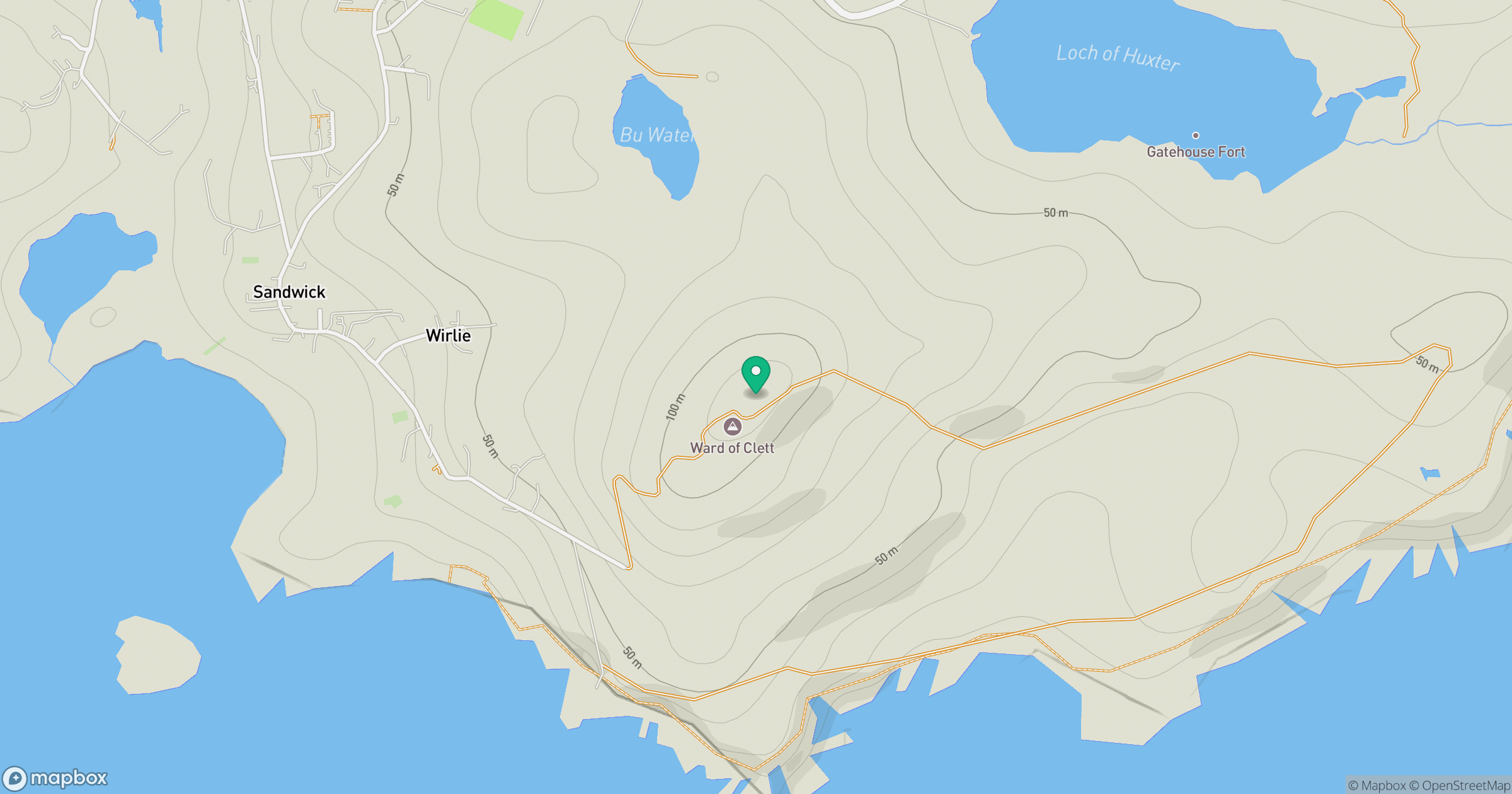
Grid reference: HU550614
View on OpenStreetMapOpens a map in a new tab, centred on the hill.
Hills within 30 km
Straight-line distance, not a walking route or confirmation of access.
Hill of Gardin
140m
Noss Head
181m
Ward of Bressay
226m
Hill of Hamarsland
158m
Hill of Moustoft
176m
No comments yet. Be the first.