

Hoo Kame
Good walks are even better shared.
Overview
Hoo Kame: An Adventure Awaits
Overview
Hoo Kame, a delightful Marilyn located within the stunning Pennines, gives hikers a gift of nature wrapped in rolling hills and stunning views. Standing at an elevation of 305 meters, this hill may not be the tallest in the region, but it offers much in character and charm.
Geology
The geology of Hoo Kame is primarily composed of sandstone, with sedimentary structures that hint at the ancient forces that shaped this beautiful land. Examining the rock formations could easily spark a fascination for geology, or at the very least, provide a nice place to take a break and ponder life’s great mysteries while enjoying a snack.
Routes
A popular way to summit Hoo Kame is by taking the Circular Route. This route spans 5 kilometres and takes about 2 hours to complete, making it perfect for families or those looking to imbibe nature without too much fervour. The route provides a moderate challenge, allowing for plenty of photo opportunities.
Summit Features
At the very top, you will be greeted by a sturdy trig point, a classic feature of British hills. It’s the perfect spot for a celebratory selfie or simply to sit quietly and soak in the panoramic views.
Terrain Type
The terrain here is mainly grassy, with a few rocky patches that add a touch of adventure. A good pair of walking boots will serve you well, especially when navigating the occasional uneven ground.
Views
Once you've reached the summit, prepare to be awed by the picturesque landscape that surrounds you. Those who venture here in spring or autumn will be particularly lucky, as these seasons offer the best visibility and vibrant colours. Be sure to pack your camera and perhaps a journal to capture your thoughts in this serene setting.
Hazards
As always, be wary of the whims of the weather gods. The Pennines are known for their rapid weather shifts, so make sure to pack accordingly! It’s best to be prepared for anything from sunshine to a sudden downpour.
Nearby Summits
For those looking to extend their hike, consider making your way to the neighbouring Hawkshead Hill, which adds to the adventure with its slightly higher elevation of 352 meters.
Access
Getting to Hoo Kame is straightforward. There’s plenty of parking in the nearby village of Hoo, and for those opting for public transport, regular bus service from Glossop makes access easy.
Facilities
Before or after your hike, stop by the local café for a warm drink and a slice of cake. Public toilets are also available in the village, allowing you to refresh before your trek.
History
The etymology of the name 'Hoo' is rooted in Old English, indicating its status as a hill. It makes one think of how long these slopes have been trodden by both two-legged and four-legged visitors alike! Historically, Hoo Kame has served as a crucial meeting point for sheep farmers in the region, emphasizing its cultural significance in the pastoral lifestyle that thrives here.
Enjoy your adventure on Hoo Kame, where every step is an invitation to appreciate the beauty of nature!
Explore routes near Hoo Kame
Public walks starting within 80 km of this hill. Nearby does not mean a route reaches the summit; check its map and access before setting out.
No public routes are currently listed within 80 km of Hoo Kame on Walkmates. This does not mean there are no paths here. Explore the map and check local access information before planning a walk.
Route planning notes
These notes describe possible approaches, not verified navigable routes or permission to cross land. Check current paths, local access rules and conditions before setting out.
The Circular Route
A friendly circular route that showcases the best of Hoo Kame’s surroundings, including gentle inclines and scenic views.
Make a day of it, together
Find someone to share the walk with, or organise a day out along a route you like.
Photo Gallery
View all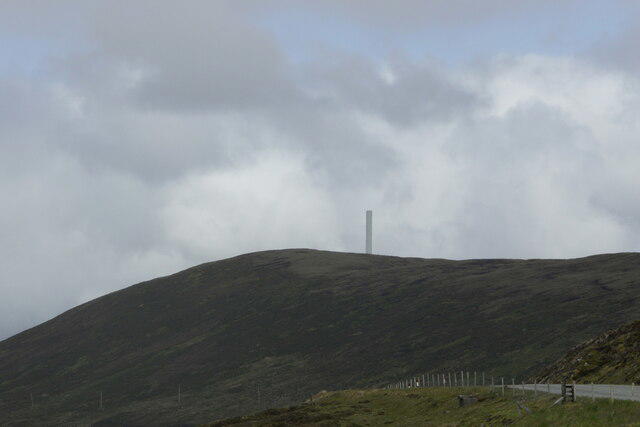 Photo could not load
HU4258 : Aerogenerator beyond Hoo Kame
Mike Pennington
 Photo could not load
HU4258 : Windmill on Hoo Kame
Mike Pennington
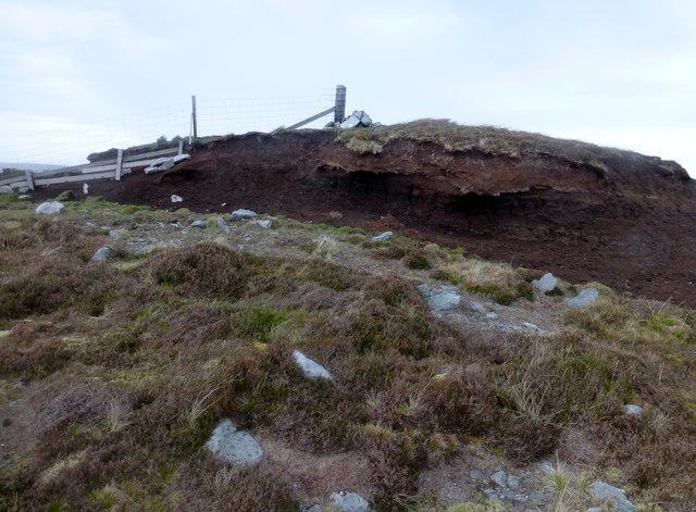 Photo could not load
HU4258 : Hoo Kame
Rude Health
Hill facts and local notes
Classifications
Elevation
209m
686 ft
Prominence
120m
Coordinates
60.3125, -1.2400
HU420589
OS Map
2 3
Explorer: 467E 468
At the Summit
The summit features a small but sturdy trig point, perfect for a quick photo op to brag to your friends who couldn’t make the hike.
Terrain & Geology
Hoo Kame is primarily comprised of sandstone with some fascinating sedimentary structures on display, indicative of the area's geological history.
Views & Scenery
From the summit, one can enjoy breathtaking views of the surrounding Pennine peaks as well as the picturesque valleys below.
History & Heritage
Name Origin
The name 'Hoo' is derived from Old English, meaning 'hill', making it rather fitting don't you think?
Historical Significance
Hoo Kame has been a meeting point for local sheep farmers for generations, contributing to the area’s rich pastoral heritage.
Getting There & Facilities
Check current local access restrictions, parking rules and transport timetables before travelling. These notes do not confirm public access to the summit.
Parking
There is ample parking available at the village of Hoo, just a short walk from the trailhead.
Public Transport
Buses to Hoo run regularly from the nearest town of Glossop, making it accessible for those using public transport.
Nearby Facilities
The village offers a charming café and public toilets for your convenience before and after your adventure.
Safety Information
Known Hazards
- Watch for sudden changes in weather; the Pennines are notorious for their unpredictable conditions.
General Safety Tips
- Check weather conditions before setting out
- Carry appropriate clothing and equipment
- Let someone know your planned route
- Take a map, compass, and GPS device
- Carry emergency supplies: food, water, first aid kit, torch
Hills
Some common questions about the hills answered
Are there group walks up Hoo Kame?
Many walkers use Walkmates to join or organise walks with others. You can check for group walks around Hoo Kame through the maps
Are there other walkers around Hoo Kame?
Activity varies by location and time, but Walkmates lets you see whether others have shared walks or shown interest in this area. Find other people through the walking friends search walking friends for Hoo Kame search or of course create your own walk for Hoo Kame
Can I organise a walk to Hoo Kame?
Yes. If there aren’t any walks listed already, you can create a walk and make it available for others to join.
If you're signed up to Walkmates, you can create a walk to Hoo Kame.
How do I find a walk up this hill?
There are often multiple ways to walk this hill, depending on experience and route preference. Walkmates helps you explore walks and routes that others have shared.
Can I suggest a new route up Hoo Kame?
Yes. You can suggest or create routes to share with others. Walkmates focuses on the social side of walking, so routes are used to help people organise walks and explore areas together, rather than as detailed navigation tools or route libraries.
Other uses really appreciate knowledgeable walkers sharing their routes. Share your favourite route to Hoo Kame here
The is an error or something incorrect about this hill. How do I let you know?
We always strive to keep the information on Walkmates as accurate as possible. If you find an error, please let us know through the contact form and we'll aim to correct it as quickly as possible
Community Discussion
Comments
Location
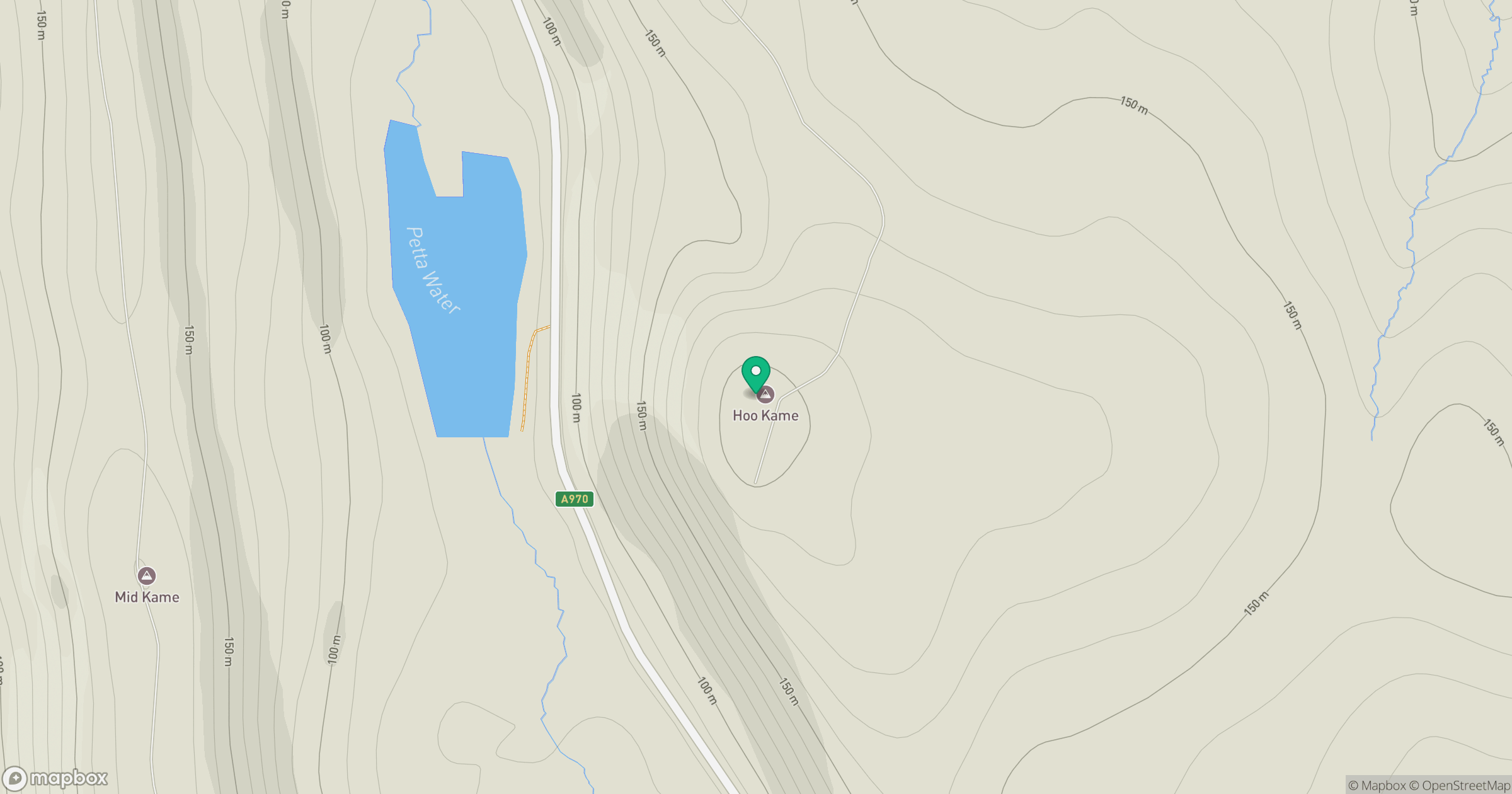
Grid reference: HU420589
View on OpenStreetMapOpens a map in a new tab, centred on the hill.
Hills within 30 km
Straight-line distance, not a walking route or confirmation of access.
Ronas Hill
450m
Hill of Moustoft
176m
Hill of Hamarsland
158m
Weisdale Hill
260m
Hill of Gardin
140m
No comments yet. Be the first.