

Cunnigill Hill
Good walks are even better shared.
Overview
Cunnigill Hill: An Overview
Welcome to Cunnigill Hill, a delightful Marilyn in the Lincolnshire Wolds that promises a stunning adventure for your boots. At an elevation of 165 meters, it may not be the highest hill you'll climb, but its scenic views and charming landscapes make it a worthy trip.
Geology
The hill is primarily formed of limestone and chalk, typical of this region's rolling countryside. This geological composition provides not just stability but also creates fascinating wildlife habitats. Keep your eyes peeled for the unique flora and fauna that thrive here, telling tales of a time when this area was covered in ancient seas. One could say it's a bit of a rock star!
Routes
A popular route is the Cunnigill Hill Circular. Stretching around 5.4 kilometers, this moderate path will take you through idyllic landscapes, ensuring your legs get a good workout while your eyes feast on the surrounding beauty. Approximately two hours of pleasure awaits!
Summit Features
Upon reaching the top, you'll find a modest cairn waiting to celebrate your effort. It's the perfect little rest stop to catch your breath and enjoy a view.
Terrain Type
Expect grassy slopes and gentle rocky outcrops leading you to nature’s uplifting spectacle. It's the type of terrain that invites you to take it slow and absorb the surroundings.
Views
Don't forget your camera! The views stretch across the Lincolnshire Wolds and, on particularly clear days, you might just spot the North Sea in the distance. These are best enjoyed in spring and early autumn when the landscape is awash with vibrant colours.
Hazards
Be cautious of slick spots after rainfall, and if you're out enjoying the greenery, watch your step for the occasional sheep surprise – they do love to leave little gifts!
Access
For car enthusiasts, there's a convenient layby off A631 near the starting point. Public transport options are on the lighter side, with a bus service from nearby Louth, so plan accordingly.
Facilities
After your hike, a quaint café in Louth is waiting to reward your efforts with a cup of one of the tastiest brews. Public toilets are also available in the town’s market area for those urgent nature calls!
History
Linguistically, Cunnigill evokes thoughts of ancient vigour, meaning ‘hill of the cuning’. Historically, it has been a cherished landmark for generations, reflecting the agrarian life surrounding it.
In summary, Cunnigill Hill is a treasure among the Lincolnshire Wolds, providing a moderate hiking experience with stunning views and a dash of history. Whether you're an experienced hiker or just fancy a lovely stroll in nature, Cunnigill has something for everyone. So lace up those hiking boots and head out!
Explore routes near Cunnigill Hill
Public walks starting within 80 km of this hill. Nearby does not mean a route reaches the summit; check its map and access before setting out.
No public routes are currently listed within 80 km of Cunnigill Hill on Walkmates. This does not mean there are no paths here. Explore the map and check local access information before planning a walk.
Route planning notes
These notes describe possible approaches, not verified navigable routes or permission to cross land. Check current paths, local access rules and conditions before setting out.
Cunnigill Hill Circular
A delightful circular route that takes in the rolling countryside, allowing hikers to experience both the hill and the surrounding Wolds.
Make a day of it, together
Find someone to share the walk with, or organise a day out along a route you like.
Photo Gallery
View all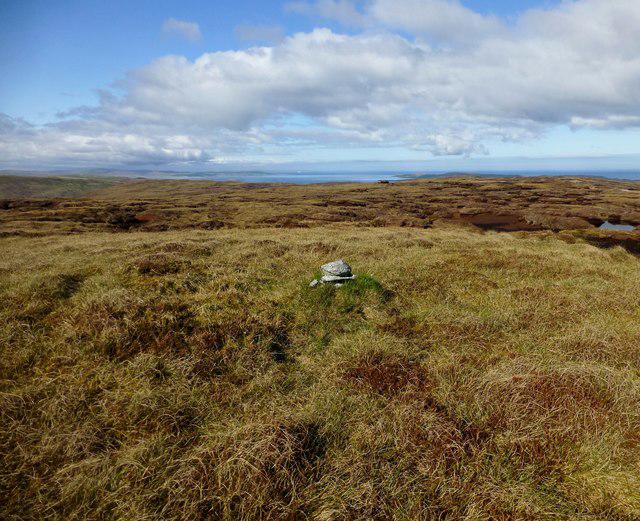 Photo could not load
HU4367 : Cunnigill Hill
Rude Health
Hill facts and local notes
Classifications
Elevation
176m
577 ft
Prominence
127m
Coordinates
60.3895, -1.2175
HU432675
OS Map
2 3
Explorer: 468
At the Summit
The summit features a modest cairn, providing a perfect spot to stop for a breather and snap that all-important selfie.
Terrain & Geology
Cunnigill Hill is primarily composed of limestone and chalk, offering a glimpse into the geological history of the area, with unique formations that tell tales of ancient marine environments.
Views & Scenery
From the summit, you can enjoy panoramic views of the Lincolnshire Wolds, with glimpses of the North Sea on a clear day.
History & Heritage
Name Origin
The name ‘Cunnigill’ likely derives from old English, meaning ‘hill of the cuning’ which refers to a place of high ground.
Historical Significance
The hill has been a local landmark for centuries, historically associated with the agricultural life of the Wolds.
Getting There & Facilities
Check current local access restrictions, parking rules and transport timetables before travelling. These notes do not confirm public access to the summit.
Parking
There is a small layby on the A631 near the start of the route, suitable for a few cars.
Public Transport
The nearest bus service operates from Louth; check local timetables for service days and times.
Nearby Facilities
Nearby facilities include a café in Louth and public toilets located at the town's market place.
Safety Information
Known Hazards
- Occasional slick spots after rain; keep an eye out for sheep droppings if you're prone to stepping in surprises.
General Safety Tips
- Check weather conditions before setting out
- Carry appropriate clothing and equipment
- Let someone know your planned route
- Take a map, compass, and GPS device
- Carry emergency supplies: food, water, first aid kit, torch
Hills
Some common questions about the hills answered
Are there group walks up Cunnigill Hill?
Many walkers use Walkmates to join or organise walks with others. You can check for group walks around Cunnigill Hill through the maps
Are there other walkers around Cunnigill Hill?
Activity varies by location and time, but Walkmates lets you see whether others have shared walks or shown interest in this area. Find other people through the walking friends search walking friends for Cunnigill Hill search or of course create your own walk for Cunnigill Hill
Can I organise a walk to Cunnigill Hill?
Yes. If there aren’t any walks listed already, you can create a walk and make it available for others to join.
If you're signed up to Walkmates, you can create a walk to Cunnigill Hill.
How do I find a walk up this hill?
There are often multiple ways to walk this hill, depending on experience and route preference. Walkmates helps you explore walks and routes that others have shared.
Can I suggest a new route up Cunnigill Hill?
Yes. You can suggest or create routes to share with others. Walkmates focuses on the social side of walking, so routes are used to help people organise walks and explore areas together, rather than as detailed navigation tools or route libraries.
Other uses really appreciate knowledgeable walkers sharing their routes. Share your favourite route to Cunnigill Hill here
The is an error or something incorrect about this hill. How do I let you know?
We always strive to keep the information on Walkmates as accurate as possible. If you find an error, please let us know through the contact form and we'll aim to correct it as quickly as possible
Community Discussion
Comments
Location
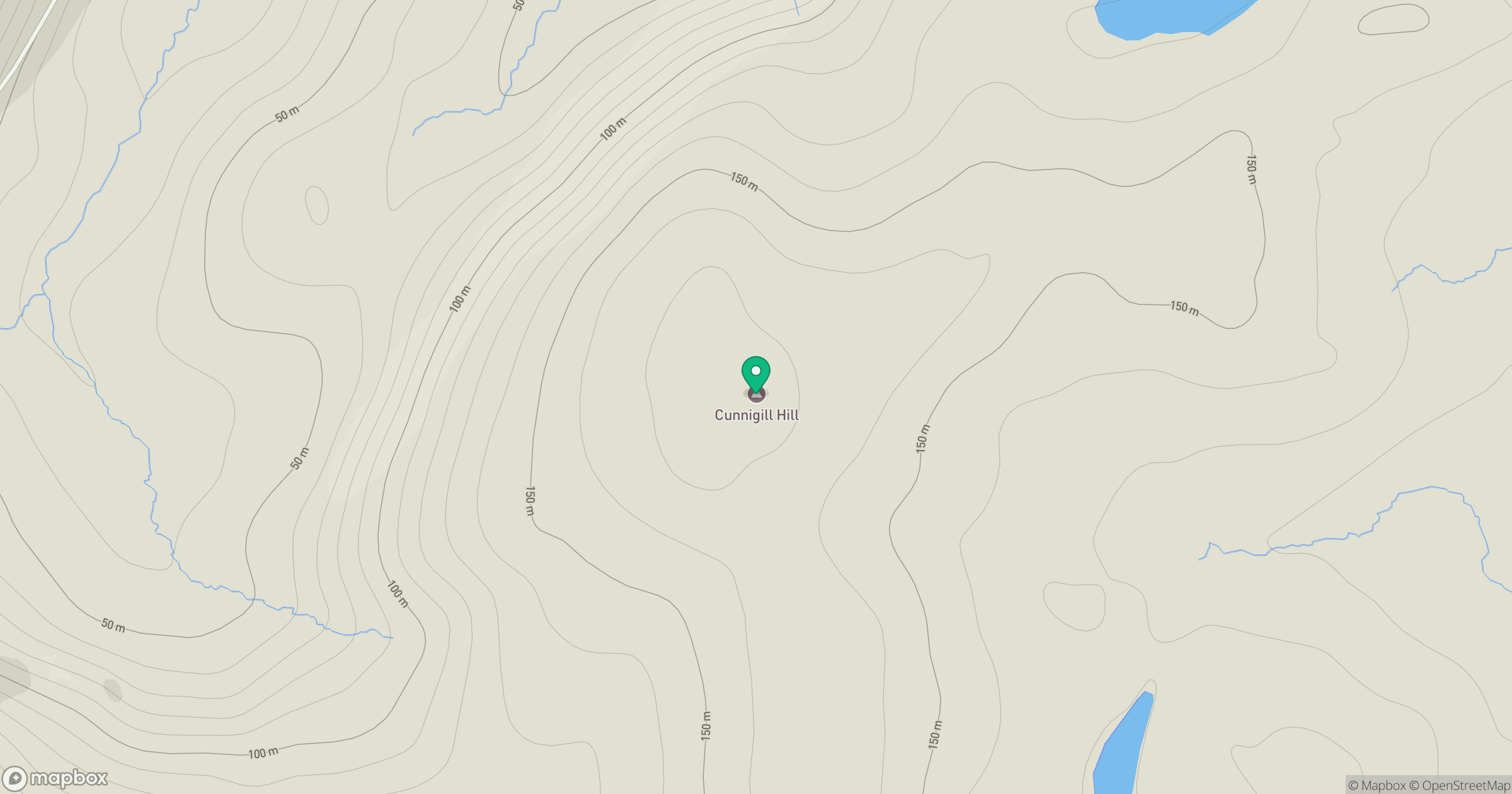
Grid reference: HU432675
View on OpenStreetMapOpens a map in a new tab, centred on the hill.
Hills within 30 km
Straight-line distance, not a walking route or confirmation of access.
Ronas Hill
450m
Hill of Gardin
140m
Hill of Moustoft
176m
Weisdale Hill
260m
Hill of Hamarsland
158m
No comments yet. Be the first.