
Tooreen
Good walks are even better shared.
Overview
Tooreen: A Hidden Gem in the Sligo Mountains
Welcome to Tooreen, a modest yet charming peak nestled in the Sligo Mountains. Standing at an elevation of 433 meters, this mountain may not be the highest, but it certainly has a personality!
Geology
Tooreen is primarily composed of sandstone and shale, steeped in the geological history of the region. These layers provide a fascinating glimpse into ancient Earth, full of stories of mountains rising and valleys forming.
Routes
Two primary routes allow hikers to experience Tooreen:
- Tooreen Circuit: A 7.5 km moderate loop that showcases the best of the lush Sligo vegetation.
- East Ridge Ascent: For those with a bit more grit, this challenging 3.5 km ascent tests your mettle while rewarding you with stunning vistas.
Summit Features
Upon reaching the summit, you'll discover a friendly cairn—a true landmark on a foggy day, just don’t expect to take it home as a souvenir.
Terrain
The terrain ranges from grassy slopes to rocky outcrops, with a smattering of bogginess to keep things interesting. Make sure you wear good hiking boots, or you may find yourself unexpectedly wading!
Views
The summit promises panoramic views, with Lough Arrow and Ben Bulben making for stellar photo ops. The best time to appreciate these views is in spring or early autumn, skipping the winter chill and summer haze.
Hazards
Be mindful of the weather; Sligo is known for its unpredictability. Slippery paths post-rain and curious wildlife may present some challenges, so pack your sense of adventure and keep those snacks tucked away!
Access
Parking is informal along the minor roads leading to the mountain's base. Public transport is available to nearby villages; just be prepared for a short taxi ride to the trailhead. Sligo Town is your best bet for refreshments and facilities.
History
The name 'Tooreen' translates to 'mound' in Irish, a nod to its ancient past. It has played a role in local legends and folklore, making it not just a hike, but a journey through time.
Conclusion
So lace up those boots and prepare for a delightful day out on Tooreen. With its enchanting views, fascinating geology, and a bit of history, it’s a hike that offers both exercise and enlightenment, whether you're a seasoned hiker or just out for a casual stroll.
Happy hiking and don’t forget to take in the view!
Explore routes near Tooreen
Public walks starting within 80 km of this hill. Nearby does not mean a route reaches the summit; check its map and access before setting out.
No public routes are currently listed within 80 km of Tooreen on Walkmates. This does not mean there are no paths here. Explore the map and check local access information before planning a walk.
Route planning notes
These notes describe possible approaches, not verified navigable routes or permission to cross land. Check current paths, local access rules and conditions before setting out.
Tooreen Circuit
A scenic loop that takes you around the base of Tooreen, passing by lush vegetation and offering glimpses of the local wildlife.
East Ridge Ascent
A direct climb up the east ridge that provides a good workout and stunning views towards the horizon.
Make a day of it, together
Find someone to share the walk with, or organise a day out along a route you like.
Hill facts and local notes
Classifications
Elevation
322m
1,056 ft
Prominence
106m
Coordinates
52.0950, -8.9010
W383940
OS Map
79
At the Summit
The summit of Tooreen features a modest cairn, which might not have won any beauty contests, but it sure is dependable on a foggy day!
Terrain & Geology
Tooreen primarily consists of sandstone and shale formations, indicative of the region's ancient geological past. The layers tell a story of continental drift and sediment deposition, making it a haven for geology enthusiasts.
Views & Scenery
From the top, you can spot Lough Arrow and the rolling hills of County Sligo, with the majestic Ben Bulben peeking over in the distance.
History & Heritage
Name Origin
The name 'Tooreen' comes from the Irish word 'tuaim', meaning 'mound' or 'tumulus', hinting at its ancient significance.
Historical Significance
The mountain has been a significant landmark for locals for centuries, often featured in local folklore and tales.
Getting There & Facilities
Check current local access restrictions, parking rules and transport timetables before travelling. These notes do not confirm public access to the summit.
Parking
Limited parking is available at the base of the mountain along the minor road. Parking is somewhat informal, so arrive early to secure a spot.
Public Transport
Regular bus services operate from Sligo town to nearby villages, though the last leg to the trailhead may require a short taxi ride.
Nearby Facilities
Facilities are limited near the trailhead; however, Sligo offers a variety of cafes, restaurants, and public toilets.
Safety Information
Known Hazards
- The typical hazards include challenging weather conditions, slippery paths due to rain, and potential wildlife encounters (keep your snacks hidden!).
General Safety Tips
- Check weather conditions before setting out
- Carry appropriate clothing and equipment
- Let someone know your planned route
- Take a map, compass, and GPS device
- Carry emergency supplies: food, water, first aid kit, torch
Hills
Some common questions about the hills answered
Are there group walks up Tooreen?
Many walkers use Walkmates to join or organise walks with others. You can check for group walks around Tooreen through the maps
Are there other walkers around Tooreen?
Activity varies by location and time, but Walkmates lets you see whether others have shared walks or shown interest in this area. Find other people through the walking friends search walking friends for Tooreen search or of course create your own walk for Tooreen
Can I organise a walk to Tooreen?
Yes. If there aren’t any walks listed already, you can create a walk and make it available for others to join.
If you're signed up to Walkmates, you can create a walk to Tooreen.
How do I find a walk up this hill?
There are often multiple ways to walk this hill, depending on experience and route preference. Walkmates helps you explore walks and routes that others have shared.
Can I suggest a new route up Tooreen?
Yes. You can suggest or create routes to share with others. Walkmates focuses on the social side of walking, so routes are used to help people organise walks and explore areas together, rather than as detailed navigation tools or route libraries.
Other uses really appreciate knowledgeable walkers sharing their routes. Share your favourite route to Tooreen here
The is an error or something incorrect about this hill. How do I let you know?
We always strive to keep the information on Walkmates as accurate as possible. If you find an error, please let us know through the contact form and we'll aim to correct it as quickly as possible
Community Discussion
Comments
Location
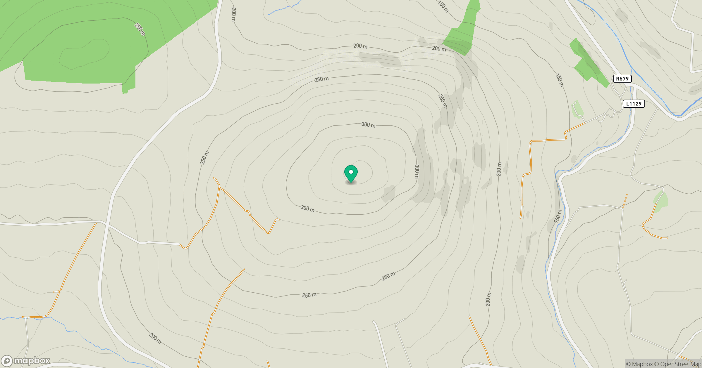
Grid reference: W383940
View on OpenStreetMapOpens a map in a new tab, centred on the hill.
Hills within 30 km
Straight-line distance, not a walking route or confirmation of access.
No comments yet. Be the first.