
Sugarloaf Hill
Good walks are even better shared.
Overview
Sugarloaf Hill
Nestled in the picturesque Brecon Beacons, Sugarloaf Hill is a remarkable hill that stands proud at 596 meters. Famous for its distinctly conical shape, it's a Marilyn that beckons hikers with promises of breathtaking views and a delightful path. The hill is composed mainly of Old Red Sandstone, formed eons ago during the Devonian period.
Geology
As you ascend, take a moment to appreciate the unique geological features. The sandstone is not only interesting but also serves as a record of the Earth's history, showcasing ancient riverbeds and sedimentary structures. Keep your eyes peeled for the fascinating rock formations that dot the hillside.
Routes
The most popular route is the Sugarloaf Circular Route, an enjoyable trek of about 5.7 km that generally takes around 3 hours to complete. This moderately challenging walk begins at the lower car park and weaves its way up through lush scenery and rocky outcrops.
Summit Features
Upon reaching the summit, you will be greeted by a stone cairn and a wooden post indicating the hill's height and the direction of various landmarks. It’s the perfect spot for a well-deserved break and to snap a few photographs that will have your friends convinced you’ve discovered paradise.
Terrain and Hazards
The terrain is predominantly grassy, but beware of rocky outcrops that can appear unexpectedly. Keep an eye on the weather, as conditions can change rapidly, and always ensure to wear appropriate footwear.
Views
From the top, the views are absolutely stunning. You can see the Black Mountains stretching out in the distance, the beautiful Usk Valley below, and on a clear day, you might even get a glimpse of the south Wales coast. The best seasons for viewing are spring and autumn when the colours come alive.
Access
Accessing Sugarloaf Hill is relatively simple. The nearest car park is located at the base, and public transport options from Abergavenny can ease your journey. While there aren’t any facilities on the hill, Abergavenny offers everything from charming cafes to cosy pubs for a post-hike meal.
History
The name ‘Sugarloaf’ comes from its resemblance to the traditional conical sugar mold, which is an interesting tidbit that adds to its charm. Historically, the hill has been a landmark for hikers and a soothing sight for locals for many years.
Considering all that's on offer, Sugarloaf Hill is a gem in the Brecon Beacons that should not be missed. Lace up those boots, bring a snack (or two), and enjoy your climb! Remember, it’s not just about the destination, but the journey too.
Explore routes near Sugarloaf Hill
Walks starting near this hill. Open a route to check its map, distance and full itinerary.
Scarva to Poyntzpass: Newry Canal and Lough Shark Return
View route
Portadown to Knock Bridge: Bann Boulevard and Moneypenny’s Lock
View route
Silent Valley to Ben Crom Dam: Reservoir Road Walk, County Down
View route
Tollymore Forest Park: River Trail near Newcastle
View route
Route planning notes
These notes describe possible approaches. Check a route's map and access information when planning your walk.
Sugarloaf Circular Route
A popular circular walk that begins at the lower car park and takes you up to the summit, offering picturesque views along the way.
Make a day of it, together
Find someone to share the walk with, or organise a day out along a route you like.
Hill facts and local notes
Classifications
Elevation
253m
830 ft
Prominence
90m
Coordinates
54.1676, -6.4497
J013254
OS Map
29
At the Summit
At the summit, you will find a sizeable stone cairn and a wooden post proudly displaying the summit elevation and compass directions.
Terrain & Geology
Sugarloaf Hill comprises predominantly Old Red Sandstone, formed in the Devonian period. The striking cliffs and distinctive conical shape make it a geological marvel worth exploring.
Views & Scenery
Stunning views of the Black Mountains, the distant South Wales coastline, and the magnificent Usk Valley are your reward for the climb.
History & Heritage
Name Origin
The name 'Sugarloaf' is thought to come from its resemblance to a sugar loaf, a type of conical sugar mold used in ancient trade.
Historical Significance
Sugarloaf Hill has a rich cultural history and has been a beloved landmark for both locals and visitors for generations.
Getting There & Facilities
Parking
There is a designated car park at the bottom of the hill near the farm, capable of accommodating a reasonable number of vehicles.
Public Transport
The nearest public transport link is the local bus service from Abergavenny, which operates several times a day.
Nearby Facilities
There are no facilities directly on the hill, but Abergavenny offers several cafes, pubs, and toilets for before or after your hike.
Safety Information
Known Hazards
- Loose rocks, sudden changes in weather, and steep sections of path can pose risks. Always be prepared and check the forecast before setting off.
General Safety Tips
- Check weather conditions before setting out
- Carry appropriate clothing and equipment
- Let someone know your planned route
- Take a map, compass, and GPS device
- Carry emergency supplies: food, water, first aid kit, torch
Hills
Some common questions about the hills answered
Are there group walks up Sugarloaf Hill?
Many walkers use Walkmates to join or organise walks with others. You can check for group walks around Sugarloaf Hill through the maps
Are there other walkers around Sugarloaf Hill?
Activity varies by location and time, but Walkmates lets you see whether others have shared walks or shown interest in this area. Find other people through the walking friends search walking friends for Sugarloaf Hill search or of course create your own walk for Sugarloaf Hill
Can I organise a walk to Sugarloaf Hill?
Yes. If there aren’t any walks listed already, you can create a walk and make it available for others to join.
If you're signed up to Walkmates, you can create a walk to Sugarloaf Hill.
How do I find a walk up this hill?
There are often multiple ways to walk this hill, depending on experience and route preference. Walkmates helps you explore walks and routes that others have shared.
Can I suggest a new route up Sugarloaf Hill?
Yes. You can suggest or create routes to share with others. Walkmates focuses on the social side of walking, so routes are used to help people organise walks and explore areas together, rather than as detailed navigation tools or route libraries.
Other uses really appreciate knowledgeable walkers sharing their routes. Share your favourite route to Sugarloaf Hill here
The is an error or something incorrect about this hill. How do I let you know?
We always strive to keep the information on Walkmates as accurate as possible. If you find an error, please let us know through the contact form and we'll aim to correct it as quickly as possible
Community Discussion
Comments
Location
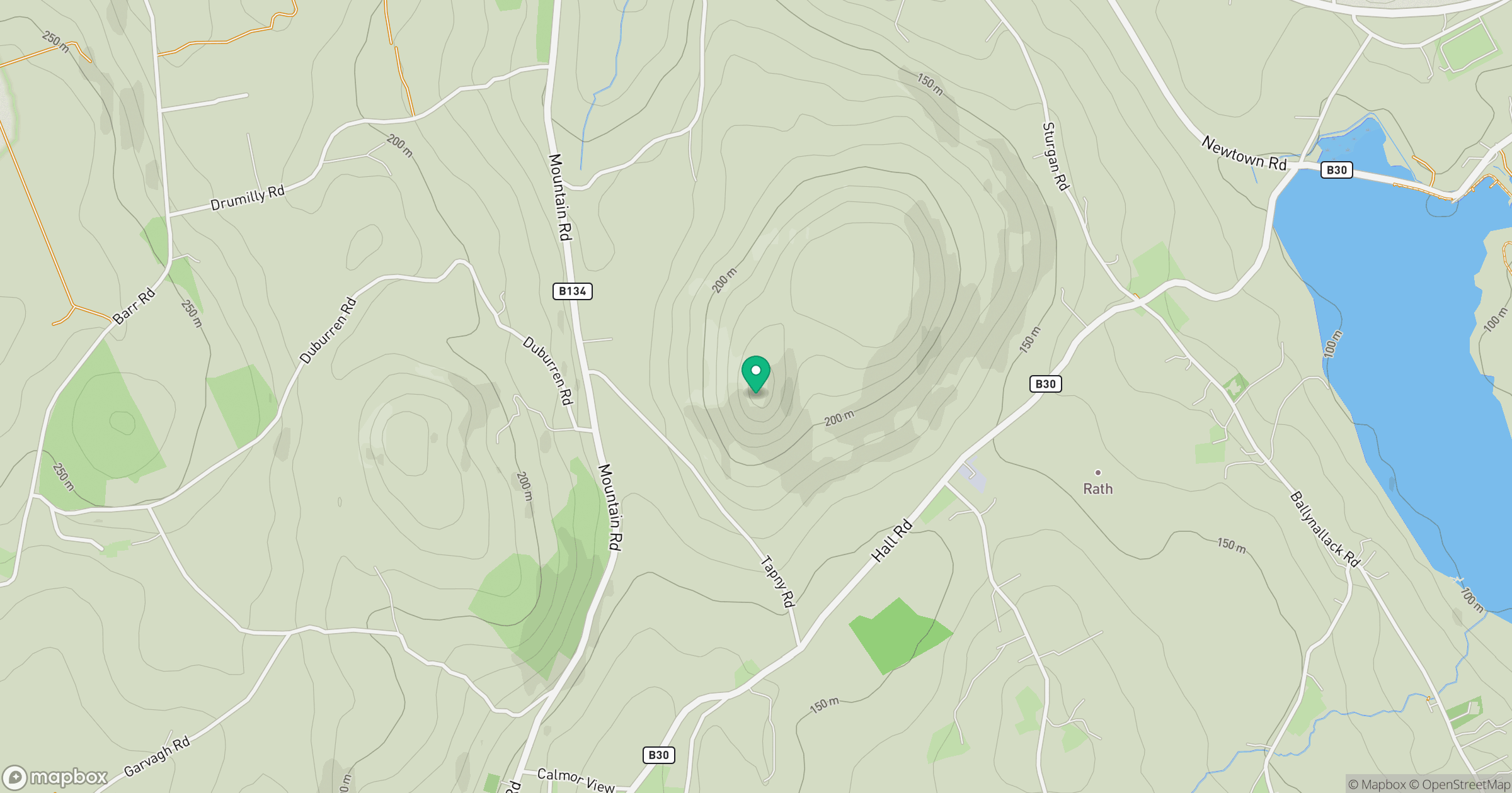
Grid reference: J013254
View on OpenStreetMapOpens a map in a new tab, centred on the hill.
No comments yet. Be the first.