

Stone Arthur
Good walks are even better shared.
NY3409 : On Stone Arthur
Michael Graham Photo source
Overview
Stone Arthur
Introduction
Nestled in the heart of the Lake District, Stone Arthur stands as a splendid gem among the fells, boasting a stunning elevation of 442 meters. While it may not be the tallest peak, it offers rich experiences for walkers and breathtaking vistas that will leave you both humbled and invigorated.
Geology
Containing volcanic rock and basalt formations, Stone Arthur's rugged profile provides a fascinating insight into the geological history of the region. Who knew that millions of years ago, fiery eruptions could lead to your delightful hike today?
Routes
Two popular routes serve as the main arteries to reach Stone Arthur:
- Thirlmere to Stone Arthur: This moderate trail is particularly delightful as it guides you through lush woodlands, with a gradual ascent culminating in stunning vistas at the summit. Ideal for a brisk afternoon escapade!
- Grasmere to Stone Arthur: A lighter option for those keen on a gentler incline, this 4km walk lets you soak in the beauty of the valley while enjoying a smattering of wildflowers along the way, perfect for all ages and abilities.
Summit Features
Upon reaching the summit, you are greeted by a sturdy cairn and panoramic views of the fells stretching endlessly before you. Nearby, an ancient stone circle whispers tales of the past, beckoning the curious wanderer to ponder its origins.
Terrain
The terrain on Stone Arthur is primarily grassy with an occasional rocky outcrop poking through, offering challenges that are just enough to keep you on your toes. Muddy patches can appear, particularly after heavy rain, so a robust pair of boots is your best friend!
Views
The summit rewards climbers with impressive views of magnificent peaks including Helvellyn and Blencathra, alongside the shimmering Thirlmere Reservoir. The best times to witness these enchanting views are in late spring and autumn when the air is crisp and clear, offering a picture-perfect canvas for your memories.
Hazards
As with any venture into the fells, conditions can be slippery. Keep your wits about you while navigating the rocky paths, especially after rainfall or during sudden changes in weather – typical Lake District behaviour, alas!
Access
With handy parking options at Thirlmere, you’re all set for your adventure. Buses from Keswick make the journey straightforward for those relying on public transport. After your hike, indulge in the many facilities around Grasmere and Keswick, where a well-earned cup of tea awaits you!
History
The name Stone Arthur conjures images of myth and legend, possibly linking to King Arthur himself! Over the centuries, this area has inspired poets and artists, adding a rich tapestry of cultural significance to your hiking experience.
Conclusion
Whether you choose the gentle path from Grasmere or the more challenging route from Thirlmere, Stone Arthur offers a delightful escape into nature, steeped in legend, breathtaking views, and the promise of adventure. So lace up those walking boots and set off – the fells are calling!
Last updated
2023-10-15
Explore routes near Stone Arthur
Walks starting near this hill. Open a route to check its map, distance and full itinerary.
Bow Fell from Langdale
View route
Helvellyn via Striding Edge
View route
Striding Edge, Helvellyn and Catstye Cam
View route
Great Carrs Halifax Wreckage from Wrynose Pass
View route
Route planning notes
These notes describe possible approaches. Check a route's map and access information when planning your walk.
Thirlmere to Stone Arthur
A popular route starting from Thirlmere, meandering through scenic woodlands and ascending to stunning views on the way to the summit.
Grasmere to Stone Arthur
This route from Grasmere provides a gentle ascent, offering panoramic views of the surrounding fells and lakes.
Make a day of it, together
Find someone to share the walk with, or organise a day out along a route you like.
Photo Gallery
View all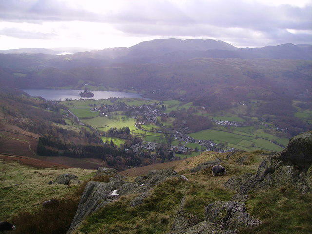 Photo could not load
NY3409 : On Stone Arthur
Michael Graham
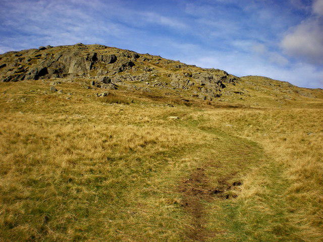 Photo could not load
NY3409 : Footpath below Stone Arthur
Alexander P Kapp
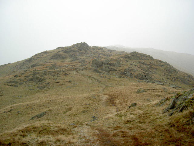 Photo could not load
NY3409 : Brackenwife Knotts from Stone Arthur
Ian Greig
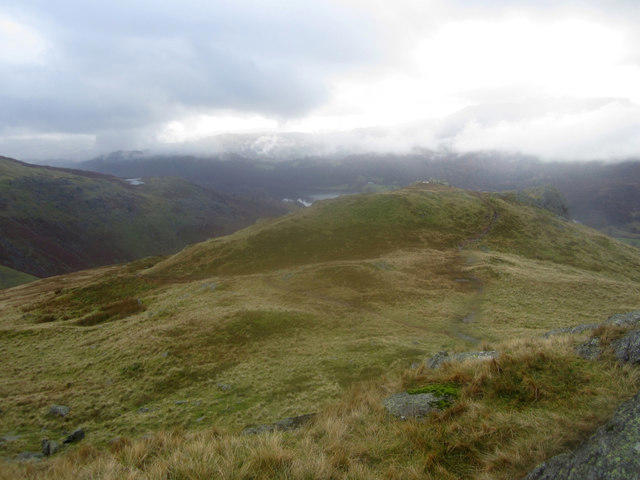 Photo could not load
NY3409 : Looking towards the summit of Stone Arthur
Graham Robson
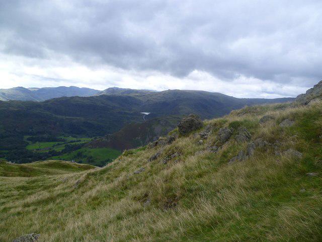 Photo could not load
NY3409 : Ascending Great Rigg
Michael Graham
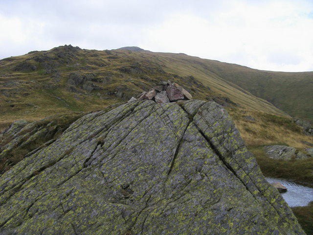 Photo could not load
NY3409 : Stone Arthur Summit
Shaun Ferguson
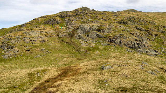 Photo could not load
NY3409 : Stone Arthur
Peter McDermott
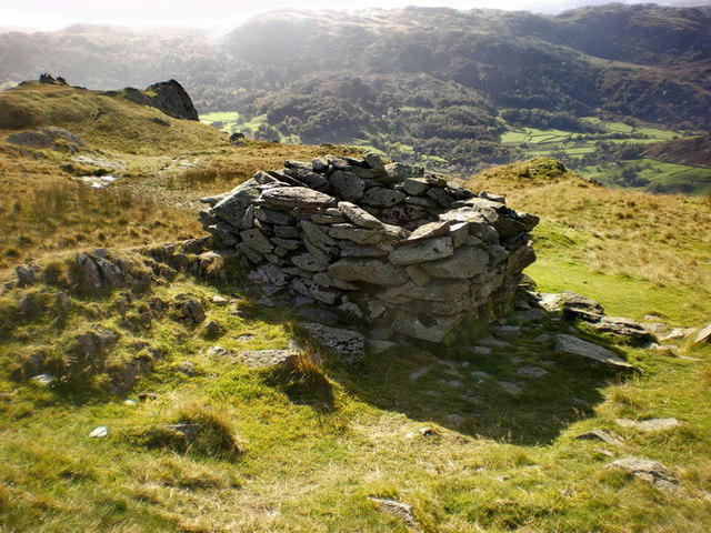 Photo could not load
NY3409 : Pen? shelter? near Stone Arthur
Alexander P Kapp
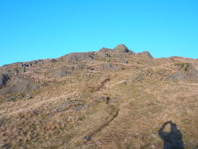 Photo could not load
NY3409 : Stone Arthur
John H Darch
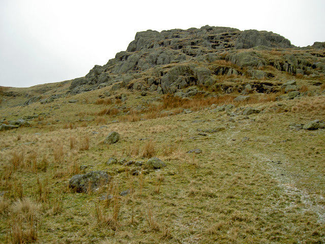
NY3409 : Stone Arthur in a hailstorm
Ian Greig
Hill facts and local notes
Classifications
Elevation
504m
1,654 ft
Prominence
3m
Coordinates
54.4743, -3.0084
NY347092
OS Map
90
Explorer: OL5S OL7N
At the Summit
The summit features a prominent cairn, and provides stunning 360-degree views of the surrounding fells and valleys. An ancient stone circle can also be found nearby, giving a hint of the area's prehistoric past.
Terrain & Geology
Stone Arthur is primarily composed of volcanic rock and basalt formations, giving it a rugged appearance that testifies to the area’s geological history, which dates back millions of years.
Views & Scenery
From the summit, enjoy views of Helvellyn, the Thirlmere Reservoir, and the picturesque village of Grasmere nestled in the valley below.
History & Heritage
Name Origin
The name 'Stone Arthur' likely derives from the rocky outcrop and the legend of King Arthur, linking the area to myth and folklore.
Historical Significance
The mountain has been a popular walking destination for centuries, attracting poets, artists, and nature lovers alike.
Getting There & Facilities
Parking
There is ample parking at Thirlmere, and several lay-bys along the A591 road provide additional options.
Public Transport
Buses run regularly from Keswick to Thirlmere; check the local timetable for the latest updates.
Nearby Facilities
Nearby facilities include several cafés and shops in Grasmere and Keswick, with public toilets available near the starting points.
Safety Information
Known Hazards
- Be cautious of slippery rocks, especially during wet conditions. Keep an eye out for sudden weather changes typical of the Lake District.
General Safety Tips
- Check weather conditions before setting out
- Carry appropriate clothing and equipment
- Let someone know your planned route
- Take a map, compass, and GPS device
- Carry emergency supplies: food, water, first aid kit, torch
Hills
Some common questions about the hills answered
Are there group walks up Stone Arthur?
Many walkers use Walkmates to join or organise walks with others. You can check for group walks around Stone Arthur through the maps
Are there other walkers around Stone Arthur?
Activity varies by location and time, but Walkmates lets you see whether others have shared walks or shown interest in this area. Find other people through the walking friends search walking friends for Stone Arthur search or of course create your own walk for Stone Arthur
Can I organise a walk to Stone Arthur?
Yes. If there aren’t any walks listed already, you can create a walk and make it available for others to join.
If you're signed up to Walkmates, you can create a walk to Stone Arthur.
How do I find a walk up this hill?
There are often multiple ways to walk this hill, depending on experience and route preference. Walkmates helps you explore walks and routes that others have shared.
Can I suggest a new route up Stone Arthur?
Yes. You can suggest or create routes to share with others. Walkmates focuses on the social side of walking, so routes are used to help people organise walks and explore areas together, rather than as detailed navigation tools or route libraries.
Other uses really appreciate knowledgeable walkers sharing their routes. Share your favourite route to Stone Arthur here
The is an error or something incorrect about this hill. How do I let you know?
We always strive to keep the information on Walkmates as accurate as possible. If you find an error, please let us know through the contact form and we'll aim to correct it as quickly as possible
Community Discussion
Comments
Location
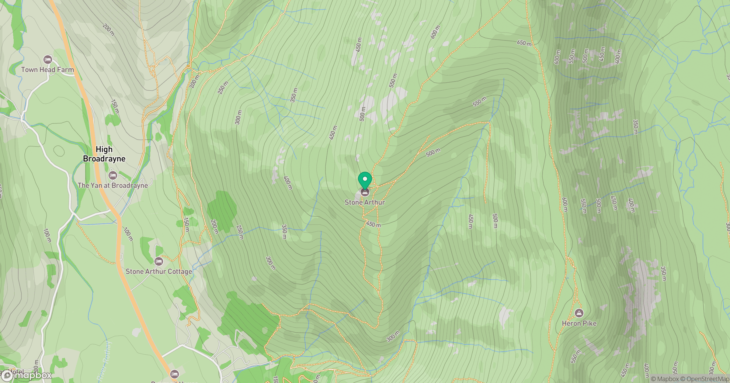
Grid reference: NY347092
View on OpenStreetMapOpens a map in a new tab, centred on the hill.

No comments yet. Be the first.