

Stafford Castle
Good walks are even better shared.
SJ9022 : The access road to Stafford Castle
Bill Boaden Photo source
Overview
Stafford Castle
Stafford Castle is a captivating historical site located near the bustling town of Stafford in the West Midlands. Though it may not reach the heights of the peaks found in Wales or the Highlands, its rich history and scenic views make it a worthwhile destination for hikers and history buffs alike.
Geology
The area surrounding Stafford Castle features Jurassic limestone, which is responsible for the castle's impressive fortifications. The rich clay in the region supports lush vegetation that attracts nature enthusiasts and casual walkers alike. The geology provides a fascinating backdrop that tells the story of the land long before the castle was built.
Access and Parking
The nearest parking can be found at Castle Hill Road, where visitors can securely leave their vehicles. From there, it’s merely a stone’s throw to the castle entrance. If public transport is more your style, regular bus services operate from Stafford town centre, making access a breeze. You’ll be in good stead for a pleasant afternoon wandering the grounds!
The Castle Walk
For those who fancy a gentle stroll rather than a hike, the Castle Walk is ideal. Spanning approximately 1.5 km, this easy route leads directly from the town centre to the castle. It’s suitable for families, so feel free to bring the little ones; just keep an eye out for any wayward squirrels!
Summit Features
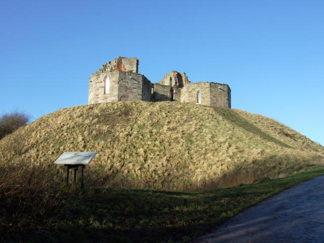
While you won’t encounter a summit in the traditional mountain sense, the elevated position of Stafford Castle offers sweeping views. The castle ruins are a prominent feature, evocative of a time long past, surrounded by colourful gardens and expansive lawns. It’s a great spot to take a moment, catch your breath, and soak in the scenery.
Terrain Type
The terrain leading up to the castle is primarily grassy with paved paths, making it accessible for walkers of all abilities. Just be cautious of uneven ground near the castle ruins—those crumbling stones have been standing for centuries, and even they deserve some respect!
Views and Best Seasons
From the castle, visitors can enjoy stunning views of Stafford and the beautiful River Sow. On clear days, you might even catch a glimpse of the rolling Cannock Chase hills in the distance. Spring and summer are the best seasons to visit, when nature is in full bloom and the views are at their peak.
Historical Significance
Stafford Castle dates back to the late 11th century and has great historical importance. It has seen many battles and reconfigurations throughout the ages, symbolising the changes in power dynamics within the region. The etymology of its name is equally intriguing, linking back to Old English and signifying a 'ford by a post'—a nod to its roots as a strategic location.
Facilities
In terms of facilities, nearby Stafford Park has public toilets for your convenience, and the town offers a variety of cafes to refuel after your exploration. Local eateries serve up a fine selection of refreshments, whether you fancy a cheeky scone or a cup of tea.
All in all, Stafford Castle is a delightful outing for those keen to combine a bit of history with a light hike. Remember to bring your camera; you’ll want to capture the sights and savour the experience!
Happy hiking!
Explore routes near Stafford Castle
Walks starting near this hill. Open a route to check its map, distance and full itinerary.
Cannock Chase, Shugborough, and Canal Circular
View route
Chasewater Walk with Men Walking & Talking
View route
Granville Country Park Woodland Circuit
View route
Bloxwich Walk (Sunday Group) with Men Walking & Talking
View route
Route planning notes
These notes describe possible approaches. Check a route's map and access information when planning your walk.
Castle Walk
A leisurely path leading directly to Stafford Castle from the town centre, suitable for all ages.
Make a day of it, together
Find someone to share the walk with, or organise a day out along a route you like.
Photo Gallery
View all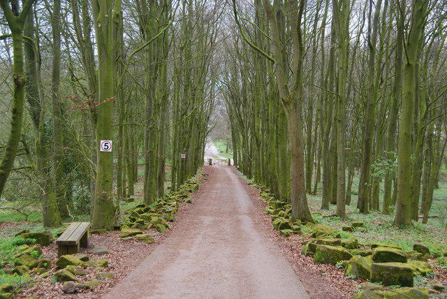 Photo could not load
SJ9022 : The access road to Stafford Castle
Bill Boaden
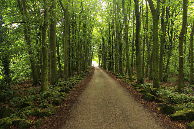 Photo could not load
SJ9022 : Castle Wood
Richard Croft
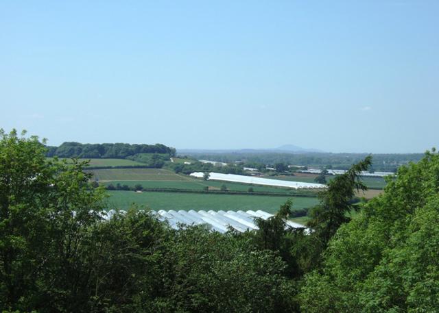 Photo could not load
SJ9022 : View from Stafford Castle keep.
Simon Huguet
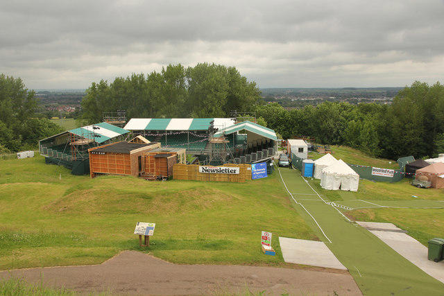 Photo could not load
SJ9022 : Stafford Castle bailey
Richard Croft
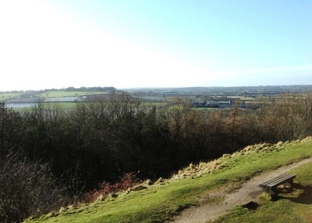 Photo could not load
SJ9022 : View from Stafford Castle
Simon Huguet
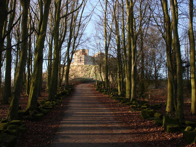 Photo could not load
SJ9022 : Stafford Castle in winter sunlight
Dave Lewis
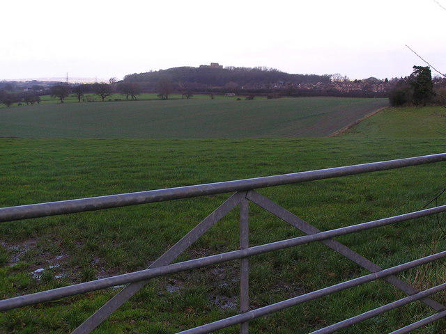 Photo could not load
SJ9022 : Stafford Castle from Thorneyfields Lane
Jack Barber
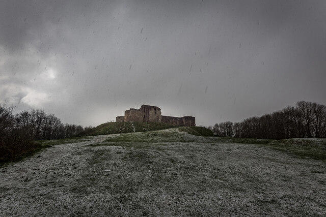 Photo could not load
SJ9022 : Stafford Castle
Brian Deegan
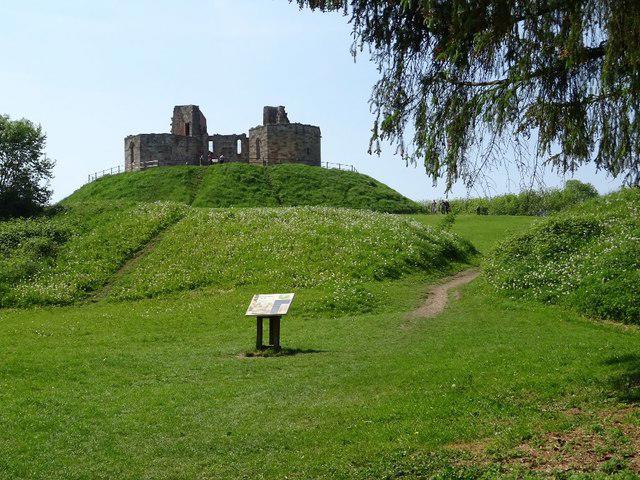 Photo could not load
SJ9022 : Stafford Castle
Philip Halling
SJ9022 : Stafford Castle
Simon Huguet
Hill facts and local notes
Classifications
Elevation
144m
472 ft
Prominence
37m
Coordinates
52.7980, -2.1474
SJ901222
OS Map
127
Explorer: 244
At the Summit
Prominent stone ruins of the castle and panoramic views of the surrounding area.
Terrain & Geology
The area is primarily composed of Jurassic limestone with patches of clay, providing a solid foundation for this historical site.
Views & Scenery
Spectacular views of the Stafford town, the River Sow, and on clear days, the rolling hills of Cannock Chase.
History & Heritage
Name Origin
The name 'Stafford' is believed to derive from the Old English 'Stæf-ford', meaning 'ford by a post or staff'.
Historical Significance
Built in the late 11th century, Stafford Castle played a key role in the history of the region and underwent significant changes during the medieval period.
Getting There & Facilities
Parking
There is a public car park on Castle Hill Road, a short walk from the castle entrance.
Public Transport
Bus services from Stafford town centre frequently run to stops near the castle.
Nearby Facilities
There are public toilets available at the nearby Stafford Park and several cafes within walking distance in the town centre.
Safety Information
Known Hazards
- Uneven ground around the castle ruins; caution advised during wet weather.
General Safety Tips
- Check weather conditions before setting out
- Carry appropriate clothing and equipment
- Let someone know your planned route
- Take a map, compass, and GPS device
- Carry emergency supplies: food, water, first aid kit, torch
Hills
Some common questions about the hills answered
Are there group walks up Stafford Castle?
Many walkers use Walkmates to join or organise walks with others. You can check for group walks around Stafford Castle through the maps
Are there other walkers around Stafford Castle?
Activity varies by location and time, but Walkmates lets you see whether others have shared walks or shown interest in this area. Find other people through the walking friends search walking friends for Stafford Castle search or of course create your own walk for Stafford Castle
Can I organise a walk to Stafford Castle?
Yes. If there aren’t any walks listed already, you can create a walk and make it available for others to join.
If you're signed up to Walkmates, you can create a walk to Stafford Castle.
How do I find a walk up this hill?
There are often multiple ways to walk this hill, depending on experience and route preference. Walkmates helps you explore walks and routes that others have shared.
Can I suggest a new route up Stafford Castle?
Yes. You can suggest or create routes to share with others. Walkmates focuses on the social side of walking, so routes are used to help people organise walks and explore areas together, rather than as detailed navigation tools or route libraries.
Other uses really appreciate knowledgeable walkers sharing their routes. Share your favourite route to Stafford Castle here
The is an error or something incorrect about this hill. How do I let you know?
We always strive to keep the information on Walkmates as accurate as possible. If you find an error, please let us know through the contact form and we'll aim to correct it as quickly as possible
Community Discussion
Comments
Location
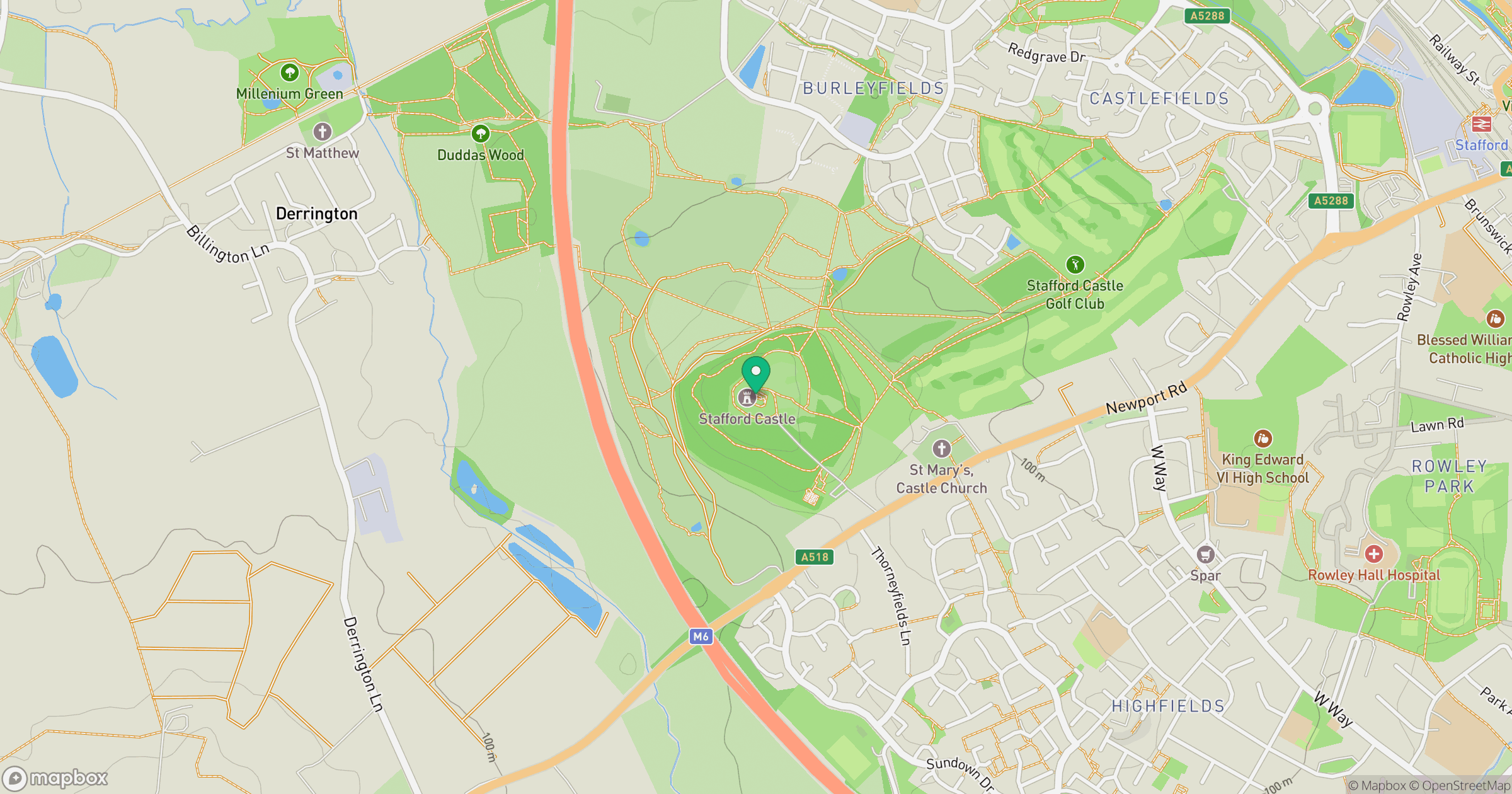
Grid reference: SJ901222
View on OpenStreetMapOpens a map in a new tab, centred on the hill.
Nearby Hills
The Roaches
505m

The Wrekin
407m
Titterstone Clee Hill
533m

Kinder Scout
636m
Worcestershire Beacon
425m
No comments yet. Be the first.