
Sgurr nan Gillean
Good walks are even better shared.
Overview
Sgurr nan Gillean
Sgurr nan Gillean is one of the most striking peaks on the Isle of Skye. Standing majestically at 964 meters, it’s a Munro that demands respect and rewards determination. Not for the faint-hearted, this mountain is a true gem for serious hikers and climbers alike.
Geology
The mountain consists primarily of ancient volcanic rock, including gabbro, which is famous for its grippy surface—ideal for climbers who appreciate a bit more than just a walk in the park. Its rugged terrain and nearly vertical cliffs are thrilling for some, and a slight nightmare for those who might have a tendency to stumble over their own feet.
Routes
There are a couple of primary routes to tackle Sgurr nan Gillean:
- West Ridge Route: A steep and direct ascent with spectacular views along the way. It is challenging but well worth the effort.
- South-East Ridge Route: A longer, more moderate trek for those who prefer a gentler climb while still soaking in the splendid vistas.
Summit Features
At the top, adventurers are greeted by a remarkable cairn, a perfect spot for a moment of reflection or a celebratory biscuit. Just be sure to focus and mind the drop—it’s not the kind of place you’d want to roll off!
Terrain Type
Expect a challenging wander through rocky, rugged terrain interspersed with some grassy spots. Every step offers a fresh view, but due caution is advised, particularly in inclement weather.
Views
Once at the summit, you’ll be met with breathtaking views of the surrounding Cuillin Ridge and, on a clear day, even the distant Outer Hebrides. It's recommended to time your hike for late spring to early autumn for the finest vistas.
Hazards
Always be wary of the Scottish weather—it has a habit of turning on a sixpence. Steep and loose rocks add to the adventure but can also pose risks, especially in wet conditions. Make sure you wear appropriate footwear and check forecasts before you head out.
Access
Getting to Sgurr nan Gillean is convenient from the Sligachan Hotel, which offers parking—albeit limited during peak seasons. Public transport is available to Sligachan from Portree, so firm up your travel plans!
Facilities
After tackling the peaks, you can find your way back to Sligachan Hotel for refreshments, meals, and resting aching feet. Toilets are also available, a necessity after a long day of climbing.
History
The name Sgurr nan Gillean means 'the peak of the young men', reflecting the adventurous spirit that the mountain personifies. This peak has become a beloved feature of local folklore and is integral to the heritage of the Isle of Skye.
If you're looking for a mountain that tests your limits and rewards you with unparalleled beauty, Sgurr nan Gillean is a must. Pack your gear, gather your friends, and set forth on an adventure!
Explore routes near Sgurr nan Gillean
Walks starting near this hill. Open a route to check its map, distance and full itinerary.
Dun Mhulan Broch Quick Walk
View route
Banavie to Glen Loy Aqueduct: Neptune’s Staircase Canal Towpath
View route
Ben Nevis via Mountain Path
View route
Route planning notes
These notes describe possible approaches. Check a route's map and access information when planning your walk.
Sgurr nan Gillean via the Tourist Route
This is the most popular and well-known route to the summit of Sgurr nan Gillean, starting from the Sligachan Hotel. The route follows a good path along the Allt Dearg Mor before ascending Coire Riabhach. The final scramble to the summit involves some exposed sections, but it is manageable for experienced hillwalkers.
Sgurr nan Gillean via Pinnacle Ridge
This route is a classic scramble and one of the most adventurous ways to reach the summit. Starting from Sligachan, the approach leads to Coire a' Bhasteir before ascending the dramatic Pinnacle Ridge. This is a highly technical route involving sustained scrambling and exposure, suitable only for experienced climbers.
Sgurr nan Gillean via the West Ridge
This route approaches the summit from the west, starting from Glen Brittle and ascending via Coire Lagan. The West Ridge involves some scrambling and airy sections, providing an alternative to the more commonly used Tourist Route for experienced hillwalkers.
Sgurr nan Gillean Traverse from Sligachan to Glen Brittle
This full traverse of Sgurr nan Gillean is a demanding day out, linking the summit with other peaks of the Black Cuillin. Starting from Sligachan, the route climbs Sgurr nan Gillean via Coire Riabhach before continuing along the ridge to Glen Brittle. A high level of fitness and scrambling experience is required.
Sgurr nan Gillean and Am Basteir Circuit
This circuit combines the ascent of Sgurr nan Gillean with its neighbouring peak, Am Basteir. Starting from Sligachan, the route climbs Coire a' Bhasteir to reach Am Basteir before continuing to the summit of Sgurr nan Gillean. The descent follows the Tourist Route. Some scrambling experience is required.
Make a day of it, together
Find someone to share the walk with, or organise a day out along a route you like.
Hill facts and local notes
Classifications
Elevation
764m
2,507 ft
Prominence
79m
Coordinates
56.9542, -6.3104
NM380930
OS Map
39
Explorer: 397
At the Summit
The summit is marked by a prominent cairn, which is a fitting token to leave atop your adventures. Just a heads up—it's not for lounging, but it might make for a great photo op!
Terrain & Geology
Sgurr nan Gillean is primarily composed of old volcanic rock, with a unique formation of gabbro, which is renowned for its durability and excellent grip for climbers. Just try not to take too many embarrassing tumbles up these rocky slopes!
Views & Scenery
From the summit, you can enjoy stunning views of the Cuillin ridge, the Isle of Skye, and even glimpses of the Outer Hebrides on a clear day. And yes, the sunsets? They're worth every step.
History & Heritage
Name Origin
Sgurr nan Gillean translates to 'the peak of the young men' in Gaelic, a nod to the youthful spirits that have accepted its challenge over the centuries.
Historical Significance
It holds a prominent place in the culture and legends of the Isle of Skye, often featured in local folktales and an iconic feature in Scottish mountaineering.
Getting There & Facilities
Parking
The nearest parking is at the Sligachan Hotel car park, which offers ample space, though it can fill up quickly during peak season. Arrive early, or risk a long walk!
Public Transport
Buses run regularly to Sligachan from Portree and other locations on the Isle of Skye. Be sure to plan your journey back as services may be limited.
Nearby Facilities
Sligachan Hotel offers meals, drinks, and a warm place to rest those weary limbs. Toilets are available on site, which is always a relief after a long trek!
Safety Information
Known Hazards
- Steep, rugged terrain can be treacherous in wet conditions. Watch out for loose rocks and sudden weather changes. Always check the forecast before venturing out!
General Safety Tips
- Check weather conditions before setting out
- Carry appropriate clothing and equipment
- Let someone know your planned route
- Take a map, compass, and GPS device
- Carry emergency supplies: food, water, first aid kit, torch
Hills
Some common questions about the hills answered
Are there group walks up Sgurr nan Gillean?
Many walkers use Walkmates to join or organise walks with others. You can check for group walks around Sgurr nan Gillean through the maps
Are there other walkers around Sgurr nan Gillean?
Activity varies by location and time, but Walkmates lets you see whether others have shared walks or shown interest in this area. Find other people through the walking friends search walking friends for Sgurr nan Gillean search or of course create your own walk for Sgurr nan Gillean
Can I organise a walk to Sgurr nan Gillean?
Yes. If there aren’t any walks listed already, you can create a walk and make it available for others to join.
If you're signed up to Walkmates, you can create a walk to Sgurr nan Gillean.
How do I find a walk up this hill?
There are often multiple ways to walk this hill, depending on experience and route preference. Walkmates helps you explore walks and routes that others have shared.
Can I suggest a new route up Sgurr nan Gillean?
Yes. You can suggest or create routes to share with others. Walkmates focuses on the social side of walking, so routes are used to help people organise walks and explore areas together, rather than as detailed navigation tools or route libraries.
Other uses really appreciate knowledgeable walkers sharing their routes. Share your favourite route to Sgurr nan Gillean here
The is an error or something incorrect about this hill. How do I let you know?
We always strive to keep the information on Walkmates as accurate as possible. If you find an error, please let us know through the contact form and we'll aim to correct it as quickly as possible
Community Discussion
Comments
Location
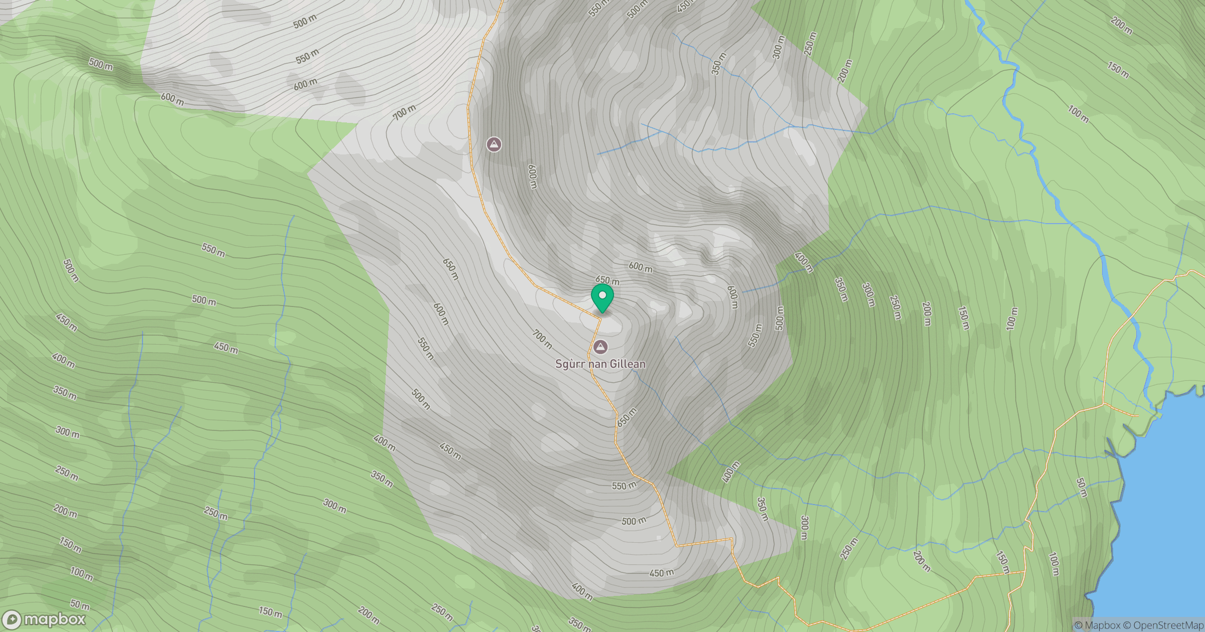
Grid reference: NM380930
View on OpenStreetMapOpens a map in a new tab, centred on the hill.
No comments yet. Be the first.