

Sgorr an Fharaidh
Good walks are even better shared.
Overview
Sgorr an Fharaidh
Sgorr an Fharaidh stands tall at 1029 meters, gracing the Scottish Highlands with its majestic presence. This Munro is popular among hikers for its challenges and stunning vistas, the ideal combination to satisfy your adventurous spirit.
Geology
The mountain is primarily composed of granite, formed from ancient geological processes that have shaped the Highlands over millennia. The steep crags and rocky outcrops are perfect for those who appreciate the rugged beauty of nature and the art of erosion.
Routes
One of the most popular routes begins in Glen Dessarry. This route, measuring about 10 km, takes approximately 5 hours and offers a moderately challenging hike. The gradual ascent through heather-covered hills ensures that hikers can enjoy the stunning surroundings without feeling too overwhelmed.
Summit Features
At the summit, you will find a well-constructed cairn that not only marks the peak but also serves as a perfect spot for a well-deserved rest. From here, you can gaze out over the valleys below and the spectacular peaks nearby—perfect for that iconic photo opportunity!
Terrain Type
Expect a mix of rocky and grassy paths, with a few boggy areas that can catch the unwary. Good hiking boots are essential if you’d rather not participate in an accidental mud spa treatment!
Views
Once you’ve conquered the summit, prepare to be awestruck by views of Sgurr na Ciche and even Ben Nevis when the skies are clear. For those looking to capture nature's beauty, spring and early summer provide the best chances, with clear skies and blooming wildflowers vying for attention.
Hazards
As enjoyable as it is to explore Sgorr an Fharaidh, be mindful of your surroundings. Slippery rocks, sudden weather changes, and unpredictable boggy sections can add a dash of excitement—or danger—if you’re unprepared. Always carry suitable gear and check the weather before you head out.
Access
To get to Sgorr an Fharaidh, park at the end of the road in Glen Dessarry. Spaces are limited, so make sure to arrive early. If you’re relying on public transport, be aware that options are somewhat sparse, but Fort William lies about 30 km away, providing various amenities and services.
Facilities
In Fort William, you’ll find ample facilities, from cafes to outdoor shops, catering to your every hiking need. Basic toilet facilities are also located at the parking area for that necessary pit stop before you embark.
History
The name 'Sgorr an Fharaidh', meaning 'Peak of the Spear', reflects its prominent shape. The mountain holds not just geographical significance but also cultural, being woven into the local folklore of the Highlands.
So lace up those hiking boots, grab your walking stick, and set out for an adventure in the Scottish Highlands. Just remember to breathe in the fresh air and soak up the views—after all, they’re worth every step taken!
Happy hiking!
Explore routes near Sgorr an Fharaidh
Public walks starting within 80 km of this hill. Nearby does not mean a route reaches the summit; check its map and access before setting out.
Banavie to Glen Loy Aqueduct: Neptune’s Staircase Canal Towpath
View route
Ben Nevis via Mountain Path
View route
Loch Affric full circuit from River Affric
View route
Route planning notes
These notes describe possible approaches, not verified navigable routes or permission to cross land. Check current paths, local access rules and conditions before setting out.
Glen Dessarry
Starting from Glen Dessarry, this route winds through beautiful heather and provides a gradual ascent to the summit, suitable for most hikers.
Make a day of it, together
Find someone to share the walk with, or organise a day out along a route you like.
Photo Gallery
View all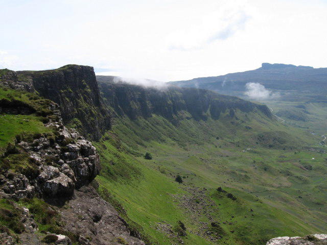 Photo could not load
NM4889 : Sgorr an Fharaidh
Chris Wimbush
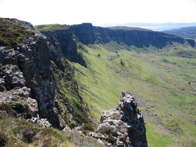 Photo could not load
NM4889 : Sgorr an Fharaidh
wendy bradley
Hill facts and local notes
Classifications
Elevation
340m
1,115 ft
Prominence
264m
Coordinates
56.9265, -6.1343
NM485893
OS Map
39
Explorer: 397
At the Summit
The summit boasts a prominent cairn, providing an excellent viewpoint over the surrounding valleys and distant peaks. It’s the perfect spot to pause, catch your breath, and contemplate life's mysteries.
Terrain & Geology
Composed predominantly of granite, Sgorr an Fharaidh features spectacular crags and steep faces, indicative of significant glacial erosion. The summit's rocky terrain offers glimpses of ancient geological processes at work.
Views & Scenery
Views of the surrounding peaks such as Sgurr na Ciche and Ben Nevis are spectacular. On a clear day, Loch Nevis and the Inner Isles come into view.
History & Heritage
Name Origin
The name 'Sgorr an Fharaidh' translates roughly to 'Peak of the Spear', reflecting its sharp summit profile.
Historical Significance
This mountain is not just a feast for the eyes; it is steeped in local folklore and offers insights into the rich cultural landscape of the Highlands.
Getting There & Facilities
Check current local access restrictions, parking rules and transport timetables before travelling. These notes do not confirm public access to the summit.
Parking
Parking is available at the end of the road in Glen Dessarry. Spaces are limited, so arrive early to secure a spot.
Public Transport
Public transport options are sparse; plan for a drive or check local bus schedules that serve nearby villages.
Nearby Facilities
Local facilities in Fort William include cafes, restaurants, and outdoor shops. Basic toilet facilities can be found at the parking area.
Safety Information
Known Hazards
- Potentially slippery rocky paths, sudden weather changes, and boggy terrain to be wary of. It’s advisable to bring appropriate gear.
General Safety Tips
- Check weather conditions before setting out
- Carry appropriate clothing and equipment
- Let someone know your planned route
- Take a map, compass, and GPS device
- Carry emergency supplies: food, water, first aid kit, torch
Hills
Some common questions about the hills answered
Are there group walks up Sgorr an Fharaidh?
Many walkers use Walkmates to join or organise walks with others. You can check for group walks around Sgorr an Fharaidh through the maps
Are there other walkers around Sgorr an Fharaidh?
Activity varies by location and time, but Walkmates lets you see whether others have shared walks or shown interest in this area. Find other people through the walking friends search walking friends for Sgorr an Fharaidh search or of course create your own walk for Sgorr an Fharaidh
Can I organise a walk to Sgorr an Fharaidh?
Yes. If there aren’t any walks listed already, you can create a walk and make it available for others to join.
If you're signed up to Walkmates, you can create a walk to Sgorr an Fharaidh.
How do I find a walk up this hill?
There are often multiple ways to walk this hill, depending on experience and route preference. Walkmates helps you explore walks and routes that others have shared.
Can I suggest a new route up Sgorr an Fharaidh?
Yes. You can suggest or create routes to share with others. Walkmates focuses on the social side of walking, so routes are used to help people organise walks and explore areas together, rather than as detailed navigation tools or route libraries.
Other uses really appreciate knowledgeable walkers sharing their routes. Share your favourite route to Sgorr an Fharaidh here
The is an error or something incorrect about this hill. How do I let you know?
We always strive to keep the information on Walkmates as accurate as possible. If you find an error, please let us know through the contact form and we'll aim to correct it as quickly as possible
Community Discussion
Comments
Location
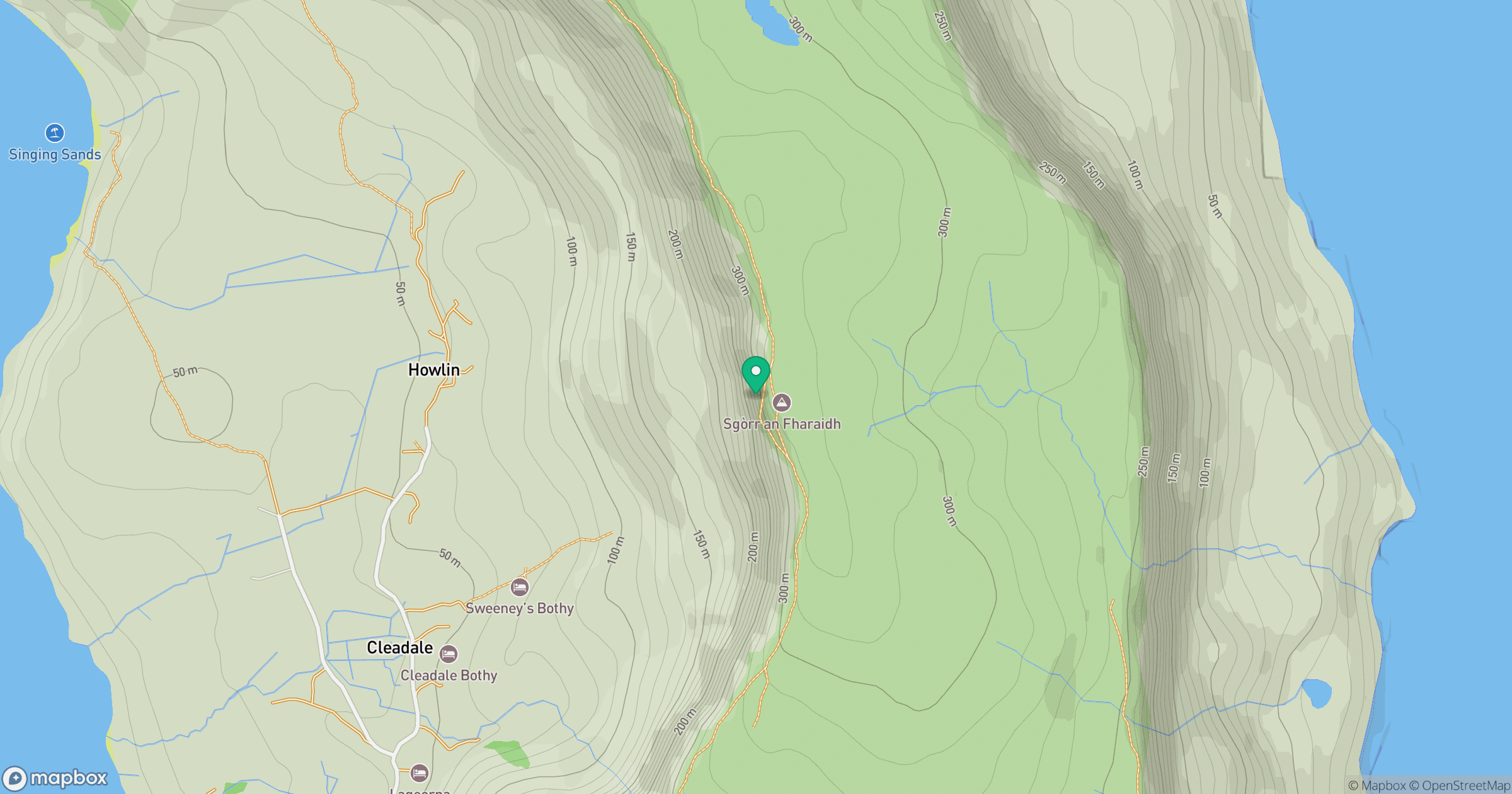
Grid reference: NM485893
View on OpenStreetMapOpens a map in a new tab, centred on the hill.
Hills within 30 km
Straight-line distance, not a walking route or confirmation of access.
No comments yet. Be the first.