

Saxa Vord
Good walks are even better shared.
HP6316 : Saxa Vord radome
Mike Pennington Photo source
Overview
Saxa Vord
Saxa Vord is a remarkable peak located in the Shetland Islands, off the northern coast of Scotland. Standing at a modest elevation of 195 meters, this Marilyn may not be the highest mountain on the block, but it has a great deal to offer to hikers and outdoor enthusiasts.
Geology
The engaging geological composition of Saxa Vord primarily consists of schist and gneiss, with impressive cliff formations that narrate the ancient history of the Earth. As you ascend, you'll encounter weathered rock faces that testify to the ages gone by.
Routes
The most popular route, the Saxa Vord Trail, is a well-defined path that challenges you with diverse terrain ranging from grassy slopes to rocky outcrops. It is approximately 3.5 km long and typically takes around 1.5 hours to complete. With a moderate difficulty rating, it is suitable for most hikers, albeit with a few squelchy areas to keep you alert.
Summit Features
Upon reaching the summit, the trig point proudly sits above the landscape, offering an ideal spot for that coveted summit selfie with friends, family, or your dog. The views are simply staggering and worth every step of the climb.
Terrain Type
Hikers should prepare for a mixed environment, including rocky patches and soft grassy areas, with the occasional boggy patch to liven things up. Make sure your boots are ready!
Views
From the top, the panoramic views encompass the majestic Atlantic Ocean, the nearby islands of Unst and Yell, and even the hills of mainland Scotland under clear skies. For an invigorating experience, spring and summer are ideal; however, the autumn paints the landscape with vibrant hues that are spectacular in their own right.
Hazards
While the climb is enjoyable, do keep an eye on the weather - it can turn as quickly as a cat on a hot tin roof! Additionally, carefully navigate through boggy areas to avoid any unwelcome surprises.
Nearby Summits
For those looking for more adventure, nearby summits like Vord Hill and Ward Hill are worth exploring, providing alternative views of the rugged Shetland landscape.
Access
To get to Saxa Vord, park at the designated area near the start of the trail. If you're relying on public transport, check local bus services, as they connect Lerwick with Baltasound, the nearest town about 6 km away. Don't forget to fuel up at one of the local cafes before your adventure begins!
Facilities
The small village of Baltasound offers basic facilities such as a shop for snacks and a couple of cafes where you can grab a bite and enjoy the local atmosphere.
History
The name 'Saxa Vord' derives from the Old Norse language, meaning 'rocky point,' which aptly reflects its rugged characteristics. Historically, this point has served a vital role in navigation, helping guide sailors safely through Shetland's treacherous waters.
In summary, Saxa Vord is not just a hike; it's an adventure filled with history, geology, and breathtaking views - a true gem in the Shetland crown. Whether you're an experienced hiker or just out for a leisurely stroll, this peak is well worth a visit. Bring your camera, your sense of humour, and perhaps a sandwich or two!
Happy hiking!
Explore routes near Saxa Vord
Walks starting near this hill. Open a route to check its map, distance and full itinerary.
Route planning notes
These notes describe possible approaches. Check a route's map and access information when planning your walk.
Saxa Vord Trail
A picturesque path that takes you through lush grasslands and rocky outcrops leading directly to the summit of Saxa Vord.
Make a day of it, together
Find someone to share the walk with, or organise a day out along a route you like.
Photo Gallery
View all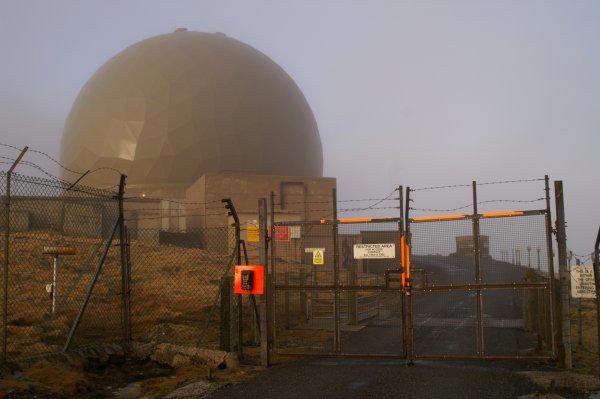 Photo could not load
HP6316 : Saxa Vord radome
Mike Pennington
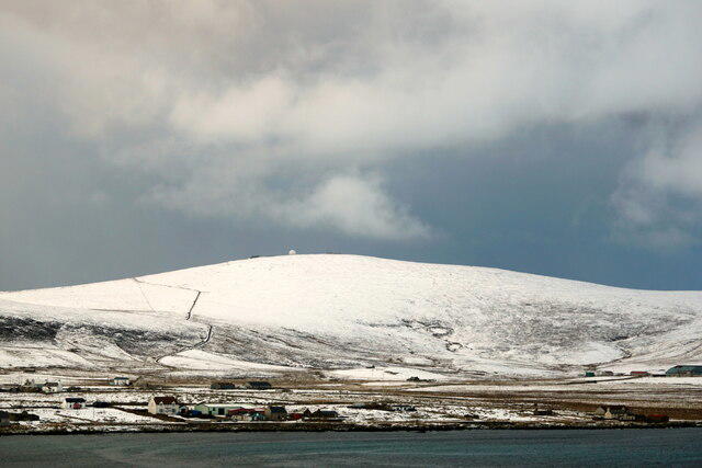 Photo could not load
HP6316 : Saxa Vord from Setters Hill
Mike Pennington
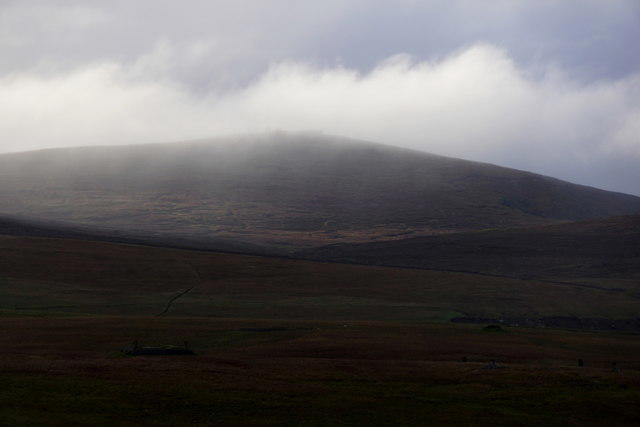 Photo could not load
HP6316 : Saxa Vord from Lamba Ness
Mike Pennington
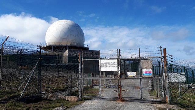 Photo could not load
HP6316 : The new radome on Saxa Vord
Mike Pennington
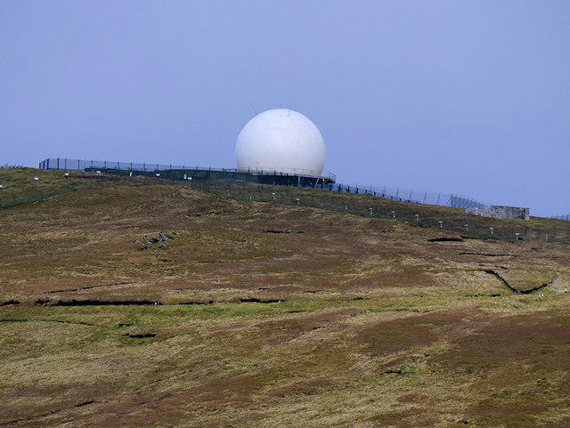 Photo could not load
HP6316 : Remote Radar Station Saxa Vord
David Dixon
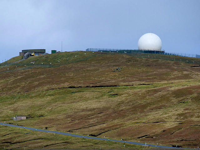 Photo could not load
HP6316 : RAF Saxa Vord
David Dixon
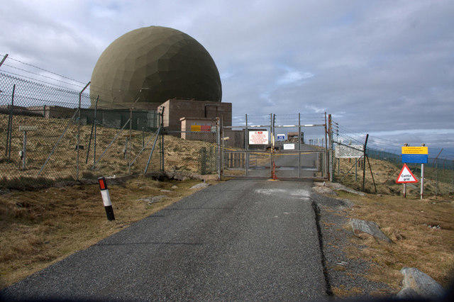 Photo could not load
HP6316 : Radome on top of Saxa Vord
Mike Pennington
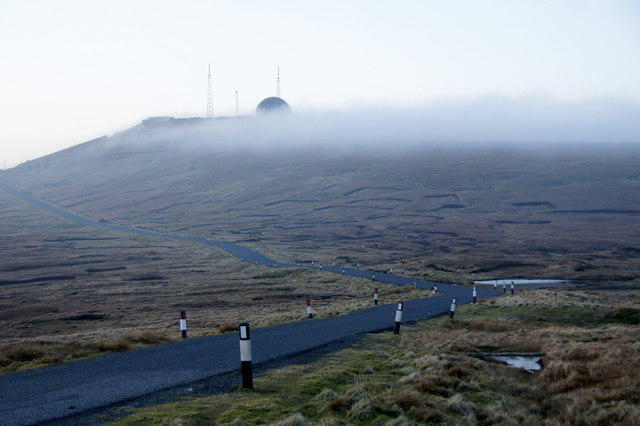 Photo could not load
HP6316 : Saxa Vord at dusk
Mike Pennington
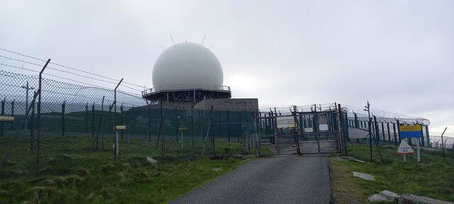 Photo could not load
HP6316 : Radome on top of Saxa Vord
Mike Pennington

HP6316 : Saxa Vord
Stephen McKay
Hill facts and local notes
Classifications
Elevation
284m
932 ft
Prominence
284m
Coordinates
60.8275, -0.8411
HP631166
OS Map
1
Explorer: 470N
At the Summit
The summit boasts a prominent trig point which serves as a brilliant photo opportunity, and offers a panoramic view of the surrounding landscapes.
Terrain & Geology
Saxa Vord features unique geological formations predominantly composed of metamorphic rocks, including schist and gneiss, with scenic coastal cliffs that narrate the earth's ancient history.
Views & Scenery
From the summit, enjoy breathtaking views of the Atlantic Ocean, Unst, and Yell, along with the distant hills of mainland Scotland on a clear day.
History & Heritage
Name Origin
The name 'Saxa Vord' translates to 'rocky point' in Old Norse, a nod to its rugged terrain.
Historical Significance
Historically, this area has been significant for navigation, aiding seafarers for centuries with its prominent elevation.
Getting There & Facilities
Parking
There is a parking area at the bottom of the Saxa Vord trail, with sufficient space for several vehicles.
Public Transport
Regular bus services connect Lerwick with nearby villages, but check local timetables for the latest updates.
Nearby Facilities
There are limited facilities at nearby Baltasound, including a small shop and a couple of cafes to replenish your energy levels post-hike.
Safety Information
Known Hazards
- Beware of sudden weather changes, as conditions can shift rapidly. Additionally, watch your step in boggy areas and while navigating rocky patches.
General Safety Tips
- Check weather conditions before setting out
- Carry appropriate clothing and equipment
- Let someone know your planned route
- Take a map, compass, and GPS device
- Carry emergency supplies: food, water, first aid kit, torch
Hills
Some common questions about the hills answered
Are there group walks up Saxa Vord?
Many walkers use Walkmates to join or organise walks with others. You can check for group walks around Saxa Vord through the maps
Are there other walkers around Saxa Vord?
Activity varies by location and time, but Walkmates lets you see whether others have shared walks or shown interest in this area. Find other people through the walking friends search walking friends for Saxa Vord search or of course create your own walk for Saxa Vord
Can I organise a walk to Saxa Vord?
Yes. If there aren’t any walks listed already, you can create a walk and make it available for others to join.
If you're signed up to Walkmates, you can create a walk to Saxa Vord.
How do I find a walk up this hill?
There are often multiple ways to walk this hill, depending on experience and route preference. Walkmates helps you explore walks and routes that others have shared.
Can I suggest a new route up Saxa Vord?
Yes. You can suggest or create routes to share with others. Walkmates focuses on the social side of walking, so routes are used to help people organise walks and explore areas together, rather than as detailed navigation tools or route libraries.
Other uses really appreciate knowledgeable walkers sharing their routes. Share your favourite route to Saxa Vord here
The is an error or something incorrect about this hill. How do I let you know?
We always strive to keep the information on Walkmates as accurate as possible. If you find an error, please let us know through the contact form and we'll aim to correct it as quickly as possible
Community Discussion
Comments
Location
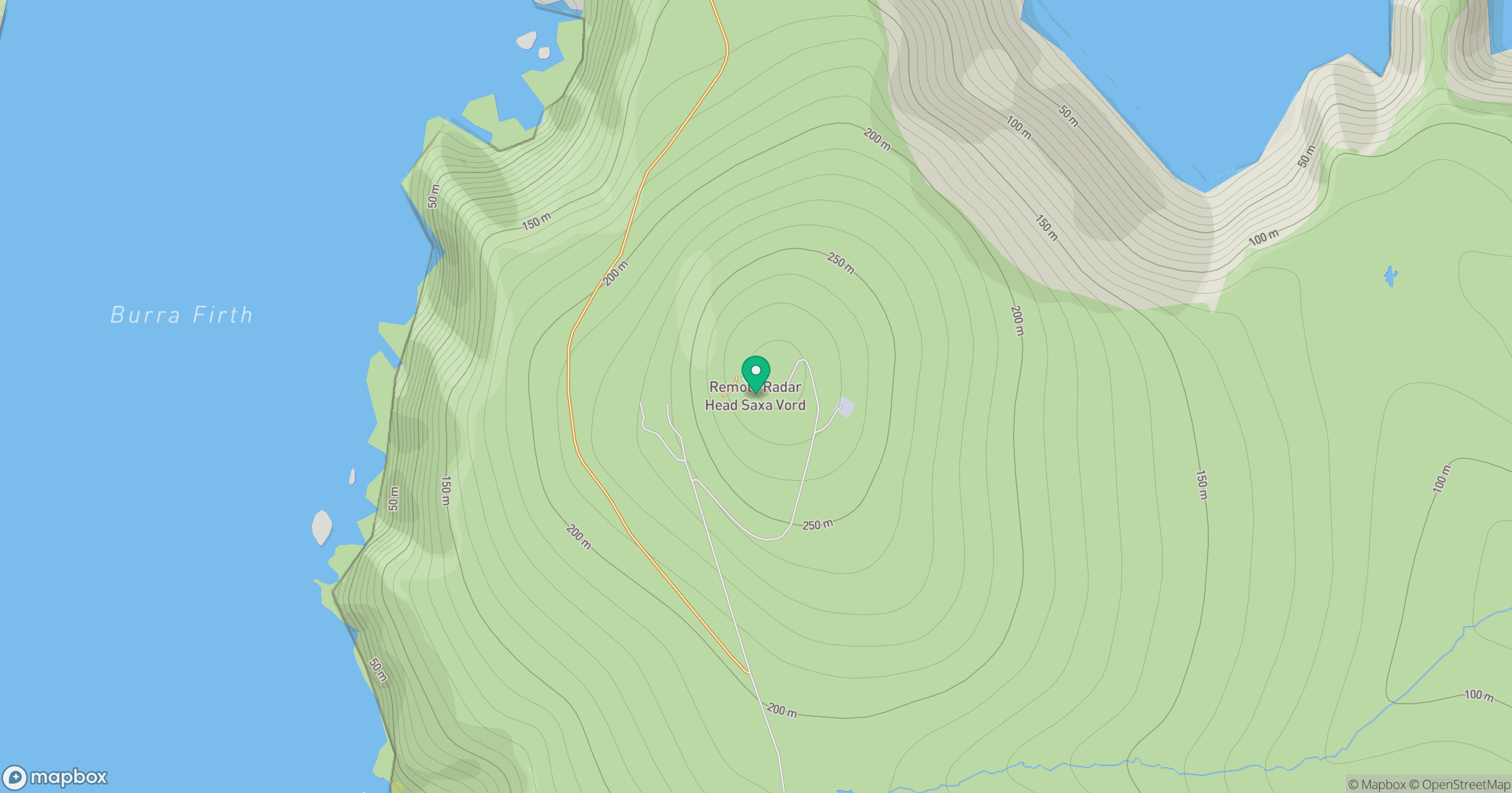
Grid reference: HP631166
View on OpenStreetMapOpens a map in a new tab, centred on the hill.
No comments yet. Be the first.