

Hill of Clibberswick
Good walks are even better shared.
Overview
Hill of Clibberswick
Nestled in the magnificent Shetland Islands, the Hill of Clibberswick is an ideal destination for those seeking a delightful outdoor experience without the fuss of high-altitude hiking.
Geology
The rock formations here are primarily sedimentary, showcasing the geological history of this unique location. Fossils can be found in the layers—if you’re lucky, you might discover a few ancient sea creatures, albeit while resisting the urge to turn them into your new best friends.
Route
Starting from Clibberswick, the trail spans approximately 3.5 km, winding its way up to the peak. The ascent is engaging but not overly strenuous, making it an excellent option for families or anyone looking to stretch their legs while soaking up the stunning scenery.
Summit Features
When you finally reach the summit, you will be greeted by a modest stone cairn—a trusty marker for fellow adventurers. The views from here are nothing short of spectacular. You’ll have the world at your feet, which—let's be honest—is always a nice feeling!
Terrain
The terrain is varied, comprising grassy slopes interspersed with rocky patches, which tend to keep you on your toes. Heather adorns the landscape, adding a pop of purple that gives the hill its charm. Perfect for some unforgettable photos!
Views
As you take in the panoramic sights, look out for distant landmarks like Fair Isle on clear days. The best time for enjoying these fabulous vistas is during spring or summer when the natural palette is in full bloom.
Hazards
While the hike is relatively safe, sudden weather shifts can lead to unexpected adventures. It’s always wise to check the forecast and remember that boulders are not your friends—they have a habit of rolling away from you when you least expect it.
Access
For those driving, there’s a modest parking area nearby. It offers the convenience of leaving your vehicle while you trek up the hill. Public transport options are limited but seasonal bus routes will deliver you from Lerwick to nearby Clibberswick—just make sure to keep an eye on schedules!
Facilities
While amenities on the hill are virtually non-existent, neighbouring Lerwick is brimming with cafes and public toilets. Feast your heart out before heading up the hill!
History
The etymology of 'Clibberswick' hints at its steep and scenic banks, immortalising its landscape in its name. Its historical roots run deep, with Viking connections surfacing in tales and archeological finds.
Whether you're after a gentle hike, a family outing, or just a reason to flaunt your hiking boots, the Hill of Clibberswick offers an experience steeped in both natural beauty and lively history. Grab your walking stick and enjoy the ride!
Explore routes near Hill of Clibberswick
Public walks starting within 80 km of this hill. Nearby does not mean a route reaches the summit; check its map and access before setting out.
No public routes are currently listed within 80 km of Hill of Clibberswick on Walkmates. This does not mean there are no paths here. Explore the map and check local access information before planning a walk.
Route planning notes
These notes describe possible approaches, not verified navigable routes or permission to cross land. Check current paths, local access rules and conditions before setting out.
Clibberswick to Summit Trail
A pleasant trail that meanders through coastal meadows before ascending the hill, offering fantastic views along the way.
Make a day of it, together
Find someone to share the walk with, or organise a day out along a route you like.
Photo Gallery
View all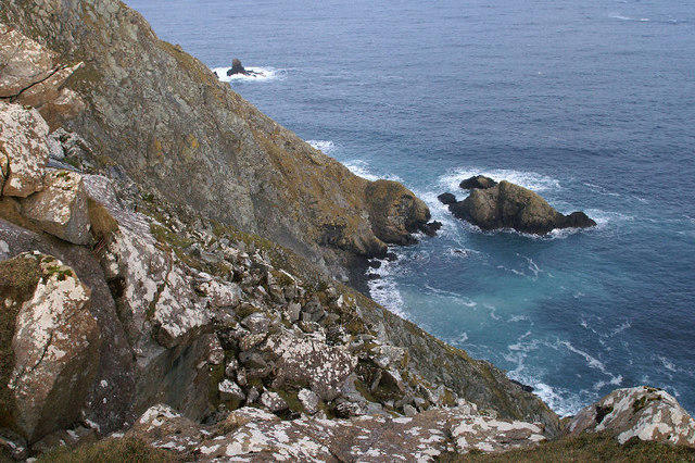 Photo could not load
HP6612 : Clibberswick cliffs
Mike Pennington
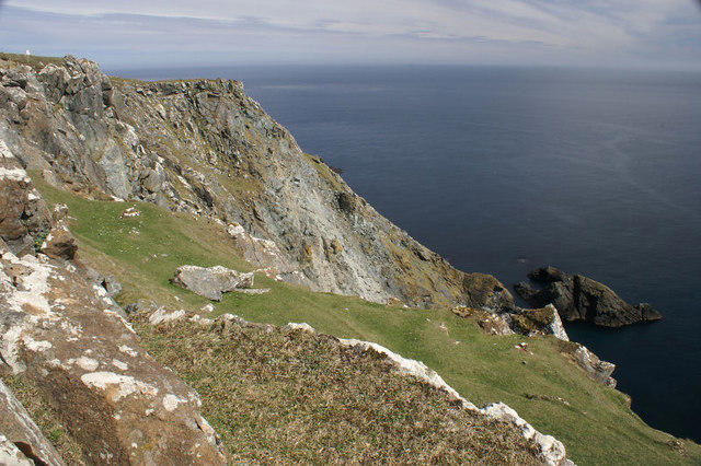 Photo could not load
HP6612 : Clibberswick cliffs
Mike Pennington
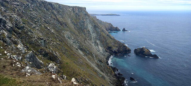 Photo could not load
HP6612 : Cliffs at Clibberswick
Mike Pennington
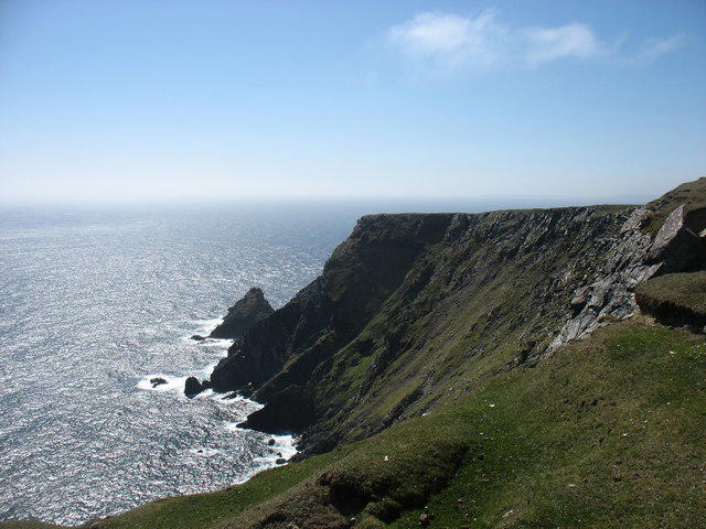 Photo could not load
HP6612 : The Horns of Hagmark
David Purchase
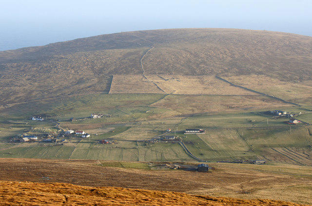 Photo could not load
HP6612 : Hill of Clibberswick from Sothers Field
Mike Pennington
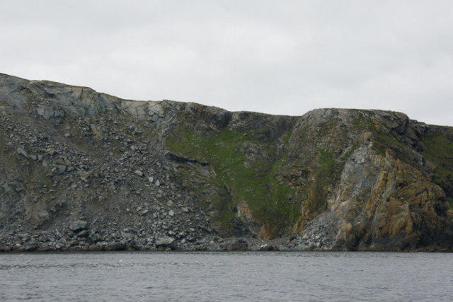 Photo could not load
HP6612 : Cliffs below the Hill of Clibberswick
Mike Pennington
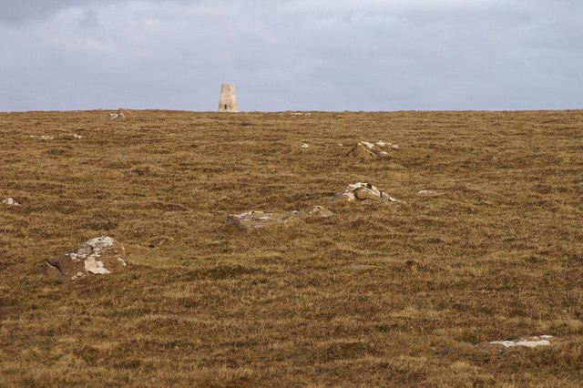 Photo could not load
HP6612 : Summit of the Hill of Clibberswick
Mike Pennington
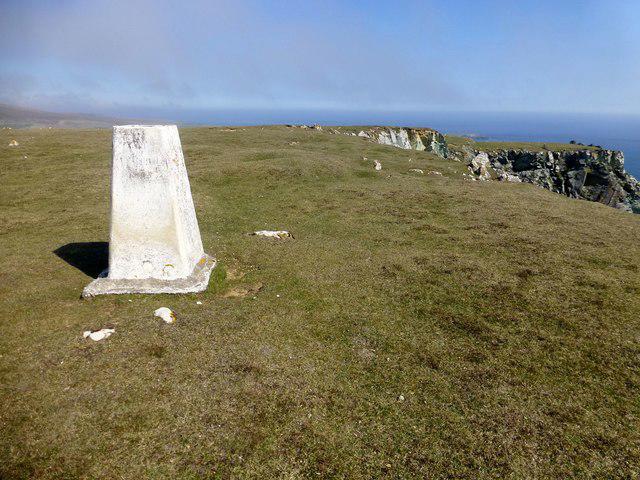 Photo could not load
HP6612 : Hill of Clibberswick
Rude Health
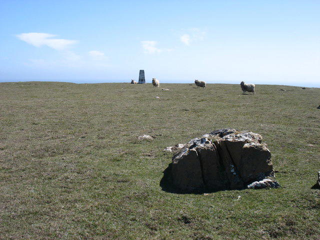 Photo could not load
HP6612 : Hill of Clibberswick summit
David Purchase
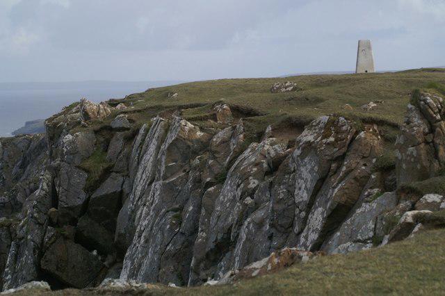 Photo could not load
HP6612 : Clibberswick trig
Mike Pennington
Hill facts and local notes
Classifications
Elevation
160m
527 ft
Prominence
149m
Coordinates
60.7915, -0.7850
HP662126
OS Map
1
Explorer: 470N
At the Summit
At the summit, you will find a modest cairn, which is like a small stone party hat that marks the highest point. There’s also a fantastic view—definitely worth the climb!
Terrain & Geology
The Hill of Clibberswick is comprised mainly of sedimentary rock formations typical of the Shetland archipelago, including sandstone and shale, which are rich in fossils. It's the kind of rock that could probably tell a story or two—if only it could talk!
Views & Scenery
From the summit, you can gaze over the dramatic coastline and the serene waters surrounding the Shetland Islands, as well as the distant Fair Isle on a clear day.
History & Heritage
Name Origin
The name 'Clibberswick' is believed to derive from the Old Norse word 'klibb,' meaning 'a steep bank' or 'cliff'. Quite fitting for a hill that gives you a bit of a workout!
Historical Significance
Historically, this area has been inhabited since Viking times, and the hill offers a glimpse into the rich heritage of the Shetland Islands.
Getting There & Facilities
Check current local access restrictions, parking rules and transport timetables before travelling. These notes do not confirm public access to the summit.
Parking
There's a small parking area near Clibberswick where you can safely leave your vehicle while you embark on your adventure.
Public Transport
Bus services run seasonally, connecting you from Lerwick to nearby hamlets. Do check local schedules as they may play hide and seek!
Nearby Facilities
There are no facilities directly on Clibberswick, but Lerwick offers a plethora of cafes, restaurants, and toilets. It’s a good idea to take advantage of these before heading up the hill!
Safety Information
Known Hazards
- Be wary of sudden weather changes, which can turn sunny strolls into windy adventures in moments. Also, watch your step on the rocky parts—those boulders are not as friendly as they look!
General Safety Tips
- Check weather conditions before setting out
- Carry appropriate clothing and equipment
- Let someone know your planned route
- Take a map, compass, and GPS device
- Carry emergency supplies: food, water, first aid kit, torch
Hills
Some common questions about the hills answered
Are there group walks up Hill of Clibberswick?
Many walkers use Walkmates to join or organise walks with others. You can check for group walks around Hill of Clibberswick through the maps
Are there other walkers around Hill of Clibberswick?
Activity varies by location and time, but Walkmates lets you see whether others have shared walks or shown interest in this area. Find other people through the walking friends search walking friends for Hill of Clibberswick search or of course create your own walk for Hill of Clibberswick
Can I organise a walk to Hill of Clibberswick?
Yes. If there aren’t any walks listed already, you can create a walk and make it available for others to join.
If you're signed up to Walkmates, you can create a walk to Hill of Clibberswick.
How do I find a walk up this hill?
There are often multiple ways to walk this hill, depending on experience and route preference. Walkmates helps you explore walks and routes that others have shared.
Can I suggest a new route up Hill of Clibberswick?
Yes. You can suggest or create routes to share with others. Walkmates focuses on the social side of walking, so routes are used to help people organise walks and explore areas together, rather than as detailed navigation tools or route libraries.
Other uses really appreciate knowledgeable walkers sharing their routes. Share your favourite route to Hill of Clibberswick here
The is an error or something incorrect about this hill. How do I let you know?
We always strive to keep the information on Walkmates as accurate as possible. If you find an error, please let us know through the contact form and we'll aim to correct it as quickly as possible
Community Discussion
Comments
Location
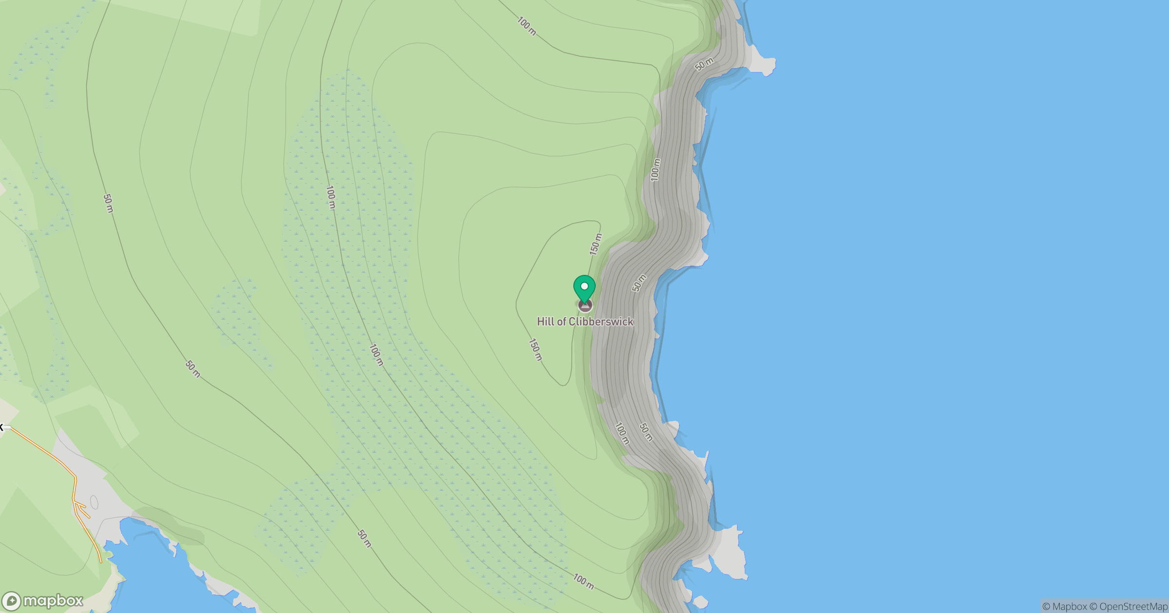
Grid reference: HP662126
View on OpenStreetMapOpens a map in a new tab, centred on the hill.
Hills within 30 km
Straight-line distance, not a walking route or confirmation of access.
No comments yet. Be the first.