

Hermaness Hill
Good walks are even better shared.
HP6017 : The old signal station on Hermaness Hill
Mike Pennington Photo source
Overview
Hermaness Hill: The Crown Jewel of the Shetlands
Nestled in the heart of Shetland, Hermaness Hill offers a unique blend of natural beauty, rich history, and geological wonder. Standing proudly at 197 meters, this Marilyn is a pivotal part of the Hermaness Nature Reserve, known for its breathtaking landscapes and vibrant wildlife.
Geology
The hill's geological story unfolds through its sandstone formations, reflecting the rugged elemental forces that shaped the Shetland landscape. These rocks tell tales older than time and showcase the area's varied geological history.
Routes
Embarking on the Hermaness Nature Reserve Trail is a must for those keen to explore this majestic hill. Spanning approximately 4.5 km, the trail provides a delightful balance of challenge and accessibility—perfect for families or seasoned hikers looking to stretch their legs while soaking in the stunning vistas.
Summit Features
Reaching the top, adventurers will find a trig point, a small cairn, and panoramic views that will make your camera weep with joy. It’s a spot where the majesty of nature truly shines, with sights stretching far and wide.
Terrain
The terrain varies from grassy inclines to rocky patches, with just a dash of bog thrown in for good measure. A sturdy pair of hiking boots will make all the difference here, especially in wetter months.
Views
The sweeping views from Hermaness Hill are arguably some of the best in the Shetland Islands. Look out towards the Muckle Flugga lighthouse and marvel at the rugged coastline dotted with seabirds. Best visited in spring or summer, the sights are nothing short of magnificent.
Hazards
The Shetland weather can be notoriously fickle, so be prepared for anything—from sunshine to sudden rain. Keep an eye on your footing, especially around the rocky outcrops.
Access
Finding your way to Hermaness is relatively straightforward, with parking available at the nearby nature reserve car park. Just a short hike leads you to the stunning sights that await! While public transport exists, it is best to check local timetables to avoid being left in the lurch.
Facilities
Facilities in the surrounding areas are limited, but nearby Brae offers some quaint cafés and conveniences for a much-needed pit stop after your excursion.
History
The name 'Hermaness' reveals a glimpse into the past, likely derived from Norse roots meaning 'high place'. It holds cultural significance, weaving together the rich maritime heritage of the Shetland Islands with the incredible natural beauty that continues to attract adventurers from all around.
So pack your bags, lace up those boots, and get ready to discover Hermaness Hill—an adventure that promises unforgettable memories amid the breathtaking landscapes of Shetland. Happy hiking!
Explore routes near Hermaness Hill
Walks starting near this hill. Open a route to check its map, distance and full itinerary.
Route planning notes
These notes describe possible approaches. Check a route's map and access information when planning your walk.
Hermaness Nature Reserve Circular Route
This popular route starts at the Hermaness Visitor Centre and follows a well-maintained path through the nature reserve. You’ll traverse peat bogs on boardwalks, climb to the summit of Hermaness Hill, and enjoy panoramic views of Muckle Flugga and the dramatic sea cliffs. Keep an eye out for puffins and other seabirds along the way.
Hermaness Coastal Walk
This route begins at the Hermaness Visitor Centre and takes a coastal path along the edge of the cliffs, offering breathtaking views of the North Atlantic. The trail loops back via the summit of Hermaness Hill, providing a mix of coastal scenery and highland landscape.
Clifftop and Summit Explorer
This route combines the highlights of Hermaness with a focus on clifftop views. Starting at the visitor centre, the trail follows a longer loop that includes more time along the dramatic cliffs before ascending Hermaness Hill for a rewarding summit experience.
Short Summit Ascent
For those seeking a quicker hike, this route takes a direct path to the summit of Hermaness Hill from the visitor centre. Though shorter, it still provides excellent views and a chance to experience the stark beauty of the area.
Hermaness Wildlife Trail
This route caters to wildlife enthusiasts, offering a leisurely loop through the Hermaness Nature Reserve. The trail includes the summit of Hermaness Hill and offers opportunities for birdwatching, including spotting puffins and gannets, as well as seals along the coastline.
Make a day of it, together
Find someone to share the walk with, or organise a day out along a route you like.
Photo Gallery
View all Photo could not load
HP6017 : Walkers on Hermaness Hill
Mike Pennington
 Photo could not load
HP6017 : View north from Hermaness Hill
Mike Pennington
 Photo could not load
HP6017 : Sheep on the westside of Hermaness Hill
Mike Pennington
 Photo could not load
HP6017 : Great Skua (Stercorarius skua), Hermaness Hill
Mike Pennington
 Photo could not load
HP6017 : Hermaness Hill
Rude Health
 Photo could not load
HP6017 : Herma Ness: remains of a building on Hermaness Hill
Chris Downer
 Photo could not load
HP6017 : Former signal station, Hermaness Hill
Mike Pennington
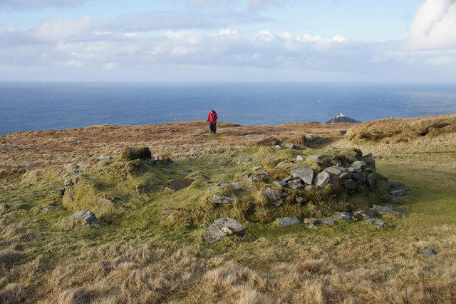 Photo could not load
HP6017 : The old signal station on Hermaness Hill
Mike Pennington
 Photo could not load
HP6017 : The summit area of Hermaness Hill
David Purchase

HP6017 : Rickle o' Stanes, Hermaness Hill
Anne Burgess
Hill facts and local notes
Classifications
Elevation
200m
656 ft
Prominence
139m
Coordinates
60.8365, -0.8855
HP606175
OS Map
1
Explorer: 470N
At the Summit
The summit features a prominent trig point and a small cairn, serving as a testament to the many adventurers who have made their way to the top. The panoramic views from here are simply breathtaking.
Terrain & Geology
Hermaness Hill is primarily composed of sandstone and showcases fascinating geological formations that hint at the area's dynamic past. The rocky outcrops and cliffs reveal layers of sediment that have shaped the landscape over millennia.
Views & Scenery
From the summit, experience jaw-dropping views of the Out Skerries, Unst, and the sea cliffs dotted with seabirds. Look out for the iconic Muckle Flugga lighthouse in the distance.
History & Heritage
Name Origin
The name 'Hermaness' is believed to derive from the Norse term for 'high place' or 'promontory', fitting for this elevated area.
Historical Significance
This area has been significant for local communities, particularly in relation to its maritime history and the nearby lighthouses that guide ships through treacherous waters.
Getting There & Facilities
Parking
There is limited parking available at the Hermaness Nature Reserve car park, approximately 1 km from the start of the walking trail.
Public Transport
Buses to Hermaness can be accessed from Lerwick, but services are limited. Check local schedules for updates.
Nearby Facilities
While there are no facilities directly at Hermaness Hill, Brae offers cafés and public conveniences for hikers looking to refuel before or after their adventure.
Safety Information
Known Hazards
- Watch out for sudden weather changes typical of the Shetland climate. Always carry waterproof clothing and be cautious of slippery rocky areas after rain.
General Safety Tips
- Check weather conditions before setting out
- Carry appropriate clothing and equipment
- Let someone know your planned route
- Take a map, compass, and GPS device
- Carry emergency supplies: food, water, first aid kit, torch
Hills
Some common questions about the hills answered
Are there group walks up Hermaness Hill?
Many walkers use Walkmates to join or organise walks with others. You can check for group walks around Hermaness Hill through the maps
Are there other walkers around Hermaness Hill?
Activity varies by location and time, but Walkmates lets you see whether others have shared walks or shown interest in this area. Find other people through the walking friends search walking friends for Hermaness Hill search or of course create your own walk for Hermaness Hill
Can I organise a walk to Hermaness Hill?
Yes. If there aren’t any walks listed already, you can create a walk and make it available for others to join.
If you're signed up to Walkmates, you can create a walk to Hermaness Hill.
How do I find a walk up this hill?
There are often multiple ways to walk this hill, depending on experience and route preference. Walkmates helps you explore walks and routes that others have shared.
Can I suggest a new route up Hermaness Hill?
Yes. You can suggest or create routes to share with others. Walkmates focuses on the social side of walking, so routes are used to help people organise walks and explore areas together, rather than as detailed navigation tools or route libraries.
Other uses really appreciate knowledgeable walkers sharing their routes. Share your favourite route to Hermaness Hill here
The is an error or something incorrect about this hill. How do I let you know?
We always strive to keep the information on Walkmates as accurate as possible. If you find an error, please let us know through the contact form and we'll aim to correct it as quickly as possible
Community Discussion
Comments
Location
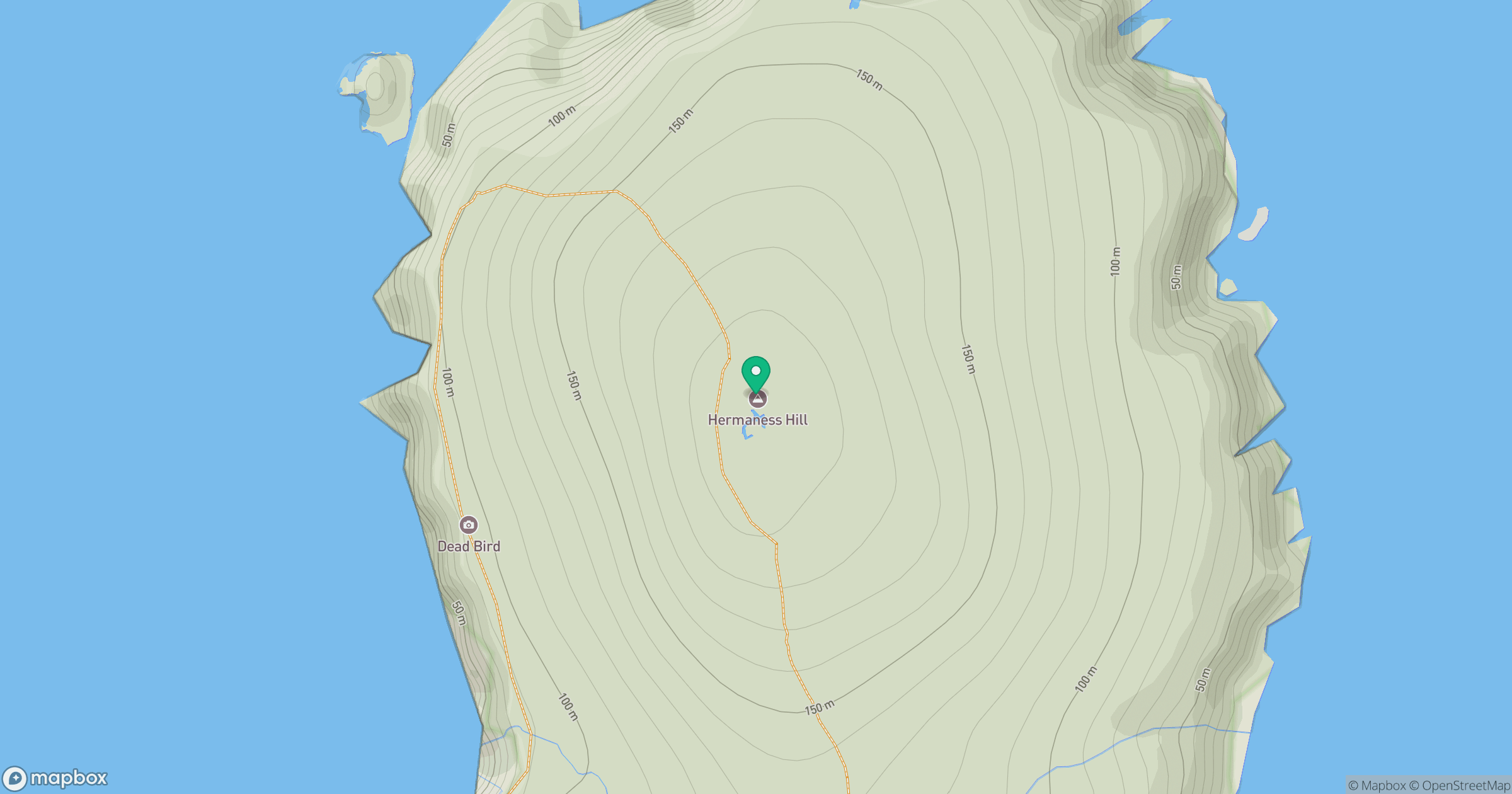
Grid reference: HP606175
View on OpenStreetMapOpens a map in a new tab, centred on the hill.
No comments yet. Be the first.