

Pen y Bryn-mawr
Good walks are even better shared.
Overview
Pen y Bryn-mawr
Overview
Nestled within the stunning Brecon Beacons, Pen y Bryn-mawr stands at an elevation of 594 meters. This hill is a popular destination for hikers eager to enjoy the beautiful Welsh countryside and is classified as both a Hewitt and a Nuttall. With its rolling landscapes and scenic views, it is a perfect family-friendly hike.
Geology
The geology of Pen y Bryn-mawr reveals intriguing layers of mudstone and sandstone, crafted over eons into a hill that holds a remarkable biodiversity. The rock formations provide not just stability but also an attractive landscape with patches of greenery.
Routes
Brynmawr Circular Route
This 9.5 km route begins in Brynmawr and takes you around the hill, allowing for panoramic views and a chance to enjoy the flora and fauna. Expect to spend about 3.5 hours on a moderate trail that is well marked and suitable for most abilities.
North Ridge Ascent
If you're looking for a bit more of a challenge, try the North Ridge Ascent. This steeper route measures 2.8 km and can take about 1.5 hours, rewarding hikers with breathtaking views midway through the climb.
Summit Features
Upon reaching the summit, you’ll find a humble stone cairn and a trig point, perfect for that triumphant photo. Don’t forget to savour the sweet taste of success!
Terrain
Expect a delightful mix of grassy slopes and the occasional rocky patches. The trail is relatively easy to navigate, but keep your wits about you especially after wet weather.
Views
The vistas you encounter on a clear day from the summit are nothing short of enchanting. You can catch sight of the majestic Pen y Fan to the southwest and the rolling hills stretching as far as the eye can see.
Hazards
Be cautious of the mountain’s temperament. Wet weather can create slippery conditions, and visibility can change dramatically in the blink of an eye. Always pack accordingly!
Nearby Summits
Don’t miss the opportunity to explore nearby peaks such as Mynydd y Garn and the iconic Pen y Fan for a more thrilling adventure.
Access
Brynmawr provides ample parking options and is well connected by public transport for those looking to use buses from nearby towns.
Facilities
Stock up on snacks or grab a cup of coffee in Brynmawr before you start your hike. The town has conveniences that cater to all your pre-adventure needs.
History
The name Pen y Bryn-mawr may seem straightforward, but it’s a nod to the hill's significance in local culture—it's the towering sentinel of the region.
Embrace the challenge and thrill of hiking Pen y Bryn-mawr, and don't forget to enjoy the journey as much as the destination!
Explore routes near Pen y Bryn-mawr
Public walks starting within 80 km of this hill. Nearby does not mean a route reaches the summit; check its map and access before setting out.
Ystwyth Trail: Black Covert to Llanilar and back
View route
Hafren Forest: full Source of the Severn Trail
View route
Elan Valley: Reservoir Trail to Pen y Garreg Dam
View route
Llanerchaeron: Lanlas, Aberaeron and Aeron Valley circular
View route
Route planning notes
These notes describe possible approaches, not verified navigable routes or permission to cross land. Check current paths, local access rules and conditions before setting out.
Brynmawr Circular Route
A delightful circular route starting from the village of Brynmawr, showcasing stunning landscapes of the Brecon Beacons National Park.
North Ridge Ascent
This ascent from the north offers a steeper climb with rewarding views across the rural landscape.
Make a day of it, together
Find someone to share the walk with, or organise a day out along a route you like.
Photo Gallery
View all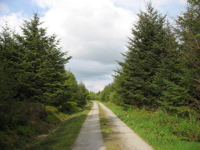 Photo could not load
SN7073 : Track in Pen y Bryn-mawr wood
David Purchase
Hill facts and local notes
Classifications
Elevation
342m
1,122 ft
Prominence
119m
Coordinates
52.3418, -3.9014
SN705732
OS Map
135 147
Explorer: 213
At the Summit
The summit boasts a modest stone cairn, with a nearby trig point offering a perfect photo opportunity. Be sure to cap off your climb with a victory dance (or at least a selfie).
Terrain & Geology
Pen y Bryn-mawr is primarily composed of mudstone and sandstone, typical of the South Wales geology. These sedimentary rocks provide a stable foundation for the hill's lush green pastures and occasional rocky outcrops.
Views & Scenery
From the top, gaze upon the rolling hills of the Brecon Beacons, the Black Mountains to the southeast, and on a clear day, the distant peaks of Snowdonia.
History & Heritage
Name Origin
The name 'Pen y Bryn-mawr' translates to 'the top of the big hill' in Welsh, which is fitting for its prominent position in the area.
Historical Significance
This hill has been a landmark for locals for generations, guiding them through the rugged terrains of the Brecon Beacons.
Getting There & Facilities
Check current local access restrictions, parking rules and transport timetables before travelling. These notes do not confirm public access to the summit.
Parking
The nearest car park can be found at Brynmawr town centre, there are also a couple of lay-bys along the A465.
Public Transport
Buses operate from nearby towns, including regular services from Abergavenny and Merthyr Tydfil.
Nearby Facilities
Brynmawr offers several cafes, shops for snacks, and public toilets, making it a great starting point for your adventure.
Safety Information
Known Hazards
- Wet and muddy conditions prevail after rain, making some areas slippery. Always keep an eye out for sudden weather changes in the mountains.
General Safety Tips
- Check weather conditions before setting out
- Carry appropriate clothing and equipment
- Let someone know your planned route
- Take a map, compass, and GPS device
- Carry emergency supplies: food, water, first aid kit, torch
Hills
Some common questions about the hills answered
Are there group walks up Pen y Bryn-mawr?
Many walkers use Walkmates to join or organise walks with others. You can check for group walks around Pen y Bryn-mawr through the maps
Are there other walkers around Pen y Bryn-mawr?
Activity varies by location and time, but Walkmates lets you see whether others have shared walks or shown interest in this area. Find other people through the walking friends search walking friends for Pen y Bryn-mawr search or of course create your own walk for Pen y Bryn-mawr
Can I organise a walk to Pen y Bryn-mawr?
Yes. If there aren’t any walks listed already, you can create a walk and make it available for others to join.
If you're signed up to Walkmates, you can create a walk to Pen y Bryn-mawr.
How do I find a walk up this hill?
There are often multiple ways to walk this hill, depending on experience and route preference. Walkmates helps you explore walks and routes that others have shared.
Can I suggest a new route up Pen y Bryn-mawr?
Yes. You can suggest or create routes to share with others. Walkmates focuses on the social side of walking, so routes are used to help people organise walks and explore areas together, rather than as detailed navigation tools or route libraries.
Other uses really appreciate knowledgeable walkers sharing their routes. Share your favourite route to Pen y Bryn-mawr here
The is an error or something incorrect about this hill. How do I let you know?
We always strive to keep the information on Walkmates as accurate as possible. If you find an error, please let us know through the contact form and we'll aim to correct it as quickly as possible
Community Discussion
Comments
Location
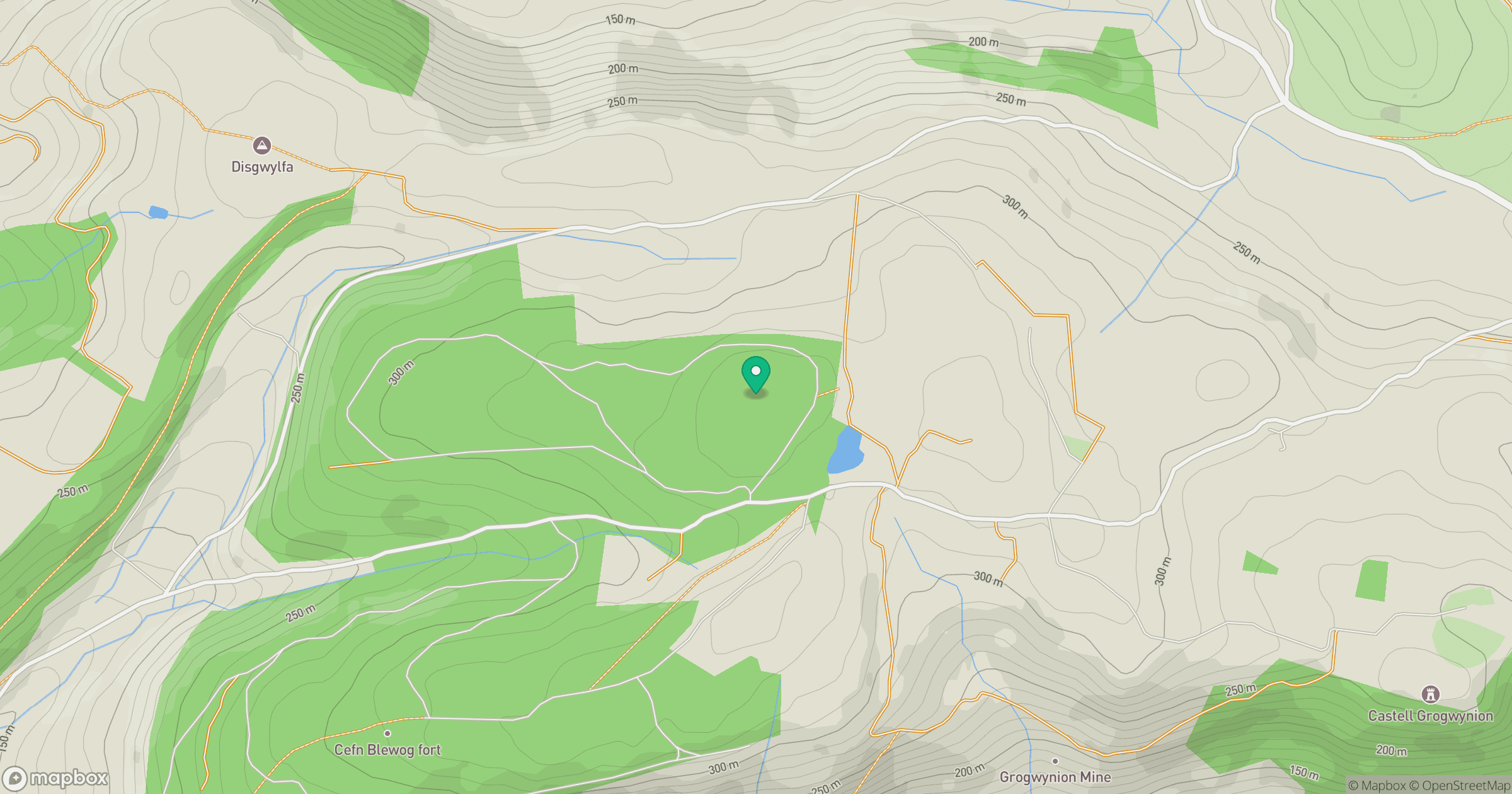
Grid reference: SN705732
View on OpenStreetMapOpens a map in a new tab, centred on the hill.
Hills within 30 km
Straight-line distance, not a walking route or confirmation of access.
Pumlumon Fawr [Plynlimon]
753m
Mynydd Bach
374m
Banc y Garn
437m
Disgwylfa Fawr
507m
Llan Ddu Fawr [Waun Claerddu]
594m
No comments yet. Be the first.