

Old Sarum
Good walks are even better shared.
SU1332 : Old Sarum
Eirian Evans Photo source
Overview
Old Sarum: A Hiker's Delight with a Dash of History
Nestled in the heart of South Wiltshire, Old Sarum offers not just stunning views but also a slice of history you can almost taste. At 125 meters high, this ancient hill fort may not break any elevation records, but it certainly brings a bounty of historical significance and breathtaking scenery.
Geology
Old Sarum is set upon a hill composed chiefly of chalk and flint. This region was sculpted during the last Ice Age and is a perfect representation of classic chalk downland geology. You might stumble over a few sharp flint stones, but don’t let that deter you; they’re great for stunning selfies!
Routes
The Old Sarum Circular Walk is a fantastic option for those eager to stretch their legs while soaking in the sights. This easy 3.5 km path encircles the fort, making it suitable for all ages. With an average time of 1.5 hours, you’ll have ample opportunity to stop, gaze, and ponder the lives of those who walked these grounds centuries ago.
Summit Features
Upon reaching the summit, you’ll be greeted by medieval castle ruins and the ghostly foundations of a cathedral. It’s the perfect spot to catch your breath and take in the panoramic views that stretch across Salisbury and beyond. Don't forget to channel your inner historian while you’re there!
Terrain & Access
This is a grassy yet uneven terrain, but nothing too treacherous; ideal for a relaxing hike or family outing. Access is a breeze with public transport links running regularly from Salisbury, along with ample parking at the visitor centre.
Views
The most rewarding views can be found during spring and autumn, when clear skies and the golden hues of nature create picturesque vistas. Spot landmarks like Salisbury Cathedral in the distance and admire the rolling hills of the South Downs.
Hazards
While the walk is straightforward, do keep an eye out for uneven paths and steep drops near the fortifications. Remember, common sense is your best friend here!
Facilities & History
feel free to pop into the small café near the visitor centre for a bite to eat and a cuppa. As for history, Old Sarum goes way back to the Iron Age, with significant Roman and medieval connections adding to its character. The term 'Old Sarum' itself is derived from the Latin 'Sarum', nodding to its rich history.
So, lace up your hiking boots, grab that sandwich, and head to Old Sarum, where history and beauty await! It’s a favourite that doesn’t require climbing Everest to enjoy.
Conclusion
Old Sarum is a perfect day out for families, history buffs, and anyone who enjoys a good view. Just keep your wits about you on those paths, and don’t forget the camera!
Explore routes near Old Sarum
Walks starting near this hill. Open a route to check its map, distance and full itinerary.
Devizes Wharf and Caen Hill Lock Flight Towpath Walk
View route
Wilverley Inclosure Walk, New Forest
View route
Badbury Rings and The Oaks from Heron Drove, Dorset
View route
South Downs Way: Winchester to Exton via Beacon Hill
View route
Route planning notes
These notes describe possible approaches. Check a route's map and access information when planning your walk.
Old Sarum Circular Walk
A popular circular route starting from the Old Sarum car park. This route takes you around the ancient hill fort, offering stunning views of the surrounding countryside and Salisbury Cathedral in the distance. The trail includes a mix of grassy paths and well-trodden tracks, providing a gentle introduction to the area's history and natural beauty.
Old Sarum to Salisbury Cathedral Walk
This linear route begins at Old Sarum and descends through rolling fields and quiet lanes towards Salisbury Cathedral. The path follows part of the Avon Valley and offers a scenic journey with historic significance, connecting the ancient hill fort to the iconic medieval cathedral.
Old Sarum and River Avon Circuit
A longer circular walk that combines Old Sarum with a peaceful stretch along the River Avon. Starting from the Old Sarum car park, the route meanders through farmland, riverside paths, and woodland trails before looping back to the hill fort. Ideal for walkers seeking a mix of landscapes and wildlife.
Old Sarum Historical Trail
This route focuses on exploring the historical significance of Old Sarum. Starting at the hill fort, it delves into the site's rich history, including the Iron Age, Roman, and Norman periods. The walk includes interpretive stops at key locations around the fort and nearby archaeological features.
Old Sarum to Hudson’s Field Loop
A family-friendly loop that starts at Old Sarum and ventures into Hudson’s Field, a popular green space nearby. The route offers a mix of open landscapes, picnic spots, and gentle gradients, making it suitable for all ages and abilities.
Make a day of it, together
Find someone to share the walk with, or organise a day out along a route you like.
Photo Gallery
View all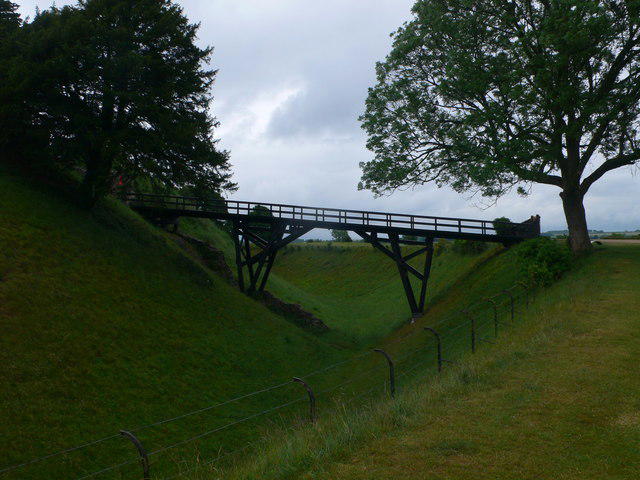 Photo could not load
SU1332 : Old Sarum
Eirian Evans
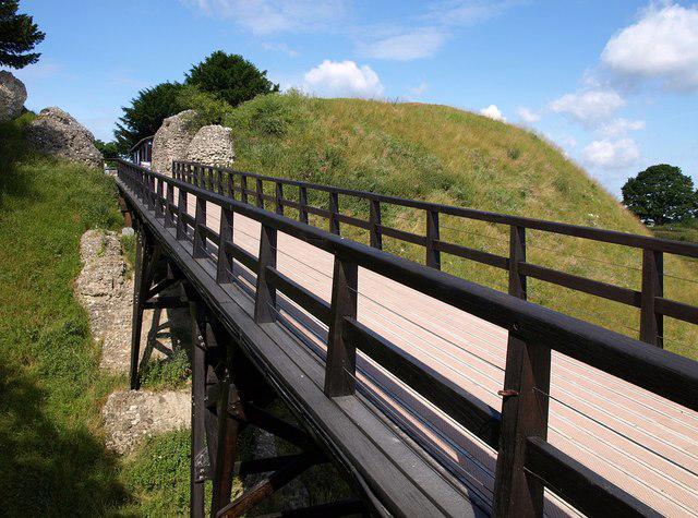 Photo could not load
SU1332 : Bridge into Old Sarum castle
Derek Harper
![SU1332 : Old Sarum [6]](https://cdn.walkmates.com/gallery-images/b42ba2917b8645a6ab11c9f5b932c683.jpg) Photo could not load
Photo could not load
SU1332 : Old Sarum [6]
Michael Dibb
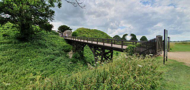 Photo could not load
SU1332 : Footbridge across the moat at Old Sarum
Helen Steed
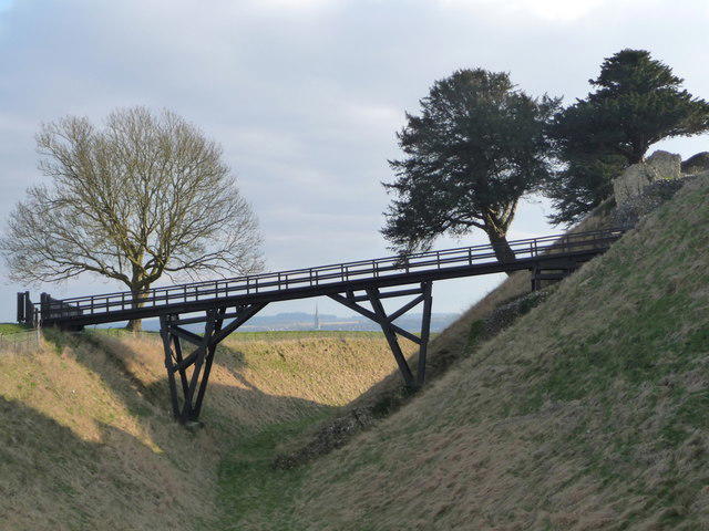 Photo could not load
SU1332 : Salisbury: bridge to Old Sarum castle
Chris Downer
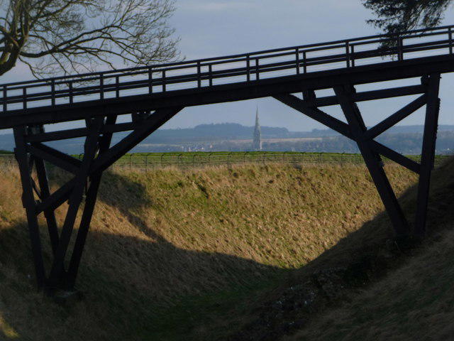 Photo could not load
SU1332 : Salisbury: cathedral view from Old Sarum
Chris Downer
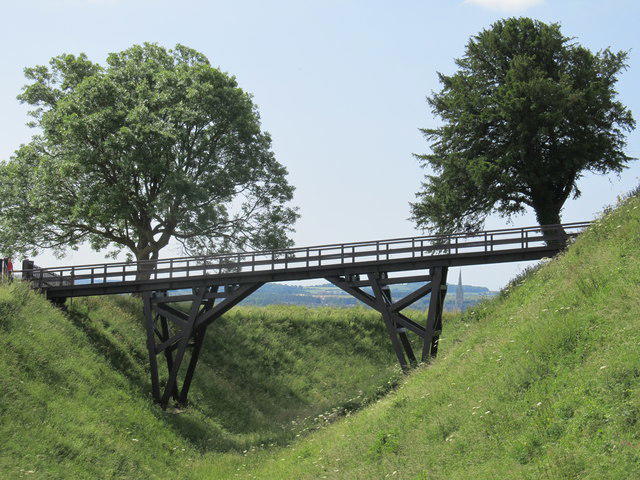 Photo could not load
SU1332 : Footbridge to the entrance to Old Sarum
Richard Rogerson
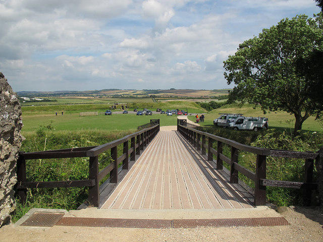 Photo could not load
SU1332 : Moat bridge at Old Sarum
Stephen Craven
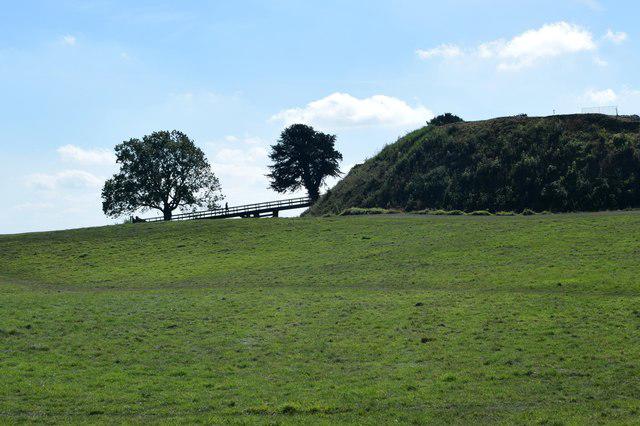 Photo could not load
SU1332 : Old Sarum
Trevor Harris
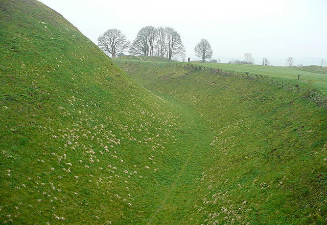
SU1332 : Old Sarum, inner bailey
Graham Horn
Hill facts and local notes
Classifications
Elevation
122m
400 ft
Prominence
43m
Coordinates
51.0935, -1.8042
SU138327
OS Map
184
Explorer: 130S
At the Summit
The summit features the remains of a medieval castle and the foundations of a cathedral, along with panoramic views over the surrounding countryside.
Terrain & Geology
Old Sarum is primarily composed of chalk and flint, resting atop a hill formed during the last Ice Age. The area showcases classic chalk downland geology, which is quite the spectacle!
Views & Scenery
From the summit, you can spot landmarks like the city of Salisbury and the distant rolling hills of the South Downs.
History & Heritage
Name Origin
The name 'Old Sarum' is derived from the Latin 'Sarum', reflecting its Roman connections.
Historical Significance
Old Sarum has a rich history as a settlement since the Iron Age, with remnants from various periods, including Neolithic, Roman, and medieval times.
Getting There & Facilities
Parking
There is ample parking at the Old Sarum visitor centre, just a stone's throw away from the site.
Public Transport
Regular bus services from Salisbury to Old Sarum make it easy to get here without a car.
Nearby Facilities
A small café is near the visitor centre, along with public toilets, so you can refuel and refresh after your explorations.
Safety Information
Known Hazards
- Uneven ground and steep drops around the fortifications. Common sense should prevail!
General Safety Tips
- Check weather conditions before setting out
- Carry appropriate clothing and equipment
- Let someone know your planned route
- Take a map, compass, and GPS device
- Carry emergency supplies: food, water, first aid kit, torch
Hills
Some common questions about the hills answered
Are there group walks up Old Sarum?
Many walkers use Walkmates to join or organise walks with others. You can check for group walks around Old Sarum through the maps
Are there other walkers around Old Sarum?
Activity varies by location and time, but Walkmates lets you see whether others have shared walks or shown interest in this area. Find other people through the walking friends search walking friends for Old Sarum search or of course create your own walk for Old Sarum
Can I organise a walk to Old Sarum?
Yes. If there aren’t any walks listed already, you can create a walk and make it available for others to join.
If you're signed up to Walkmates, you can create a walk to Old Sarum.
How do I find a walk up this hill?
There are often multiple ways to walk this hill, depending on experience and route preference. Walkmates helps you explore walks and routes that others have shared.
Can I suggest a new route up Old Sarum?
Yes. You can suggest or create routes to share with others. Walkmates focuses on the social side of walking, so routes are used to help people organise walks and explore areas together, rather than as detailed navigation tools or route libraries.
Other uses really appreciate knowledgeable walkers sharing their routes. Share your favourite route to Old Sarum here
The is an error or something incorrect about this hill. How do I let you know?
We always strive to keep the information on Walkmates as accurate as possible. If you find an error, please let us know through the contact form and we'll aim to correct it as quickly as possible
Community Discussion
Comments
Location
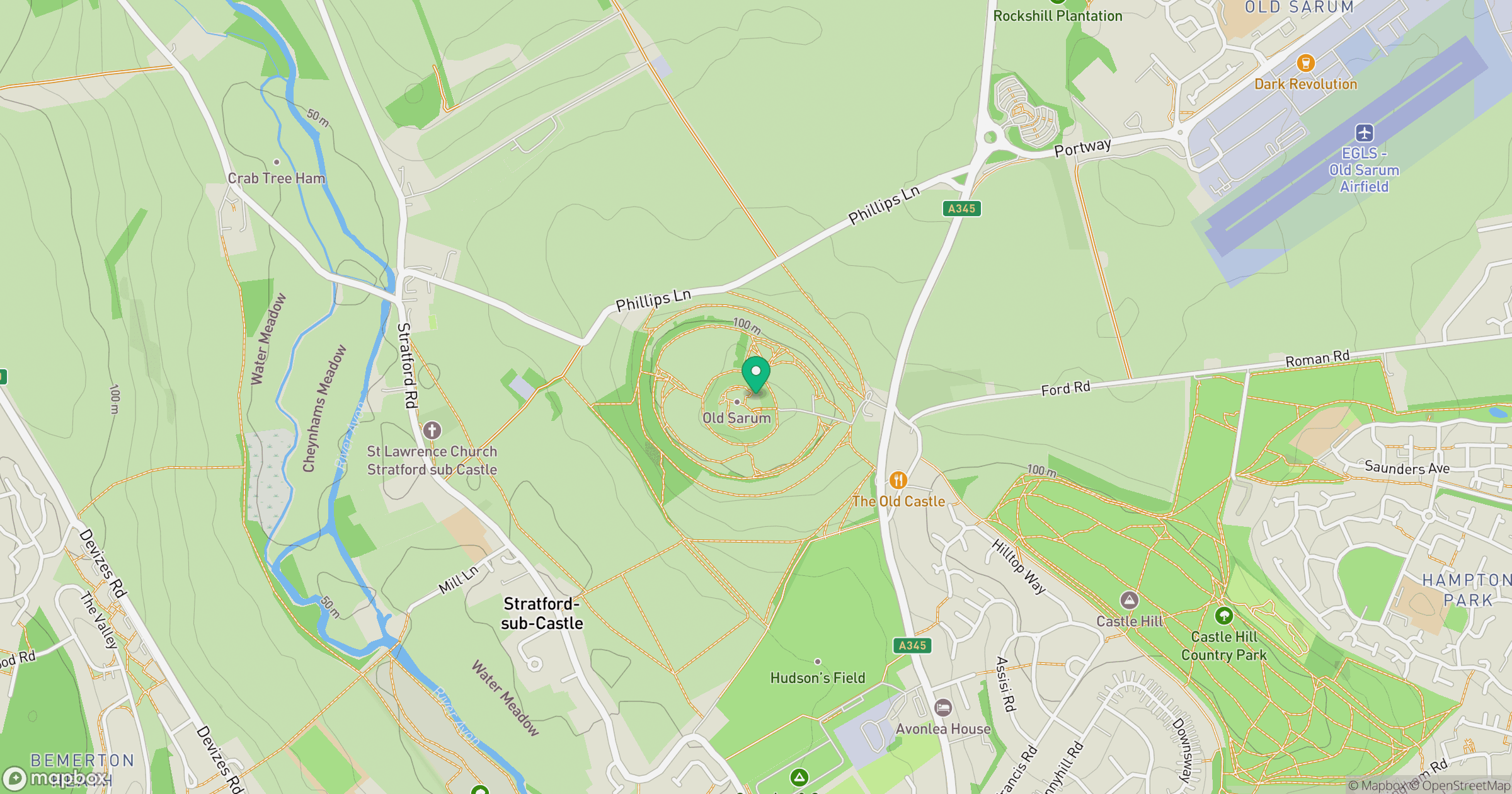
Grid reference: SU138327
View on OpenStreetMapOpens a map in a new tab, centred on the hill.
Nearby Hills
Glastonbury Tor
158m
Worcestershire Beacon
425m
Leith Hill
294m
Titterstone Clee Hill
533m
Ditchling Beacon
248m
No comments yet. Be the first.