

Noup Head
Good walks are even better shared.
HY3949 : Cliffs by Noup Head Lighthouse
Andy Farrington Photo source
Overview
Noup Head
Welcome to Noup Head, a stunning Marilyn located on the Orkney Islands, with an elevation of 142 meters. This rugged beauty offers adventurers an exhilarating day out amidst dramatic coastal scenery.
Geology
Noup Head is mainly composed of Old Red Sandstone, which gives the landscape its distinct rust-red hue. Wander through this geological wonder, and keep your eyes peeled for fossils that tell tales of a time long past.
Access
The journey begins in the charming village of Rackwick, where you’ll find a small parking area. Be warned, it fills up quickly during the warmer months, so arriving early is advisable. Public transport options from Kirkwall are available, but check the bus schedules as they don’t run super frequently. Prepare for a wee bit of a hike after your bus ride!
Route Description
Noup Head Coastal Path
- Distance: 4.5 km round trip
- Estimated Time: 2.5 hours
- Difficulty: Moderate
The Coastal Path leads you along cliff edges, treating you to breathtaking panoramic views of the North Sea and the rugged Orkney coast. Keep your camera at the ready, as the scenery is picture-perfect — just be careful not to drop your phone over the edge!
Summit Features
At the summit, you’ll find a trig point and expansive grassy areas laced with wildflowers. Take a moment to catch your breath and soak in the 360-degree views — they really make the hike worthwhile.
Terrain
Expect a combination of rocky outcrops and grassy patches, with a few boggy sections near the trailhead that can provide surprise mud baths for unsuspecting hikers (don’t worry, your shoes will survive!).
Views
From the summit, gaze upon the beautiful cliffs of Noup Head, the distant uninhabited islands that dot the horizon, and the majestic North Sea stretching out into infinity. For the best views, visit during late spring to early autumn, and don't miss the phenomenal sunsets that bathe the landscape in golden light.
Hazards
While nothing spoils a hike quicker than a tumble, be cautious around cliff edges and beware of sudden weather changes that can sweep in like a surprising guest at a party. The winds can be brisk here, and those rocky paths may not always be as stable as they appear.
Nearby Summits
For those looking to extend their adventure, consider heading to nearby Westray or the lower Papa Westray for a varied hiking experience in the Orkney’s striking landscapes.
Conclusion
Noup Head beckons nature lovers and adventure seekers alike. Whether it’s the geology, views, or historical significance, there’s plenty to keep you entertained. So lace up those boots, grab your walking stick, and get ready for a grand day out!
Happy hiking, and remember: if you find a better view, do send a postcard!
Explore routes near Noup Head
Walks starting near this hill. Open a route to check its map, distance and full itinerary.
Route planning notes
These notes describe possible approaches. Check a route's map and access information when planning your walk.
Noup Head Coastal Path
A scenic route starting from the village of Rackwick, weaving along the cliff edges with breathtaking views of the North Sea.
Make a day of it, together
Find someone to share the walk with, or organise a day out along a route you like.
Photo Gallery
View all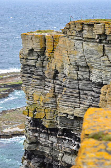 Photo could not load
HY3949 : Cliffs by Noup Head Lighthouse
Andy Farrington
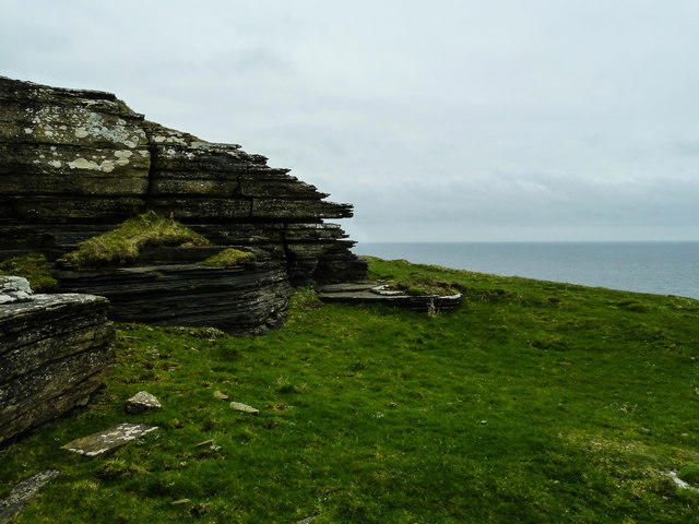 Photo could not load
HY3949 : Haas of the Stack
Andy Farrington
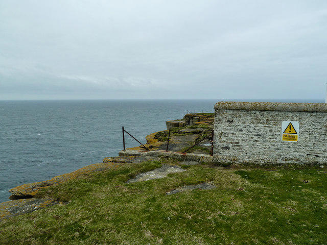 Photo could not load
HY3949 : Danger Vertical Cliffs
Andy Farrington
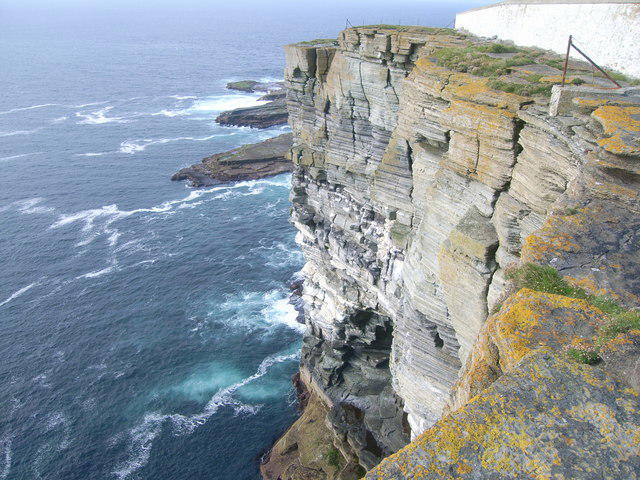 Photo could not load
HY3949 : Sheer cliffs at Noup Head
Nick Mutton 01329 000000
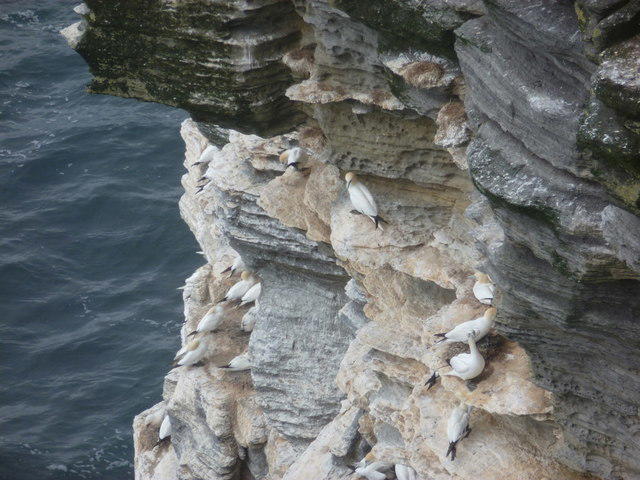 Photo could not load
HY3949 : Westray: gannets on the Noup Head cliff face
Chris Downer
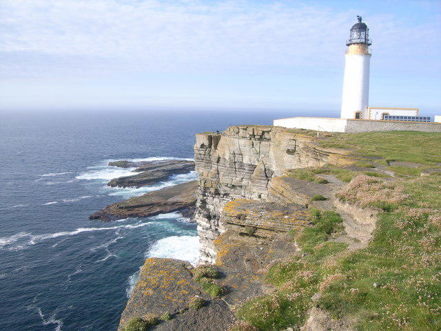 Photo could not load
HY3949 : Cliffs and lighthouse at Noup Head
Nick Mutton 01329 000000
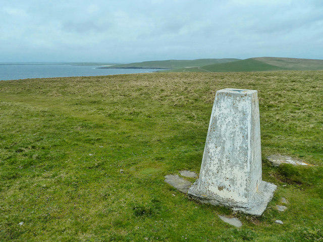 Photo could not load
HY3949 : View from the Trigpoint on Noup Head
Andy Farrington
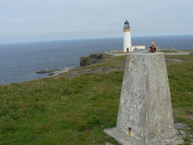 Photo could not load
HY3949 : Noup Head Trig & Lighthouse #A3736
Liz Gray
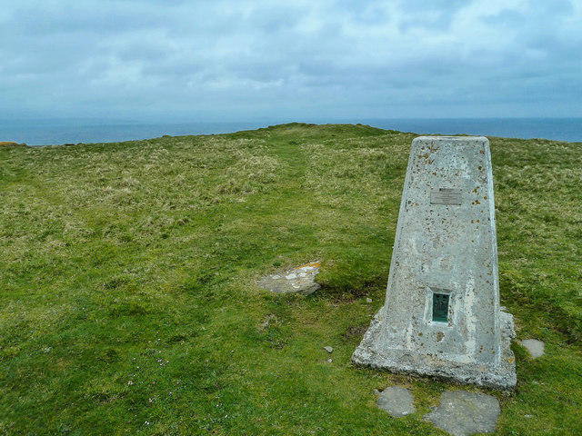 Photo could not load
HY3949 : Noup Head Trigpoint
Andy Farrington
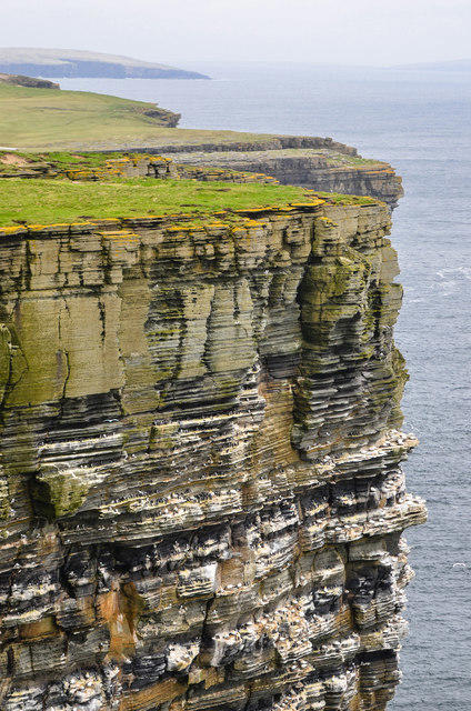
HY3949 : Gulls, Gannets and Guillemots
Andy Farrington
Hill facts and local notes
Classifications
Elevation
77m
253 ft
Prominence
33m
Coordinates
59.3295, -3.0705
HY391497
OS Map
5
Explorer: 464
At the Summit
A trig point sits proudly at the summit, with stunning views of the surrounding coastline and islands. The area is also dotted with grassy tufts and wildflowers, making it a picturesque spot for a break.
Terrain & Geology
Noup Head is primarily composed of Old Red Sandstone, characterised by its vibrant, rusty colours. This fascinating geology contributes to the stunning coastal scenery and the rugged terrain that makes hiking here an exhilarating adventure.
Views & Scenery
From the summit, you can gaze upon the dramatic cliffs of Noup Head, the uninhabited islands of the Orkney archipelago, and the vast expanse of the North Sea, showcasing nature at its most magnificent.
History & Heritage
Name Origin
The name 'Noup' is derived from the Norse word 'núp', meaning hillock or knoll, perfectly describing its prominent position.
Historical Significance
Noup Head is historically significant for its cliffs, which have served as important navigation points for mariners since the Viking era.
Getting There & Facilities
Parking
There is a small parking area at Rackwick, where hikers can leave their cars before embarking on their adventure. Be sure to arrive early to secure a space!
Public Transport
Regular buses run from the main town of Kirkwall to Rackwick. Although schedules can be sparse, planning a trip around the bus timetable is essential.
Nearby Facilities
Facilities are limited in the immediate area, so be sure to bring your own supplies. The closest cafes and toilets can be found in Kirkwall.
Safety Information
Known Hazards
- Watch out for sudden changes in weather, as conditions can change rapidly in the Orkneys. Slippery rocks and steep drops near cliff edges pose additional risks, so stick to the marked paths!
General Safety Tips
- Check weather conditions before setting out
- Carry appropriate clothing and equipment
- Let someone know your planned route
- Take a map, compass, and GPS device
- Carry emergency supplies: food, water, first aid kit, torch
Hills
Some common questions about the hills answered
Are there group walks up Noup Head?
Many walkers use Walkmates to join or organise walks with others. You can check for group walks around Noup Head through the maps
Are there other walkers around Noup Head?
Activity varies by location and time, but Walkmates lets you see whether others have shared walks or shown interest in this area. Find other people through the walking friends search walking friends for Noup Head search or of course create your own walk for Noup Head
Can I organise a walk to Noup Head?
Yes. If there aren’t any walks listed already, you can create a walk and make it available for others to join.
If you're signed up to Walkmates, you can create a walk to Noup Head.
How do I find a walk up this hill?
There are often multiple ways to walk this hill, depending on experience and route preference. Walkmates helps you explore walks and routes that others have shared.
Can I suggest a new route up Noup Head?
Yes. You can suggest or create routes to share with others. Walkmates focuses on the social side of walking, so routes are used to help people organise walks and explore areas together, rather than as detailed navigation tools or route libraries.
Other uses really appreciate knowledgeable walkers sharing their routes. Share your favourite route to Noup Head here
The is an error or something incorrect about this hill. How do I let you know?
We always strive to keep the information on Walkmates as accurate as possible. If you find an error, please let us know through the contact form and we'll aim to correct it as quickly as possible
Community Discussion
Comments
Location
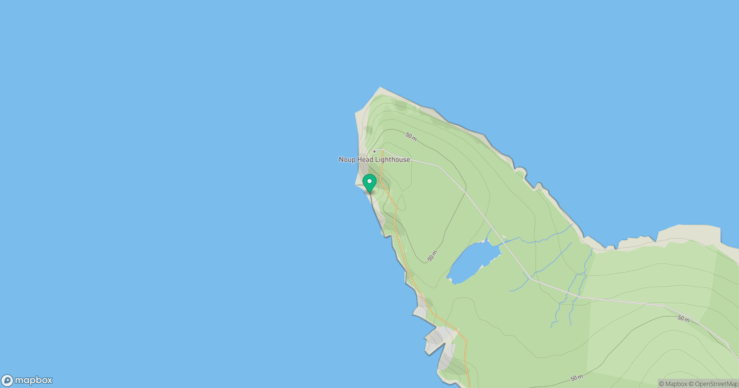
Grid reference: HY391497
View on OpenStreetMapOpens a map in a new tab, centred on the hill.
No comments yet. Be the first.