

Ward Hill (Eday)
Good walks are even better shared.
Overview
Ward Hill (Eday)
Overview
Nestled in the heart of the Orkney Islands, Ward Hill stands majestically at an elevation of 150 meters. As a Marilyn, it offers hikers rewarding views and a taste of the rich natural beauty that Orkney has to offer. Known locally for its lush rolling hills and vibrant wildlife, there’s little wonder why this hill attracts outdoor enthusiasts.
Geology
Ward Hill is composed primarily of ancient sedimentary rocks, specifically sandstone, which have shaped the landscape over millennia. The hill's geology offers a peek into the Earth's history, while also providing a playground for geology buffs. If you find yourself pondering the ancient seas that once occupied this area, take heart; you're in good company with past explorers who have been equally curious!
Routes
The Eday Circular Walk is the most common route to reach the summit. This route is around 6 km long and usually takes about 2 hours to complete, making it suitable for most fitness levels. The circular path not only takes you to Ward Hill but also rewards you with views over the scenic coastline and opportunities to spot local wildlife, including seabirds that make their nests on the cliffs.
Summit Features
Reaching the summit brings you to a small but charming cairn. It’s the perfect spot for a breather and to take in the breathtaking vistas. Just remember, no matter how spectacular the view, it’s still not a good idea to try to climb onto the cairn for a ‘better angle’!
Terrain Type
Hikers will encounter a mixture of grassy slopes and rocky outcrops on their ascent, with parts of the path potentially boggy after rainfall. Sturdy footwear is advisable, and perhaps a pair of socks you’re not too attached to, just in case.
Views
Ward Hill offers sweeping panoramas of the Orkney archipelago. Highlights include views of Eday’s stunning coastline, along with neighbouring islands like Shapinsay and Sanday. For the best experience, spring and summer months are recommended, when blooming wildflowers paint the landscape in vibrant hues.
Hazards
While Ward Hill is generally accessible, be mindful of the uneven terrain and potentially boggy areas, especially following wet weather. Always check the forecast before your trek, as the weather in Orkney can be as fickle as a cat in a room full of rocking chairs.
Access
Parking is readily available in Eday village, making access to the trail easy. For those relying on public transport, the island is reachable by ferry. Once on the island, walking is the best way to explore and connect with the stunning environment.
Facilities
Basic facilities are found in Eday, including a local shop and community centre offering refreshments during the summer season. It’s always good to plan ahead and pack your own picnic for the summit – nothing beats a scone with a view!
History
The name Ward Hill is derived from Old Norse, translating to 'watchtower' which reflects its prominent stature in the landscape. Historically, the hill has held significance for local communities, often making appearances in tales passed down through generations.
Happy hiking on Ward Hill, but remember; the only thing that should be lost on this adventure is your worries!
Explore routes near Ward Hill (Eday)
Public walks starting within 80 km of this hill. Nearby does not mean a route reaches the summit; check its map and access before setting out.
No public routes are currently listed within 80 km of Ward Hill (Eday) on Walkmates. This does not mean there are no paths here. Explore the map and check local access information before planning a walk.
Route planning notes
These notes describe possible approaches, not verified navigable routes or permission to cross land. Check current paths, local access rules and conditions before setting out.
Eday Circular Walk
Starting from the village of Eday, this circular route offers an excellent approach to Ward Hill, taking you through lush pastures and along scenic cliff edges.
Make a day of it, together
Find someone to share the walk with, or organise a day out along a route you like.
Photo Gallery
View all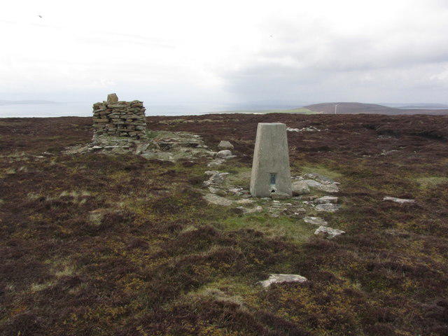 Photo could not load
HY5530 : Eday; Trig point on Ward Hill. View towards Stennie Hill
Colin Park
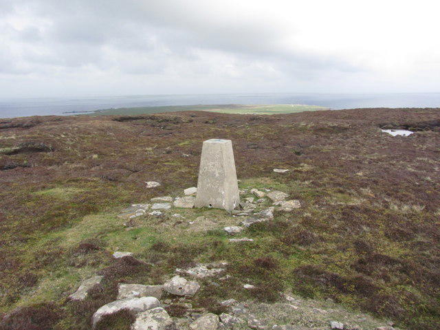 Photo could not load
HY5530 : Eday; Trig point on Ward Hill. view towards Veness
Colin Park
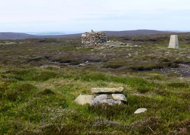 Photo could not load
HY5529 : Ward Hill, Eday, Orkney
Rude Health
Hill facts and local notes
Classifications
Elevation
102m
335 ft
Prominence
102m
Coordinates
59.1543, -2.7834
HY552299
OS Map
5 6
Explorer: 464 465S
At the Summit
The summit is adorned with a small cairn that provides a perfect place for a photo opportunity - just don't expect it to smile back!
Terrain & Geology
The hill is primarily formed from ancient sedimentary rocks, predominantly sandstone, which are characteristic of the Orkney archipelago. These rocks contribute to the area's scenic landscapes and fascinating geological history.
Views & Scenery
From the summit, one can enjoy views across the Orkney archipelago, including the stunning coastlines of Eday and neighbouring islands such as Shapinsay and Sanday.
History & Heritage
Name Origin
The name 'Ward' is derived from the Old Norse word 'vǫrðr', meaning 'watchtower', indicative of the hill's prominent position. 'Hill' is relatively straightforward in English!
Historical Significance
Ward Hill has been a site of significance for local communities over the centuries, often featuring in oral histories and folk tales of the Orkney Islands.
Getting There & Facilities
Check current local access restrictions, parking rules and transport timetables before travelling. These notes do not confirm public access to the summit.
Parking
There is ample parking available near the village of Eday, just a short walk from the trailhead.
Public Transport
Eday is accessible by ferry from mainland Orkney. The ferry docks close to the village, and local buses may also connect you to other parts of the island.
Nearby Facilities
Basic facilities can be found in the village, including a small shop and a community centre that may offer refreshments during the summer season.
Safety Information
Known Hazards
- Be wary of uneven terrain and potential boggy areas, particularly after rainfall. Weather can change rapidly; always be prepared!
General Safety Tips
- Check weather conditions before setting out
- Carry appropriate clothing and equipment
- Let someone know your planned route
- Take a map, compass, and GPS device
- Carry emergency supplies: food, water, first aid kit, torch
Hills
Some common questions about the hills answered
Are there group walks up Ward Hill (Eday)?
Many walkers use Walkmates to join or organise walks with others. You can check for group walks around Ward Hill (Eday) through the maps
Are there other walkers around Ward Hill (Eday)?
Activity varies by location and time, but Walkmates lets you see whether others have shared walks or shown interest in this area. Find other people through the walking friends search walking friends for Ward Hill (Eday) search or of course create your own walk for Ward Hill (Eday)
Can I organise a walk to Ward Hill (Eday)?
Yes. If there aren’t any walks listed already, you can create a walk and make it available for others to join.
If you're signed up to Walkmates, you can create a walk to Ward Hill (Eday).
How do I find a walk up this hill?
There are often multiple ways to walk this hill, depending on experience and route preference. Walkmates helps you explore walks and routes that others have shared.
Can I suggest a new route up Ward Hill (Eday)?
Yes. You can suggest or create routes to share with others. Walkmates focuses on the social side of walking, so routes are used to help people organise walks and explore areas together, rather than as detailed navigation tools or route libraries.
Other uses really appreciate knowledgeable walkers sharing their routes. Share your favourite route to Ward Hill (Eday) here
The is an error or something incorrect about this hill. How do I let you know?
We always strive to keep the information on Walkmates as accurate as possible. If you find an error, please let us know through the contact form and we'll aim to correct it as quickly as possible
Community Discussion
Comments
Location
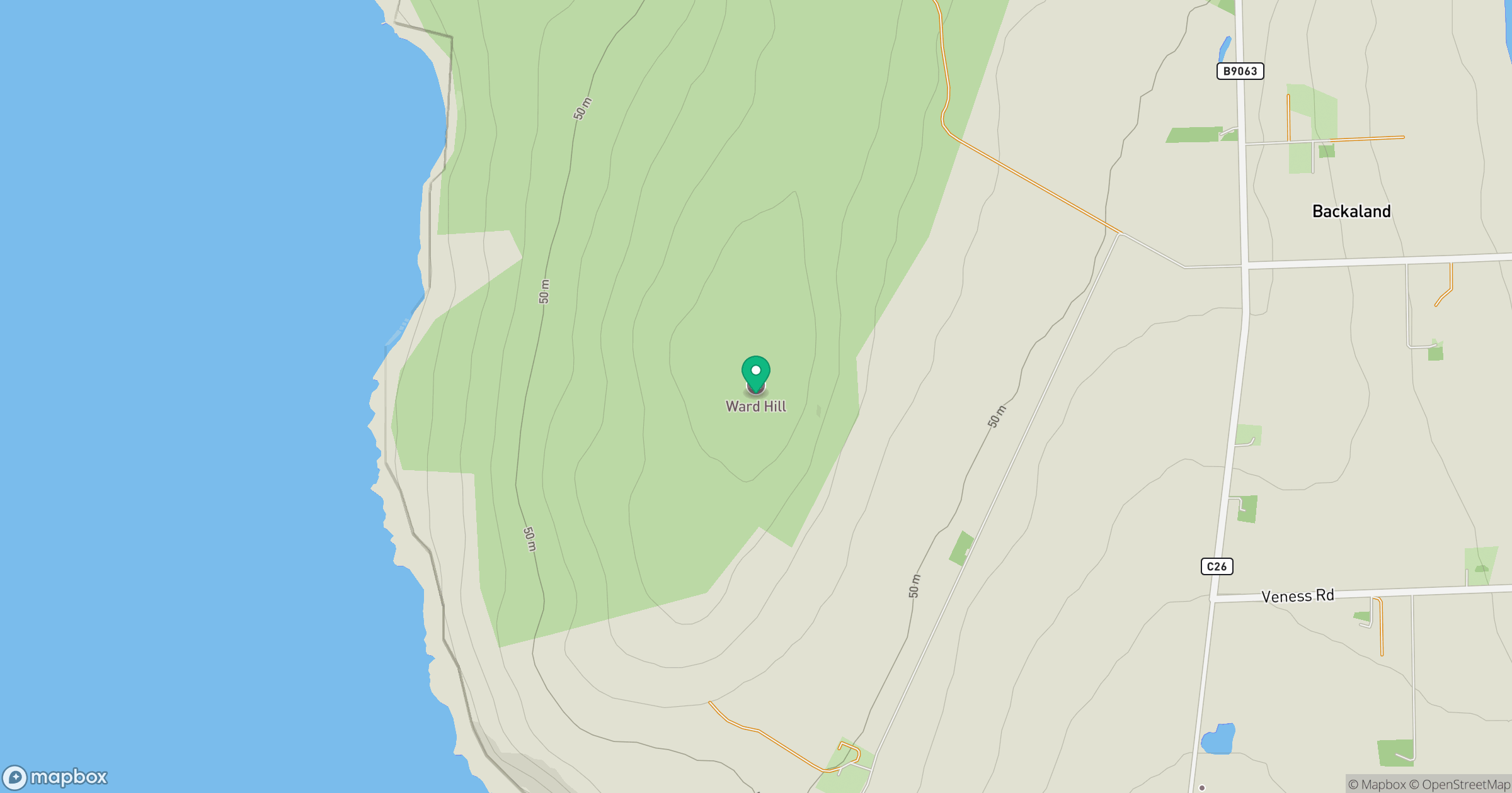
Grid reference: HY552299
View on OpenStreetMapOpens a map in a new tab, centred on the hill.
Hills within 30 km
Straight-line distance, not a walking route or confirmation of access.
Kierfea Hill
235m
Wideford Hill
225m
Milldoe - Mid Tooin
224m
Keelylang Hill
221m
Ward of Gairsay
102m
No comments yet. Be the first.