

Ward of Gairsay
Good walks are even better shared.
Overview
Ward of Gairsay
Nestled in the scenic Orkney Islands, the Ward of Gairsay stands at a modest 143 meters, but don’t let its height fool you; the views from the top are nothing short of breathtaking. This Marilyn offers a rewarding climb with a delightful blend of grassy slopes and rocky outcrops.
Geology
The mountain's geology tells the tales of waves lapping at the shores eons ago. As you traverse its path, keep an eye out for the layers of sedimentary rocks that whisper ancient secrets. The mudstones and sandstones provide a vivid backdrop, illustrating the dynamic processes of erosion that have sculpted this landscape through time.
Access and Parking
Getting there is half the fun! Park at the designated area near Gairsay, where you can kickstart your adventure. Although parking is limited, there’s a charm in the simplicity. If you fancy a ride, Kirkwall is just a short distance away, but be advised, public transport is about as frequent as a solar eclipse!
Route Overview
The recommended Gairsay Access Route is approximately 2.5 km long. It’s a moderate trek, suitable for most levels of hiking prowess. Expect a blend of gentle inclines and occasional rocky terrain—perfect for those looking for a bit of a leg stretch without overexerting themselves.
Summit Features and Views
Upon reaching the summit, be sure to take a moment to appreciate the modest yet noble stone cairn. This is not just a pile of rocks; oh no, it’s a beacon of your accomplishment! The panoramic views extend over the Orkney mainland, making it an ideal spot for that obligatory selfie or a contemplative moment.
Hazards
Like any good adventure, be mindful of the potential hazards. The weather can turn on a dime, and those grassy paths can become slippery after a downpour. A sturdy pair of boots is recommended—leave those flip-flops at home!
Facilities
While the Ward of Gairsay provides an escape into nature, amenities are close at hand in Kirkwall, where you’ll find cafes, toilets, and perhaps even the local gossip—perfect for regaling tales of your outing.
Conclusion
In summary, the Ward of Gairsay may not boast the height of some mountainous giants, but its unique blend of history, geology, and stunning views make it an inviting destination for hikers. So lace up your boots, enjoy the tranquillity, and perhaps reflect on life’s mysteries as you gaze across the horizon. You might even spot a mythical creature or two. Happy hiking!
Explore routes near Ward of Gairsay
Public walks starting within 80 km of this hill. Nearby does not mean a route reaches the summit; check its map and access before setting out.
No public routes are currently listed within 80 km of Ward of Gairsay on Walkmates. This does not mean there are no paths here. Explore the map and check local access information before planning a walk.
Route planning notes
These notes describe possible approaches, not verified navigable routes or permission to cross land. Check current paths, local access rules and conditions before setting out.
Gairsay Access Route
Starting from the small community of Gairsay, this route takes you through scenic farmland before winding its way to the summit.
Make a day of it, together
Find someone to share the walk with, or organise a day out along a route you like.
Photo Gallery
View all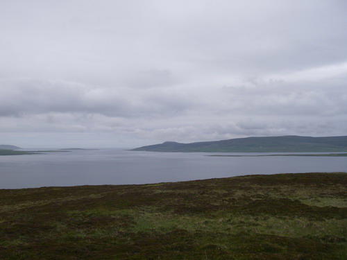 Photo could not load
HY4422 : Eynhallow Sound from Gairsay
Dave Simpson
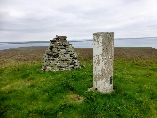 Photo could not load
HY4422 : Ward of Gairsay
Rude Health
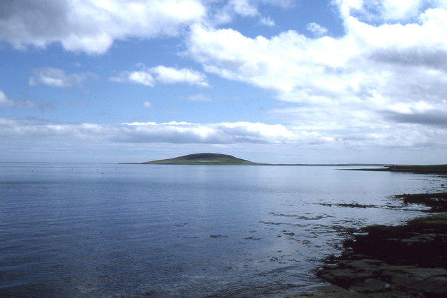 Photo could not load
HY4422 : View of Gairsay, from the ferry terminal at Tingwall
Christopher Hilton
Hill facts and local notes
Classifications
Elevation
102m
335 ft
Prominence
102m
Coordinates
59.0843, -2.9768
HY441223
OS Map
5 6
Explorer: 461N
At the Summit
At the summit, hikers will find a small stone cairn that serves as a marker for this tranquil peak, alongside panoramic views that make the climb worthwhile.
Terrain & Geology
The Ward of Gairsay is primarily composed of sedimentary rocks, predominantly mudstones and sandstones, shaped by the relentless forces of nature. The geology reveals a rich tapestry of earth's history, with exposed rock faces showcasing the effects of erosion.
Views & Scenery
From the summit, one can enjoy sweeping vistas of the Orkney mainland, the sea fringed with isles, and, on a clear day, the hazy shape of mainland Scotland.
History & Heritage
Name Origin
The name 'Ward' originates from Old Norse, meaning ‘watchtower’ or ‘lookout’, giving insight into the mountain's historical significance.
Historical Significance
Historically, the area has been used as a lookout point, reflecting its strategic importance in past centuries.
Getting There & Facilities
Check current local access restrictions, parking rules and transport timetables before travelling. These notes do not confirm public access to the summit.
Parking
There's limited parking available near the entrance to the Gairsay access route. Ensure you park considerately.
Public Transport
Public transport options are limited, but local taxis can be arranged from nearby Kirkwall.
Nearby Facilities
While there are no facilities directly on the mountain, Kirkwall offers cafes, toilets, and shopping for post-hike indulgence.
Safety Information
Known Hazards
- Variable weather conditions can change rapidly, so be prepared for all eventualities. The terrain can be slippery after rain.
General Safety Tips
- Check weather conditions before setting out
- Carry appropriate clothing and equipment
- Let someone know your planned route
- Take a map, compass, and GPS device
- Carry emergency supplies: food, water, first aid kit, torch
Hills
Some common questions about the hills answered
Are there group walks up Ward of Gairsay?
Many walkers use Walkmates to join or organise walks with others. You can check for group walks around Ward of Gairsay through the maps
Are there other walkers around Ward of Gairsay?
Activity varies by location and time, but Walkmates lets you see whether others have shared walks or shown interest in this area. Find other people through the walking friends search walking friends for Ward of Gairsay search or of course create your own walk for Ward of Gairsay
Can I organise a walk to Ward of Gairsay?
Yes. If there aren’t any walks listed already, you can create a walk and make it available for others to join.
If you're signed up to Walkmates, you can create a walk to Ward of Gairsay.
How do I find a walk up this hill?
There are often multiple ways to walk this hill, depending on experience and route preference. Walkmates helps you explore walks and routes that others have shared.
Can I suggest a new route up Ward of Gairsay?
Yes. You can suggest or create routes to share with others. Walkmates focuses on the social side of walking, so routes are used to help people organise walks and explore areas together, rather than as detailed navigation tools or route libraries.
Other uses really appreciate knowledgeable walkers sharing their routes. Share your favourite route to Ward of Gairsay here
The is an error or something incorrect about this hill. How do I let you know?
We always strive to keep the information on Walkmates as accurate as possible. If you find an error, please let us know through the contact form and we'll aim to correct it as quickly as possible
Community Discussion
Comments
Location
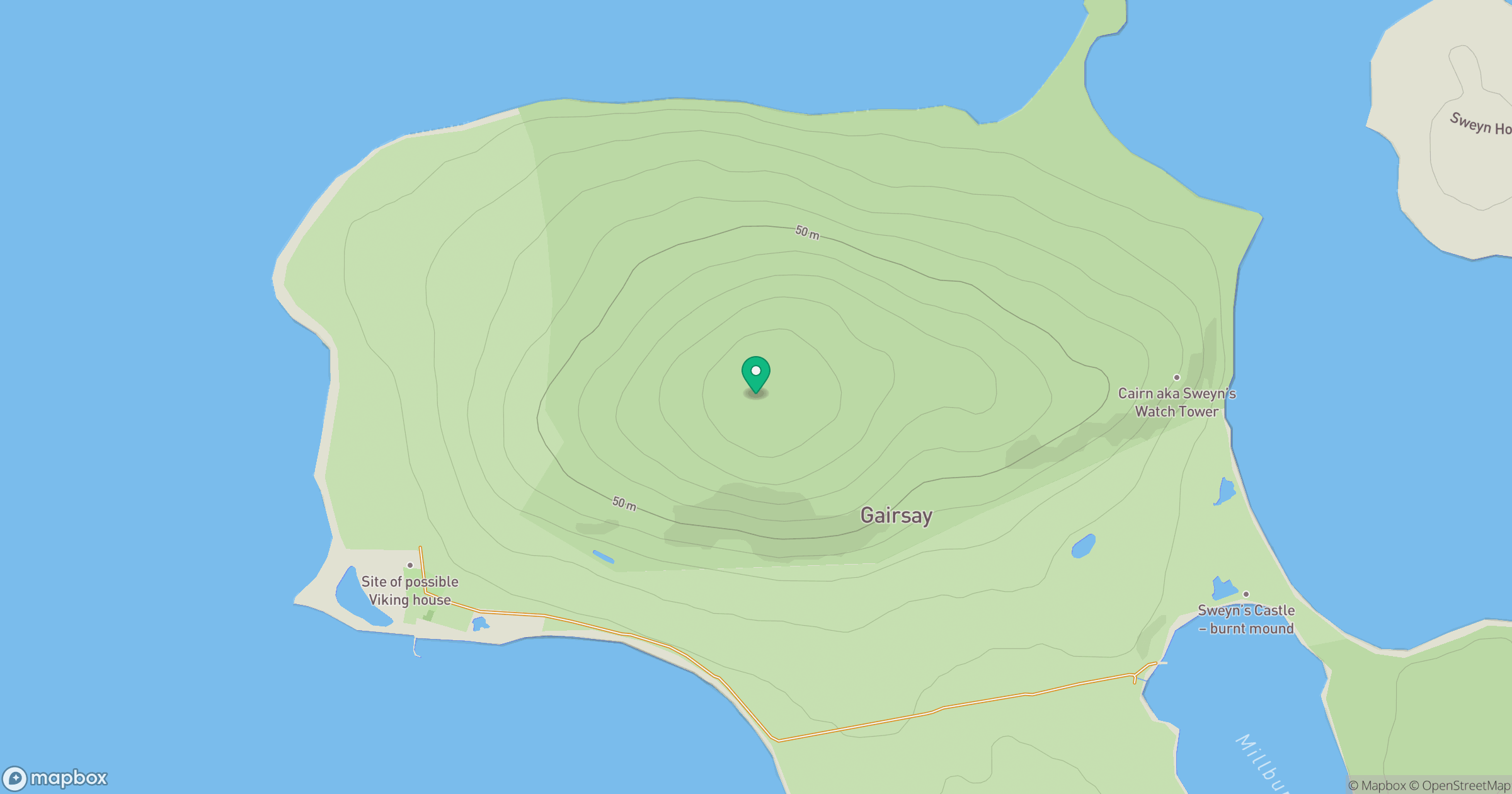
Grid reference: HY441223
View on OpenStreetMapOpens a map in a new tab, centred on the hill.
Hills within 30 km
Straight-line distance, not a walking route or confirmation of access.
Kierfea Hill
235m
Wideford Hill
225m
Milldoe - Mid Tooin
224m
Keelylang Hill
221m
Ward Hill (Eday)
102m
No comments yet. Be the first.