
Knockmore
Good walks are even better shared.
Overview
Knockmore: A Gem of the Scottish Highlands
Nestled within the rugged beauty of the Scottish Highlands, Knockmore is a delightful Marilyn that offers an accessible hike for those looking to stretch their legs and soak in some spectacular views without the sweat and tears often associated with tackling Munros.
Geology
Knockmore’s predominant granite composition tells tales of ancient geological forces at play. From distinctive boulders to weathered rock faces, the evidence of glacial activity is abundant, showcasing just how much this landscape has evolved over millennia.
Routes
The Northwest Ridge Route is the most popular approach, stretching approximately 3.5 km and taking about 2.5 hours to complete. The route weaves through patches of wildlife, offering vistas that really make you stop and ask yourself, ‘Why don’t I do this more often?’ While it’s moderate in difficulty, the occasional boggy section could have you hopping like a deer trying to avoid puddles.
Summit Features
Upon reaching the summit, you’ll be greeted by a prominent stone cairn, which doubles as a perfect natural photo frame for your achievement. Just make sure to acknowledge the mountain—she likes a bit of flattery!
Terrain Type
Expect a bit of everything: grassy patches, rocky outcrops, and let’s not forget the thrilling bog that seems to reach out and grab you when you least expect it. Wearing waterproof boots? Wise choice!
Views
From the summit, the vista is nothing short of breathtaking. In clear weather, one can feast their eyes on legendary sights such as Ben Nevis looming in the distance and the undulating hills scattering like emerald waves over the land. Best to visit in spring or early autumn when nature serves up a display of colours that would make any painter envious.
Hazards
As with all Highland adventures, a hike on Knockmore isn’t without its challenges. The bogs can be unexpectedly deep, so tread carefully. Additionally, the weather can change faster than a Highlander can complain about the rain—always be prepared!
Access
Getting to Knockmore is straightforward. The nearest parking area is at S700498, just a stone’s throw from the trailhead, though it may fill up quickly during peak season, so an early start is advisable. Fort William is the closest town, providing all the amenities you could need before or after your hike. While public transport isn’t abundant, local buses do run, and the walk from the nearest stop is scenic!
Facilities
After a long day of adventuring, head into Fort William for a hearty meal or to simply put your feet up with a hot drink. Facilities such as cafes and public toilets can be found here to refresh you for the journey home.
History
The name Knockmore directly translates to ‘big hill’ in Gaelic, which is fitting. The mountain holds cultural significance in the realm of local folklore and land use patterns, reflecting the relationship between nature and the people who have inhabited this majestic area.
In conclusion, Knockmore serves as a superb introduction to the Highlands, marrying accessibility with the stunning natural beauty typical of Scotland’s acclaimed landscapes. Go on, tackle this gem; you won’t regret it!
Happy hiking!
Explore routes near Knockmore
Public walks starting within 80 km of this hill. Nearby does not mean a route reaches the summit; check its map and access before setting out.
No public routes are currently listed within 80 km of Knockmore on Walkmates. This does not mean there are no paths here. Explore the map and check local access information before planning a walk.
Route planning notes
These notes describe possible approaches, not verified navigable routes or permission to cross land. Check current paths, local access rules and conditions before setting out.
Northwest Ridge Route
A scenic route leading from the northwest, offering stunning views of the surrounding hills and glens.
Make a day of it, together
Find someone to share the walk with, or organise a day out along a route you like.
Hill facts and local notes
Classifications
Elevation
228m
748 ft
Prominence
120m
Coordinates
52.5925, -6.8557
S776496
OS Map
68
At the Summit
The summit features a substantial stone cairn, providing a perfect spot for a summit selfie (or to contemplate your life choices).
Terrain & Geology
Knockmore is predominantly composed of granite, which can be seen in the eroded rock patterns and bouldery outcrops along the ascent, showcasing the region's glacial history.
Views & Scenery
On a clear day, the views stretch over the rolling hills of the Highlands, with Ben Nevis and even the distant peaks of the Ardgour can be spotted.
History & Heritage
Name Origin
The name 'Knockmore' translates to 'big hill' in Scottish Gaelic, reflecting its stature in the landscape.
Historical Significance
Knockmore is part of the rich tapestry of Scottish Highland culture and provides insights into the historical land use and patterns of settlement in the region.
Getting There & Facilities
Check current local access restrictions, parking rules and transport timetables before travelling. These notes do not confirm public access to the summit.
Parking
There is a small car park located at the end of the approach road, S700498. It's free and offers enough space for a handful of vehicles.
Public Transport
Public transport options are limited; however, local buses operate from Fort William to nearby villages, with a 4-mile walk to the trailhead.
Nearby Facilities
The nearest facilities can be found in Fort William, which has cafes, restaurants, and public toilets.
Safety Information
Known Hazards
- Beware of boggy patches that can be deceptively deep, and keep an eye on changing weather conditions.
General Safety Tips
- Check weather conditions before setting out
- Carry appropriate clothing and equipment
- Let someone know your planned route
- Take a map, compass, and GPS device
- Carry emergency supplies: food, water, first aid kit, torch
Hills
Some common questions about the hills answered
Are there group walks up Knockmore?
Many walkers use Walkmates to join or organise walks with others. You can check for group walks around Knockmore through the maps
Are there other walkers around Knockmore?
Activity varies by location and time, but Walkmates lets you see whether others have shared walks or shown interest in this area. Find other people through the walking friends search walking friends for Knockmore search or of course create your own walk for Knockmore
Can I organise a walk to Knockmore?
Yes. If there aren’t any walks listed already, you can create a walk and make it available for others to join.
If you're signed up to Walkmates, you can create a walk to Knockmore.
How do I find a walk up this hill?
There are often multiple ways to walk this hill, depending on experience and route preference. Walkmates helps you explore walks and routes that others have shared.
Can I suggest a new route up Knockmore?
Yes. You can suggest or create routes to share with others. Walkmates focuses on the social side of walking, so routes are used to help people organise walks and explore areas together, rather than as detailed navigation tools or route libraries.
Other uses really appreciate knowledgeable walkers sharing their routes. Share your favourite route to Knockmore here
The is an error or something incorrect about this hill. How do I let you know?
We always strive to keep the information on Walkmates as accurate as possible. If you find an error, please let us know through the contact form and we'll aim to correct it as quickly as possible
Community Discussion
Comments
Location
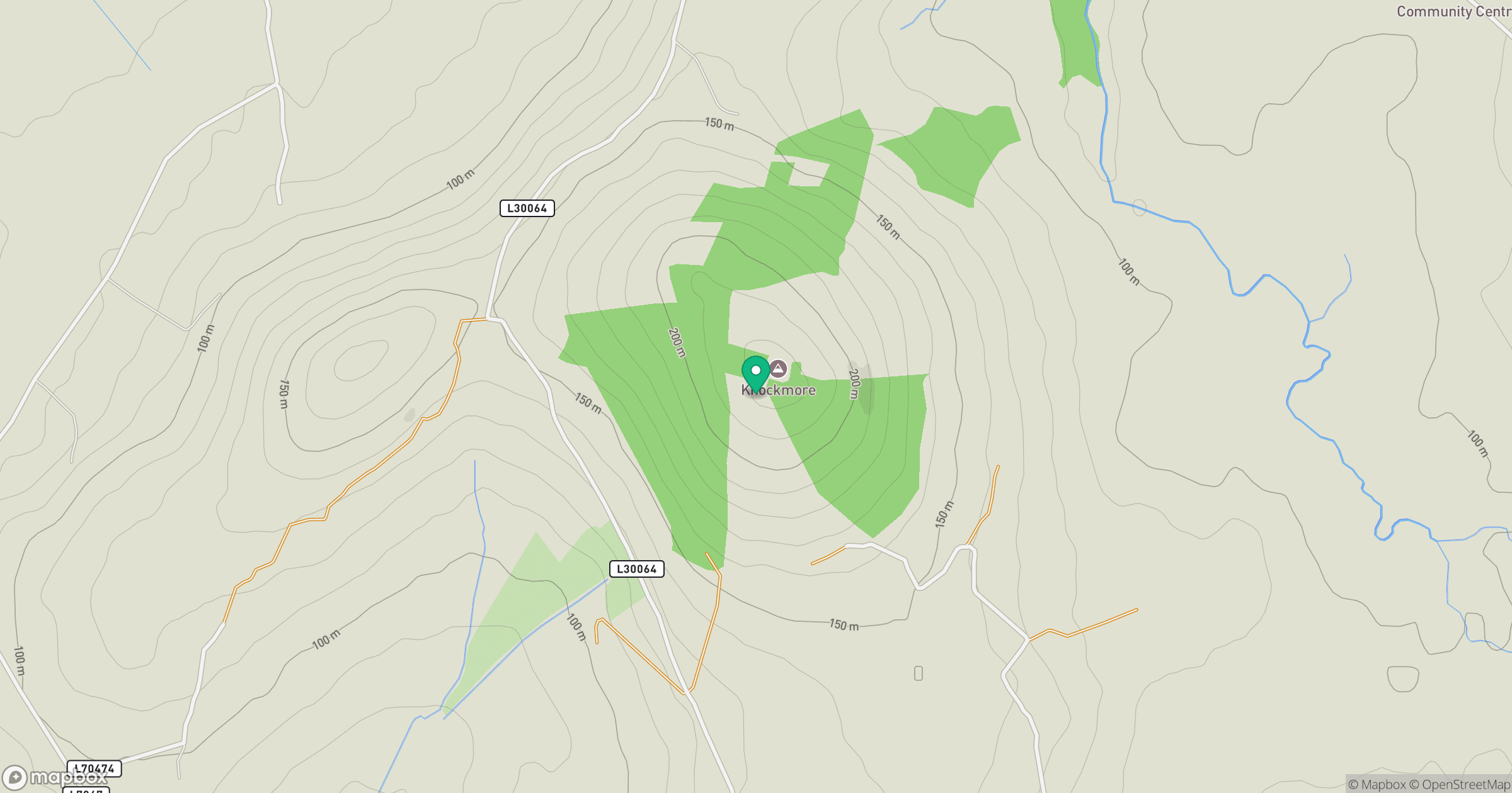
Grid reference: S776496
View on OpenStreetMapOpens a map in a new tab, centred on the hill.
Hills within 30 km
Straight-line distance, not a walking route or confirmation of access.
No comments yet. Be the first.