

Naseby Hill
Good walks are even better shared.
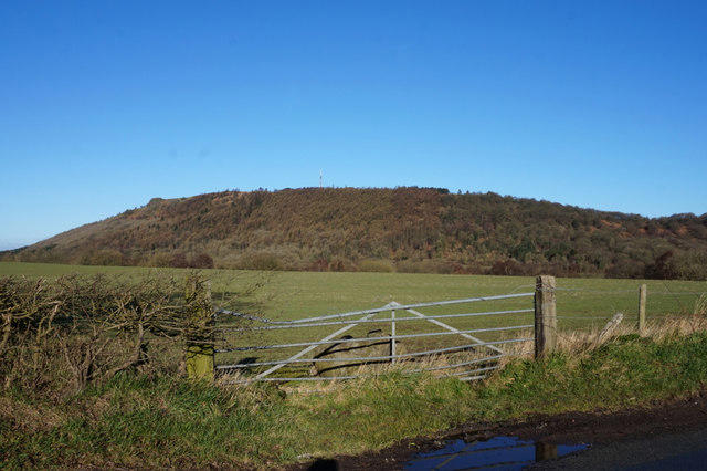
SP6978 : Farm track near Naseby
Jonathan Thacker Photo source
Overview
Naseby Hill
Naseby Hill, nestled in the heart of Northamptonshire, stands proud at an elevation of 158 meters, making it an approachable yet rewarding hike for all.
Geology
This hill is primarily composed of Middle Jurassic limestone, providing a reliable base for its rich biodiversity. The surrounding clay and marl soils foster a variety of plant life, making it a delightful destination for nature lovers.
Routes
The Naseby Hill Circular Walk is a highlight for hikers, covering approximately 6.5 km. This moderate loop beginning in Naseby Village offers not only physical engagement but also a feast for the eyes with its sweeping vistas and not-so-uncommon sightings of local wildlife.
Summit Features
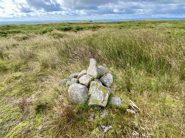
At the top, adventurers will be greeted by a quaint stone cairn alongside remains of the military trench from the English Civil War — a splendid reminder of the hill's rich historical backdrop.
Terrain Type
The terrain of Naseby Hill is primarily grassy, interspersed with rocky outcrops, providing a varied and pleasant walking experience.
Views
The sweeping views from the summit are truly something to write home about! Look out for the town of Daventry and the rolling hills of the Cotswolds contributing to a postcard-perfect scene. Spring and autumn are considered the best seasons to take it all in, with clear skies and vibrant colours to delight the senses.
Hazards
While walking, keep an eye out for sheep along the paths. They are generally well-mannered, but it’s always best to remain cautious and respectful.
Nearby Summits
Nearby, you’ll find Hollowell Hill, an excellent companion for those looking to extend their hiking experience.
Access
The nearest parking can be found at the entrance of Naseby Village, about half a kilometre from the base of the hill. For those relying on public transport, local bus services from Northampton make visiting quite convenient.
Facilities
Amenities in Naseby include the local pub, The Naseby, where you can grab a bite to eat and a refreshing drink after your hike. Public toilets are also available in the village, ensuring your outdoor adventure needn’t be marred by discomfort.
History
The name 'Naseby' translates to 'the village of the cress stream', a poetic connection to the natural beauty surrounding it. Historically, it is the site of the Battle of Naseby (1645), a pivotal event in the English Civil War.
In conclusion, whether you're a seasoned hiker or a weekend wanderer, Naseby Hill offers a delightful escape into nature, complete with historical intrigue and breathtaking vistas. Just don’t forget your camera—these views are worth the click!
Happy hiking!
Explore routes near Naseby Hill
Walks starting near this hill. Open a route to check its map, distance and full itinerary.
Pitsford Water reservoir circuit
View route
Sywell Reservoir: full lakeside circuit and Spindle End
View route
Nature Girls autumn walk at Summer Leys
View route
Draycote Water Walk: Route Map and Current Closures
View route
Route planning notes
These notes describe possible approaches. Check a route's map and access information when planning your walk.
Naseby Hill Circular Walk
A picturesque loop starting from Naseby Village, offering stunning views and a chance to explore the surrounding countryside.
Make a day of it, together
Find someone to share the walk with, or organise a day out along a route you like.
Photo Gallery
View all Photo could not load
SP6978 : Farm track near Naseby
Jonathan Thacker
 Photo could not load
SP6978 : Trees alongside Clipston Road
Jonathan Thacker
 Photo could not load
SP6978 : Naseby Obelisk
Alison Pryce
 Photo could not load
SP6978 : Naseby Obelisk
Ian Rob
 Photo could not load
SP6978 : Naseby Obelisk
Matthew Lee
 Photo could not load
SP6978 : Moat around the Naseby Obelisk
Jonathan Thacker
 Photo could not load
SP6978 : Naseby 1645 – the Cavalier monument
D Gore
 Photo could not load
SP6978 : Obelisk Inscription
Matthew Lee
 Photo could not load
SP6978 : Naseby obelisk
Jonathan Thacker

SP6978 : Naseby obelisk
Jonathan Thacker
Hill facts and local notes
Classifications
Elevation
197m
646 ft
Prominence
34m
Coordinates
52.3994, -0.9820
SP693784
OS Map
141
Explorer: 223N
At the Summit
The summit of Naseby Hill features a charming stone cairn and a historic military trench, remnants from the English Civil War.
Terrain & Geology
Naseby Hill is primarily composed of Middle Jurassic limestone, which provides a solid base for its unique flora. The surrounding clay and marl soils give rise to a variety of vegetation, making it a treat for naturalists.
Views & Scenery
From the summit, you can see the Northamptonshire countryside stretching out before you, with the town of Daventry and the rolling hills of the Cotswolds in the distance.
History & Heritage
Name Origin
The name 'Naseby' is derived from Old English, meaning 'the village of the cress stream'.
Historical Significance
Naseby Hill is historically significant due to the Battle of Naseby in 1645, a pivotal turning point in the English Civil War.
Getting There & Facilities
Parking
There is a small parking area at the entrance of Naseby Village, approximately 0.5 km from the start of the walking route.
Public Transport
The nearest bus service runs from Northampton to Naseby, with links to major towns in the area. Check local timetables as services may vary!
Nearby Facilities
The village of Naseby offers a local pub, The Naseby, which serves meals and drinks. Public toilets are available in the village.
Safety Information
Known Hazards
- Beware of muddy paths after rainfall, as well as the occasional sheep on the track. Don’t worry, they generally keep to themselves!
General Safety Tips
- Check weather conditions before setting out
- Carry appropriate clothing and equipment
- Let someone know your planned route
- Take a map, compass, and GPS device
- Carry emergency supplies: food, water, first aid kit, torch
Hills
Some common questions about the hills answered
Are there group walks up Naseby Hill?
Many walkers use Walkmates to join or organise walks with others. You can check for group walks around Naseby Hill through the maps
Are there other walkers around Naseby Hill?
Activity varies by location and time, but Walkmates lets you see whether others have shared walks or shown interest in this area. Find other people through the walking friends search walking friends for Naseby Hill search or of course create your own walk for Naseby Hill
Can I organise a walk to Naseby Hill?
Yes. If there aren’t any walks listed already, you can create a walk and make it available for others to join.
If you're signed up to Walkmates, you can create a walk to Naseby Hill.
How do I find a walk up this hill?
There are often multiple ways to walk this hill, depending on experience and route preference. Walkmates helps you explore walks and routes that others have shared.
Can I suggest a new route up Naseby Hill?
Yes. You can suggest or create routes to share with others. Walkmates focuses on the social side of walking, so routes are used to help people organise walks and explore areas together, rather than as detailed navigation tools or route libraries.
Other uses really appreciate knowledgeable walkers sharing their routes. Share your favourite route to Naseby Hill here
The is an error or something incorrect about this hill. How do I let you know?
We always strive to keep the information on Walkmates as accurate as possible. If you find an error, please let us know through the contact form and we'll aim to correct it as quickly as possible
Community Discussion
Comments
Location
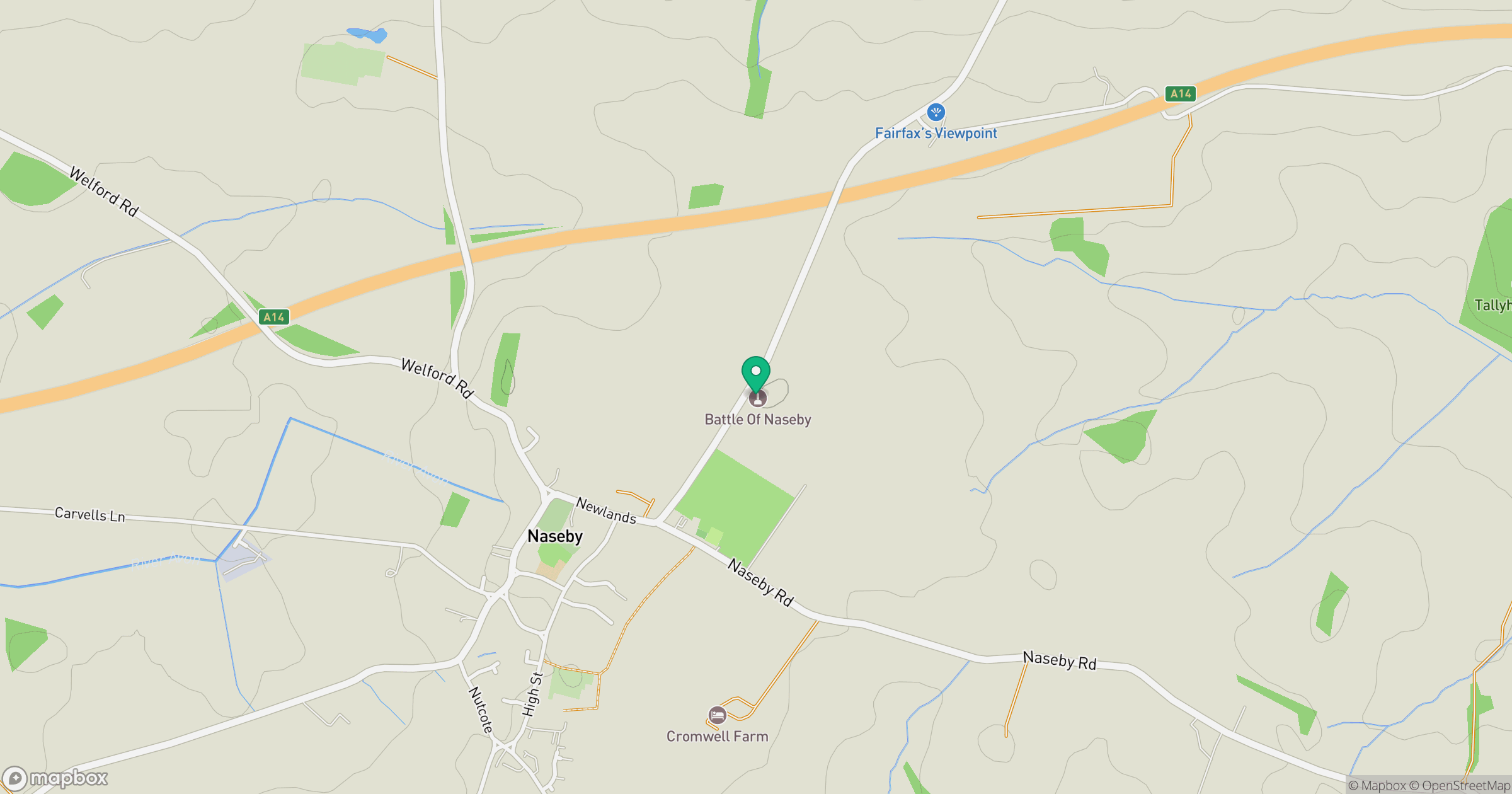
Grid reference: SP693784
View on OpenStreetMapOpens a map in a new tab, centred on the hill.
No comments yet. Be the first.