

Mount Hill
Good walks are even better shared.
NO3216 : Felled woodland on Mount Hill
Scott Cormie Photo source
Overview
Mount Hill: A Hidden Gem of the Southern Uplands
Geology
Mount Hill is primarily composed of sedimentary rocks, namely sandstone and shale. This formation dates back to the Carboniferous period, making it not only a scenic spot but also a geologist's delight. The visible layers tell the story of the earth's past.
Routes
The most popular route to the summit starts from Hillend. This trail is approximately 4.2 km long and takes about 1.5 hours, depending on your pace. It's moderately challenging, with a few steep sections and delightful views along the way.
Summit Features
Upon reaching the summit, expect a warm welcome from a sturdy stone cairn marking the peak and a trig point that might just be the best place to catch your breath and take in the views.
Terrain Type
The terrain around Mount Hill is predominantly grassy, with scattered rocky outcrops and occasional boggy patches. That said, sturdy boots are advised, especially after a good downpour!
Views
From the summit, panoramic views of the Southern Uplands unfold before you. The lush rolling hills and distant peaks make for a perfect Instagram shot (even if your friends think you’re just showing off). Autumn is particularly stunning here, with the heather in bloom painting the landscape in vibrant hues.
Hazards
Although the path is generally well-maintained, hikers should remain cautious; expect slippery sections especially if the weather has been wet. A keen eye on the surroundings will help avoid any unpleasant tumbles.
Nearby Summits
Just a stone's throw away is Mochrum Fell, another inviting hill that beckons the more adventurous-minded.
Access
Nearest Parking
Parking at Hillend is a quaint little layby that can fit a few cars, but do be mindful of other vehicles and park responsibly.
Public Transport
The nearest semblance of public transport is available from Carsphairn, although services are famously infrequent, so check the schedule and don’t miss your bus!
Nearest Town
Carsphairn is the closest town, offering lovely village charms, including a welcoming café where you can sit back, relax, and regale stories of your adventure.
Facilities
While there are no facilities directly on Mount Hill, you can find a lovely café and toilets in Carsphairn—perfect for a post-hike treat.
Conclusion
Mount Hill might not be the tallest or most famous peak, but it certainly holds its own charm with stunning views, varied terrain, and a touch of local history. So strap on those hiking boots, prepare your camera, and get ready for a delightful day out!
Explore routes near Mount Hill
Walks starting near this hill. Open a route to check its map, distance and full itinerary.
Tentsmuir Forest: Ice House Trail
View route
Club outing: Crianlarich and West Highland Way (coach departure)
View route
Club outing: Glen Ogle and Killin (coach departure)
View route
Loch Leven: Kinross Pier to RSPB Loch Leven Heritage Trail
View route
Route planning notes
These notes describe possible approaches. Check a route's map and access information when planning your walk.
Hillend to Summit
This popular route takes you from Hillend via a well-trodden path that meanders through beautiful heather and open fields.
Make a day of it, together
Find someone to share the walk with, or organise a day out along a route you like.
Photo Gallery
View all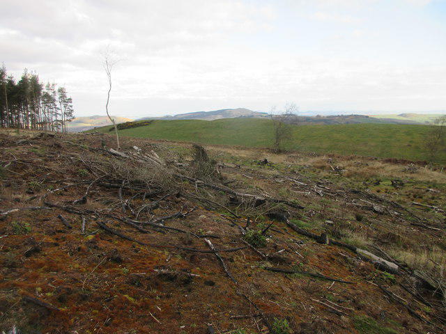 Photo could not load
NO3216 : Felled woodland on Mount Hill
Scott Cormie
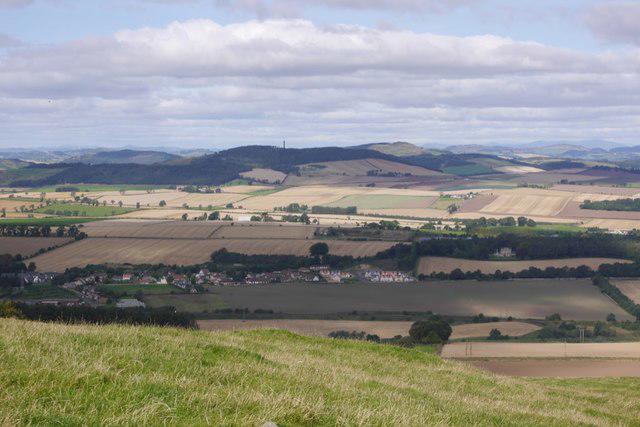 Photo could not load
NO3316 : Mount Hill seen from Hill of Tarvit
Richard Webb
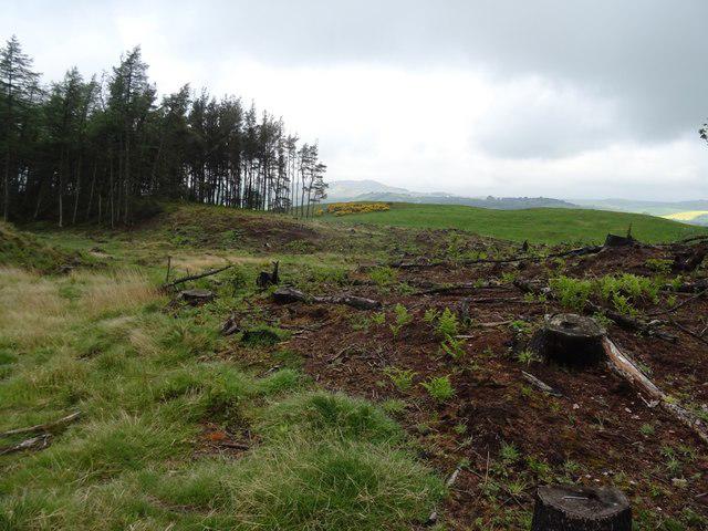 Photo could not load
NO3216 : Felled area on Mount Hill
Richard Webb
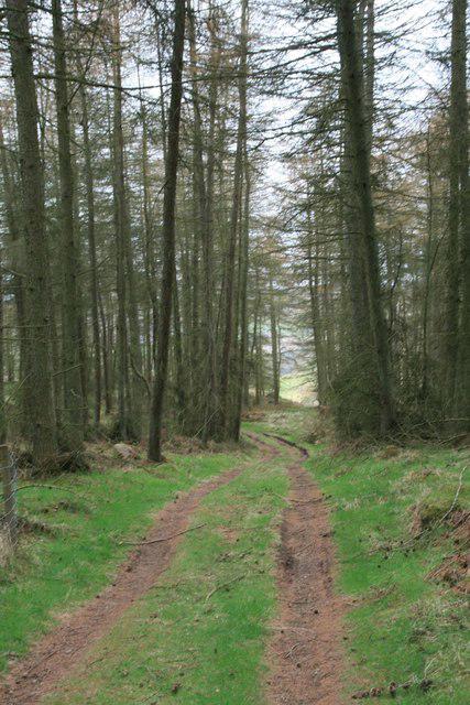 Photo could not load
NO3216 : Forest track: Mount Hill
Becky Williamson
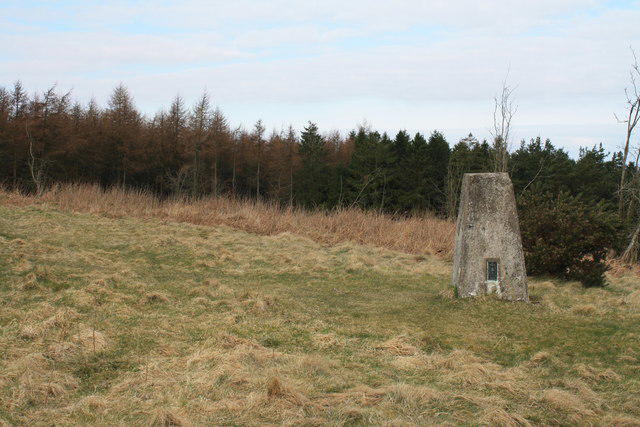 Photo could not load
NO3316 : Trig point, Mount Hill
Colin Kinnear
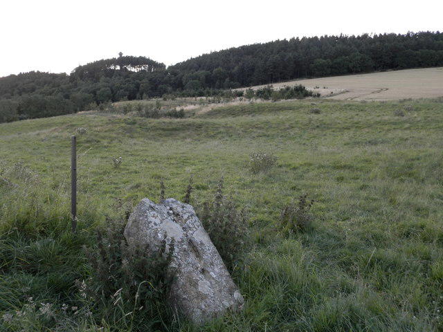 Photo could not load
NO3316 : Across the fields to The Hopetoun Monument and Mount Hill
Douglas Nelson
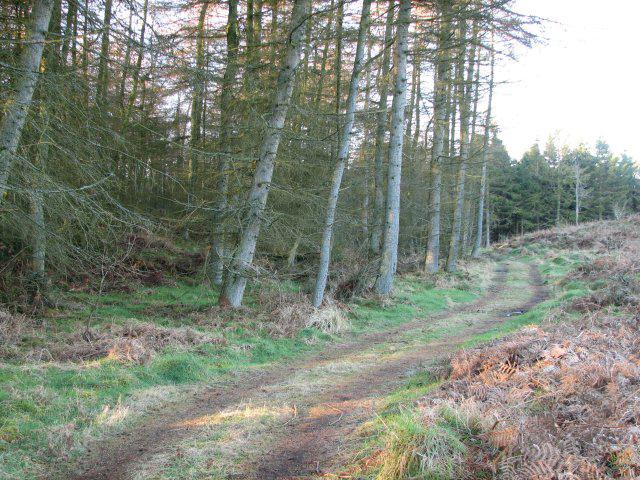 Photo could not load
NO3216 : Path on Mount Hill
Callum Black
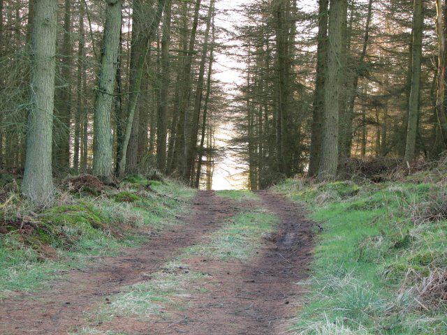 Photo could not load
NO3216 : Forest track, Mount Hill
Callum Black
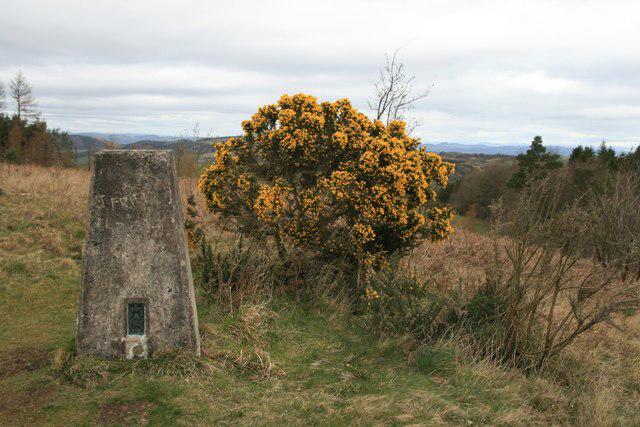 Photo could not load
NO3316 : Trigpoint on Mount Hill
Becky Williamson
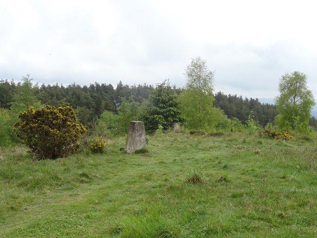
NO3316 : Triangulation pillar, Mount Hill
Richard Webb
Hill facts and local notes
Classifications
Elevation
222m
729 ft
Prominence
163m
Coordinates
56.3360, -3.0838
NO330164
OS Map
59
Explorer: 370 371N
At the Summit
At the summit, you'll find a modest stone cairn and a trig point offering a firm handshake with the sky.
Terrain & Geology
Mount Hill is primarily composed of sedimentary rocks, including sandstone and shale, offering a peek into the geological history formed during the Carboniferous period. The distinctive layering is a treat for geology enthusiasts.
Views & Scenery
From the summit, one can gaze at the rolling hills of the Southern Uplands, including clear views of nearby Galloway Forest.
History & Heritage
Name Origin
The name 'Mount Hill' is a straightforward moniker, implying a hill that's notable enough to be called a mountain, perhaps with a wink to the Scottish sense of humour about high places.
Historical Significance
Locally, Mount Hill has served as a landmark for generations and a site for community gatherings, often seen as a gentle giant amongst its taller neighbours.
Getting There & Facilities
Parking
Parking is available at Hillend, a small layby that can accommodate a few cars. Be sure to park responsibly.
Public Transport
The nearest public transport is from the village of Carsphairn with local bus services, but they are limited. Plan well ahead.
Nearby Facilities
There are no facilities directly on the mountain, but Carsphairn has a lovely café and toilets available in the village.
Safety Information
Known Hazards
- Possible slippery areas especially after rain; be cautious on uneven ground.
General Safety Tips
- Check weather conditions before setting out
- Carry appropriate clothing and equipment
- Let someone know your planned route
- Take a map, compass, and GPS device
- Carry emergency supplies: food, water, first aid kit, torch
Hills
Some common questions about the hills answered
Are there group walks up Mount Hill?
Many walkers use Walkmates to join or organise walks with others. You can check for group walks around Mount Hill through the maps
Are there other walkers around Mount Hill?
Activity varies by location and time, but Walkmates lets you see whether others have shared walks or shown interest in this area. Find other people through the walking friends search walking friends for Mount Hill search or of course create your own walk for Mount Hill
Can I organise a walk to Mount Hill?
Yes. If there aren’t any walks listed already, you can create a walk and make it available for others to join.
If you're signed up to Walkmates, you can create a walk to Mount Hill.
How do I find a walk up this hill?
There are often multiple ways to walk this hill, depending on experience and route preference. Walkmates helps you explore walks and routes that others have shared.
Can I suggest a new route up Mount Hill?
Yes. You can suggest or create routes to share with others. Walkmates focuses on the social side of walking, so routes are used to help people organise walks and explore areas together, rather than as detailed navigation tools or route libraries.
Other uses really appreciate knowledgeable walkers sharing their routes. Share your favourite route to Mount Hill here
The is an error or something incorrect about this hill. How do I let you know?
We always strive to keep the information on Walkmates as accurate as possible. If you find an error, please let us know through the contact form and we'll aim to correct it as quickly as possible
Community Discussion
Comments
Location
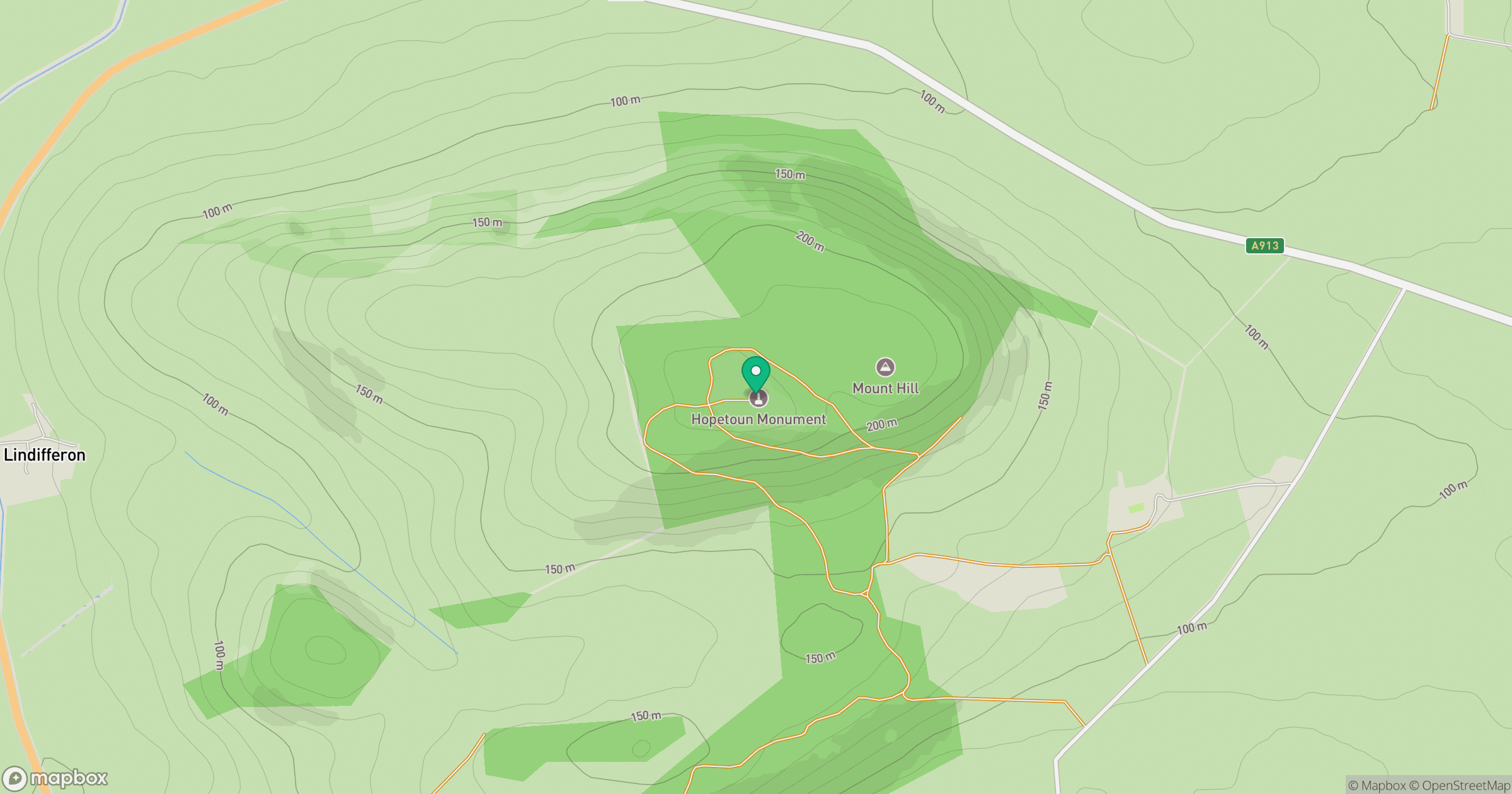
Grid reference: NO330164
View on OpenStreetMapOpens a map in a new tab, centred on the hill.



No comments yet. Be the first.