

Meall nan Clach Ruadha
Good walks are even better shared.
NC6056 : Meall nan Clach Ruadha
Richard Webb Photo source
Overview
Meall nan Clach Ruadha
Welcome to Meall nan Clach Ruadha, the Hill of the Red Stones! This hidden gem in the Scottish Highlands should be on every hiker's list.
Geology
Composed predominantly of granite, this Corbett showcases the stunning features shaped by ancient glacial movements.
The rocky outcrops and grassy slopes make for a delightful trek, but be wary of those boggy patches!
Routes
The common route starts from the west, near Tain. It's a lovely 7.5 km journey with a moderate level of difficulty, perfect for those looking to stretch their legs without too much strain.
Don't forget to bring your sandwiches—no journey is complete without a good nosh at the top!
Summit Features
Atop this magnificent hill, you'll find a substantial stone cairn, the perfect backdrop for your triumphal summit photos. Grab some selfies and take in the glorious view, just don't expect a five-star Michelin experience at the top—nature's beauty is far more satisfying than any restaurant's fare.
Terrain
The terrain is a mix of grassy slopes and some rocky bits to keep the trek exciting. Watch your step in certain areas, as the Highlands are known for their, shall we say, 'eclectic foot placements'.
Views
Once at the summit, you’ll be treated to stunning panoramas of distant peaks and valleys, all while feeling like you’re on top of the world. The best seasons for taking in these vistas are spring and autumn when the colours are vibrant and visibility is at its finest.
Hazards
Be mindful of the rapidly changing weather. It can shift quicker than you can say 'Ewan McGregor'! Always check the forecast before heading out and pack accordingly.
Nearby Summits
Don’t forget to check out nearby peaks like Meall a' Phuill and Cnoc na h-Uamh for some extra hiking challenges!
Access
For those driving, the nearest parking is a small area in Tain, about 4 km from the actual trailhead. If public transport is more your style, there are buses from Inverness to Tain. From there, it’s a taxi ride or a bit of a shuffle to get to the start of your journey.
Facilities
Before or after your adventure, Tain has a selection of cafes for a hot brew or a bite to eat. Public toilets are also available to freshen up before your journey.
History
The mountain’s name means 'Hill of the Red Stones', steeped in local legend and folklore. It’s an enchanting place that beckons to those intrigued by nature's mysteries.
So lace up your hiking boots, pack your bag, and set off to conquer Meall nan Clach Ruadha! Here’s to a great day in the hills—may your legs be strong, and your snacks plentiful!
Explore routes near Meall nan Clach Ruadha
Walks starting near this hill. Open a route to check its map, distance and full itinerary.
Ben Klibreck
View route
Loch Migdale from Torroy: Spinningdale pinewood and loch shore walk
View route
Route planning notes
These notes describe possible approaches. Check a route's map and access information when planning your walk.
From the west near Tain
A scenic route starting at the small parking area west of the summit, offering a mix of grassy slopes and rocky paths.
Make a day of it, together
Find someone to share the walk with, or organise a day out along a route you like.
Photo Gallery
View all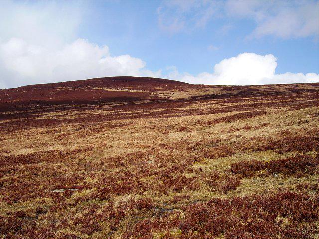 Photo could not load
NC6056 : Meall nan Clach Ruadha
Richard Webb
Hill facts and local notes
Classifications
Elevation
336m
1,102 ft
Prominence
171m
Coordinates
58.4788, -4.3938
NC605569
OS Map
10
Explorer: 447N 448N
At the Summit
The summit features a prominent cairn built of stone, offering a perfect spot for a well-deserved snack and a view of the sprawling Highlands.
Terrain & Geology
Meall nan Clach Ruadha is primarily composed of granite, characteristic of the rugged Highland landscape. The surrounding hills are marked by glacial action, resulting in its steep ascents and distinctive cliffs.
Views & Scenery
Panoramic views of the surrounding mountains, including the distant peaks of the North West Highlands and the Dornoch Firth.
History & Heritage
Name Origin
The name 'Meall nan Clach Ruadha' translates to 'Hill of the Red Stones', likely referring to the distinctive coloration found in some of the rocks in the area.
Historical Significance
The area is steeped in history and folklore, often mentioned in local tales of mountain spirits and ancient clans.
Getting There & Facilities
Parking
There is a small parking area near the village of Tain, approximately 4 km away from the start of the walking route.
Public Transport
The nearest public transport options include bus services from Inverness to Tain, followed by a taxi or a long walk to the starting point.
Nearby Facilities
Tain has several facilities, including cafes, shops, and public toilets, providing a good starting point for any adventurer.
Safety Information
Known Hazards
- Watch out for sudden weather changes, as the Highlands can turn from sunny to stormy quicker than a Scottish pub can serve a pint!
General Safety Tips
- Check weather conditions before setting out
- Carry appropriate clothing and equipment
- Let someone know your planned route
- Take a map, compass, and GPS device
- Carry emergency supplies: food, water, first aid kit, torch
Hills
Some common questions about the hills answered
Are there group walks up Meall nan Clach Ruadha?
Many walkers use Walkmates to join or organise walks with others. You can check for group walks around Meall nan Clach Ruadha through the maps
Are there other walkers around Meall nan Clach Ruadha?
Activity varies by location and time, but Walkmates lets you see whether others have shared walks or shown interest in this area. Find other people through the walking friends search walking friends for Meall nan Clach Ruadha search or of course create your own walk for Meall nan Clach Ruadha
Can I organise a walk to Meall nan Clach Ruadha?
Yes. If there aren’t any walks listed already, you can create a walk and make it available for others to join.
If you're signed up to Walkmates, you can create a walk to Meall nan Clach Ruadha.
How do I find a walk up this hill?
There are often multiple ways to walk this hill, depending on experience and route preference. Walkmates helps you explore walks and routes that others have shared.
Can I suggest a new route up Meall nan Clach Ruadha?
Yes. You can suggest or create routes to share with others. Walkmates focuses on the social side of walking, so routes are used to help people organise walks and explore areas together, rather than as detailed navigation tools or route libraries.
Other uses really appreciate knowledgeable walkers sharing their routes. Share your favourite route to Meall nan Clach Ruadha here
The is an error or something incorrect about this hill. How do I let you know?
We always strive to keep the information on Walkmates as accurate as possible. If you find an error, please let us know through the contact form and we'll aim to correct it as quickly as possible
Community Discussion
Comments
Location
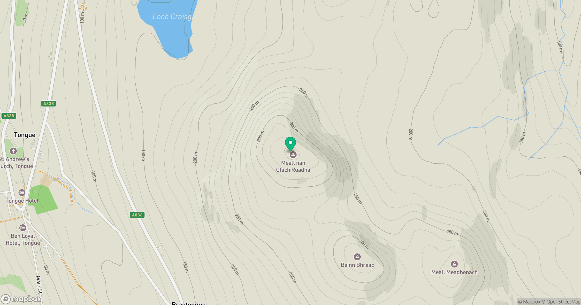
Grid reference: NC605569
View on OpenStreetMapOpens a map in a new tab, centred on the hill.
Nearby Hills
Ben Loyal - An Caisteal
764m
Ben Hope
927m
Ben More Assynt
999m
Ben Stack
721m
Quinag - Sail Gharbh
809m
No comments yet. Be the first.