

Cnoc Craggie
Good walks are even better shared.
Overview
Cnoc Craggie
Cnoc Craggie, standing at an elevation of 437 meters, offers outdoor enthusiasts a delightful experience in the Scottish Highlands. While not the tallest hill in the area, its charming character makes it a perfect destination for a day hike.
Geology
The bedrock mainly consists of schist, shaped by glacial movements. The rich geology invites both amateur geologists and curious hikers alike to marvel at the natural history that has sculpted this landscape.
Routes
The Cnoc Craggie Circular Trail is the most popular route, covering approximately 8 km and requiring around 3.5 hours to complete. This path ascends gently through verdant hills, ensuring you aren't gasping for breath before you reach the summit. The trail’s moderate rating makes it suitable for most hikers, but a decent pair of boots is advisable.
Summit Features
Upon reaching the summit, you will be greeted by a quaint cairn and expansive views. Perfect for a sunny afternoon, just remember, the midges have more of a flair for picnicking than you might!
Terrain Type
The predominant terrain is a mixture of grassy slopes, rocky outcrops, and the occasional boggy patch. Keep an eye on your footing and enjoy the variety; it keeps things interesting!
Views
From the summit, your view is truly grand. You can gaze upon the Kintail range and even catch a glimpse of the mythical Loch Ness. Spring and early autumn provide the clearest vistas when nature shows off in its full glory.
Hazards
Exercise caution with loose rocks and be prepared for sudden weather changes typical of this stunning area. A waterproof jacket is never a bad idea when you venture into the Highlands, just in case the skies have other plans.
Nearby Summits
Cnoc Craggie is in proximity to Ben Wyvis, an impressive peak that may tempt you for a second adventure. Why not make a weekend of it?
Access
Getting there is relatively straightforward. The nearest parking options are scattered throughout Strathpeffer, and there's regular bus service from Inverness, meaning no need for the car if you don’t fancy it.
Facilities
Strathpeffer boasts several cafes for your post-hike rewards, public toilets, and even a little shop for those last-minute snack grabs.
History
The name Cnoc Craggie literally means 'hill of rocks', a testament to its rugged nature. Historically, this land has played a role in sheep grazing and bears a wealth of local folklore. It’s quite the talking point!
So, dust off those hiking boots and make your way to Cnoc Craggie, a friendly hill with plenty of character just waiting for your company!
Happy hiking!
Explore routes near Cnoc Craggie
Public walks starting within 80 km of this hill. Nearby does not mean a route reaches the summit; check its map and access before setting out.
Ben Klibreck
View route
Loch Migdale from Torroy: Spinningdale pinewood and loch shore walk
View route
Route planning notes
These notes describe possible approaches, not verified navigable routes or permission to cross land. Check current paths, local access rules and conditions before setting out.
Cnoc Craggie Circular Trail
A scenic circular route starting from the nearby village of Strathpeffer, offering a moderate climb with stunning views.
Make a day of it, together
Find someone to share the walk with, or organise a day out along a route you like.
Photo Gallery
View all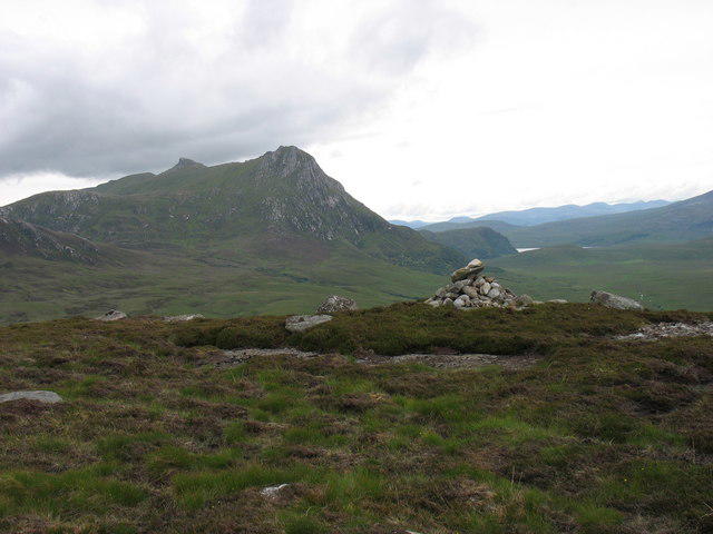 Photo could not load
NC6052 : Cnoc Craggie summit
David Purchase
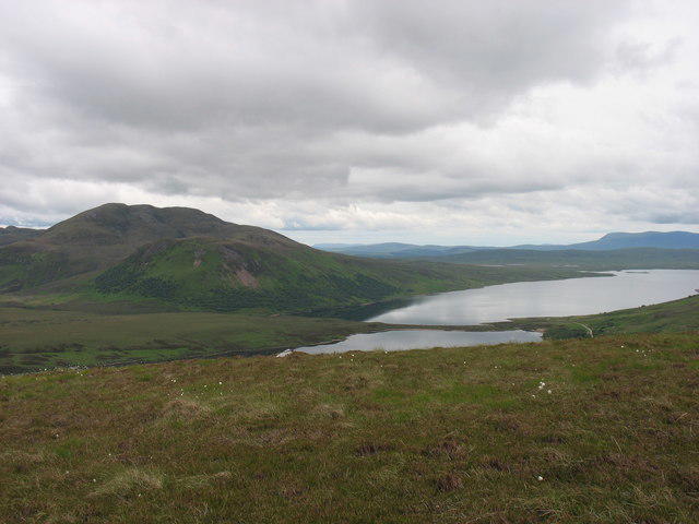 Photo could not load
NC6052 : Upper slopes of Cnoc Craggie
David Purchase
Hill facts and local notes
Classifications
Elevation
319m
1,047 ft
Prominence
143m
Coordinates
58.4420, -4.3913
NC605528
OS Map
10
Explorer: 447N 448N
At the Summit
The summit boasts a modest cairn, a perfect spot for a summer picnic or an Instagram shot. Just watch out for the cheeky midges!
Terrain & Geology
The geology of Cnoc Craggie predominantly features glacial till and schist, characteristic of the surrounding area, shaped by the forces of ice over millennia.
Views & Scenery
From the summit, one can see the distant peaks of the Kintail range, Loch Ness shimmering in the distance, and the Glen Affric hills.
History & Heritage
Name Origin
Cnoc Craggie translates roughly to 'hill of rocks' in Scottish Gaelic, fitting for its rugged terrain.
Historical Significance
Historically, the area has been used for sheep grazing and has significant local folklore associated with the Highland clans.
Getting There & Facilities
Check current local access restrictions, parking rules and transport timetables before travelling. These notes do not confirm public access to the summit.
Parking
The nearest parking is available in Strathpeffer, where there are several unmarked laybys and village spaces.
Public Transport
Buses run regularly from Inverness to Strathpeffer, making it accessible for those relying on public transport.
Nearby Facilities
Strathpeffer has several cafes and restaurants, public toilets, and a small shop for supplies before your hike.
Safety Information
Known Hazards
- Be wary of loose rocks on the ascent and the potential for sudden weather changes common in the Highlands.
General Safety Tips
- Check weather conditions before setting out
- Carry appropriate clothing and equipment
- Let someone know your planned route
- Take a map, compass, and GPS device
- Carry emergency supplies: food, water, first aid kit, torch
Hills
Some common questions about the hills answered
Are there group walks up Cnoc Craggie?
Many walkers use Walkmates to join or organise walks with others. You can check for group walks around Cnoc Craggie through the maps
Are there other walkers around Cnoc Craggie?
Activity varies by location and time, but Walkmates lets you see whether others have shared walks or shown interest in this area. Find other people through the walking friends search walking friends for Cnoc Craggie search or of course create your own walk for Cnoc Craggie
Can I organise a walk to Cnoc Craggie?
Yes. If there aren’t any walks listed already, you can create a walk and make it available for others to join.
If you're signed up to Walkmates, you can create a walk to Cnoc Craggie.
How do I find a walk up this hill?
There are often multiple ways to walk this hill, depending on experience and route preference. Walkmates helps you explore walks and routes that others have shared.
Can I suggest a new route up Cnoc Craggie?
Yes. You can suggest or create routes to share with others. Walkmates focuses on the social side of walking, so routes are used to help people organise walks and explore areas together, rather than as detailed navigation tools or route libraries.
Other uses really appreciate knowledgeable walkers sharing their routes. Share your favourite route to Cnoc Craggie here
The is an error or something incorrect about this hill. How do I let you know?
We always strive to keep the information on Walkmates as accurate as possible. If you find an error, please let us know through the contact form and we'll aim to correct it as quickly as possible
Community Discussion
Comments
Location
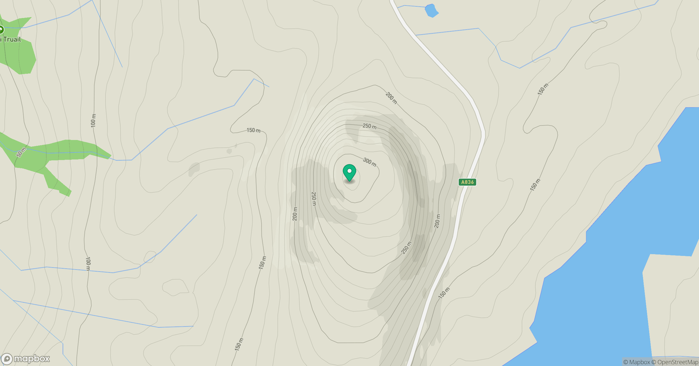
Grid reference: NC605528
View on OpenStreetMapOpens a map in a new tab, centred on the hill.
Hills within 30 km
Straight-line distance, not a walking route or confirmation of access.
Ben Loyal - An Caisteal
764m
Ben Hope
927m
Ben Hiel
535m
Meall nan Clach Ruadha
336m
Beinn Stumanadh
527m
No comments yet. Be the first.