

Langhowe Pike (Synge summit)
Good walks are even better shared.
NY5213 : Cairn on Langhowe Pike
David Brown Photo source
Overview
Langhowe Pike (Synge summit)
Overview
Langhowe Pike, standing at an elevation of 578 meters, is a charming hill nestled within the breathtaking Lake District National Park. Known for its splendid views and tranquil walks, it's the perfect spot for both seasoned hikers and those just looking to stretch their legs.
Geology
Langhowe Pike's foundation is constructed from volcanic rock, rich in geological interest. As you hike, take a moment to appreciate the rugged beauty of its ancient formations, a reminder of the forces that shaped this land millions of years ago.
Routes
One of the most popular routes to the summit is the Corridor Route from Loweswater. This moderate walk offers a delightful experience, commencing from the village of Loweswater. You'll find yourself meandering through lush pastures and past shimmering streams, with the pleasantly mellow ascent making it accessible for many.
- Distance: 5.5 km
- Estimated Time: 3 hours
Summit Features
At the pinnacle, you will be greeted by a modest cairn and an ancient stone wall. Make sure to bring your camera, as the views are nothing short of spectacular! Just remember to snap quickly before the mist rolls in,
Terrain Type
The terrain features a mixture of grassy paths, interspersed with rocky outcrops. Good hiking boots are recommended, especially on wetter days when things can get a little slippery just to keep you on your toes!
Views
From the summit, you will enjoy sweeping views of the surrounding peaks of the Lake District, including the formidable High Stile. To your east, Crummock Water sparkles invitingly.
Best time for views? Mid to late spring when the landscape is lush and the evenings are long, or during autumn when the scenery adopts those delicious golden hues.
Hazards
While Langhowe Pike may be inviting, it’s not without its hazards. Be wary of slippery paths, especially after a good British drizzle, and ensure you're well-prepared with proper footwear to navigate the rocky sections carefully.
Nearby Summits
Don’t forget about Rannerdale Knotts and Starling Dodd, both offering captivating sights and routes for the avid hiker.
Access
Accessing Langhowe Pike is straightforward with the nearest parking located in Loweswater village. Limited spaces mean it’s advisable to arrive early, and public transport options are available from Cockermouth to Loweswater. Cockermouth itself is a lovely town with additional amenities.
Facilities
Facilities in Loweswater include a cozy pub ideal for a post-hike bite, as well as basic toilets in Cockermouth.
History
Let's not forget the rich history linked to this lovely peak. 'Langhowe' hints at its Old Norse roots and its cultural significance throughout the ages as a local refuge during uneasier times.
Conclusion
So there you have it! Langhowe Pike is not just a hill; it’s a slice of nature’s artwork waiting for you to explore. Pack your bags, bring a mate (or a friendly stray dog), and go get your adventure on!
Last Updated: 2023-10-04
Source: OpenStreetMap, Ordnance Survey
Explore routes near Langhowe Pike (Synge summit)
Walks starting near this hill. Open a route to check its map, distance and full itinerary.
Striding Edge, Helvellyn and Catstye Cam
View route
Helvellyn via Striding Edge
View route
Long Meg and Lacy's Caves
View route
Bannerdale Crags from Mungrisdale Wainwright
View route
Route planning notes
These notes describe possible approaches. Check a route's map and access information when planning your walk.
Corridor Route from Loweswater
A scenic approach winding through gentle slopes, ideal for a leisurely hike with ample opportunities to enjoy the local flora and fauna.
Make a day of it, together
Find someone to share the walk with, or organise a day out along a route you like.
Photo Gallery
View all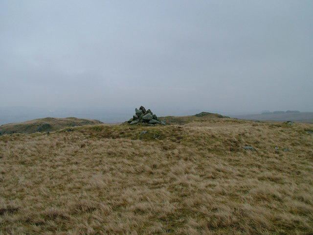 Photo could not load
NY5213 : Cairn on Langhowe Pike
David Brown
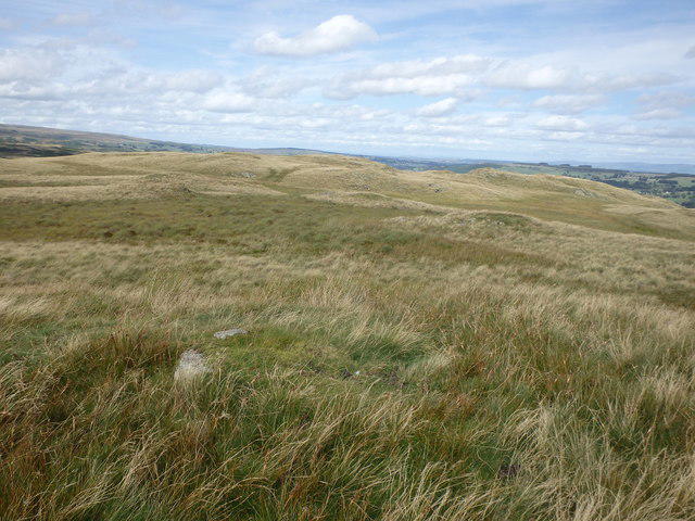 Photo could not load
NY5213 : On Langhowe Pike
Michael Graham
Hill facts and local notes
Classifications
Elevation
405m
1,329 ft
Prominence
20m
Coordinates
54.5111, -2.7282
NY529131
OS Map
90
Explorer: OL5S
At the Summit
The summit boasts a modest cairn and stunning views that might just take your breath away (though don't hold your breath for too long), alongside a stone wall that provides a good spot for photos.
Terrain & Geology
Langhowe Pike is primarily composed of volcanic rock, specifically andesite. The geology offers a glimpse into the area's volcanic past, with interesting formations alongside the trails.
Views & Scenery
From the summit, you can see the majestic peaks of the Lake District including High Stile, and across the valleys you may catch a glimpse of the shimmering waters of Crummock Water.
History & Heritage
Name Origin
The name 'Langhowe' links to the Old Norse 'hlátr' meaning hill, while 'Pike' denotes a pointed mountain.
Historical Significance
The area is steeped in history and culture, once a temporary refuge for locals during turbulent times.
Getting There & Facilities
Parking
Parking available at Loweswater village, with spaces for about 10 cars. Arrive early to secure a spot.
Public Transport
Bus services run from Cockermouth to Loweswater. Check current schedules as they may vary.
Nearby Facilities
The nearest facilities can be found in Loweswater, including a lovely pub and refreshments during peak season. Toilets are available in Cockermouth.
Safety Information
Known Hazards
- Beware of slippery paths, especially after rainfall. The rocky outcrops may present additional challenges.
General Safety Tips
- Check weather conditions before setting out
- Carry appropriate clothing and equipment
- Let someone know your planned route
- Take a map, compass, and GPS device
- Carry emergency supplies: food, water, first aid kit, torch
Hills
Some common questions about the hills answered
Are there group walks up Langhowe Pike (Synge summit)?
Many walkers use Walkmates to join or organise walks with others. You can check for group walks around Langhowe Pike (Synge summit) through the maps
Are there other walkers around Langhowe Pike (Synge summit)?
Activity varies by location and time, but Walkmates lets you see whether others have shared walks or shown interest in this area. Find other people through the walking friends search walking friends for Langhowe Pike (Synge summit) search or of course create your own walk for Langhowe Pike (Synge summit)
Can I organise a walk to Langhowe Pike (Synge summit)?
Yes. If there aren’t any walks listed already, you can create a walk and make it available for others to join.
If you're signed up to Walkmates, you can create a walk to Langhowe Pike (Synge summit).
How do I find a walk up this hill?
There are often multiple ways to walk this hill, depending on experience and route preference. Walkmates helps you explore walks and routes that others have shared.
Can I suggest a new route up Langhowe Pike (Synge summit)?
Yes. You can suggest or create routes to share with others. Walkmates focuses on the social side of walking, so routes are used to help people organise walks and explore areas together, rather than as detailed navigation tools or route libraries.
Other uses really appreciate knowledgeable walkers sharing their routes. Share your favourite route to Langhowe Pike (Synge summit) here
The is an error or something incorrect about this hill. How do I let you know?
We always strive to keep the information on Walkmates as accurate as possible. If you find an error, please let us know through the contact form and we'll aim to correct it as quickly as possible
Community Discussion
Comments
Location
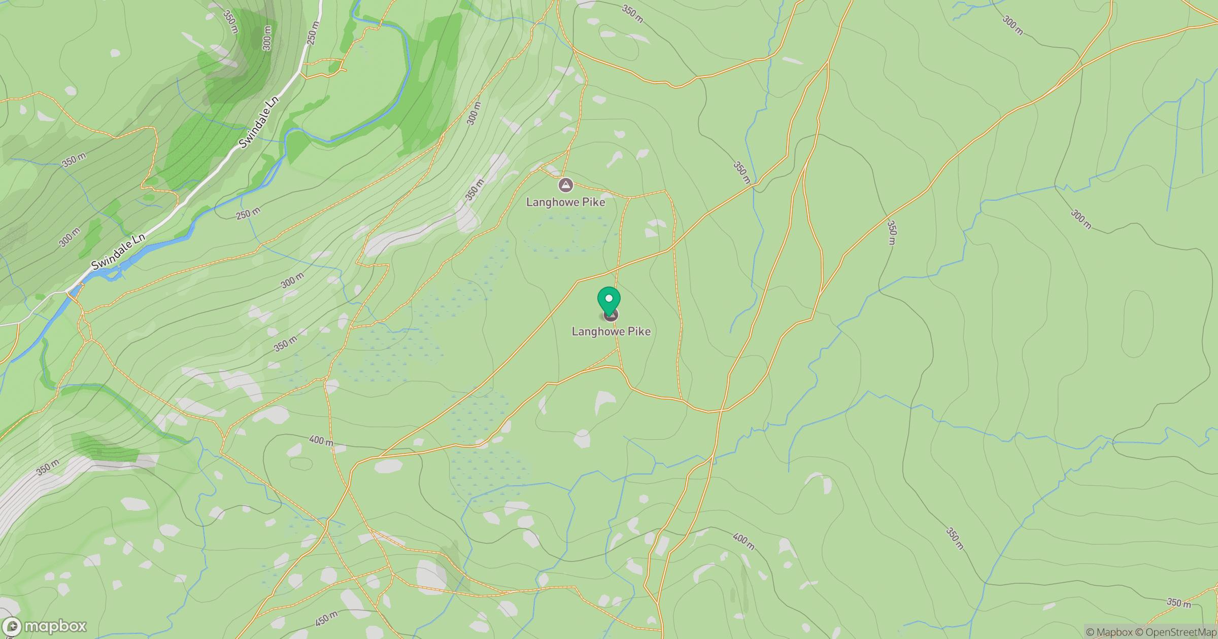
Grid reference: NY529131
View on OpenStreetMapOpens a map in a new tab, centred on the hill.

No comments yet. Be the first.