
Knockseefin
Good walks are even better shared.
Overview
Knockseefin: An Enchanting Adventure
Knockseefin stands proudly at an elevation of 641 meters, a commanding presence in the Slieve Bloom Mountains. Whether you're an experienced hiker or a casual walker, this hill promises a rewarding experience!
Geology
The mountain showcases spectacular geology, primarily featuring Old Red Sandstone, interspersed with schist and quartzite. The rocky outcrops add to the rugged beauty, proving that nature has an impeccable eye for design.
Routes
The most popular route begins at Lough Boora Discovery Park. The Lough Boora Route is approximately 8 km long and usually takes about 3.5 hours to complete, making it moderately challenging, yet enjoyable. Don’t forget to pack snacks; trust us, your stomach deserves a treat!
Summit Features
At the summit, hikers will find a sturdy cairn alongside a concrete pillar marking the peak. It's the perfect location for those panoramic selfies or a well-deserved rest.
Terrain
Expect grassy slopes, rocky patches, and spots of bog that will spike your inner mountain warrior. While it looks serene, your legs might let out amusing complaints as they navigate the terrain.
Views
Once you reach the peak, you’ll be rewarded with breathtaking views of the Slieve Bloom range and beyond. On clear days, the shimmering waters of Lough Derg can be seen, a sight worth every step of the hike.
Hazards
Be wary of the slippy rocks and boggy terrain. The weather can be notoriously unpredictable. Always consult a weather forecast, lest you find yourself uphill in a shower.
Nearby Summits
Nearby, you have Tullydonnell Mountain and Seefin Mountain, both inviting more adventures for the keen explorer.
Access
Parking is available at Lough Boora Discovery Park, which is easily accessible. The nearest bus stop is in Kinnitty, providing limited transport, so having a car is advisable.
Facilities
After conquering the summit, Kinnitty’s cafes and pubs serve as perfect spots to recharge. Just remember, summit toilets are a mere dream—make plans accordingly!
History
Knockseefin’s name hints at its mythical past, translating from Irish as 'hill of the fairy branch.' The mountain not only offers scenic beauty but also a touch of folklore deeply embedded in its roots.
Conclusion
Whether you're in search of tranquility or a good leg workout, Knockseefin presents a perfect blend of both!
Explore routes near Knockseefin
Public walks starting within 80 km of this hill. Nearby does not mean a route reaches the summit; check its map and access before setting out.
No public routes are currently listed within 80 km of Knockseefin on Walkmates. This does not mean there are no paths here. Explore the map and check local access information before planning a walk.
Route planning notes
These notes describe possible approaches, not verified navigable routes or permission to cross land. Check current paths, local access rules and conditions before setting out.
The Lough Boora Route
A popular approach that starts at Lough Boora, combining gentle slopes with more challenging ascents.
Make a day of it, together
Find someone to share the walk with, or organise a day out along a route you like.
Hill facts and local notes
Classifications
Elevation
235m
771 ft
Prominence
113m
Coordinates
52.5562, -8.3634
R754450
OS Map
65
At the Summit
At the summit, hikers will find a well-constructed cairn, with a concrete pillar nearby that offers a noble tribute to the climb. It's the perfect spot to catch your breath and snap a few photos.
Terrain & Geology
The mountain is primarily composed of Old Red Sandstone, with rich deposits of schist and quartzite that speak to its ancient geological history. The rugged crags and rolling heather-clad hills create a stunning profile against the skyline.
Views & Scenery
From the summit, one can see the expansive reach of the Slieve Bloom range, including the distant peaks of the Galtees, and on a clear day, the shimmering waters of Lough Derg.
History & Heritage
Name Origin
The name 'Knockseefin' derives from the Irish 'Cnoc Síofinn,' meaning 'hill of the fairy branch,' hinting at mysticism woven through its history.
Historical Significance
The region has historical importance with ancient burial sites and a rich tapestry of folklore related to local legends and the surrounding landscape.
Getting There & Facilities
Check current local access restrictions, parking rules and transport timetables before travelling. These notes do not confirm public access to the summit.
Parking
Parking can be found at the Lough Boora Discovery Park, where you can stretch your legs before the climb.
Public Transport
The closest bus service runs from Tullamore to Birr, but it's wise to check timings as this service can be dodgy.
Nearby Facilities
Kinnitty offers a few charming cafes and pubs to fuel up before and after your trek. Unfortunately, there's been no official toilet added to the summit area, so plan accordingly!
Safety Information
Known Hazards
- The weather can turn unexpectedly; mist and rain are regular visitors. Watch for slippery rocks and boggy ground that could take trainers hostage.
- Mobile signal can be patchy, so make sure you bring a map and compass.
General Safety Tips
- Check weather conditions before setting out
- Carry appropriate clothing and equipment
- Let someone know your planned route
- Take a map, compass, and GPS device
- Carry emergency supplies: food, water, first aid kit, torch
Hills
Some common questions about the hills answered
Are there group walks up Knockseefin?
Many walkers use Walkmates to join or organise walks with others. You can check for group walks around Knockseefin through the maps
Are there other walkers around Knockseefin?
Activity varies by location and time, but Walkmates lets you see whether others have shared walks or shown interest in this area. Find other people through the walking friends search walking friends for Knockseefin search or of course create your own walk for Knockseefin
Can I organise a walk to Knockseefin?
Yes. If there aren’t any walks listed already, you can create a walk and make it available for others to join.
If you're signed up to Walkmates, you can create a walk to Knockseefin.
How do I find a walk up this hill?
There are often multiple ways to walk this hill, depending on experience and route preference. Walkmates helps you explore walks and routes that others have shared.
Can I suggest a new route up Knockseefin?
Yes. You can suggest or create routes to share with others. Walkmates focuses on the social side of walking, so routes are used to help people organise walks and explore areas together, rather than as detailed navigation tools or route libraries.
Other uses really appreciate knowledgeable walkers sharing their routes. Share your favourite route to Knockseefin here
The is an error or something incorrect about this hill. How do I let you know?
We always strive to keep the information on Walkmates as accurate as possible. If you find an error, please let us know through the contact form and we'll aim to correct it as quickly as possible
Community Discussion
Comments
Location
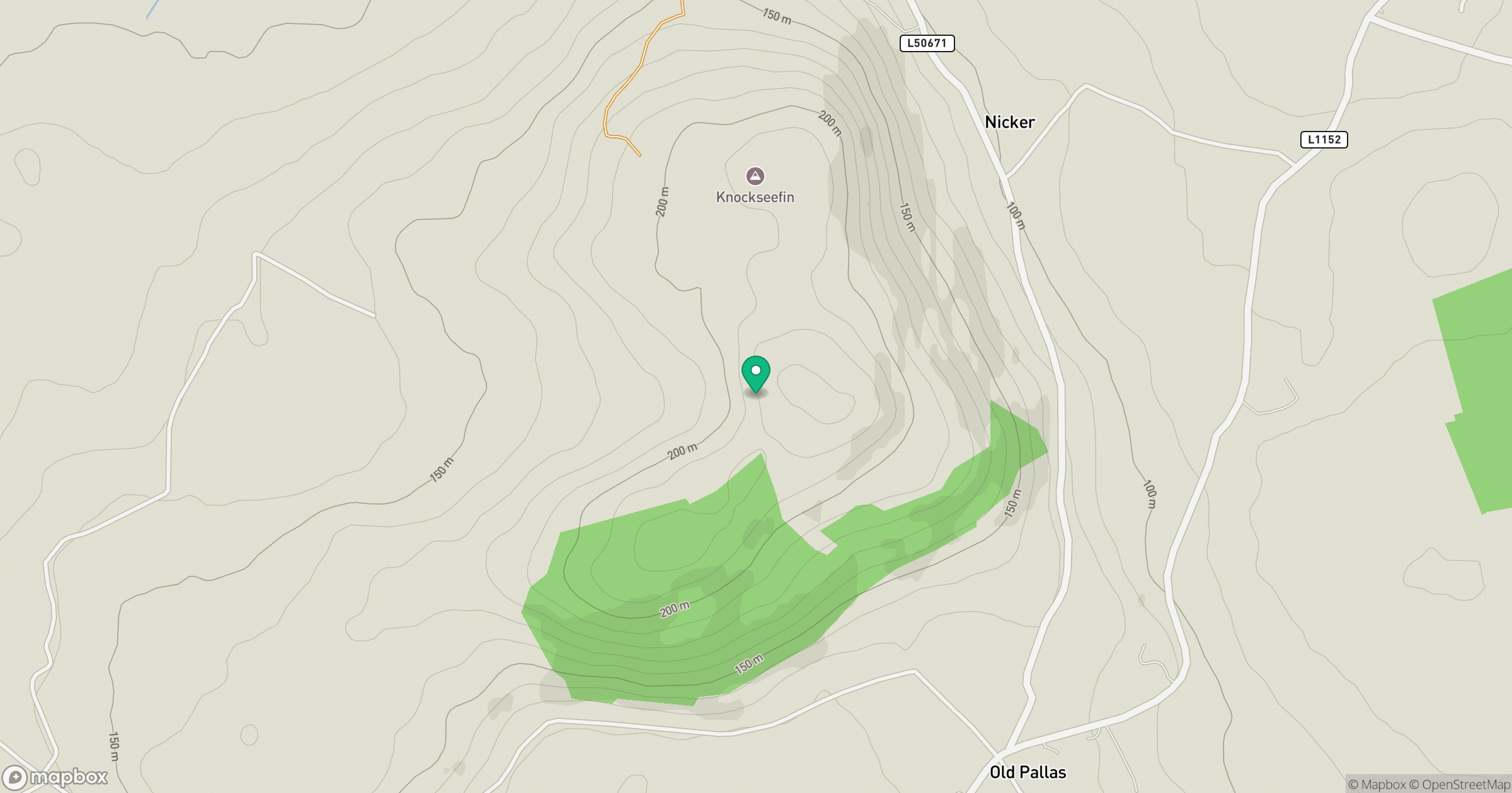
Grid reference: R754450
View on OpenStreetMapOpens a map in a new tab, centred on the hill.
Hills within 30 km
Straight-line distance, not a walking route or confirmation of access.
Galtymore [Cnoc Mor na nGaibhlte]
918m
Knockroe
204m
Duntryleague Hill
278m
Slievereagh [The Pinnacle] [An Sliabh Riabhach]
464m
Slievenamuck
368m
No comments yet. Be the first.