
Knockroe
Good walks are even better shared.
Overview
Knockroe
Nestled within the breathtaking Wicklow Mountains, Knockroe stands proudly at 303 meters, offering hiking enthusiasts a delightful and engaging trek.
Geology
The geology of Knockroe is a fantastic blend of granite and volcanic rock. The rugged landscape features spectacular glacial remnants, such as U-shaped valleys and significant moraine deposits, that tell a tale of the last Ice Age.
The Routes
The Knockroe Loop is a splendid route that wraps around this charming hill, covering approximately 6.5 km in a moderate 2.5 hours. With a blend of grassy paths and gentle slopes, it's ideal for a leisurely day out in nature. Just keep an eye out for those cheeky boggy spots!
Summit Features
At the summit, you will find a substantial stone cairn, a perfect backdrop for a well-deserved photo after all that climbing. Be sure to take a moment to soak in the surroundings—it's a reward worth waiting for.
Terrain Type
Expect to traverse a mix of rocky outcrops and grassy slopes. If the good old Irish weather has been rainy, you may encounter some surprisingly slippery sections, so wear suitable footwear.
Views
Highlights: The views from Knockroe are nothing short of spectacular. On a clear day, the rolling hills of Wicklow stretch out before you, with charming vistas of Lough Dan and the magnificent Irish Sea glistening in the distance.
Best Seasons: Spring and early autumn are favoured times to visit, offering vibrant colours and the clearest skies.
Hazards
While the trek is moderate, hikers should remain vigilant of sudden weather changes. The terrain can become slippery and boggy, so a careful step is advised. Always remember—it's not fun if you end up face-first in the mud!
Nearby Summits
Two notable neighbours worth a visit include Turloigh at 312 meters and the somewhat taller Knocknacree at 399 meters. Each summit offers unique viewpoints and worthy challenges for the eager hiker.
Access
Nearest Parking: A small car park can be found at R662480, with limited space, particularly on sunny weekends.
Public Transport: Buses run from Dublin to nearby Laragh, where a short taxi ride will get you to the trailhead.
Nearest Town: The delightful village of Laragh awaits nearby, perfect for a post-hike bite.
Facilities
When you’ve conquered the heights of Knockroe, be sure to treat yourself at one of the lovely cafes in Laragh. There are also public toilets available to freshen up after your adventure.
History
The name Knockroe stems from the Irish Cnoc Rua, which translates to 'Red Hill'. This region is rich in history, with remnants of ancient structures whispering stories of Ireland's illustrious past.
Whether you're an experienced climber or a casual walker, Knockroe promises a remarkable experience wrapped in the stunning embrace of nature. Grab your rucksack, lace up those hiking boots, and enjoy your adventure!
Explore routes near Knockroe
Public walks starting within 80 km of this hill. Nearby does not mean a route reaches the summit; check its map and access before setting out.
No public routes are currently listed within 80 km of Knockroe on Walkmates. This does not mean there are no paths here. Explore the map and check local access information before planning a walk.
Route planning notes
These notes describe possible approaches, not verified navigable routes or permission to cross land. Check current paths, local access rules and conditions before setting out.
Knockroe Loop
A scenic loop that circles the hill and provides a mix of grassy paths and gentle slopes.
Make a day of it, together
Find someone to share the walk with, or organise a day out along a route you like.
Hill facts and local notes
Classifications
Elevation
204m
669 ft
Prominence
128m
Coordinates
52.5790, -8.5023
R660476
OS Map
65
At the Summit
The summit features a large stone cairn, offering a perfect backdrop for your victory photo after conquering the peak.
Terrain & Geology
Primarily composed of granite with some volcanic rock, contributing to its rugged terrain. The landscape also showcases striking glacial features, such as U-shaped valleys and moraine deposits.
Views & Scenery
On a clear day, you can catch stunning vistas of Wicklow's rolling hills, including views of Lough Dan and beyond towards the Irish Sea.
History & Heritage
Name Origin
The name Knockroe is derived from the Irish 'Cnoc Rua', meaning 'Red Hill'.
Historical Significance
This area is steeped in history, with ancient stone structures and folklore that hint at long-lost tales of Irish warriors.
Getting There & Facilities
Check current local access restrictions, parking rules and transport timetables before travelling. These notes do not confirm public access to the summit.
Parking
There's a small car park at R662480, suitable for several vehicles. Arrive early to snag a spot during weekends.
Public Transport
Bus services run from Dublin to Laragh, with a short taxi ride available to reach the parking area.
Nearby Facilities
Cafes and toilets are available in Laragh. Don't forget to treat yourself to a well-deserved slice of cake!
Safety Information
Known Hazards
- Beware of sudden changes in weather as it can become boggy and slippery. Always watch your footing on rocky paths.
General Safety Tips
- Check weather conditions before setting out
- Carry appropriate clothing and equipment
- Let someone know your planned route
- Take a map, compass, and GPS device
- Carry emergency supplies: food, water, first aid kit, torch
Hills
Some common questions about the hills answered
Are there group walks up Knockroe?
Many walkers use Walkmates to join or organise walks with others. You can check for group walks around Knockroe through the maps
Are there other walkers around Knockroe?
Activity varies by location and time, but Walkmates lets you see whether others have shared walks or shown interest in this area. Find other people through the walking friends search walking friends for Knockroe search or of course create your own walk for Knockroe
Can I organise a walk to Knockroe?
Yes. If there aren’t any walks listed already, you can create a walk and make it available for others to join.
If you're signed up to Walkmates, you can create a walk to Knockroe.
How do I find a walk up this hill?
There are often multiple ways to walk this hill, depending on experience and route preference. Walkmates helps you explore walks and routes that others have shared.
Can I suggest a new route up Knockroe?
Yes. You can suggest or create routes to share with others. Walkmates focuses on the social side of walking, so routes are used to help people organise walks and explore areas together, rather than as detailed navigation tools or route libraries.
Other uses really appreciate knowledgeable walkers sharing their routes. Share your favourite route to Knockroe here
The is an error or something incorrect about this hill. How do I let you know?
We always strive to keep the information on Walkmates as accurate as possible. If you find an error, please let us know through the contact form and we'll aim to correct it as quickly as possible
Community Discussion
Comments
Location
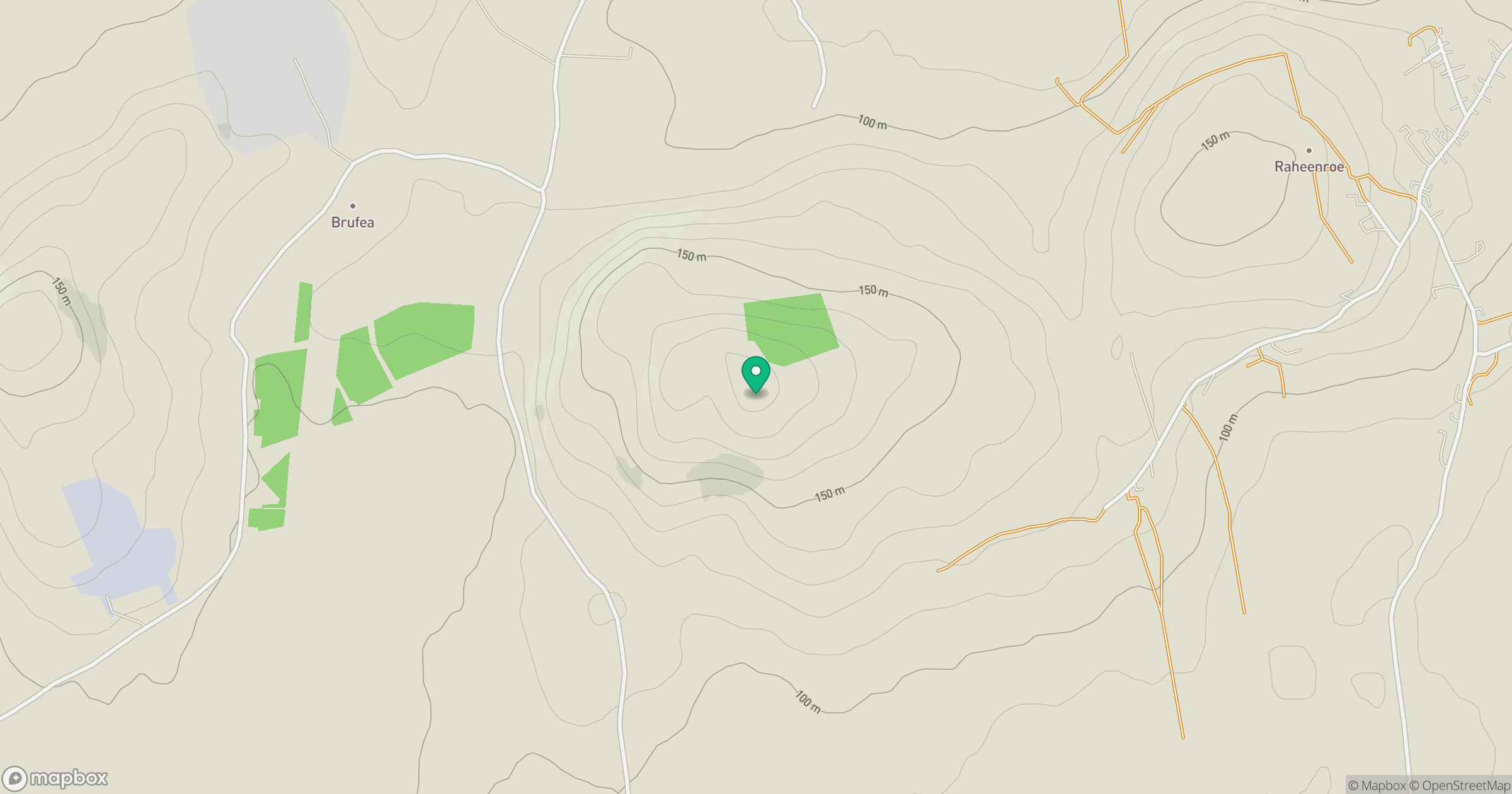
Grid reference: R660476
View on OpenStreetMapOpens a map in a new tab, centred on the hill.
Hills within 30 km
Straight-line distance, not a walking route or confirmation of access.
No comments yet. Be the first.