

Keeper Hill
Good walks are even better shared.
R8266 : On Keeper Hill, Silvermine Mountains - View towards Coolyhorney ridge
Colin Park Photo source
Overview
Keeper Hill, also known as Slievekimalta or Sliabh Coimeálta, is a 691.6 m mountain in County Tipperary between the Silvermines and Slieve Felim hills. The Doonane approach climbs through Ballyhourigan Woods to open heath and blanket bog, with views towards Lough Derg and the Shannon countryside in clear weather.
Keeper Hill
Keeper Hill, also known as Slievekimalta or Sliabh Coimeálta, is a 691.6 m mountain in County Tipperary between the Silvermines and Slieve Felim hills. The Doonane approach climbs through Ballyhourigan Woods to open heath and blanket bog, with views towards Lough Derg and the Shannon countryside in clear weather.
Summit identity
The surveyed high point is a rock beside the trig pillar at R 82395 66705, 691.6 m above sea level. Communications infrastructure is nearby; the separate Firbrega stone circle is on the northeastern slopes.
Summit walk from Doonane
Keeper Hill summit via Ballyhourigan Woods and Boolatin
Start and finish at the Doonane car park. Follow the marked lane into Ballyhourigan Woods, then the forest road to the junction with the summit branch. Follow the red arrows to Keeper Hill and the rock beside its trig pillar, then retrace the summit branch to the same junction. Complete the woodland loop through Boolatin, passing the sweat house before returning to the car park. The official trailhead map gives 14 km and 550 m of ascent for this complete circuit with its out-and-back summit spur. The lower woodland loop alone does not reach the top. Follow forestry-work diversions and keep dogs on a lead.
Access, transport and facilities
Use the Coillte Doonane / Keeper Hill and Ballyhourigan trailhead car park, about 7 km from Newport. Check Coillte’s current access notices and follow forestry-work signs or diversions.
Bus Éireann route 332 and TFI Local Link route 391 serve Newport. Arrange onward travel to the Doonane trailhead and check the operators’ current timetables for the return journey.
Coillte lists a car park and walking trails at Doonane. Bring food and drinking water for the summit walk.
Terrain and safety
The approach follows forestry roads and woodland trails before reaching the open upper mountain. The summit walk is strenuous.
- The upper mountain is exposed above the forest; carry weather protection and navigation equipment.
- The summit branch must be retraced to the woodland-loop junction. Check the return direction carefully in low cloud.
- Wet peat and woodland trails can be slippery; keep to established paths through the bog and heath.
- Forestry operations can affect access. Follow closures, diversions and safety signs, and keep dogs on a lead.
Geology and habitats
Keeper Hill is a sandstone mountain. Its open upper slopes support wet heath and blanket bog above the surrounding conifer plantations. Keeper Hill Special Area of Conservation protects these peatland habitats.
The Doonane and Ballyhourigan woods also lie within a Special Protection Area important for hen harriers. Give wildlife space and stay on established routes through the peatland.
Views and nearby features
In clear weather the summit offers views towards Lough Derg, the Shannon estuary and the surrounding Tipperary countryside. The Galtee Mountains may also be visible in the distance.
The stone sweat house beside the Boolatin woodland-loop return; open summit heath and blanket bog; the separate Firbrega stone circle on the northeastern slopes.
Nearby tops include Boolatin Top (446.6 m) and Silvermine Mountains (489 m). These are separate summits, not additional stops on the described Keeper Hill circuit.
Name and history
Sliabh Coimeálta means "mountain of guarding". Paul Tempan links the name to a traditional story of Sadb raising her children on the mountain; it is not evidence of a historical lookout station.
Historical accounts describe a festive assembly on Keeper Hill in mid-August. The Firbrega stone circle lies in Bauraglanna on the northeastern slopes, separate from the summit and the western walking circuit. A stone sweat house survives beside the woodland-loop return through Boolatin.
Explore routes near Keeper Hill
Walks starting near this hill. Open a route to check its map, distance and full itinerary.
Route planning notes
These notes describe possible approaches. Check a route's map and access information when planning your walk.
Keeper Hill summit via Ballyhourigan Woods and Boolatin
Start and finish at the Doonane car park. Follow the marked lane into Ballyhourigan Woods, then the forest road to the junction with the summit branch. Follow the red arrows to Keeper Hill and the rock beside its trig pillar, then retrace the summit branch to the same junction. Complete the woodland loop through Boolatin, passing the sweat house before returning to the car park. The official trailhead map gives 14 km and 550 m of ascent for this complete circuit with its out-and-back summit spur. The lower woodland loop alone does not reach the top. Follow forestry-work diversions and keep dogs on a lead.
Make a day of it, together
Find someone to share the walk with, or organise a day out along a route you like.
Photo Gallery
View all Photo could not load
R8266 : On Keeper Hill, Silvermine Mountains - View towards Coolyhorney ridge
Colin Park
 Photo could not load
R8266 : On Keeper Hill, Silvermine Mountains - Summit trig point
Colin Park
Hill facts and local notes
Classifications
Elevation
692m
2,269 ft
Prominence
605m
Coordinates
52.7515, -8.2615
R823667
OS Map
59
At the Summit
The surveyed high point is a rock beside the trig pillar at R 82395 66705, 691.6 m above sea level. Communications infrastructure is nearby; the separate Firbrega stone circle is on the northeastern slopes.
Terrain & Geology
Keeper Hill is a sandstone mountain. Its open upper slopes support wet heath and blanket bog above the surrounding conifer plantations. Keeper Hill Special Area of Conservation protects these peatland habitats.
Views & Scenery
In clear weather the summit offers views towards Lough Derg, the Shannon estuary and the surrounding Tipperary countryside. The Galtee Mountains may also be visible in the distance.
History & Heritage
Name Origin
Sliabh Coimeálta means "mountain of guarding". Paul Tempan links the name to a traditional story of Sadb raising her children on the mountain; it is not evidence of a historical lookout station.
Historical Significance
Historical accounts describe a festive assembly on Keeper Hill in mid-August. The Firbrega stone circle lies in Bauraglanna on the northeastern slopes, separate from the summit and the western walking circuit. A stone sweat house survives beside the woodland-loop return through Boolatin.
Getting There & Facilities
Parking
Use the Coillte Doonane / Keeper Hill and Ballyhourigan trailhead car park, about 7 km from Newport. Check Coillte’s current access notices and follow forestry-work signs or diversions.
Public Transport
Bus Éireann route 332 and TFI Local Link route 391 serve Newport. Arrange onward travel to the Doonane trailhead and check the operators’ current timetables for the return journey.
Nearby Facilities
Coillte lists a car park and walking trails at Doonane. Bring food and drinking water for the summit walk.
Safety Information
Known Hazards
- The upper mountain is exposed above the forest; carry weather protection and navigation equipment.
- The summit branch must be retraced to the woodland-loop junction. Check the return direction carefully in low cloud.
- Wet peat and woodland trails can be slippery; keep to established paths through the bog and heath.
- Forestry operations can affect access. Follow closures, diversions and safety signs, and keep dogs on a lead.
General Safety Tips
- Check weather conditions before setting out
- Carry appropriate clothing and equipment
- Let someone know your planned route
- Take a map, compass, and GPS device
- Carry emergency supplies: food, water, first aid kit, torch
Hills
Some common questions about the hills answered
Are there group walks up Keeper Hill?
Many walkers use Walkmates to join or organise walks with others. You can check for group walks around Keeper Hill through the maps
Are there other walkers around Keeper Hill?
Activity varies by location and time, but Walkmates lets you see whether others have shared walks or shown interest in this area. Find other people through the walking friends search walking friends for Keeper Hill search or of course create your own walk for Keeper Hill
Can I organise a walk to Keeper Hill?
Yes. If there aren’t any walks listed already, you can create a walk and make it available for others to join.
If you're signed up to Walkmates, you can create a walk to Keeper Hill.
How do I find a walk up this hill?
There are often multiple ways to walk this hill, depending on experience and route preference. Walkmates helps you explore walks and routes that others have shared.
Can I suggest a new route up Keeper Hill?
Yes. You can suggest or create routes to share with others. Walkmates focuses on the social side of walking, so routes are used to help people organise walks and explore areas together, rather than as detailed navigation tools or route libraries.
Other uses really appreciate knowledgeable walkers sharing their routes. Share your favourite route to Keeper Hill here
The is an error or something incorrect about this hill. How do I let you know?
We always strive to keep the information on Walkmates as accurate as possible. If you find an error, please let us know through the contact form and we'll aim to correct it as quickly as possible
Community Discussion
Comments
Location
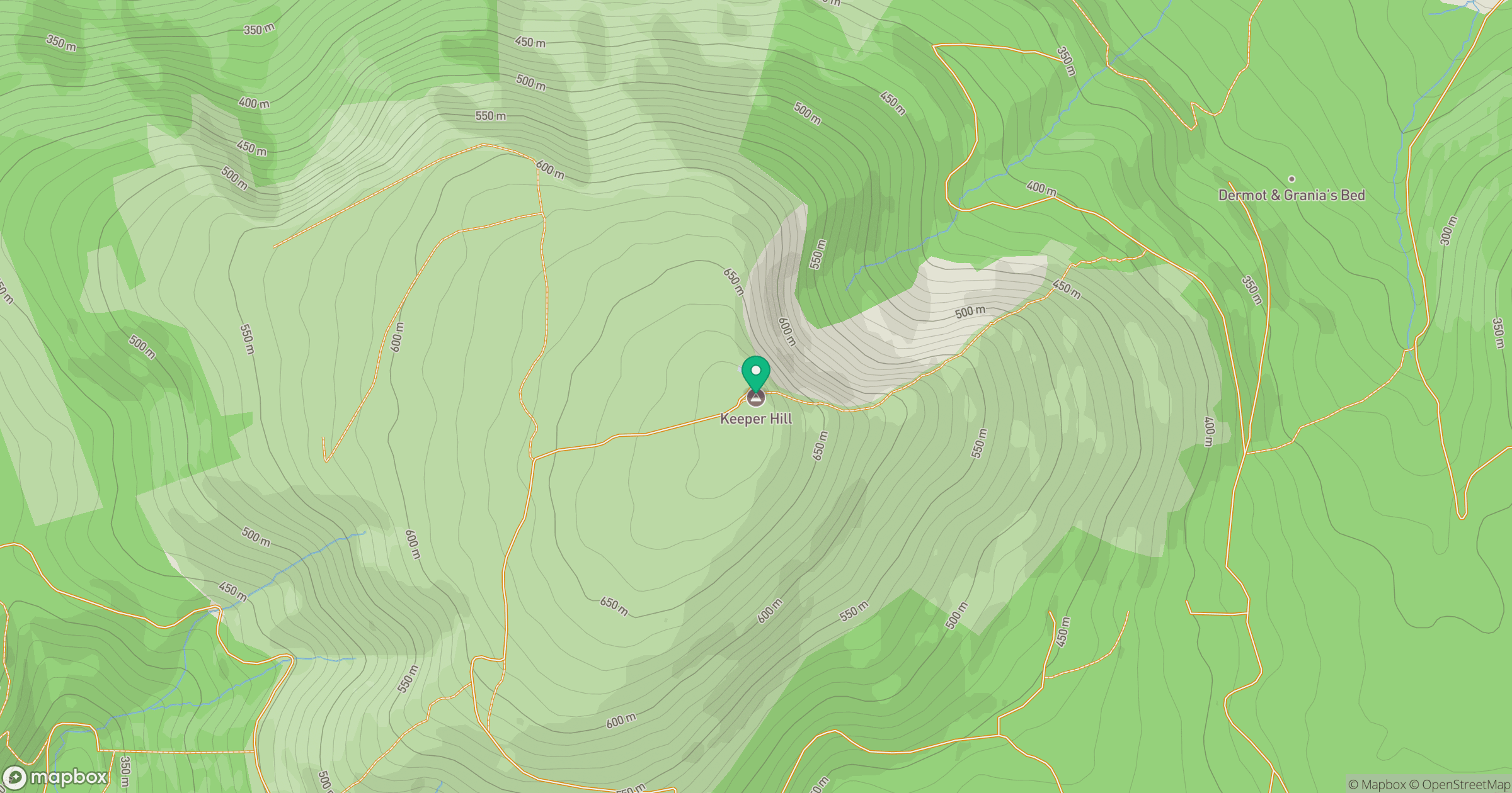
Grid reference: R823667
View on OpenStreetMapOpens a map in a new tab, centred on the hill.
No comments yet. Be the first.