

Knockenhair
Good walks are even better shared.
Overview
Knockenhair
Overview
Knockenhair is a charming and delightful Marilyn nestled in the Southern Uplands of Scotland. Standing at 319 meters, it may not be the highest peak in the country, but don’t let its modest elevation fool you—its gentle slopes and stunning vistas make it an excellent choice for outdoor enthusiasts of all ages and abilities.
Geology
Primarily composed of sandstone, Knockenhair's geological features provide an interesting look at the processes that have shaped this stunning region. From rolling hills to gentle slopes, hikers are treated to a landscape that tells a tale of Scotland’s ancient past, dating back to the Carboniferous period.
Routes
A popular route to the summit begins at High Buckholm Farm. This easy trek offers a perfect introduction for those new to hiking and a leisurely stroll for seasoned walkers. Along the way, be sure to admire the blooming flora and listen for the cheerful sounds of birds enjoying their day.
- Distance: 4.0 km
- Time: Approximately 1.5 hours
- Difficulty: Easy
Summit Features
At the summit, hikers will find a small cairn, an iconic sight that might well inspire a spontaneous celebration. Make sure to take a moment to enjoy the surrounding views, perhaps in a moment of profound reflection or just to catch your breath!
Terrain Type
The terrain is predominantly grassy with occasional rocky outcrops. This makes for a pleasant walking experience, except when you hit a muddy patch—then it’s just a bit of a laugh!
Views
The panoramas from Knockenhair are simply delightful. On a clear day, you can spot the peaks of the Borders in the distance, with Spring and Autumn providing the best conditions to witness them. Just remember, the beauty of nature can be deeply humbling.
Hazards
While the trail is generally safe, do keep an eye on muddy sections after rainfall. And as always, watch out for the local sheep; they seem to have an uncanny knack for establishing their authority!
Nearby Summits
If you’re in the mood for a little more adventure, consider tackling one of the nearby summits:
- Meikle Millyea (568 meters)
- Merrick (843 meters)
These peaks offer a lovely contrast to the gentle Knockenhair and might just stretch your legs a bit more!
Access
- Nearest Parking: High Buckholm Farm provides parking for several cars.
- Public Transport: The nearest bus service is to Denny, though a taxi is necessary from there.
- Nearest Town: Denny offers all the amenities you might need before or after your hike, including shops and cafes.
Facilities
Post-hike, head down to Denny for a well-deserved slice of cake and perhaps a cup of tea to go with it.
History
The mountain's name is thought to derive from the Gaelic for 'little hill', which is very fitting given its stature. Though it might not be steeped in legend and lore, it offers a vital connection to the landscape and the ancient stories it holds.
Whether you're a seasoned hiker or just looking for a nice day out, Knockenhair is a splendid option.
Enjoy your adventure!
Explore routes near Knockenhair
Public walks starting within 80 km of this hill. Nearby does not mean a route reaches the summit; check its map and access before setting out.
Forest of Ae Water of Ae Riverside Trail
View route
Moffat Gallow Hill Woodland and Viewpoint Circuit
View route
Carrick Forest Drive: Stinchar Bridge to Loch Doon
View route
Motherwell: Strathclyde Loch full shoreline circuit
View route
Route planning notes
These notes describe possible approaches, not verified navigable routes or permission to cross land. Check current paths, local access rules and conditions before setting out.
From High Buckholm Farm
A straightforward ascent from the nearby farm, leading up the gentle slopes towards the summit. A great route for families and less experienced hikers.
Make a day of it, together
Find someone to share the walk with, or organise a day out along a route you like.
Photo Gallery
View all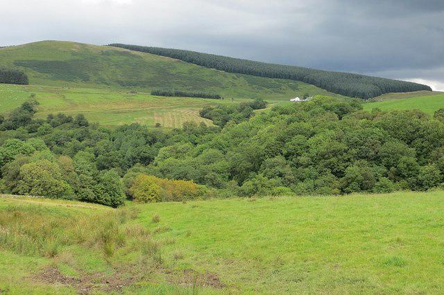 Photo could not load
NS7913 : Knockenhair
Richard Webb
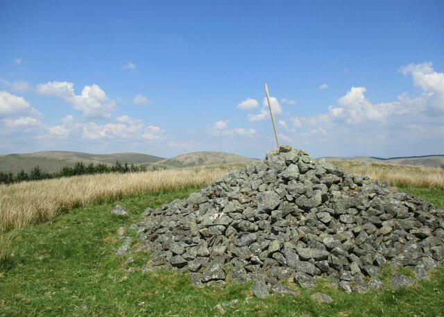 Photo could not load
NS7913 : Remains of cairn on Knockenhair
Alan O'Dowd
Hill facts and local notes
Classifications
Elevation
404m
1,327 ft
Prominence
118m
Coordinates
55.3991, -3.9094
NS791133
OS Map
71 78
Explorer: 329
At the Summit
The summit is marked by a small cairn, offering a sense of achievement that might just make you shout 'Huzzah!' when you reach it. There's also a lovely natural rock formation to sit and ponder the meaning of life.
Terrain & Geology
Primarily composed of sandstone, Knockenhair features rolling hills and gentle slopes, offering a unique glimpse into the geological processes that have shaped Scotland over millennia, particularly during the Carboniferous period.
Views & Scenery
From the top, you can enjoy expansive views of the surrounding hills, including the distant peaks of the Borders.
History & Heritage
Name Origin
The name 'Knockenhair' likely derives from the Gaelic 'Cnocan', meaning 'little hill', paired with 'hair', possibly referencing the hilly landscape.
Historical Significance
While lacking a rich history of battles or legendary creatures, the area forms part of the ancient landscape shaped by human and natural forces alike.
Getting There & Facilities
Check current local access restrictions, parking rules and transport timetables before travelling. These notes do not confirm public access to the summit.
Parking
Parking is available at High Buckholm Farm, which can accommodate several cars. Follow the farm road to the starting point.
Public Transport
The closest bus stop is in the village of Denny, with services running to nearby towns, though a taxi will be required to reach the farm.
Nearby Facilities
There are no facilities directly on the mountain, but you can find a café in Denny for a well-deserved post-hike slice of cake.
Safety Information
Known Hazards
- Be cautious of muddy sections after rain and watch out for the occasional rogue sheep that may attempt to assert its dominance.
General Safety Tips
- Check weather conditions before setting out
- Carry appropriate clothing and equipment
- Let someone know your planned route
- Take a map, compass, and GPS device
- Carry emergency supplies: food, water, first aid kit, torch
Hills
Some common questions about the hills answered
Are there group walks up Knockenhair?
Many walkers use Walkmates to join or organise walks with others. You can check for group walks around Knockenhair through the maps
Are there other walkers around Knockenhair?
Activity varies by location and time, but Walkmates lets you see whether others have shared walks or shown interest in this area. Find other people through the walking friends search walking friends for Knockenhair search or of course create your own walk for Knockenhair
Can I organise a walk to Knockenhair?
Yes. If there aren’t any walks listed already, you can create a walk and make it available for others to join.
If you're signed up to Walkmates, you can create a walk to Knockenhair.
How do I find a walk up this hill?
There are often multiple ways to walk this hill, depending on experience and route preference. Walkmates helps you explore walks and routes that others have shared.
Can I suggest a new route up Knockenhair?
Yes. You can suggest or create routes to share with others. Walkmates focuses on the social side of walking, so routes are used to help people organise walks and explore areas together, rather than as detailed navigation tools or route libraries.
Other uses really appreciate knowledgeable walkers sharing their routes. Share your favourite route to Knockenhair here
The is an error or something incorrect about this hill. How do I let you know?
We always strive to keep the information on Walkmates as accurate as possible. If you find an error, please let us know through the contact form and we'll aim to correct it as quickly as possible
Community Discussion
Comments
Location
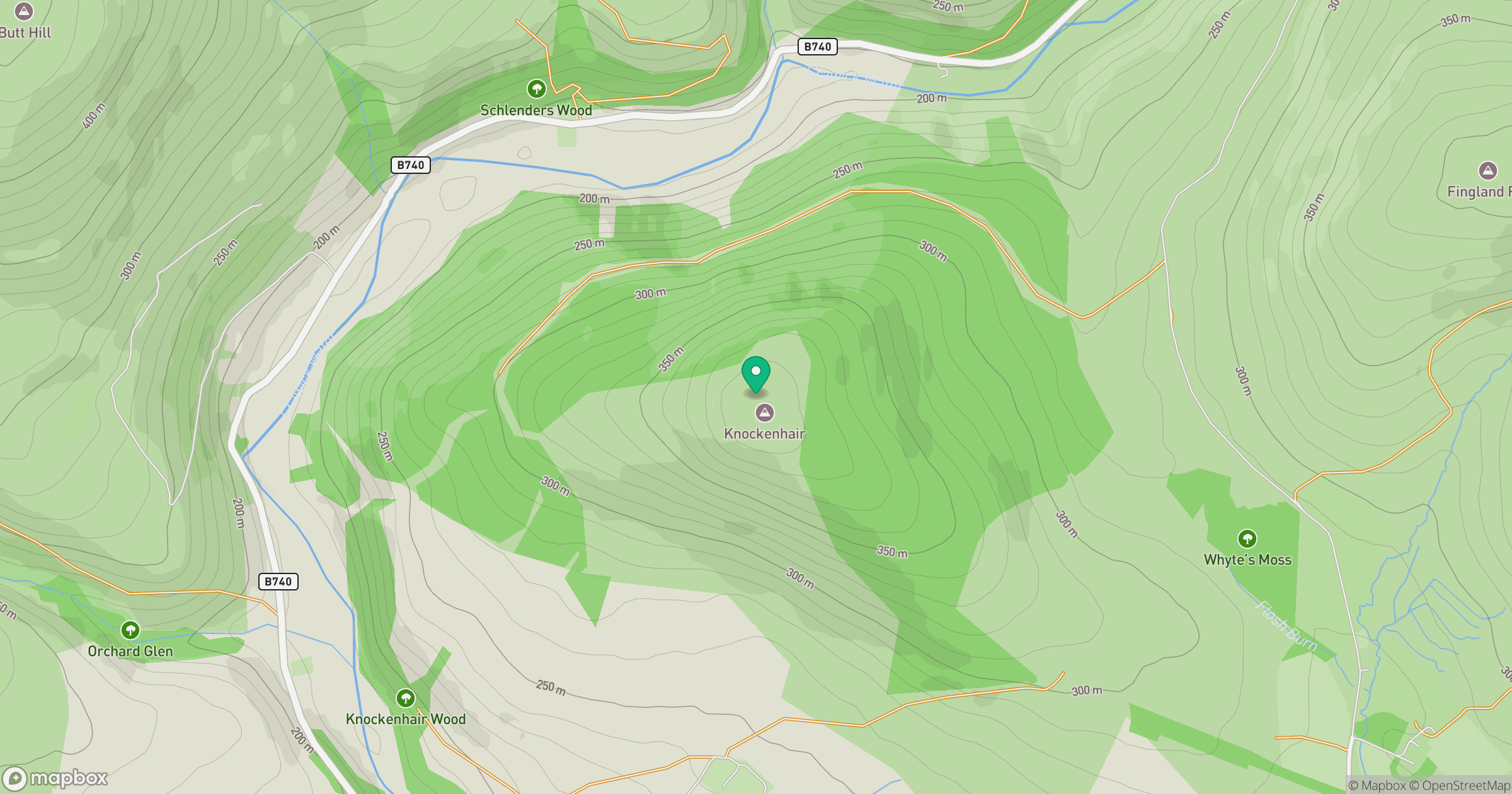
Grid reference: NS791133
View on OpenStreetMapOpens a map in a new tab, centred on the hill.
Hills within 30 km
Straight-line distance, not a walking route or confirmation of access.

No comments yet. Be the first.