
Hareshaw Hill
Good walks are even better shared.
Overview
Discovering Hareshaw Hill
Welcome to Hareshaw Hill, a Marilyn that may not steal the limelight like some of its taller cousins, but boasts a charm all its own. This 444-meter gem in the Northumberland National Park offers not only fresh air and scenic beauty but also a taste of the region's rich geological history.
Geology
Hareshaw Hill is primarily composed of beautiful Carboniferous sandstone, which has stood the test of time remarkably well. You might say it's as tough as old boots! The rugged terrain mixes rocky outcrops with lush grassy slopes, making it a delight for geologists and nature lovers alike.
Routes
There are several routes to choose from, but the Hareshaw Linn Trail is particularly popular, winding its way alongside the Hareshaw Burn through enchanting woodlands. For those looking to stretch their legs with a loop, the Circular Walk from Bellingham combines forest paths and upland tracks for an all-around lovely experience.
Summit Features
At the summit, you'll find a distinctly majestic trig point — a beacon for hapless hikers in search of their next Instagram shot! Once you reach the top, you’ll feel like you’ve conquered your own Everest (well, maybe not quite, but you get the idea).
Terrain
The terrain switches between grassy slopes, rocky sections, and some areas of woodland, ensuring that you have plenty to marvel at (and occasionally stumble over). Just remember: a sense of humour goes a long way while navigating this mixed bag of landscapes.
Views
From the summit, the views are nothing short of stunning. You can see the Cheviot Hills standing proud among the rolling moorlands, with the best time to take it all in being during Spring or Autumn when the colours are vibrant and the sky is clear.
Hazards
However, like all good things in life, there are a few hazards to keep in mind. Weather can change with little warning, so plan accordingly to avoid being caught in a soaking. Additionally, loose rocks can pose risks, particularly on steeper sections, so tread carefully!
Nearby Summits
Just a stone's throw away, you can also say hello to neighbouring summits like The Cheviot and Windy Gyle, each offering their own unique charms.
Access
Getting to Hareshaw Hill is as easy as pie! The nearest parking can be found in Bellingham, which is also accessible via public transport. Here you’ll find all the facilities you need to prepare before your adventure, including cafes and shops.
History
And let's not forget a bit of history! The name 'Hareshaw' has its roots in Old Norse, meaning 'high wooded hill'. This area has been alive with tales of ancient settlements and folklore, and walking here is like stepping back in time.
So grab your hiking boots, pack a sandwich, and set forth on the adventures waiting for you at Hareshaw Hill. Happy hiking!
Explore routes near Hareshaw Hill
Public walks starting within 80 km of this hill. Nearby does not mean a route reaches the summit; check its map and access before setting out.
Motherwell: Strathclyde Loch full shoreline circuit
View route
Cambuslang Walk with Men Walking & Talking
View route
Lochend Loch at Drumpellier
View route
Moffat Gallow Hill Woodland and Viewpoint Circuit
View route
Route planning notes
These notes describe possible approaches, not verified navigable routes or permission to cross land. Check current paths, local access rules and conditions before setting out.
Hareshaw Linn Trail
A picturesque route that follows the Hareshaw Burn, offering scenic woodland sections alongside stunning views of the surrounding hills.
Circular Walk from Bellingham
A delightful circular walk starting and ending in Bellingham, this route combines forest paths and upland tracks for a varied experience.
Make a day of it, together
Find someone to share the walk with, or organise a day out along a route you like.
Hill facts and local notes
Classifications
Elevation
467m
1,532 ft
Prominence
129m
Coordinates
55.5447, -3.9608
NS763296
OS Map
71
Explorer: 328N
At the Summit
Hareshaw Hill features a prominent trig point at the summit, offering a perfect photo op for aspiring mountaineers and selfie enthusiasts alike.
Terrain & Geology
Primarily composed of Carboniferous sandstone, Hareshaw Hill features a mix of rugged terrain and grassy slopes, providing a glimpse into the geological history of the region.
Views & Scenery
Spectacular views of the Northumberland National Park, including the distinctive Cheviot Hills and rolling moorland.
History & Heritage
Name Origin
The name 'Hareshaw' is derived from Old Norse, where 'haer' signifies 'high' and 'shaw' means 'wooded hill' – fitting for our elevated friend.
Historical Significance
The area is rich in history, once playing host to ancient settlements and surrounded by tales of folklore and local traditions.
Getting There & Facilities
Check current local access restrictions, parking rules and transport timetables before travelling. These notes do not confirm public access to the summit.
Parking
Bellingham has several car parks, with a small area near the start of the Hareshaw Linn Trail. Please park responsibly!
Public Transport
Buses run regularly to Bellingham from nearby towns such as Hexham and Newcastle.
Nearby Facilities
Bellingham offers a range of facilities including cafés, pubs, shops, and public toilets.
Safety Information
Known Hazards
- Weather can change rapidly; be prepared for wet conditions. Loose rocks may pose a risk, particularly on steeper sections.
General Safety Tips
- Check weather conditions before setting out
- Carry appropriate clothing and equipment
- Let someone know your planned route
- Take a map, compass, and GPS device
- Carry emergency supplies: food, water, first aid kit, torch
Hills
Some common questions about the hills answered
Are there group walks up Hareshaw Hill?
Many walkers use Walkmates to join or organise walks with others. You can check for group walks around Hareshaw Hill through the maps
Are there other walkers around Hareshaw Hill?
Activity varies by location and time, but Walkmates lets you see whether others have shared walks or shown interest in this area. Find other people through the walking friends search walking friends for Hareshaw Hill search or of course create your own walk for Hareshaw Hill
Can I organise a walk to Hareshaw Hill?
Yes. If there aren’t any walks listed already, you can create a walk and make it available for others to join.
If you're signed up to Walkmates, you can create a walk to Hareshaw Hill.
How do I find a walk up this hill?
There are often multiple ways to walk this hill, depending on experience and route preference. Walkmates helps you explore walks and routes that others have shared.
Can I suggest a new route up Hareshaw Hill?
Yes. You can suggest or create routes to share with others. Walkmates focuses on the social side of walking, so routes are used to help people organise walks and explore areas together, rather than as detailed navigation tools or route libraries.
Other uses really appreciate knowledgeable walkers sharing their routes. Share your favourite route to Hareshaw Hill here
The is an error or something incorrect about this hill. How do I let you know?
We always strive to keep the information on Walkmates as accurate as possible. If you find an error, please let us know through the contact form and we'll aim to correct it as quickly as possible
Community Discussion
Comments
Location
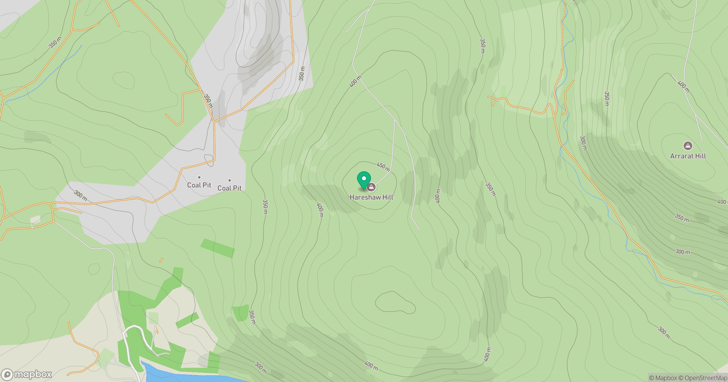
Grid reference: NS763296
View on OpenStreetMapOpens a map in a new tab, centred on the hill.
Hills within 30 km
Straight-line distance, not a walking route or confirmation of access.

No comments yet. Be the first.