
Kill Hill
Good walks are even better shared.
Overview
Kill Hill: A Peak District Jewel
Nestled in the heart of the Peak District, Kill Hill stands tall at 771 meters, providing a moderate challenge for hikers looking to soak in the stunning scenery of this iconic region. Often overshadowed by its taller neighbours, Kill Hill is like that underrated band you discover and rave about to friends.
Geology
Kill Hill is primarily constructed of sandstone, known for its durability and the breathtaking cliffs that form due to erosion. The geology offers not just a visual treat but also a peek into the natural history that has shaped the landscape over millions of years.
Routes
The Kill Hill Circuit is a delightful 8.5 km loop that starts in Edale. With a combination of woodland paths and open moorland, trekkers can enjoy diverse scenery before tackling the ascent to the summit. Expect to spend around 3.5 hours depending on your pace and how often you stop for photos (a common pitfall for all hikers).
Summit Features
Upon reaching the summit, hikers are greeted with a trig point that proudly marks their achievement. It's a fantastic spot for a snapshot, best accompanied by a triumphant pose and perhaps a cheeky thumbs up.
Terrain Type
The terrain offers a bit of everything: rocky paths, grassy fields, and a few notorious boggy patches, so be prepared for a potential encounter with the Peak District mud!
Views
Once at the summit, panoramic views await. On a clear day, you'll see the breathtaking expanse of Hope Valley and the majestic peaks surrounding it. Spring and autumn present the best seasons for these views, showcasing vibrant blooms and autumnal colours that are sure to capture the heart.
Hazards
As with any mountainous adventure, be wary of sudden weather shifts. The skies can change quicker than you can say 'jacket potato,' so always carry appropriate gear. Slippery rocks can surprise the unwary as well.
Nearby Summits
Not far from Kill Hill, you'll find other gems like Mam Tor and Lose Hill, making for an enjoyable day of exploring the great outdoors just a stone’s throw away.
Access
Edale is the gateway to this hiking paradise. Parking can get a bit hectic at the Village Hall, especially during weekends, so be sure to arrive early. For public transport connections, frequent trains run from Sheffield to Edale, making it accessible for all. After your trek, reward yourself with a refreshing pint in one of Edale's cosy pubs.
Facilities
Edale has all you need for a comfortable visit, including delightful cafes for that much-needed post-hike treat, as well as public toilets.
History
The name 'Kill Hill' comes from the Old Norse word 'kjall,' or 'cell,' a nod to the mountain’s rugged past. It has been a notable part of the Peak District's cultural landscape, attracting adventurers and historians alike.
In summary, Kill Hill offers everything a nature lover could wish for: stunning views, a variety of terrain, and a slice of British history wrapped up in a delightful hiking experience. Don your boots, grab your walking stick, and march up that hill with pride!
If you're lucky, you might even spot a sheep or two, making the experience all the more authentically British!
Explore routes near Kill Hill
Public walks starting within 80 km of this hill. Nearby does not mean a route reaches the summit; check its map and access before setting out.
No public routes are currently listed within 80 km of Kill Hill on Walkmates. This does not mean there are no paths here. Explore the map and check local access information before planning a walk.
Route planning notes
These notes describe possible approaches, not verified navigable routes or permission to cross land. Check current paths, local access rules and conditions before setting out.
The Kill Hill Circuit
A delightful loop from Edale that offers a mix of woodland paths and open moorland before ascending to the summit of Kill Hill.
Make a day of it, together
Find someone to share the walk with, or organise a day out along a route you like.
Hill facts and local notes
Classifications
Elevation
241m
791 ft
Prominence
114m
Coordinates
52.5413, -7.7856
S146433
OS Map
66
At the Summit
The summit features a prominent trig point, affording hikers a place to catch their breath and take a selfie with a bit of geological history.
Terrain & Geology
The mountain is primarily composed of sandstone, known for its resilience and striking cliff features, contributing to the rugged beauty typical of the Peak District.
Views & Scenery
From the summit, enjoy sweeping vistas of the Hope Valley and the surrounding hills, including Mam Tor and the darker peaks to the north.
History & Heritage
Name Origin
The name 'Kill' is believed to derive from the Old Norse term 'kjall,' meaning 'cell' or 'hole,' hinting at the mountain's rugged past.
Historical Significance
Kill Hill holds cultural significance as part of the ancient landscape of the Peak District, an area rich in Neolithic and Bronze Age history.
Getting There & Facilities
Check current local access restrictions, parking rules and transport timetables before travelling. These notes do not confirm public access to the summit.
Parking
Parking is available at Edale Village Hall, but arrive early as spots fill up faster than tea at a British café.
Public Transport
Regular train services run from Sheffield to Edale, with the station just a stone's throw from the start of your hike.
Nearby Facilities
Edale offers several facilities, including a lovely cafe for refreshments and public toilets for those urgent calls of nature.
Safety Information
Known Hazards
- Potential for sudden weather changes, so ensure you're prepared. Also, watch out for slippery rocks and the infamous Peak District mud.
General Safety Tips
- Check weather conditions before setting out
- Carry appropriate clothing and equipment
- Let someone know your planned route
- Take a map, compass, and GPS device
- Carry emergency supplies: food, water, first aid kit, torch
Hills
Some common questions about the hills answered
Are there group walks up Kill Hill?
Many walkers use Walkmates to join or organise walks with others. You can check for group walks around Kill Hill through the maps
Are there other walkers around Kill Hill?
Activity varies by location and time, but Walkmates lets you see whether others have shared walks or shown interest in this area. Find other people through the walking friends search walking friends for Kill Hill search or of course create your own walk for Kill Hill
Can I organise a walk to Kill Hill?
Yes. If there aren’t any walks listed already, you can create a walk and make it available for others to join.
If you're signed up to Walkmates, you can create a walk to Kill Hill.
How do I find a walk up this hill?
There are often multiple ways to walk this hill, depending on experience and route preference. Walkmates helps you explore walks and routes that others have shared.
Can I suggest a new route up Kill Hill?
Yes. You can suggest or create routes to share with others. Walkmates focuses on the social side of walking, so routes are used to help people organise walks and explore areas together, rather than as detailed navigation tools or route libraries.
Other uses really appreciate knowledgeable walkers sharing their routes. Share your favourite route to Kill Hill here
The is an error or something incorrect about this hill. How do I let you know?
We always strive to keep the information on Walkmates as accurate as possible. If you find an error, please let us know through the contact form and we'll aim to correct it as quickly as possible
Community Discussion
Comments
Location
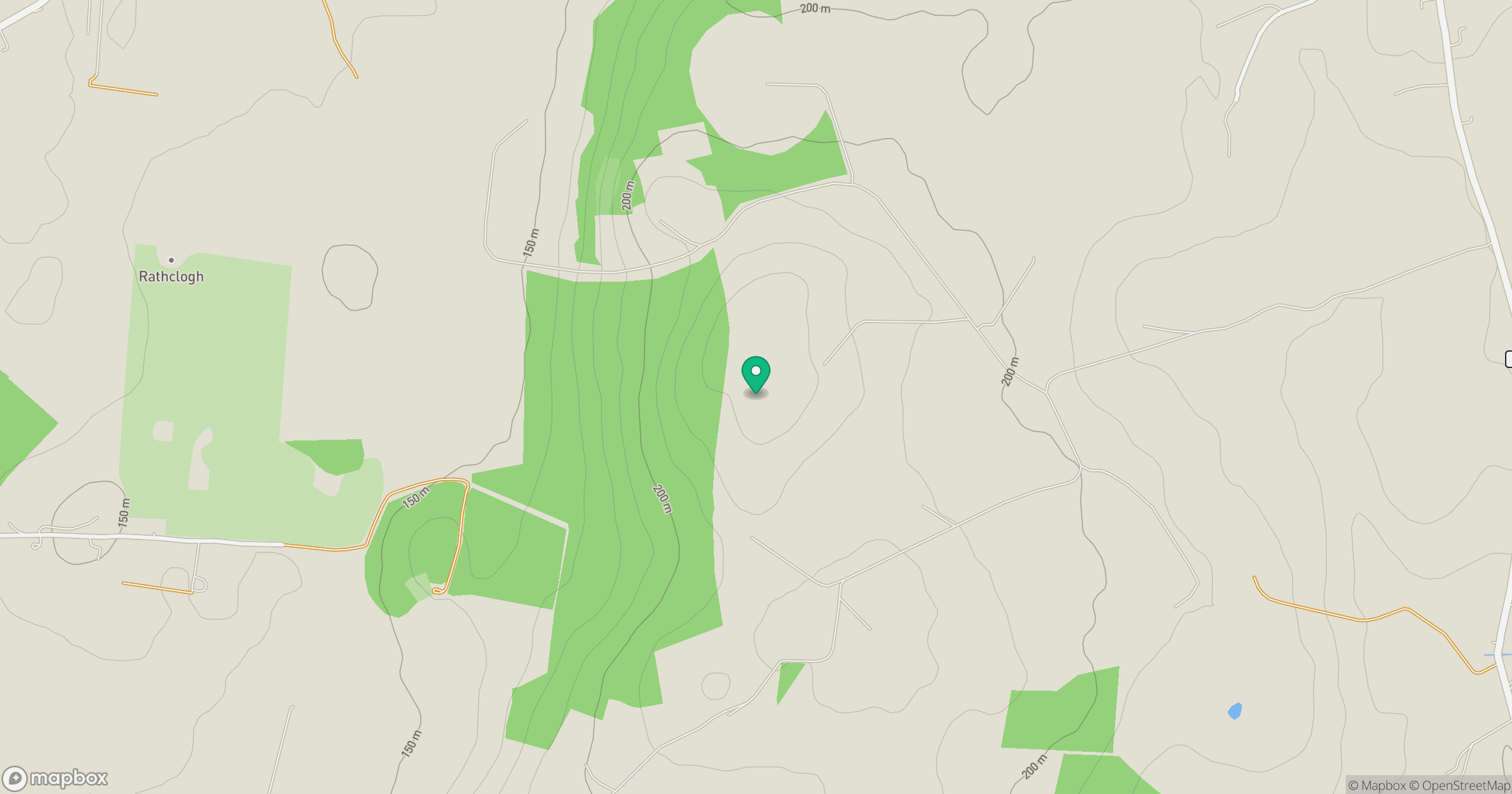
Grid reference: S146433
View on OpenStreetMapOpens a map in a new tab, centred on the hill.
Hills within 30 km
Straight-line distance, not a walking route or confirmation of access.
No comments yet. Be the first.