

Laghtnafrankee
Good walks are even better shared.
Overview
Laghtnafrankee
Laghtnafrankee stands proudly at an elevation of 460 meters, offering both seasoned adventurers and casual walkers a delightful challenge in Northern Ireland's rugged landscape.
Geology
The mountain, comprised predominantly of sandstone with flecks of siltstone, narrates a tale of the ancient Devonian seas. The resultant rock formations create captivating vistas and interesting geological structures.
Routes
Pinker's Path
- Distance: 6.5 km
- Time: Approximately 2.5 hours
- Difficulty: Moderate
Winding through heather and grass, this trail serves as an excellent gateway to the hill. It combines stunning views and rich flora, perfect for nature enthusiasts.
Slieve Beagh Circuit
- Distance: 12.0 km
- Time: Approximately 5 hours
- Difficulty: Challenging
This loop connects multiple summits and is recommended for well-prepared hikers looking to immerse themselves fully in each breathtaking view. Just don’t forget your packed lunch!
Summit Features
At the top, hikers are greeted by a classic stone cairn and views that stretch across the Fermanagh Lakelands. This spot has been known to make even the most seasoned mountaineer pause in awe.
Terrain Type
Expect a delightful mix of rocky outcrops and grassy slopes, but keep your wits about you to avoid the occasional boggy patch. Layered clothing is recommended as the weather can change faster than you can say ‘where’s my map?’.
Views
From the summit, you can enjoy panoramic vistas, including the atmospheric Mourne Mountains in clear weather. Spring and autumn bring especially vibrant colours, recommending this climb at different times of the year.
Hazards
Be mindful of the weather, as conditions can shift rapidly, and always check the forecast before you head out. Uneven ground can make for tricky navigation, so sturdy footwear is non-negotiable.
Access
Nearest Parking
Parking is conveniently located near the village of Newtownbutler, giving easy access to the trail.
Public Transport
Public buses run regularly to Newtownbutler, although a private car will offer the most flexibility.
Nearest Town
Newtownbutler is the closest town, where you’ll find friendly faces and essential facilities.
Facilities
For those planning a day hike, remember to visit Newtownbutler first for ample cafes and, yes, toilets! It’s always good to stock up on refreshments.
History
Laghtnafrankee’s name harkens back to French connections, hinting at the cultural intersections that have taken place here. Still a wonder, even as it gets a bit of poke now and then for its peculiar name!
In summary, Laghtnafrankee offers a splendid adventure with its captivating views, rich geological tapestry, and intriguing local lore. So pack your boots, bring your sense of adventure, and don’t forget to charge your camera – you’ll want to snap a few shots on your journey!
Explore routes near Laghtnafrankee
Public walks starting within 80 km of this hill. Nearby does not mean a route reaches the summit; check its map and access before setting out.
No public routes are currently listed within 80 km of Laghtnafrankee on Walkmates. This does not mean there are no paths here. Explore the map and check local access information before planning a walk.
Route planning notes
These notes describe possible approaches, not verified navigable routes or permission to cross land. Check current paths, local access rules and conditions before setting out.
Pinker's Path
This moderate trail winds through lush heather and windswept grasslands, offering a perfect introduction to the mountain's natural beauty.
Slieve Beagh Circuit
A challenging loop that connects Laghtnafrankee with surrounding hilltops, this route is best for seasoned hikers looking for a full day of adventure.
Make a day of it, together
Find someone to share the walk with, or organise a day out along a route you like.
Photo Gallery
View all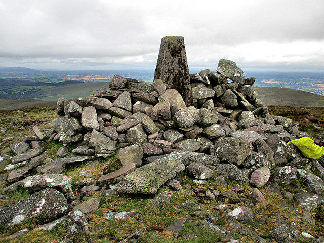 Photo could not load
S2318 : Cairn and Pillar
kevin higgins
Hill facts and local notes
Classifications
Elevation
518m
1,699 ft
Prominence
124m
Coordinates
52.3149, -7.6559
S235181
OS Map
75
At the Summit
The summit boasts a rugged cairn built from local stone, with panoramic views that truly take your breath away – if the wind doesn't do it first.
Terrain & Geology
The bedrock of Laghtnafrankee mainly consists of sandstone interspersed with siltstone, forming rugged outcrops ideal for exploration. The geological history of this region is intricate, dating back to the Devonian period.
Views & Scenery
Famed views of the Fermanagh Lakelands and, on a clear day, you might even spot the Mourne Mountains to the east. It's a sight for sore eyes, no doubt!
History & Heritage
Name Origin
Laghtnafrankee derives from ‘Laght na Fraince’, meaning 'the hollows of the French', possibly linked to historical French expeditions in the area.
Historical Significance
The hill is noted in local folklore, often featured in stories of ancient settlements and battles in the region.
Getting There & Facilities
Check current local access restrictions, parking rules and transport timetables before travelling. These notes do not confirm public access to the summit.
Parking
The nearest parking area is at the base of the trail on the B-road near the village of Newtownbutler. Ample room for cars, but do arrive early during peak times.
Public Transport
Buses service Newtownbutler from nearby towns, but a private vehicle is recommended for closer access.
Nearby Facilities
The nearest facilities, including cafes and toilets, are located in Newtownbutler. It's advisable to refuel before setting off!
Safety Information
Known Hazards
- Be wary of sudden changes in weather, as conditions can turn on a dime. Additionally, the terrain can be uneven, so proper footwear is essential.
General Safety Tips
- Check weather conditions before setting out
- Carry appropriate clothing and equipment
- Let someone know your planned route
- Take a map, compass, and GPS device
- Carry emergency supplies: food, water, first aid kit, torch
Hills
Some common questions about the hills answered
Are there group walks up Laghtnafrankee?
Many walkers use Walkmates to join or organise walks with others. You can check for group walks around Laghtnafrankee through the maps
Are there other walkers around Laghtnafrankee?
Activity varies by location and time, but Walkmates lets you see whether others have shared walks or shown interest in this area. Find other people through the walking friends search walking friends for Laghtnafrankee search or of course create your own walk for Laghtnafrankee
Can I organise a walk to Laghtnafrankee?
Yes. If there aren’t any walks listed already, you can create a walk and make it available for others to join.
If you're signed up to Walkmates, you can create a walk to Laghtnafrankee.
How do I find a walk up this hill?
There are often multiple ways to walk this hill, depending on experience and route preference. Walkmates helps you explore walks and routes that others have shared.
Can I suggest a new route up Laghtnafrankee?
Yes. You can suggest or create routes to share with others. Walkmates focuses on the social side of walking, so routes are used to help people organise walks and explore areas together, rather than as detailed navigation tools or route libraries.
Other uses really appreciate knowledgeable walkers sharing their routes. Share your favourite route to Laghtnafrankee here
The is an error or something incorrect about this hill. How do I let you know?
We always strive to keep the information on Walkmates as accurate as possible. If you find an error, please let us know through the contact form and we'll aim to correct it as quickly as possible
Community Discussion
Comments
Location
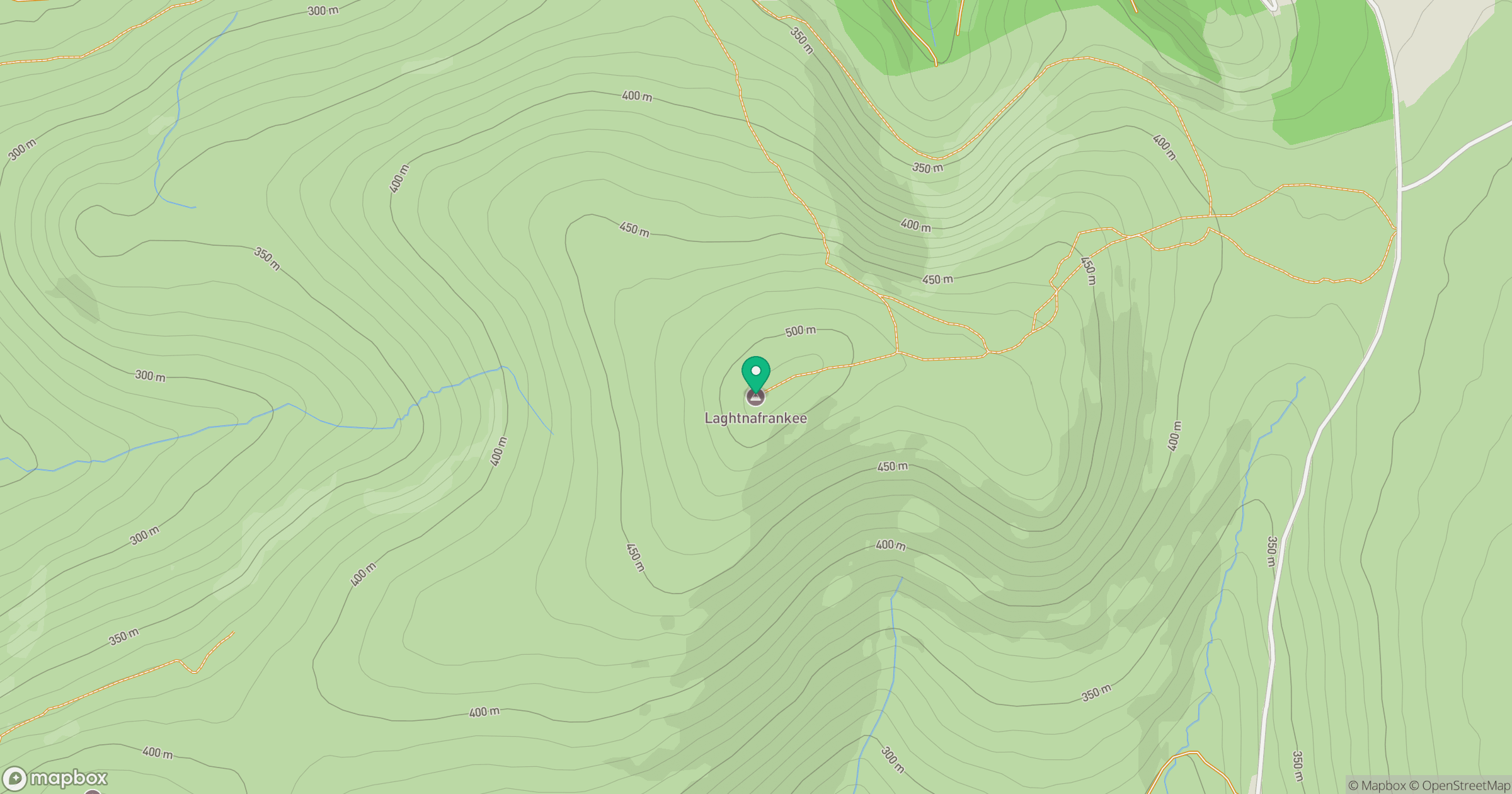
Grid reference: S235181
View on OpenStreetMapOpens a map in a new tab, centred on the hill.
Hills within 30 km
Straight-line distance, not a walking route or confirmation of access.
Knockanaffrin [Cnoc an Aifrinn]
755m
Kilclooney Mountain [Fauscoum]
792m
Slievenamon [Sliabh na mBan]
720m
Crohaun [Cruachan Deiseach]
483m
Knocknanask
486m
No comments yet. Be the first.