
Killough
Good walks are even better shared.
Overview
All About Killough
Introduction
Killough is a charming Marilyn located in County Down, Northern Ireland, with a moderate elevation of 276 meters. Nestled near the coast, this unsuspecting hill offers fantastic views and a pleasant hike. Perfect for a weekend explorer looking to stretch their legs!
Geology
Walking up Killough, you’ll be treading on Carboniferous limestone, a reminder that this land was once submerged beneath a warm, shallow sea. Keep an eye out for interesting fossils as you hike—who knows, you might just be the next local palaeontologist!
Routes
One of the most popular routes is the Killough Coastal Path. This 4.5 km trek meanders through lush coastal heath and kicks off from the village of Killough. Expect an ascent that tests your heart rate but rewards you with stunning views. Plan about 2.5 hours for this outing; good times are guaranteed, and don't forget your picnic!
Summit Features
Upon reaching the summit, you’re greeted by a modest cairn bearing testament to the many adventurers who've come before you. The panoramic views from the top are nothing short of spectacular, stretching over the surrounding lush green countryside and the glittering Irish Sea.
Terrain Type
The terrain features a mix of grassy slopes punctuated by rocky outcrops, particularly alluring for those keen on a little challenge. Be vigilant of the boggy patches, as they can be a real menace on wet days!
Views
The views from the top of Killough are best enjoyed during late spring to early autumn. Southern panoramas reveal the majestic Mourne Mountains, and on a crystal-clear day, the distant Isle of Man may greet you under a friendly sun.
Hazards
Hikers should remain vigilant for muddy paths and slippery rocks, especially after rainfall. As the trails can also have livestock grazing about, be sure to tread carefully and keep the cow-pies at bay!
Nearby Summits
For the enthusiastic summiteer, nearby peaks like Slieve Donard and Bencorragh are calling. Add them to your list for a fantastic hiking weekend!
Access
Getting to Killough is easy breezy. There’s informal parking in the village, and if you prefer public transport, a bus from Downpatrick can drop you off nearby.
Facilities
Once back down, partake in the local charm! The village offers quaint cafes and pubs, fantastic for a post-hike pint or indulgence in a slice of cake. Public toilets are also conveniently located in the village.
History
The name 'Killough' hints at its rich history, meaning 'church of the lake.' The locals often recount tales of Vikings and ancient ecclesiastical sites, inviting you to ponder on the history held in these hills.
In conclusion, Killough offers an enjoyable day out with a healthy dose of nature, exercise, and a pinch of history. Pack your bags, lace your boots, and get ready for a splendid adventure!
Explore routes near Killough
Public walks starting within 80 km of this hill. Nearby does not mean a route reaches the summit; check its map and access before setting out.
No public routes are currently listed within 80 km of Killough on Walkmates. This does not mean there are no paths here. Explore the map and check local access information before planning a walk.
Route planning notes
These notes describe possible approaches, not verified navigable routes or permission to cross land. Check current paths, local access rules and conditions before setting out.
Killough Coastal Path
A scenic coastal route starting from the village of Killough, leading through coastal heath and stunning seaside views before a steep ascent.
Make a day of it, together
Find someone to share the walk with, or organise a day out along a route you like.
Hill facts and local notes
Classifications
Elevation
235m
771 ft
Prominence
120m
Coordinates
52.6096, -7.8369
S111509
OS Map
66
At the Summit
The summit features a modest cairn adorned with local stones and a stunning panoramic view of the surrounding countryside and coastline.
Terrain & Geology
The summit is primarily composed of Carboniferous limestone, known for its rugged outcrops and unique karst formations. Fossils from ancient marine environments can also be found.
Views & Scenery
On clear days, the Mourne Mountains and the Isle of Man can be seen on the horizon, along with the shimmering waters of the Irish Sea.
History & Heritage
Name Origin
The name 'Killough' is derived from the Irish 'Cill Locha,' meaning 'church of the lake,' referring to the area's historical ecclesiastical importance.
Historical Significance
The area has rich historical context, with remnants of ancient settlements and interwoven tales of Viking settlements along the coast.
Getting There & Facilities
Check current local access restrictions, parking rules and transport timetables before travelling. These notes do not confirm public access to the summit.
Parking
There is informal parking available in the village of Killough, with ample space near the village green.
Public Transport
Buses are available from Downpatrick to Killough, with a short walk from the bus stop to the trailhead.
Nearby Facilities
Killough has a few local cafes and pubs, perfect for a post-hike bite. Public toilets are available in the village.
Safety Information
Known Hazards
- Potential for muddy sections along the paths, especially after rainfall. Watch your footing on rocky outcrops and be mindful of livestock in the area.
General Safety Tips
- Check weather conditions before setting out
- Carry appropriate clothing and equipment
- Let someone know your planned route
- Take a map, compass, and GPS device
- Carry emergency supplies: food, water, first aid kit, torch
Hills
Some common questions about the hills answered
Are there group walks up Killough?
Many walkers use Walkmates to join or organise walks with others. You can check for group walks around Killough through the maps
Are there other walkers around Killough?
Activity varies by location and time, but Walkmates lets you see whether others have shared walks or shown interest in this area. Find other people through the walking friends search walking friends for Killough search or of course create your own walk for Killough
Can I organise a walk to Killough?
Yes. If there aren’t any walks listed already, you can create a walk and make it available for others to join.
If you're signed up to Walkmates, you can create a walk to Killough.
How do I find a walk up this hill?
There are often multiple ways to walk this hill, depending on experience and route preference. Walkmates helps you explore walks and routes that others have shared.
Can I suggest a new route up Killough?
Yes. You can suggest or create routes to share with others. Walkmates focuses on the social side of walking, so routes are used to help people organise walks and explore areas together, rather than as detailed navigation tools or route libraries.
Other uses really appreciate knowledgeable walkers sharing their routes. Share your favourite route to Killough here
The is an error or something incorrect about this hill. How do I let you know?
We always strive to keep the information on Walkmates as accurate as possible. If you find an error, please let us know through the contact form and we'll aim to correct it as quickly as possible
Community Discussion
Comments
Location
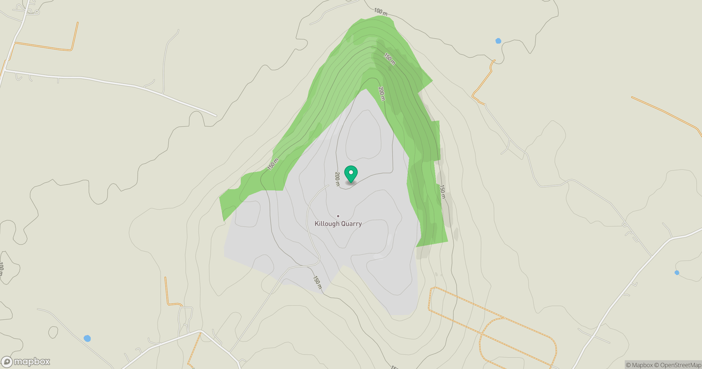
Grid reference: S111509
View on OpenStreetMapOpens a map in a new tab, centred on the hill.
Hills within 30 km
Straight-line distance, not a walking route or confirmation of access.
No comments yet. Be the first.