

High Pike (Scandale)
Good walks are even better shared.
NY3709 : Dry stone wall on High Pike
Peter S Photo source
Overview
High Pike (Scandale)
Overview
High Pike, standing proudly at 656 meters, is a Marilyn located in the breathtaking Lake District. This gem is favoured by walkers for its scenic routes and stunning vistas.
Geology
As part of the ancient geological tapestry of the Lake District, High Pike features volcanic andesite rock. Its rugged formation has been sculpted by centuries of natural forces, providing hikers with a glimpse into the earth’s formative years.
Routes
The Scandale Pass Route is the most favoured trail. Beginning from the tranquil Scandale Pass, this moderate route is roughly 5 km long and takes approximately 2.5 hours to complete. Perfect for a brisk outing or a leisurely hike, you'll be surrounded by stunning Lake District scenery with every step.
Summit Features
Upon reaching the summit, you're greeted by a large stone cairn and a trig point, which provides a perfect photo opportunity. The sense of achievement is palpable up here, as the views unfurl in all directions.
Terrain
Expect a mix of rocky paths, grassy highs, and a few boggy areas that remind you to watch your step! This diverse terrain adds to the adventure, but be wary of slippery stones after rainfall.
Views
Highlights: The summit reveals spectacular panoramas, from the iconic Helvellyn to the shimmering expanse of Windermere. It’s a view that makes the climb worthwhile.
Best Seasons: Late spring and early autumn are prime times to visit for the best clarity and lighting, with the hills appearing their most inviting.
Hazards
As is par for the course in the Lake District, sudden changes in weather can occur. There are steep sections that can be slippery, especially when wet. Remember, there's no such thing as bad weather, just unsuitable clothing!
Nearby Summits
Adventurers can also explore nearby peaks like St Sunday Crag (841 m) and Place Fell (657 m), adding a sense of adventure to your highland experience.
Access
Nearest Parking: The Cow Bridge car park is your best bet, though it can fill up fast. Arrive early!
Public Transport: Regular buses service Ambleside, from where you can take a taxi or enjoy a short walk to the start point.
Nearest Town: Ambleside is very close, offering all the amenities you'd need for your journey.
Facilities
Cafés, pubs, and shops abound in Ambleside, ensuring you have everything you need. Public toilets can also be found, so hikers can refresh before or after their trek.
History
Name Meaning: The term 'High Pike' succinctly conveys its characteristic elevation, with 'pike' suggesting a pointed, prominent hill in old English.
Significance: High Pike has long been celebrated by outdoor enthusiasts, contributing to the rich cultural tapestry woven into the Lake District.
Embark on your adventure up High Pike, and don't forget your camera – the only thing better than the climb may just be the bragging rights upon descent!
Explore routes near High Pike (Scandale)
Walks starting near this hill. Open a route to check its map, distance and full itinerary.
Striding Edge, Helvellyn and Catstye Cam
View route
Helvellyn via Striding Edge
View route
Bow Fell from Langdale
View route
Tarn Hows Fast Route
View route
Route planning notes
These notes describe possible approaches. Check a route's map and access information when planning your walk.
Scandale Pass Route
Starting from the popular Scandale Pass, this route offers a steady ascent with stunning views of the surrounding valleys.
Make a day of it, together
Find someone to share the walk with, or organise a day out along a route you like.
Photo Gallery
View all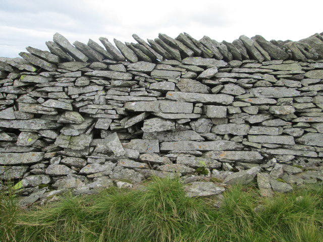 Photo could not load
NY3709 : Dry stone wall on High Pike
Peter S
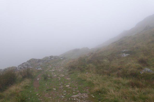 Photo could not load
NY3708 : Path from High Pike
DS Pugh
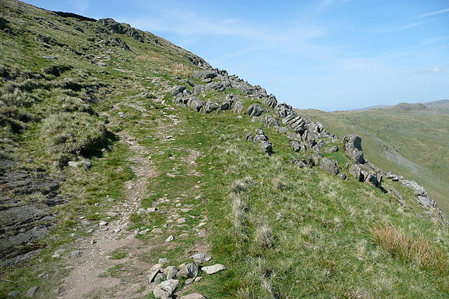 Photo could not load
NY3708 : On the path to High Pike
Graham Horn
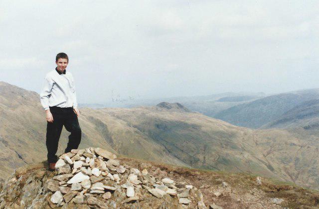 Photo could not load
NY3708 : Summit of High Pike
Tim Glover
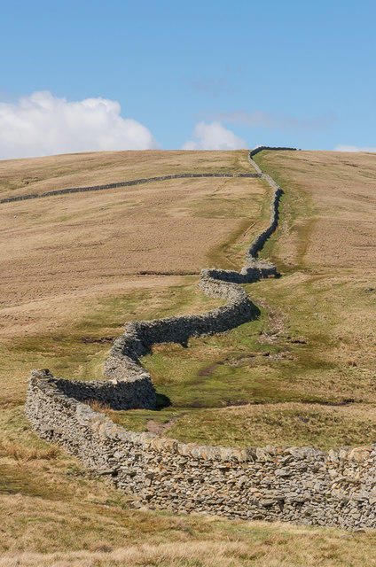 Photo could not load
NY3708 : North from High Pike
Ian Capper
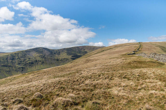 Photo could not load
NY3708 : Northwest from High Pike
Ian Capper
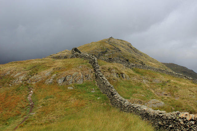 Photo could not load
NY3708 : High Pike
Chris Heaton
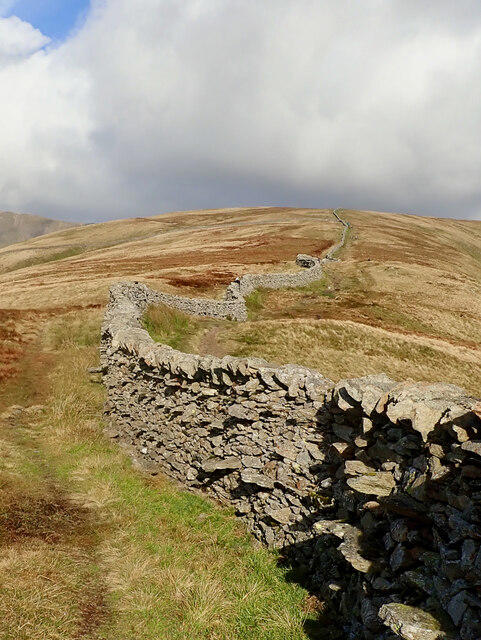 Photo could not load
NY3708 : Dry stone wall
Mick Garratt
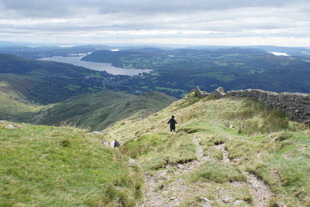 Photo could not load
NY3708 : Descent from High Pike
Bill Boaden
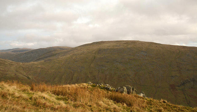
NY3708 : Minor rib of rock on ridge south of High Pike
Trevor Littlewood
Hill facts and local notes
Classifications
Elevation
657m
2,156 ft
Prominence
1m
Coordinates
54.4710, -2.9668
NY374088
OS Map
90
Explorer: OL7N
At the Summit
The summit is marked by a prominent cairn and offers a trig point, perfect for those 'I've been here' photos to share with friends and family.
Terrain & Geology
High Pike is primarily composed of volcanic rock, specifically andesite, which formed during the Ordovician period. Its rugged terrain is a testament to ancient geological activity that has shaped the splendid landscape of the Lake District.
Views & Scenery
From the summit, hikers can enjoy breathtaking views of the surrounding fells, including the famed Helvellyn and the tranquil waters of Windermere.
History & Heritage
Name Origin
The name High Pike stems from its elevation, with 'pike' signifying a pointed hill or mountain in old English.
Historical Significance
High Pike has long been a cherished destination for hikers and nature lovers alike within the Lake District, contributing to the rich cultural heritage and outdoor pursuits of the region.
Getting There & Facilities
Parking
There is a small car park at Cow Bridge, approximately 2 km from the trailhead. Limited spaces available, so arrive early!
Public Transport
Buses run to Ambleside from various locations, and from there a short taxi ride or a 30-minute walk will take you to the Scandale Pass start point.
Nearby Facilities
In Ambleside, you'll find a variety of cafés, pubs, and shops, as well as public toilets and accommodation options.
Safety Information
Known Hazards
- Steep sections that may be slippery when wet, as well as potential for sudden weather changes in the Lake District.
General Safety Tips
- Check weather conditions before setting out
- Carry appropriate clothing and equipment
- Let someone know your planned route
- Take a map, compass, and GPS device
- Carry emergency supplies: food, water, first aid kit, torch
Hills
Some common questions about the hills answered
Are there group walks up High Pike (Scandale)?
Many walkers use Walkmates to join or organise walks with others. You can check for group walks around High Pike (Scandale) through the maps
Are there other walkers around High Pike (Scandale)?
Activity varies by location and time, but Walkmates lets you see whether others have shared walks or shown interest in this area. Find other people through the walking friends search walking friends for High Pike (Scandale) search or of course create your own walk for High Pike (Scandale)
Can I organise a walk to High Pike (Scandale)?
Yes. If there aren’t any walks listed already, you can create a walk and make it available for others to join.
If you're signed up to Walkmates, you can create a walk to High Pike (Scandale).
How do I find a walk up this hill?
There are often multiple ways to walk this hill, depending on experience and route preference. Walkmates helps you explore walks and routes that others have shared.
Can I suggest a new route up High Pike (Scandale)?
Yes. You can suggest or create routes to share with others. Walkmates focuses on the social side of walking, so routes are used to help people organise walks and explore areas together, rather than as detailed navigation tools or route libraries.
Other uses really appreciate knowledgeable walkers sharing their routes. Share your favourite route to High Pike (Scandale) here
The is an error or something incorrect about this hill. How do I let you know?
We always strive to keep the information on Walkmates as accurate as possible. If you find an error, please let us know through the contact form and we'll aim to correct it as quickly as possible
Community Discussion
Comments
Location
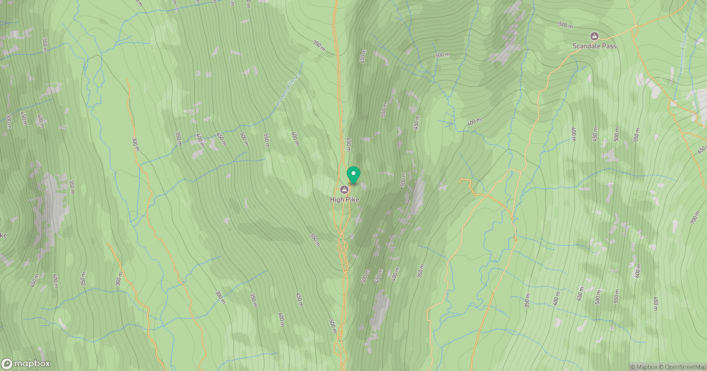
Grid reference: NY374088
View on OpenStreetMapOpens a map in a new tab, centred on the hill.

No comments yet. Be the first.