

Greenan Mountain
Good walks are even better shared.
Overview
Greenan Mountain
Overview
Nestled in the Southern Uplands of Scotland, Greenan Mountain stands tall at an unassuming 445 meters. While it may not be the highest hill in the region, it more than makes up for it with its stunning vistas and rich history.
Geology
The mountain's geology is composed mainly of sedimentary rocks, with layers of sandstone and mudstone hinting at an ancient marine environment. The effects of glaciation have added to its character, yielding remnants of moraines that tell the tale of Earth's frosty past.
Routes
One of the most popular routes to the summit is via the Greenan Castle Path. Starting at the historical Greenan Castle, this moderate trail is approximately 4 km long and can typically be completed in about 1.5 hours, making it an ideal choice for a morning or afternoon jaunt. The views along the way keep your eyes peeled for an occasional curious sheep!
Summit Features
Upon reaching the summit, you'll be greeted by a triumphant trig point standing watch over the surrounding countryside. Also, there's a stone cairn for those who like to reach new heights (pun intended) with their photography. Don’t forget your sandwiches – a snack at the top is practically a rite of passage!
Terrain Type
The terrain is a mix of grassy slopes and rocky patches. The path can become a bit slippery in wet conditions, so appropriate footwear is advised – think boots, not flip-flops!
Views
The summit not only offers a great excuse for a selfie, but also breathtaking views of the Firth of Clyde and, on a clear day, the Isle of Arran. The best time to appreciate these vistas is during spring or early autumn, when the scenery is nothing short of postcard-perfect.
Hazards
One should bear in mind the hazards that may accompany a hike in this area: muddy patches can indeed be tricky, and don't forget to watch where you step if you encounter any local sheep!
Nearby Summits
For the more adventurous hiker, consider visiting nearby Cnoc an Garbh-Choille (390 m) or Bennecraig (410 m) for additional scenic views.
Access
Parking is limited near Greenan Castle, with a few roadside spots available. Alternatively, public transport options from Ayr to Alloway can be quite convenient. The closest town, Ayr, is not only charming but has a range of facilities to ensure you’re well-prepped for your hiking adventure.
Facilities
After descending, the nearby village of Alloway has a delightful selection of cafes and pubs to refuel and boast about your hiking triumphs. Public toilets are also available for convenience.
History
The name 'Greenan' comes from the Gaelic 'Grianan', meaning sunny place – a hint of optimism that should be well-received! The mountain also bears witness to the historical significance tied to Greenan Castle, a remnant from the medieval period that adds to the allure of this hike.
Enjoy your trek up Greenan Mountain! It’s a delightful experience for all levels of hikers, so lace up your boots and embrace the great outdoors!
Explore routes near Greenan Mountain
Public walks starting within 80 km of this hill. Nearby does not mean a route reaches the summit; check its map and access before setting out.
Derry~Londonderry City Walls Circuit
View route
Banagher Glen and Forest: complete higher-return circuit
View route
Portballintrae to Giant's Causeway: railway path and Blue Trail return
View route
Peatlands Park Red Trail: Annagarriff Wood and Derryadd Lough
View route
Route planning notes
These notes describe possible approaches, not verified navigable routes or permission to cross land. Check current paths, local access rules and conditions before setting out.
Greenan Castle Path
A scenic route that starts at Greenan Castle, traversing a gentle ascent through picturesque farmland and woodlands before leading to the summit.
Make a day of it, together
Find someone to share the walk with, or organise a day out along a route you like.
Photo Gallery
View all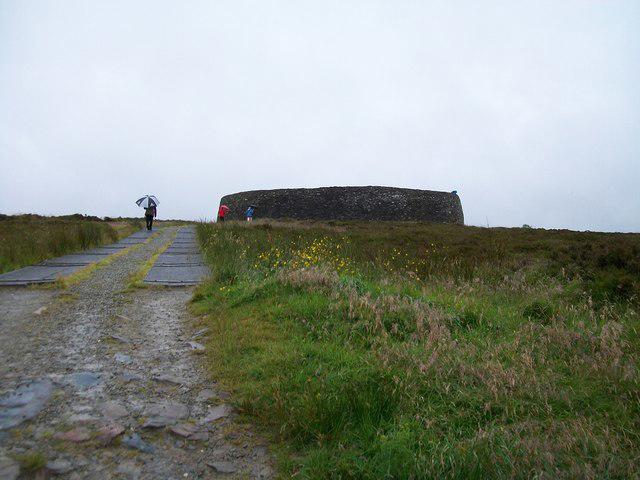 Photo could not load
C3619 : Walkway leading from the car park to the Grianan of Aileach
Eric Jones
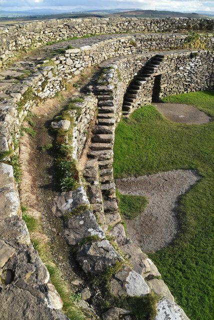 Photo could not load
C3619 : Grianan of Aileach
N Chadwick
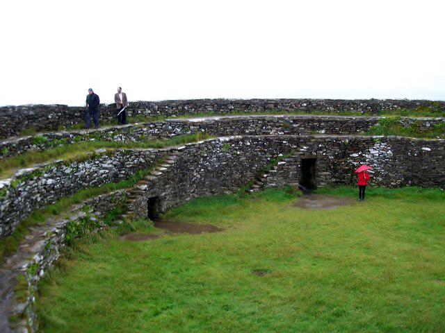 Photo could not load
C3619 : View across the interior of Grianan of Aileach fort
Eric Jones
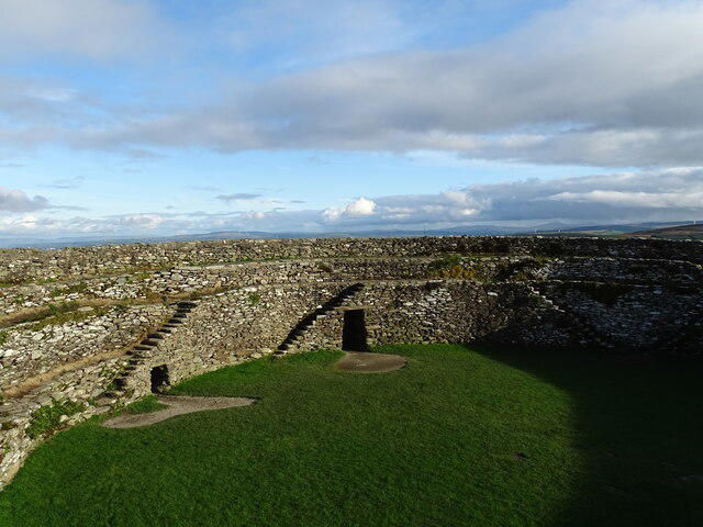 Photo could not load
C3619 : Grianan of Aileach
Matthew Chadwick
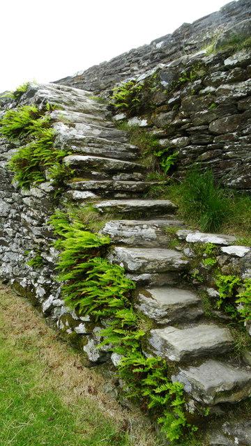 Photo could not load
C3619 : At Grianan Ailigh Fort, Co Donegal (steps)
Colin Park
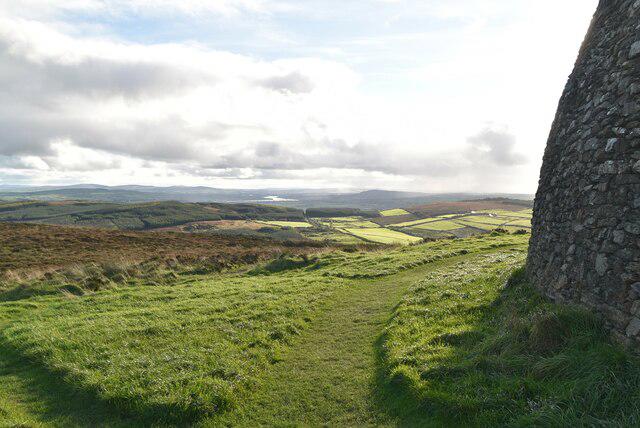 Photo could not load
C3619 : Grianan of Aileach
N Chadwick
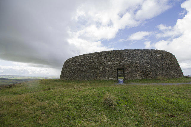 Photo could not load
C3619 : Grianan Ailigh
Malcolm Neal
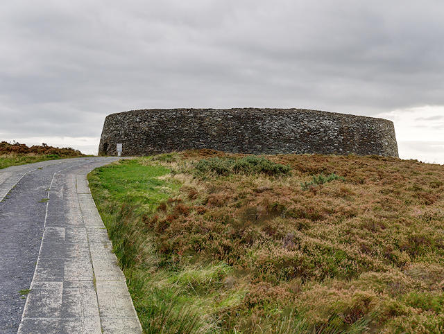 Photo could not load
C3619 : Grianán Ailigh
David Dixon
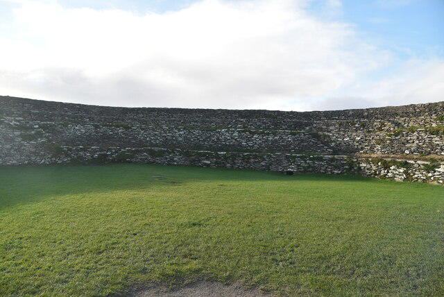 Photo could not load
C3619 : Grianan of Aileach
N Chadwick
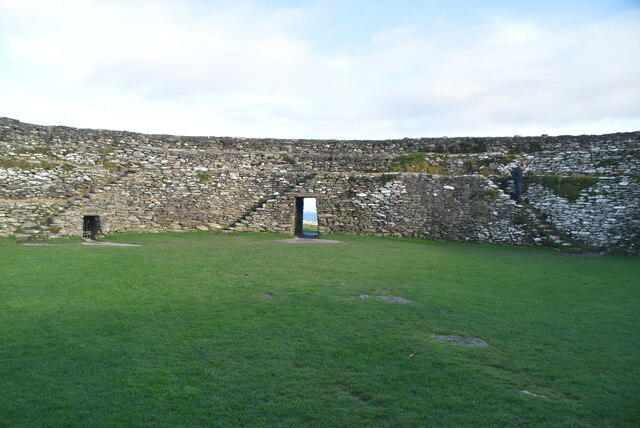
C3619 : Grianan of Aileach
N Chadwick
Hill facts and local notes
Classifications
Elevation
241m
791 ft
Prominence
106m
Coordinates
55.0238, -7.4277
C366197
OS Map
07
At the Summit
The summit boasts a prominent trig point and offers a stone cairn, both perfect for that Instagram shot. On a clear day, it's a great spot for a picnic too – sandwiches taste better at altitude!
Terrain & Geology
Greenan Mountain is primarily composed of sedimentary rock formations, with layers of sandstone and mudstone, indicative of ancient seabeds. The area also features glacial deposits from the last Ice Age, creating interesting features like moraines.
Views & Scenery
From the summit, you can enjoy panoramic views of the Firth of Clyde, the Isle of Arran on the horizon, and lush, rolling hills that characterise the Southern Uplands.
History & Heritage
Name Origin
Greenan is derived from the Gaelic 'Grianan', meaning 'sunny place', which likely references the favourable weather conditions patches of the mountain enjoy.
Historical Significance
Greenan Mountain has historical significance due to its proximity to the ruins of Greenan Castle, believed to date back to the 12th century, offering insights into the area's medieval history.
Getting There & Facilities
Check current local access restrictions, parking rules and transport timetables before travelling. These notes do not confirm public access to the summit.
Parking
There is limited roadside parking available near Greenan Castle. Be sure to park responsibly and avoid blocking access.
Public Transport
Buses regularly run from Ayr to Alloway, with a short walk required to reach the trailhead.
Nearby Facilities
There are no facilities directly on the mountain, but the nearby village of Alloway offers cafes, pubs, and public toilets.
Safety Information
Known Hazards
- Muddy paths can be treacherous, particularly after rain. Be mindful of livestock in the fields, and as always, classic UK weather can turn quickly!
General Safety Tips
- Check weather conditions before setting out
- Carry appropriate clothing and equipment
- Let someone know your planned route
- Take a map, compass, and GPS device
- Carry emergency supplies: food, water, first aid kit, torch
Hills
Some common questions about the hills answered
Are there group walks up Greenan Mountain?
Many walkers use Walkmates to join or organise walks with others. You can check for group walks around Greenan Mountain through the maps
Are there other walkers around Greenan Mountain?
Activity varies by location and time, but Walkmates lets you see whether others have shared walks or shown interest in this area. Find other people through the walking friends search walking friends for Greenan Mountain search or of course create your own walk for Greenan Mountain
Can I organise a walk to Greenan Mountain?
Yes. If there aren’t any walks listed already, you can create a walk and make it available for others to join.
If you're signed up to Walkmates, you can create a walk to Greenan Mountain.
How do I find a walk up this hill?
There are often multiple ways to walk this hill, depending on experience and route preference. Walkmates helps you explore walks and routes that others have shared.
Can I suggest a new route up Greenan Mountain?
Yes. You can suggest or create routes to share with others. Walkmates focuses on the social side of walking, so routes are used to help people organise walks and explore areas together, rather than as detailed navigation tools or route libraries.
Other uses really appreciate knowledgeable walkers sharing their routes. Share your favourite route to Greenan Mountain here
The is an error or something incorrect about this hill. How do I let you know?
We always strive to keep the information on Walkmates as accurate as possible. If you find an error, please let us know through the contact form and we'll aim to correct it as quickly as possible
Community Discussion
Comments
Location
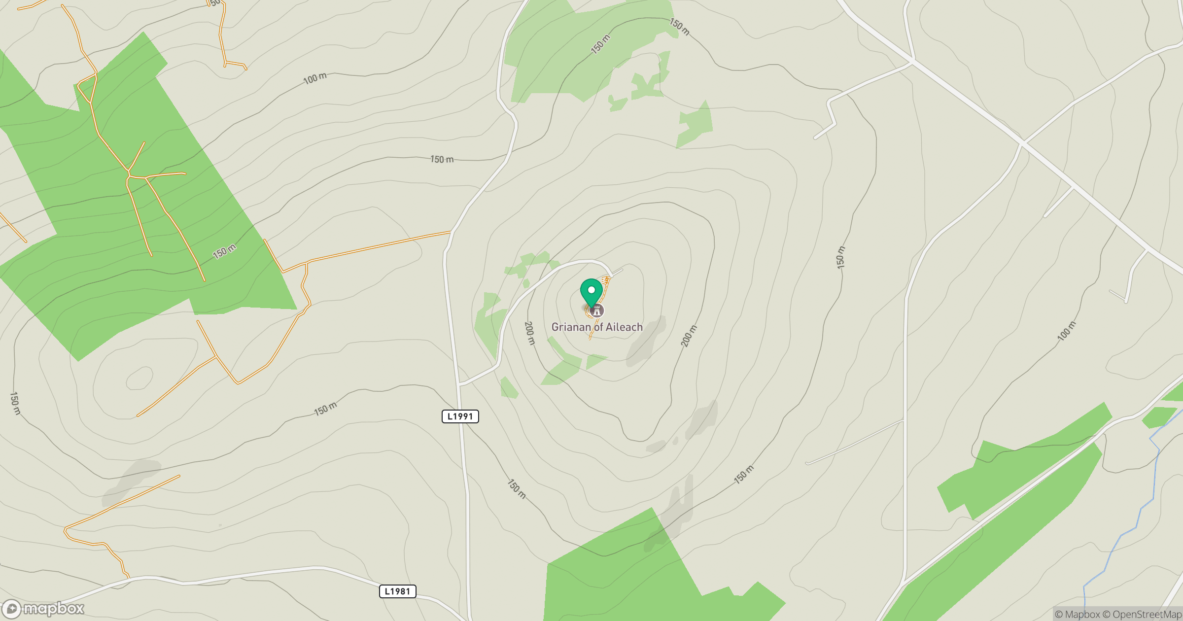
Grid reference: C366197
View on OpenStreetMapOpens a map in a new tab, centred on the hill.
Hills within 30 km
Straight-line distance, not a walking route or confirmation of access.
No comments yet. Be the first.