

Giolabhal Glas
Good walks are even better shared.
Overview
Giolabhal Glas
Situated in the picturesque Scottish Highlands, Giolabhal Glas boasts a respectable elevation of 634 meters. Classified as a Marilyn, it may not be towering like its Munro cousins, but it offers stunning vistas that make the climb worthwhile.
Geology
Giolabhal Glas is a geological gem primarily composed of granitic rock. As hikers traverse its slopes, they'll find fascinating layers of schist and gneiss, providing a rich tapestry of geological features. These rocks whisper tales of the Earth’s ancient past, so keep your ears open—but not too open, or you might hear the tunes of a few gales!
Routes
The most popular route is the West Approach from Achfary. This moderate trek spans approximately 8.5 km and typically takes around 3.5 hours to complete, unless you stop for a picnic halfway to admire the stunning landscapes! Beginning at Achfary, you'll first meander through heather-covered hills, which is a lovely sight before you tackle the craggy ascent near the summit.
Summit Features
Upon reaching the summit, you'll be greeted by a sturdy cairn, perfect for those often-needed summit selfies. If the weather turns a touch too Scottish, don’t fret! There’s a small stone shelter available for a quick breather.
Terrain Type
Expect a mixture of rocky trails, grassy slopes, and the occasional boggy adventure. As they say, every cloud has a silver lining, even the ones that make your boots soggy!
Views
The views from Giolabhal Glas are nothing short of spectacular. On a clear day, the shimmering lochs and rolling hills unfold before your eyes, plus you might even catch a glimpse of the Sutherland coastline. Late spring or early summer is the best time to enjoy these sights, as the heather carpets the land.
Hazards
Hikers should always keep their wits about them, as the weather can change faster than you can say ‘Scottish summer’. Watch out for loose stones on steeper sections—this is no time to test your ‘grace’!
Nearby Summits
Consider extending your adventure by adding a few nearby peaks to your itinerary. Ben More Assynt (997 m) and Conival (987 m) are worthy companions that won’t disappoint.
Access
Getting to Giolabhal Glas is straightforward. The nearest parking is available at Achfary, where you might bump into fellow walkers. Just remember that public transport is limited, so plan your journey accordingly. The closest town for supplies is Lairg, around 30 km away.
Facilities
In Lairg, you'll find essentials like shops, cafes, and public toilets, so it's worth stopping by to gear up or refuel before your hike.
History
The name 'Giolabhal Glas' means 'Grey Hill', a nod to the mountain’s often misty visage. Historically, this area is rich with stories from ancient Scottish clans, making it not just a hike but a journey through time.
With its breathtaking views, intriguing geology, and charming trails, a hike up Giolabhal Glas is sure to be a delightful addition to any adventurer's diary. Happy hiking!
Explore routes near Giolabhal Glas
Public walks starting within 80 km of this hill. Nearby does not mean a route reaches the summit; check its map and access before setting out.
Beautiful private beach walk Isle of Harris
View route
Berneray Community Hall to the beautiful beach
View route
Fairy Lochs Liberator Wreckage Circuit
View route
Route planning notes
These notes describe possible approaches, not verified navigable routes or permission to cross land. Check current paths, local access rules and conditions before setting out.
West Approach from Achfary
This route begins at Achfary and offers a gradual ascent through heather-clad hills before tackling the final steeper slopes to the summit.
Make a day of it, together
Find someone to share the walk with, or organise a day out along a route you like.
Photo Gallery
View all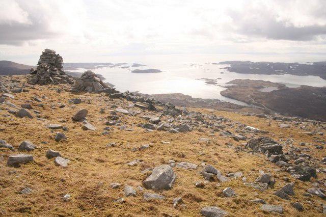 Photo could not load
NB1402 : Cairns on Giolabhal Glas
Richard Barrett
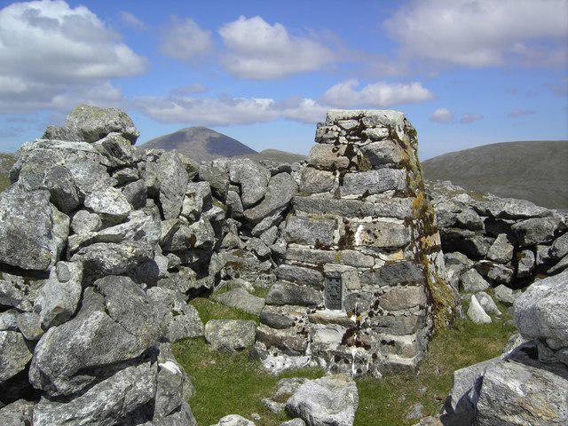 Photo could not load
NB1402 : Gillaval Glas trig
Colin Kinnear
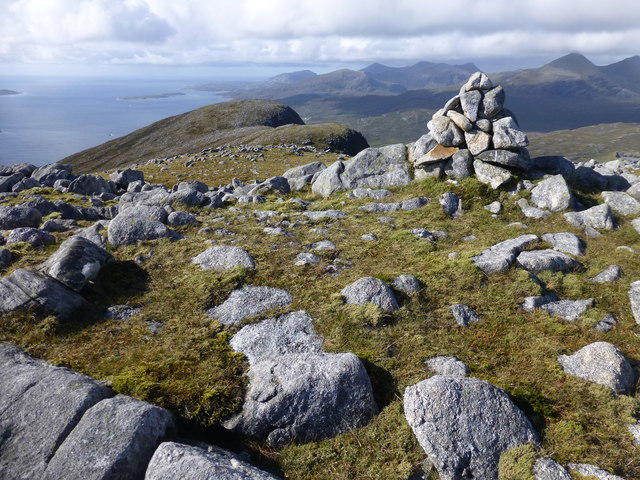 Photo could not load
NB1402 : Giolabhal Glas
Rude Health
Hill facts and local notes
Classifications
Elevation
475m
1,558 ft
Prominence
122m
Coordinates
57.9181, -6.8163
NB149022
OS Map
14
Explorer: 455 456
At the Summit
The summit is marked by a prominent cairn, offering a perfect spot for those all-important summit selfies. You'll also find a small stone shelter for when the Scottish weather turns a bit too 'typical'.
Terrain & Geology
The mountain primarily consists of ancient granitic rock, with layers of schist and gneiss found in the surrounding areas. This varied geology contributes to the rugged and fascinating landscape of the region.
Views & Scenery
From the summit, you can marvel at the tranquil lochs, rolling hills, and even catch a glimpse of the distant Sutherland coastline on a clear day.
History & Heritage
Name Origin
Giolabhal Glas translates to 'Grey Hill', inspired by the mountain's often misty, grey appearance.
Historical Significance
Home to numerous wildlife species, the area surrounding Giolabhal Glas has historical connections to ancient Scottish clans.
Getting There & Facilities
Check current local access restrictions, parking rules and transport timetables before travelling. These notes do not confirm public access to the summit.
Parking
The nearest parking is available at Achfary, there’s enough space for a few cars, although it can fill up on busy weekends.
Public Transport
Public transport options are limited, but there are bus services operating from Ullapool to Lairg that can get you close.
Nearby Facilities
Facilities in the nearest town of Lairg include small shops, a cafe, and public toilets.
Safety Information
Known Hazards
- Be cautious of sudden weather changes typical of the Highlands, and be wary of loose stones on the steeper slopes.
General Safety Tips
- Check weather conditions before setting out
- Carry appropriate clothing and equipment
- Let someone know your planned route
- Take a map, compass, and GPS device
- Carry emergency supplies: food, water, first aid kit, torch
Hills
Some common questions about the hills answered
Are there group walks up Giolabhal Glas?
Many walkers use Walkmates to join or organise walks with others. You can check for group walks around Giolabhal Glas through the maps
Are there other walkers around Giolabhal Glas?
Activity varies by location and time, but Walkmates lets you see whether others have shared walks or shown interest in this area. Find other people through the walking friends search walking friends for Giolabhal Glas search or of course create your own walk for Giolabhal Glas
Can I organise a walk to Giolabhal Glas?
Yes. If there aren’t any walks listed already, you can create a walk and make it available for others to join.
If you're signed up to Walkmates, you can create a walk to Giolabhal Glas.
How do I find a walk up this hill?
There are often multiple ways to walk this hill, depending on experience and route preference. Walkmates helps you explore walks and routes that others have shared.
Can I suggest a new route up Giolabhal Glas?
Yes. You can suggest or create routes to share with others. Walkmates focuses on the social side of walking, so routes are used to help people organise walks and explore areas together, rather than as detailed navigation tools or route libraries.
Other uses really appreciate knowledgeable walkers sharing their routes. Share your favourite route to Giolabhal Glas here
The is an error or something incorrect about this hill. How do I let you know?
We always strive to keep the information on Walkmates as accurate as possible. If you find an error, please let us know through the contact form and we'll aim to correct it as quickly as possible
Community Discussion
Comments
Location
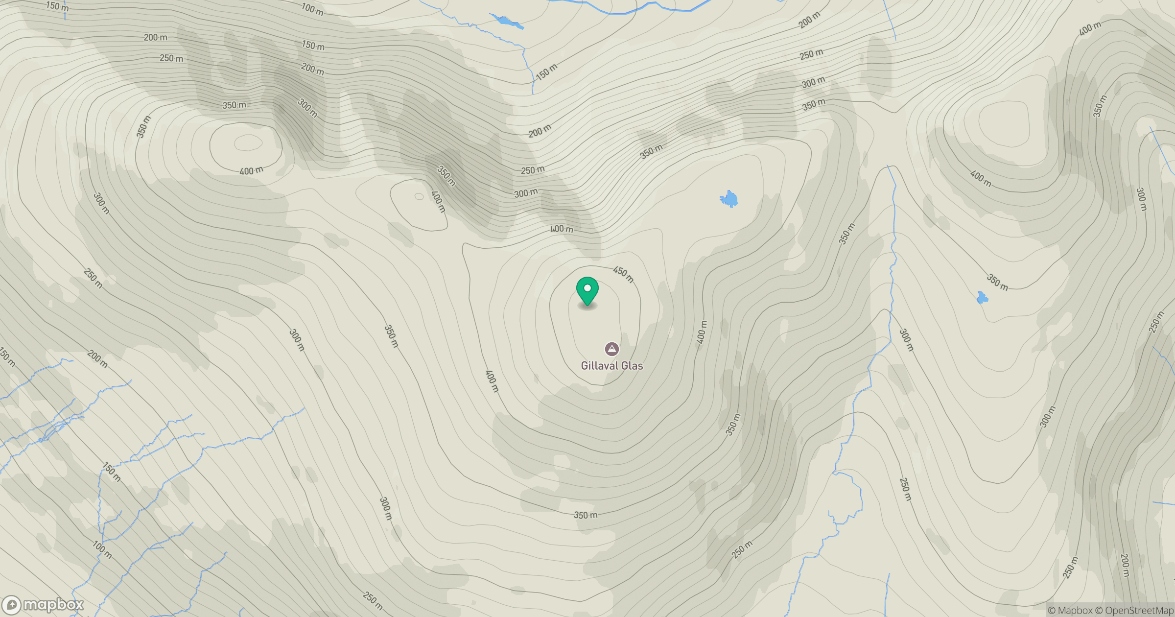
Grid reference: NB149022
View on OpenStreetMapOpens a map in a new tab, centred on the hill.
Hills within 30 km
Straight-line distance, not a walking route or confirmation of access.
An Cliseam [Clisham]
800m
Sgaoth Aird
559m
Mulla bho Dheas [Mulla-Fo-Dheas]
743m
Ceann Reamhar
467m
Uisgneabhal Mor [Uisgnaval Mor]
730m
No comments yet. Be the first.