

Beinn a' Mhuil
Good walks are even better shared.
Overview
Beinn a' Mhuil
Overview
Nestled in the majestic Scottish Highlands, Beinn a' Mhuil is an easy-to-reach Marilyn that beckons hikers with an appetite for scenic beauty. At an elevation of 600 meters, this mountain may not be the tallest in the range, but its views and unique features make it a rewarding adventure.
Geology
The geology of Beinn a' Mhuil is a mixture of ancient gneiss and schist, offering both a visual treat and a testament to the planet's geological history. It’s a real rock star!
Hiking Routes
A popular route is the Glen Loin Circuit, which is 8 km long and can be tackled in about 3.5 hours. This moderate hike offers picturesque vistas of the surrounding landscape and is suitable for most walkers. Remember to pack your sense of humour!
Summit Features
Upon reaching the summit, you'll encounter a sturdy stone cairn that provides a perfect backdrop for your mountain top pride. Just don’t let the sheep get in your picture!
Terrain
Expect rugged yet breathable terrain, with patches of grass interlaced with rocky outcrops. Proper hiking boots are essential, as is a good pair of upsized trousers for those sneaky grass stains.
Views
From the summit, you can marvel at the impressive sights, including Loch Lomond and the distinct peaks of Ben Lomond and Beinn Chabhair. The views are particularly stunning during spring and autumn, so plan your visit for a postcard-worthy moment.
Hazards
Hikers should be cautious of the ever-changing Scottish weather. Fog can descend as quickly as a Scottie chasing a squirrel, so a map and compass are a must.
Nearby Summits
Feel like a challenge? Nearby Beinn Chabhair and the iconic Ben Lomond offer additional hiking opportunities for the adventurous soul.
Access
The nearest parking area is conveniently located at the end of the Glen Loin road, providing ample space for your chariot. Public transport connections are also strong, with Balloch train station nearby and local bus services shuttling hikers to their destinations.
Facilities
Don't fret if you're feeling peckish! The charming village of Crianlarich is just a hop away, complete with a welcoming pub and cosy cafes—perfect to refuel after your hike.
History
The name 'Beinn a' Mhuil' translates to 'Mountain of the Mill', reflecting the historical significance of the region. The mountain stands not just as a natural landmark but as a reminder of the storied past of the land.
In conclusion, Beinn a' Mhuil is a delightful destination for hikers seeking stunning views and a bit of Highland charm. Just remember, the only thing that should fall on your hike are the leaves!
Explore routes near Beinn a' Mhuil
Public walks starting within 80 km of this hill. Nearby does not mean a route reaches the summit; check its map and access before setting out.
Beautiful private beach walk Isle of Harris
View route
Berneray Community Hall to the beautiful beach
View route
Fairy Lochs Liberator Wreckage Circuit
View route
Route planning notes
These notes describe possible approaches, not verified navigable routes or permission to cross land. Check current paths, local access rules and conditions before setting out.
Glen Loin Circuit
A popular route starting from Glen Loin, offering a scenic climb with breathtaking views.
Make a day of it, together
Find someone to share the walk with, or organise a day out along a route you like.
Photo Gallery
View all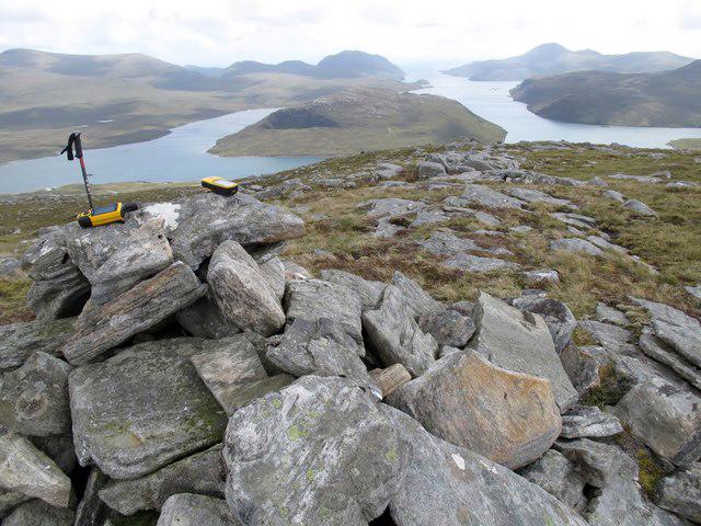 Photo could not load
NB1913 : Beinn a' Mhuil
Rude Health
Hill facts and local notes
Classifications
Elevation
370m
1,214 ft
Prominence
118m
Coordinates
58.0232, -6.7530
NB194136
OS Map
13 14
Explorer: 456
At the Summit
The summit features a delicate stone cairn, standing stoically against the highland winds, a perfect spot for a panoramic selfie. Watch for the occasional sheep trying to photobomb you!
Terrain & Geology
Composed predominantly of ancient gneiss and schist, Beinn a' Mhuil showcases the enduring resilience of the Earth’s crust. The rock formations tell tales from millions of years ago, and let's be honest, they're much older than your average mountain selfie.
Views & Scenery
From the summit, enjoy sweeping views of Loch Lomond and the surrounding hills including the majestic Ben Lomond.
History & Heritage
Name Origin
The name 'Beinn a' Mhuil' translates to 'Mountain of the Mill', possibly referencing historical milling activities in the area.
Historical Significance
Not only is Beinn a' Mhuil a scenic highlight for walkers, but it holds cultural importance, being part of the ancient lands of the Gaelic-speaking Scots.
Getting There & Facilities
Check current local access restrictions, parking rules and transport timetables before travelling. These notes do not confirm public access to the summit.
Parking
The nearest parking is at the end of the Glen Loin road, where there is a small layby for hikers.
Public Transport
The closest train station is in Balloch, from which local buses can take you towards Inverbeg.
Nearby Facilities
While facilities are scarce on the mountain itself, Crianlarich has a pub and a cafe where you can grab a bite or a pint post-hike.
Safety Information
Known Hazards
- Variable weather conditions can create rapid changes in visibility; it's advisable to carry a map and compass at all times.
General Safety Tips
- Check weather conditions before setting out
- Carry appropriate clothing and equipment
- Let someone know your planned route
- Take a map, compass, and GPS device
- Carry emergency supplies: food, water, first aid kit, torch
Hills
Some common questions about the hills answered
Are there group walks up Beinn a' Mhuil?
Many walkers use Walkmates to join or organise walks with others. You can check for group walks around Beinn a' Mhuil through the maps
Are there other walkers around Beinn a' Mhuil?
Activity varies by location and time, but Walkmates lets you see whether others have shared walks or shown interest in this area. Find other people through the walking friends search walking friends for Beinn a' Mhuil search or of course create your own walk for Beinn a' Mhuil
Can I organise a walk to Beinn a' Mhuil?
Yes. If there aren’t any walks listed already, you can create a walk and make it available for others to join.
If you're signed up to Walkmates, you can create a walk to Beinn a' Mhuil.
How do I find a walk up this hill?
There are often multiple ways to walk this hill, depending on experience and route preference. Walkmates helps you explore walks and routes that others have shared.
Can I suggest a new route up Beinn a' Mhuil?
Yes. You can suggest or create routes to share with others. Walkmates focuses on the social side of walking, so routes are used to help people organise walks and explore areas together, rather than as detailed navigation tools or route libraries.
Other uses really appreciate knowledgeable walkers sharing their routes. Share your favourite route to Beinn a' Mhuil here
The is an error or something incorrect about this hill. How do I let you know?
We always strive to keep the information on Walkmates as accurate as possible. If you find an error, please let us know through the contact form and we'll aim to correct it as quickly as possible
Community Discussion
Comments
Location
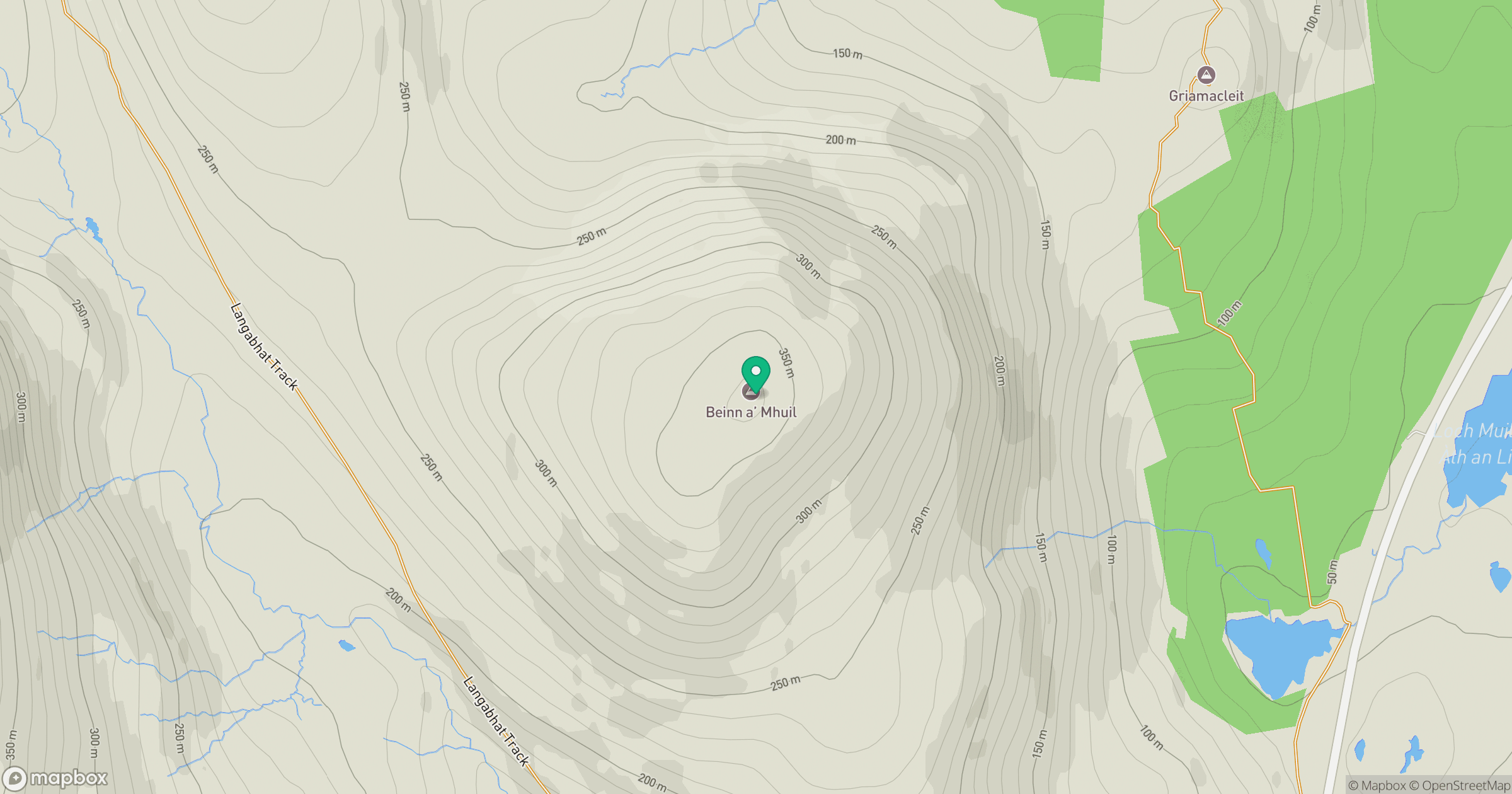
Grid reference: NB194136
View on OpenStreetMapOpens a map in a new tab, centred on the hill.
Hills within 30 km
Straight-line distance, not a walking route or confirmation of access.
No comments yet. Be the first.