

Ceann Reamhar na Sroine
Good walks are even better shared.
Overview
Ceann Reamhar na Sroine
Introduction
Nestled in the rugged beauty of the Scottish Highlands, Ceann Reamhar na Sroine offers an inviting challenge for adventurous souls. Known affectionately as the 'Fat Head', this Marilyn stands at 647 meters, boasting views that could make even a tired hiker's heart skip a beat.
Geology
The mountain's structure is primarily composed of schist and granite, reflecting the tumultuous geological history of the area. The uneven terrain is not only a test of stamina but a treat for geology enthusiasts eager to explore its fascinating rock formations.
Routes
A popular route from Glencoe ensures an enjoyable hiking experience. Spanning approximately 8.5 kilometers, this moderate route takes you through lush glens and rocky paths leading to the summit. It takes about 4 hours to complete, so pack light but be prepared!
Summit Features
Once at the summit, hikers are greeted by a sturdy stone cairn. The views of surrounding peaks, including the iconic Ben Nevis, are downright breathtaking. If you look closely, you might even spot the deeper glens that lead back down into the valley.
Terrain Type
The trail presents a mix of rocky outcrops and grassy patches, with hidden boggy areas waiting to surprise unprepared hikers. The terrain requires sturdy boots and a hearty sense of adventure.
Views
The summit views showcase the stunning highlands, with the best seasons for appreciating this beauty being late spring and early autumn. However, don’t be fooled: the weather can turn in a blink, so keep your raincoat handy!
Hazards
Be cautious of uneven ground; a misstep could lead to a sprained ankle. The quickly shifting weather can obscure paths, so proper planning and preparation are vital.
Nearby Summits
For those looking to extend their adventure, nearby summits like Stob Coire Sgreamhach and Ben Nevis provide excellent options for additional hikes.
Access
Parking is available at the Glencoe Visitor Centre, which can be quite busy at peak times. Public transport from Fort William runs regularly, making it accessible for both locals and tourists.
Facilities
The Glencoe Visitor Centre features a café and restroom facilities—perfect for a well-deserved pit stop after a day on the trail.
History
The name 'Ceann Reamhar na Sroine' paints a whimsical image in the mind, hinting at its colourful history shrouded in folklore and clan tales. A visit is not just a hike, but a step into the past of the Scottish Highlands.
Whether you're looking for a day out in nature or seeking to conquer your next hiking challenge, Ceann Reamhar na Sroine won’t disappoint. Remember, the only thing that should be fat when you leave here is the experience!
Explore routes near Ceann Reamhar na Sroine
Public walks starting within 80 km of this hill. Nearby does not mean a route reaches the summit; check its map and access before setting out.
Beautiful private beach walk Isle of Harris
View route
Berneray Community Hall to the beautiful beach
View route
Dun Mhulan Broch Quick Walk
View route
Fairy Lochs Liberator Wreckage Circuit
View route
Route planning notes
These notes describe possible approaches, not verified navigable routes or permission to cross land. Check current paths, local access rules and conditions before setting out.
Glencoe Starting Point
A popular route starting from Glencoe leads to the summit, winding through scenic glens and across gentle hills before the steep ascent to the top.
Make a day of it, together
Find someone to share the walk with, or organise a day out along a route you like.
Photo Gallery
View all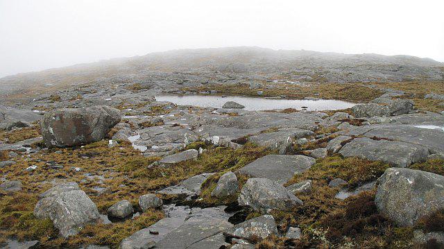 Photo could not load
NG0993 : Ceann Reamhar na Sròine
Richard Webb
Hill facts and local notes
Classifications
Elevation
357m
1,171 ft
Prominence
106m
Coordinates
57.8341, -6.8992
NG093932
OS Map
14
Explorer: 455
At the Summit
The summit sports a modest stone cairn and offers a stunning panoramic view that will surely make you forget about your last gym session.
Terrain & Geology
The mountain is predominantly composed of schist and granite, providing a rugged terrain that keeps both the hiker and the rock climber interested. Its geological history reflects significant tectonic activity in the region.
Views & Scenery
From the summit, you can catch a glimpse of the mighty Ben Nevis, the shimmering Loch Leven, and many other surrounding peaks that could easily lure you into another hiking adventure.
History & Heritage
Name Origin
Ceann Reamhar na Sroine translates to 'The Fat Head of the Sroine', a name that sounds like a character from a festival, rather than a mountain!
Historical Significance
The mountain has historical significance in local culture and folklore, often referenced in stories of local clans and battles that took place in the expansive highlands.
Getting There & Facilities
Check current local access restrictions, parking rules and transport timetables before travelling. These notes do not confirm public access to the summit.
Parking
The nearest parking is at the Glencoe Visitor Centre. There's ample space, but it fills up quickly during peak season—get there early to avoid parking like a jigsaw puzzle!
Public Transport
Bus services from Fort William frequently run to the Glencoe area, making it accessible for those without private transport.
Nearby Facilities
The nearby Glencoe Visitor Centre has a café and toilets, a perfect pit-stop prior to or after your hike.
Safety Information
Known Hazards
- Uneven terrain can lead to ankle injuries; it's wise to wear sturdy boots. Sudden weather changes can obscure visibility, so pack extra layers.
General Safety Tips
- Check weather conditions before setting out
- Carry appropriate clothing and equipment
- Let someone know your planned route
- Take a map, compass, and GPS device
- Carry emergency supplies: food, water, first aid kit, torch
Hills
Some common questions about the hills answered
Are there group walks up Ceann Reamhar na Sroine?
Many walkers use Walkmates to join or organise walks with others. You can check for group walks around Ceann Reamhar na Sroine through the maps
Are there other walkers around Ceann Reamhar na Sroine?
Activity varies by location and time, but Walkmates lets you see whether others have shared walks or shown interest in this area. Find other people through the walking friends search walking friends for Ceann Reamhar na Sroine search or of course create your own walk for Ceann Reamhar na Sroine
Can I organise a walk to Ceann Reamhar na Sroine?
Yes. If there aren’t any walks listed already, you can create a walk and make it available for others to join.
If you're signed up to Walkmates, you can create a walk to Ceann Reamhar na Sroine.
How do I find a walk up this hill?
There are often multiple ways to walk this hill, depending on experience and route preference. Walkmates helps you explore walks and routes that others have shared.
Can I suggest a new route up Ceann Reamhar na Sroine?
Yes. You can suggest or create routes to share with others. Walkmates focuses on the social side of walking, so routes are used to help people organise walks and explore areas together, rather than as detailed navigation tools or route libraries.
Other uses really appreciate knowledgeable walkers sharing their routes. Share your favourite route to Ceann Reamhar na Sroine here
The is an error or something incorrect about this hill. How do I let you know?
We always strive to keep the information on Walkmates as accurate as possible. If you find an error, please let us know through the contact form and we'll aim to correct it as quickly as possible
Community Discussion
Comments
Location
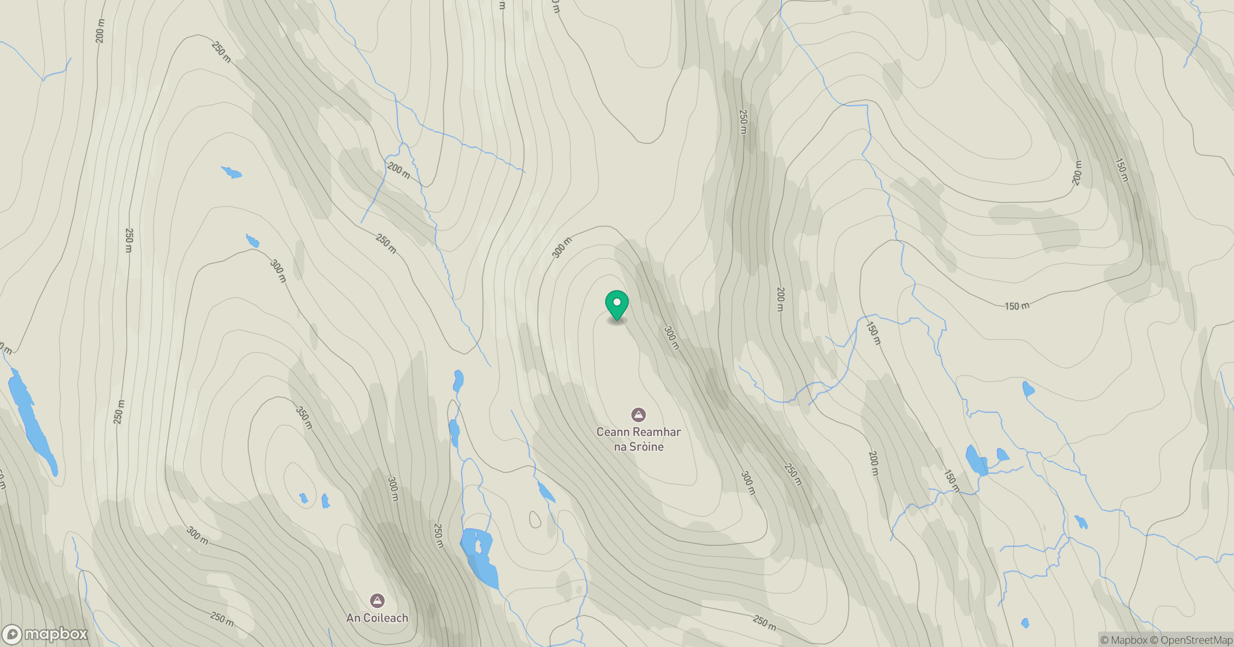
Grid reference: NG093932
View on OpenStreetMapOpens a map in a new tab, centred on the hill.
Hills within 30 km
Straight-line distance, not a walking route or confirmation of access.
No comments yet. Be the first.