
Ceann Reamhar
Good walks are even better shared.
Overview
Ceann Reamhar
Ceann Reamhar, standing at a proud 763 meters, is a captivating Marilyn located in the breathtaking Scottish Highlands. Its name, translating to 'Fat Head', could invoke a chuckle or two among hikers, especially after a hearty summit snack!
Geology
This magnificent mountain is primarily composed of granite and schist, which gives its slopes that rugged charm we all adore. The combination creates striking contrasts in scenery, particularly as the light changes throughout the day.
Routes
There are several routes to the summit, with the Invergarry Route being a popular choice for many. It offers a steady ascent that’s not too taxing, making it suitable for those who prefer a leisurely hike, while experienced hikers may enjoy the Strathglass Route, which presents a bit of a challenge but rewards with stunning natural views.
Summit Features
Reaching the top, you're greeted by a substantial cairn, perfect for a photo opportunity. Notably, there's also a viewfinder, adding a touch of quirky practicality—great for those who mistakenly thought they were standing on Mars!
Terrain
Expect grass-covered slopes interspersed with rocky outcrops. It’s the kind of terrain that might make even a mountain goat question their footing at times—so keep your wits about you!
Views
Undoubtedly, the views from Ceann Reamhar are some of the finest in the Highlands. The peaks of Ben Nevis can be spotted in the distance, and the shimmering lochs provide a stunning backdrop that will make your camera very happy. For the best experience, aim for spring or early autumn when the skies are clearer and the scenery is simply marvellous.
Hazards
While generally accessible, be mindful of loose stones and the notorious Scottish weather; it has a habit of changing quicker than a game of cards. Always consider your safety, especially in less-than-ideal conditions.
Access
Getting there is half the fun! Nearest parking can be found at the Invergarry car park, which accommodates about 15 vehicles. Public transport is available from Inverness, so you can leave the car behind and let someone else do the driving.
Facilities
If you need to refuel after your hike, a small café in Invergarry offers refreshments, and public toilets are conveniently located at the car park.
History
Not just a pretty face, Ceann Reamhar carries cultural significance in local folklore, often whispered of in stories passed down through generations. Its name hints at its rounded summit, leading one to ponder if ancient folk had a cheeky sense of humour.
Adventuring up Ceann Reamhar is an experience not to be missed, whether for the views, the company, or the joyous challenge of the hike!
Happy hiking! 🥾
Explore routes near Ceann Reamhar
Public walks starting within 80 km of this hill. Nearby does not mean a route reaches the summit; check its map and access before setting out.
Beautiful private beach walk Isle of Harris
View route
Berneray Community Hall to the beautiful beach
View route
Fairy Lochs Liberator Wreckage Circuit
View route
Dun Mhulan Broch Quick Walk
View route
Route planning notes
These notes describe possible approaches, not verified navigable routes or permission to cross land. Check current paths, local access rules and conditions before setting out.
Invergarry Route
A scenic route starting from Invergarry, offering a gradual ascent.
Strathglass Route
A less-trodden but rewarding route taking you through lush landscapes.
Make a day of it, together
Find someone to share the walk with, or organise a day out along a route you like.
Hill facts and local notes
Classifications
Elevation
467m
1,532 ft
Prominence
134m
Coordinates
57.8877, -6.8638
NG118990
OS Map
14
Explorer: 455
At the Summit
The summit features a substantial cairn and a stunning viewfinder to help you identify the surrounding peaks.
Terrain & Geology
Granite and Schist
Views & Scenery
From the summit, you can see the distant peaks of Ben Nevis and the beautiful lochs that punctuate the landscape.
History & Heritage
Name Origin
Ceann Reamhar translates to 'Fat Head' in Gaelic, possibly due to its broad summit.
Historical Significance
The mountain has cultural importance to local communities, often featuring in local folklore.
Getting There & Facilities
Check current local access restrictions, parking rules and transport timetables before travelling. These notes do not confirm public access to the summit.
Parking
Parking is available at the Invergarry car park, which can accommodate around 15 vehicles.
Public Transport
Buses run from Inverness to Invergarry; check local schedules for times.
Nearby Facilities
There's a small café in Invergarry, and public toilets are available at the car park.
Safety Information
Known Hazards
- Loose stones and changing weather conditions can pose risks. It's advisable to be cautious in poor visibility.
General Safety Tips
- Check weather conditions before setting out
- Carry appropriate clothing and equipment
- Let someone know your planned route
- Take a map, compass, and GPS device
- Carry emergency supplies: food, water, first aid kit, torch
Hills
Some common questions about the hills answered
Are there group walks up Ceann Reamhar?
Many walkers use Walkmates to join or organise walks with others. You can check for group walks around Ceann Reamhar through the maps
Are there other walkers around Ceann Reamhar?
Activity varies by location and time, but Walkmates lets you see whether others have shared walks or shown interest in this area. Find other people through the walking friends search walking friends for Ceann Reamhar search or of course create your own walk for Ceann Reamhar
Can I organise a walk to Ceann Reamhar?
Yes. If there aren’t any walks listed already, you can create a walk and make it available for others to join.
If you're signed up to Walkmates, you can create a walk to Ceann Reamhar.
How do I find a walk up this hill?
There are often multiple ways to walk this hill, depending on experience and route preference. Walkmates helps you explore walks and routes that others have shared.
Can I suggest a new route up Ceann Reamhar?
Yes. You can suggest or create routes to share with others. Walkmates focuses on the social side of walking, so routes are used to help people organise walks and explore areas together, rather than as detailed navigation tools or route libraries.
Other uses really appreciate knowledgeable walkers sharing their routes. Share your favourite route to Ceann Reamhar here
The is an error or something incorrect about this hill. How do I let you know?
We always strive to keep the information on Walkmates as accurate as possible. If you find an error, please let us know through the contact form and we'll aim to correct it as quickly as possible
Community Discussion
Comments
Location
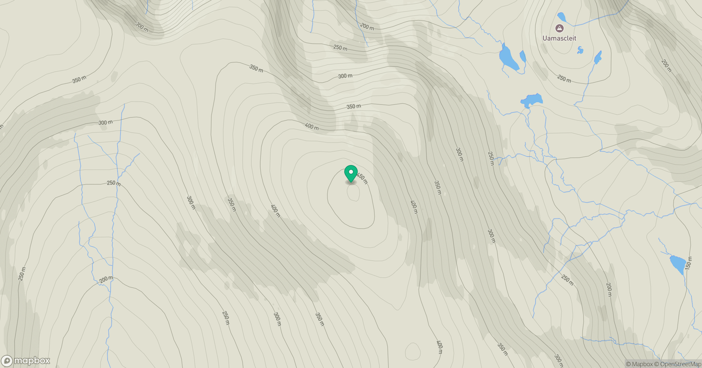
Grid reference: NG118990
View on OpenStreetMapOpens a map in a new tab, centred on the hill.
Hills within 30 km
Straight-line distance, not a walking route or confirmation of access.
An Cliseam [Clisham]
800m
Giolabhal Glas
475m
Ceann Reamhar na Sroine
357m
An Coileach
389m
Mulla bho Dheas [Mulla-Fo-Dheas]
743m
No comments yet. Be the first.