

Frankley Beeches
Good walks are even better shared.
SO9979 : Fly tipping appears to be a problem here
Philip Halling Photo source
Overview
Frankley Beeches: A Hidden Gem in the West Midlands
Nestled in the heart of the West Midlands, Frankley Beeches is often overlooked amid the bustling city life yet offers a refreshing retreat into nature. With an elevation of 145 meters, it's not the biggest peak, but it is certainly a charming area for both casual walkers and seasoned hikers alike.
Geology
Frankley Beeches boasts a unique geological composition with limestone and clay soils creating a rich environment for various flora. If you're lucky, you might stumble across fossils that tell ancient stories of a time long before cars and smartphones ruled our lives.
Routes
The most popular route is the Frankley Beeches Circular Walk, a manageable 4.5 km that takes around 1.5 hours to complete. It's perfect for families or anyone looking to stretch their legs without breaking a sweat. Don’t forget to enjoy the sights of local wildlife as you tread along the paths.
Summit Features
At the summit, you'll find a quaint cairn, a great spot to rest and perhaps reflect on life… or just grab a sandwich!
Terrain Type
Expect a combination of wooded paths and grassy areas, with some spots that can be uneven. Don't worry, it won't challenge your rock climbing skills—unless you decide to chase a squirrel or two!
Views
Once you've reached the top, the panoramic views are simply lovely. You can gaze out towards the distant hills and the shimmering outline of Birmingham. Best times to catch the view? Spring and autumn when nature puts on its finest attire!
Hazards
Watch your footing, especially when the paths are slippery after a rain. And while the branches may look friendly, a sudden head bump might remind you they’re not as forgiving!
Nearby Summits
If you're eager for more adventure, you might explore the Clent Hills and Lickey Hills, both offering higher elevations and additional trails.
Access
You can easily access Frankley Beeches with ample parking options around Frankley Beeches Road. Just be considerate when finding a spot, won't you? Public transport is available from Birmingham, while the nearest town, Birmingham, provides various amenities.
Facilities
Though there are no toilets or cafés at Frankley Beeches, Birmingham is just a stone’s throw away, ensuring you can grab a cuppa or a snack before or after your adventure.
History
The name ‘Frankley’ speaks of ancient times, originating from ‘Franca’ and ‘leah', hinting at its historical importance. Interestingly, the area was once part of vast ancient forests that provided countless resources for the early inhabitants.
So, pack your gear, bring your sense of adventure, and let Frankley Beeches show you that sometimes the best things come in small packages!
Explore routes near Frankley Beeches
Walks starting near this hill. Open a route to check its map, distance and full itinerary.
Quinton Walk with Men Walking & Talking
View route
Lickey Hills: Bilberry Hill and Cofton woodland circuit
View route
Clent Hills: Buzzard Trail and Four Stones
View route
Bournville Walk with Men Walking & Talking
View route
Route planning notes
These notes describe possible approaches. Check a route's map and access information when planning your walk.
Frankley Beeches Circular Walk
A popular circular route taking you through woodlands and along the scenic edges of Frankley Beeches. A great way to discover local wildlife and plants.
Make a day of it, together
Find someone to share the walk with, or organise a day out along a route you like.
Photo Gallery
View all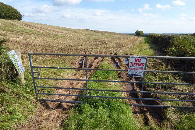 Photo could not load
SO9979 : Fly tipping appears to be a problem here
Philip Halling
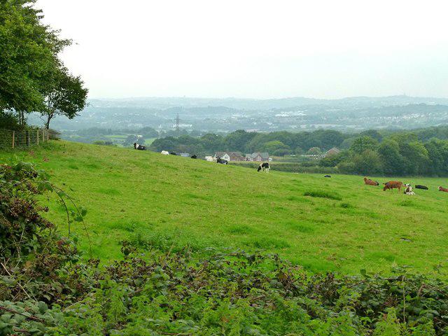 Photo could not load
SO9979 : Landscape near Frankley
Alan Murray-Rust
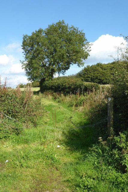 Photo could not load
SO9979 : Footpath to Frankley Beeches
Philip Halling
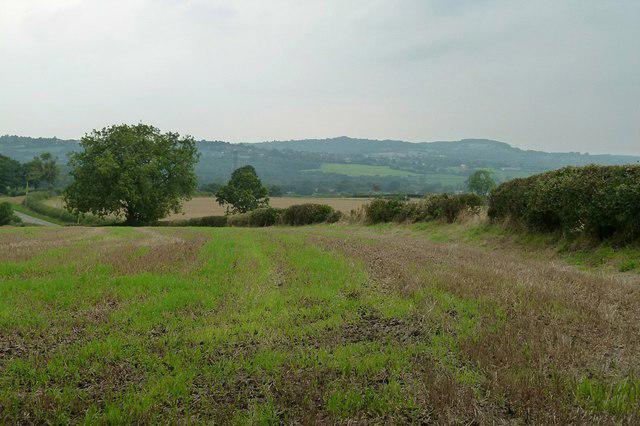 Photo could not load
SO9979 : View from Frankley Beeches
Alan Murray-Rust
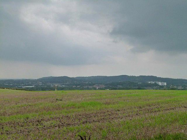 Photo could not load
SO9979 : View from Frankley Beeches
Alan Murray-Rust
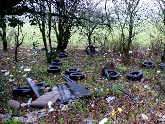 Photo could not load
SO9979 : Fly Tipping on Egg Hill
Nigel Mykura
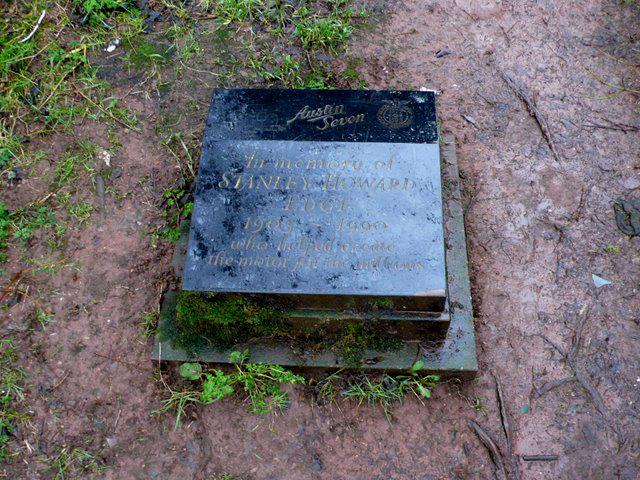 Photo could not load
SO9979 : Memorial to Stanley Edge
Nigel Mykura
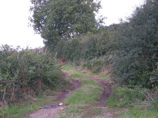 Photo could not load
SO9979 : Farm track near Frankley Beeches
Row17
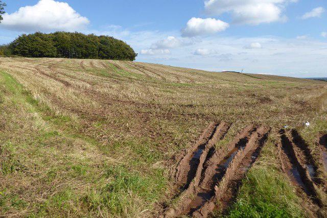 Photo could not load
SO9979 : Frankley Beeches
Philip Halling
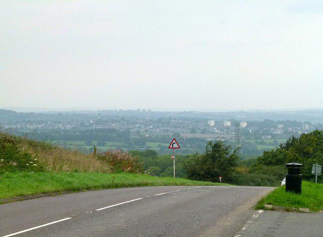
SO9979 : View from Frankley Hill
Alan Murray-Rust
Hill facts and local notes
Classifications
Elevation
256m
840 ft
Prominence
32m
Coordinates
52.4157, -2.0127
SO992797
OS Map
139
Explorer: 219S
At the Summit
The highest point features a modest cairn surrounded by lush greenery, making it an excellent picnic spot if you fancy a bite amidst nature.
Terrain & Geology
Frankley Beeches is primarily composed of limestone and clay soils, offering a varied landscape of flora and fauna. The area showcases interesting fossilised remains, hinting at its ancient geological past.
Views & Scenery
From the summit, hikers can enjoy views of the surrounding hills and the distant cityscape of Birmingham.
History & Heritage
Name Origin
Frankley is derived from the Old English ‘Franca’ and ‘leah’, meaning ‘clearing of the Franks’. Quite a mouthful, isn’t it?
Historical Significance
Historically, the area was part of the ancient forests that provided timber and resources for local communities.
Getting There & Facilities
Parking
There is a small car park on Frankley Beeches Road (SO992797), with additional roadside parking available. Just be sure not to block any driveways!
Public Transport
Regular bus services operate from Birmingham to nearby stops; check the local timetable for any updates.
Nearby Facilities
While there are no facilities directly at Frankley Beeches, nearby Birmingham offers everything from cafés to toilets. Stock up on snacks before you head out!
Safety Information
Known Hazards
- Slippery paths during wet conditions, and the occasional overhanging branch, so watch your head!
General Safety Tips
- Check weather conditions before setting out
- Carry appropriate clothing and equipment
- Let someone know your planned route
- Take a map, compass, and GPS device
- Carry emergency supplies: food, water, first aid kit, torch
Hills
Some common questions about the hills answered
Are there group walks up Frankley Beeches?
Many walkers use Walkmates to join or organise walks with others. You can check for group walks around Frankley Beeches through the maps
Are there other walkers around Frankley Beeches?
Activity varies by location and time, but Walkmates lets you see whether others have shared walks or shown interest in this area. Find other people through the walking friends search walking friends for Frankley Beeches search or of course create your own walk for Frankley Beeches
Can I organise a walk to Frankley Beeches?
Yes. If there aren’t any walks listed already, you can create a walk and make it available for others to join.
If you're signed up to Walkmates, you can create a walk to Frankley Beeches.
How do I find a walk up this hill?
There are often multiple ways to walk this hill, depending on experience and route preference. Walkmates helps you explore walks and routes that others have shared.
Can I suggest a new route up Frankley Beeches?
Yes. You can suggest or create routes to share with others. Walkmates focuses on the social side of walking, so routes are used to help people organise walks and explore areas together, rather than as detailed navigation tools or route libraries.
Other uses really appreciate knowledgeable walkers sharing their routes. Share your favourite route to Frankley Beeches here
The is an error or something incorrect about this hill. How do I let you know?
We always strive to keep the information on Walkmates as accurate as possible. If you find an error, please let us know through the contact form and we'll aim to correct it as quickly as possible
Community Discussion
Comments
Location
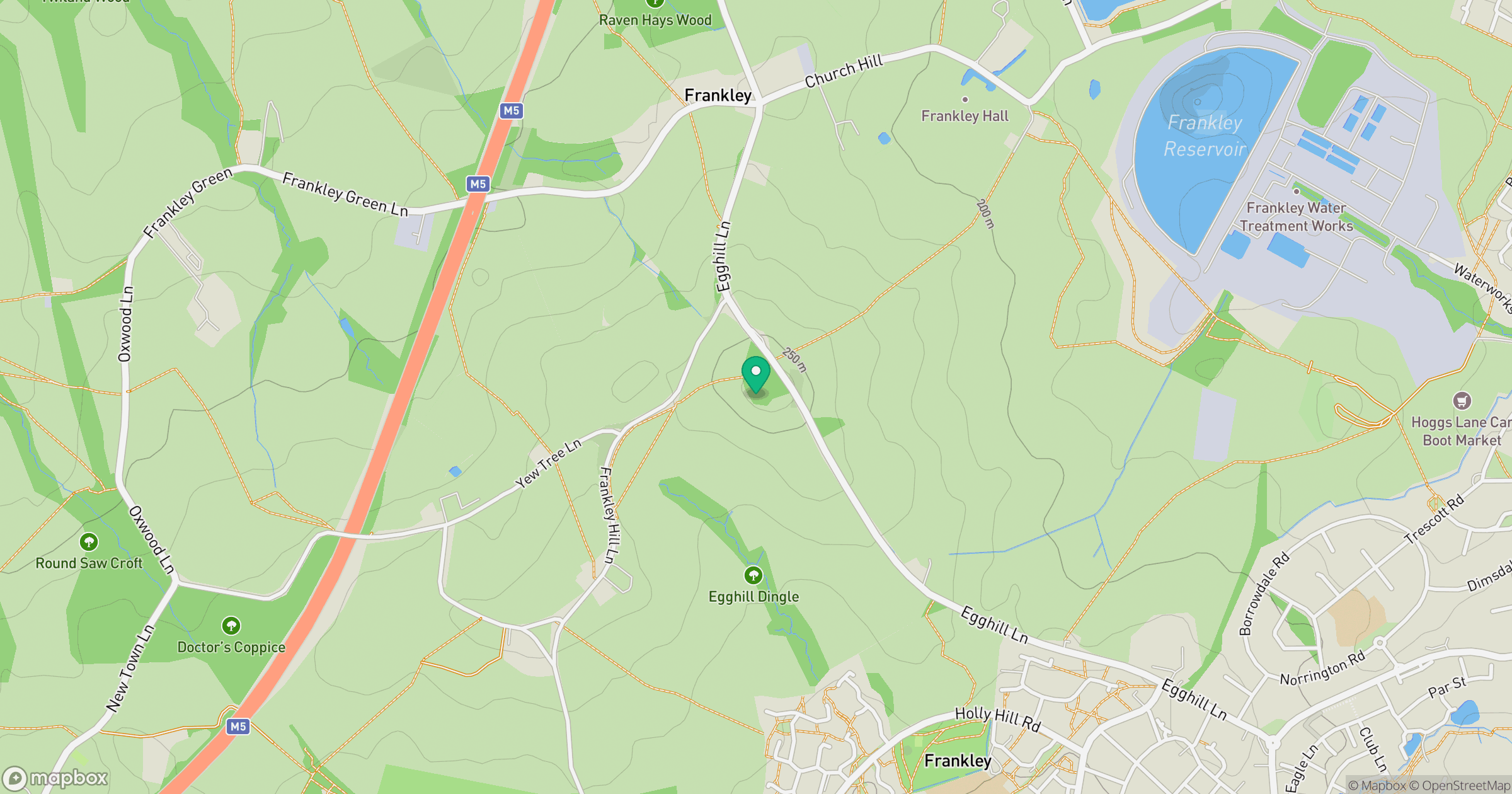
Grid reference: SO992797
View on OpenStreetMapOpens a map in a new tab, centred on the hill.
Nearby Hills
Worcestershire Beacon
425m
Titterstone Clee Hill
533m

The Wrekin
407m
The Roaches
505m
Long Mynd - Pole Bank
517m
No comments yet. Be the first.