

Dodman Point
Good walks are even better shared.
SX0039 : Dodman Point
Derek Harper Photo source
Overview
Dodman Point
Dodman Point stands majestic at 110 meters above sea level, offering a high point from which to survey the brilliant Cornish coastline. Situated near the village of Gorran Haven, it is an inviting destination for walkers and nature enthusiasts alike.
Geology
The cliffs of Dodman Point are primarily formed from granite, a testament to the volcanic activity of ages past. These granite outcrops create a striking landscape, rich in geological interest and providing a home to various local flora and fauna. Whether you're a budding geologist or just someone who appreciates a good rocky climb, Dodman’s geology will leave you captivated.
Route Details
One of the most popular routes is the Dodman Point Circular Walk. This six-and-a-half-kilometre trail takes you from Gorran Haven along the scenic South West Coast Path. Set aside about 2.5 hours to complete it, and don’t forget to pack your camera — the views are simply a sight to behold!
Summit Features
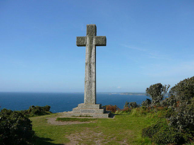
At the peak, you’ll find a large granite cross, erected in memory of a shipwreck in 1847. It's a reminder not only of the area's maritime history but also ensures you won’t get lost gazing at the view!
Terrain Type and Safety
The terrain is a mix of grassy areas, rocky paths, and occasional boggy patches. Footwear suitable for varied conditions is essential here, as Mother Nature has her own plans about where to direct puddles.
Spectacular Views
Prepare yourself for breathtaking views of the English Channel and the stunning Roseland Peninsula. The landscape is especially beautiful during late spring and summer, though the autumn sunsets will leave you speechless as the sky dances with colour.
Hazards
Just a friendly reminder: keep clear of the steep cliffs! And as always, keep an eye on the weather, as it can change quicker than you can say 'Cornish pasty'.
Access and Amenities
The nearest car park is in Gorran Haven village, a short stroll from the trailhead. If you're using public transport, buses regularly connect St Austell to Gorran Haven, where you can grab a coffee and perhaps a cream tea before hitting the trails.
Facilities in Gorran Haven include a few quaint cafes and public toilets perfect for pre- or post-hike relief!
History
The name 'Dodman' has some local lore, deriving from the Cornish term for 'sea bird'. This picturesque point has not only served as a navigational aid for sailors but has also recently become a beloved spot for walkers seeking that quintessential Cornwall experience.
So lace up those hiking boots, bring your adventurous spirit, and head on up to Dodman Point — where the land meets the sea, and perhaps a seagull or two will try to snatch your sandwich!
Happy Hiking!
Explore routes near Dodman Point
Walks starting near this hill. Open a route to check its map, distance and full itinerary.
Ropehaven Cliffs and Black Head
View route
Trelissick and Roundwood Quay: Fal estuary woodland circuit
View route
Falmouth Walk with Men Walking & Talking
View route
Lanhydrock: Deer Wall, River Fowey and Woodland Circuit
View route
Route planning notes
These notes describe possible approaches. Check a route's map and access information when planning your walk.
Dodman Point Circular Walk
A scenic circular route starting from the village of Gorran Haven, taking you along the South West Coast Path and up to the stunning Dodman Point.
Make a day of it, together
Find someone to share the walk with, or organise a day out along a route you like.
Photo Gallery
View all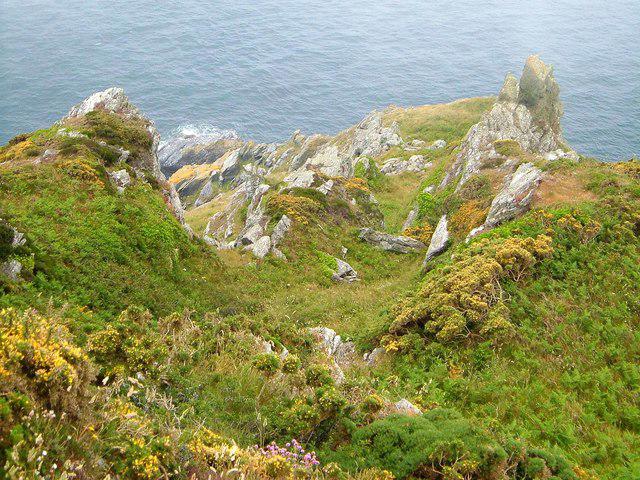 Photo could not load
SX0039 : Dodman Point
Derek Harper
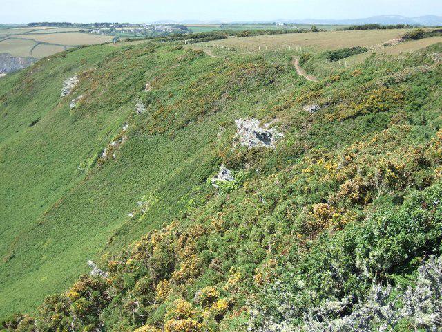 Photo could not load
SX0039 : The west side of the Dodman
David Smith
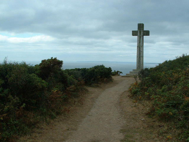 Photo could not load
SX0039 : Stone Cross, Dodman Point
Nigel Homer
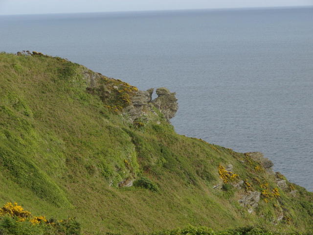 Photo could not load
SX0039 : Dodman Point
Alan Hunt
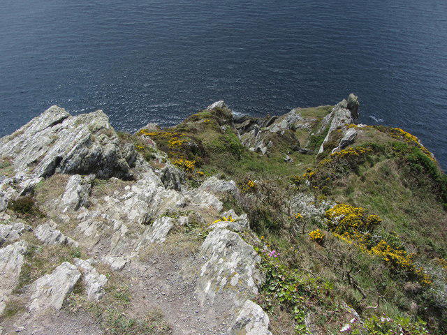 Photo could not load
SX0039 : Looking down on to Maen-Lay Rock at Dodman Point
Gareth James
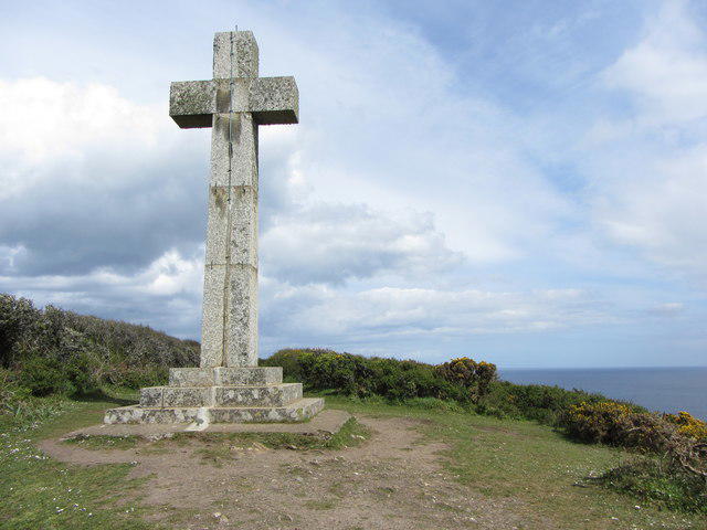 Photo could not load
SX0039 : Stone cross on Dodman Point
Gareth James
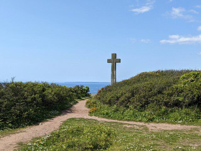 Photo could not load
SX0039 : Cross at Dodman Point
don cload
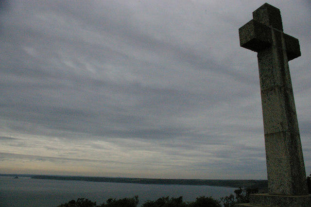 Photo could not load
SX0039 : Dodman Point: the cross, and view out to sea
Christopher Hilton
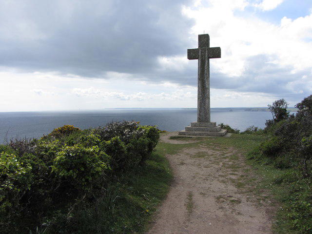 Photo could not load
SX0039 : Stone cross on Dodman Point
Gareth James
SX0039 : The cross at Dodman Point
Colin Park
Hill facts and local notes
Classifications
Elevation
114m
374 ft
Prominence
39m
Coordinates
50.2207, -4.8022
SX002393
OS Map
204
Explorer: 105
At the Summit
At the summit, you'll find a prominent granite cross, which not only marks the high point but is also a historical landmark visible for miles around.
Terrain & Geology
Dodman Point is primarily composed of granite, formed from volcanic activity. The granite cliffs and surrounding landscape contribute to the rugged beauty of the area, offering a fascinating glimpse into the geological history of Cornwall.
Views & Scenery
From the summit, you can enjoy sweeping views of the English Channel, as well as the picturesque village of Gorran Haven and the distant coastline stretching towards the Roseland Peninsula.
History & Heritage
Name Origin
The name 'Dodman' is believed to derive from the Cornish word 'dodman', meaning 'sea bird', likely referencing the many seabirds that inhabit the area.
Historical Significance
Dodman Point has been a cherished natural landmark, used for navigation by sailors and appreciated for its stunning natural beauty.
Getting There & Facilities
Parking
The nearest parking is available in the village of Gorran Haven, with a car park located near the beach. Be mindful of parking fees during peak season.
Public Transport
Regular bus services connect nearby towns like St Austell to Gorran Haven, making it accessible for those using public transport.
Nearby Facilities
Gorran Haven offers several cafes and a public toilet, perfect for a quick pit stop before or after your hike.
Safety Information
Known Hazards
- Be cautious of steep cliffs along the coast. There's also the potential for sudden weather changes, so it’s wise to be prepared.
General Safety Tips
- Check weather conditions before setting out
- Carry appropriate clothing and equipment
- Let someone know your planned route
- Take a map, compass, and GPS device
- Carry emergency supplies: food, water, first aid kit, torch
Hills
Some common questions about the hills answered
Are there group walks up Dodman Point?
Many walkers use Walkmates to join or organise walks with others. You can check for group walks around Dodman Point through the maps
Are there other walkers around Dodman Point?
Activity varies by location and time, but Walkmates lets you see whether others have shared walks or shown interest in this area. Find other people through the walking friends search walking friends for Dodman Point search or of course create your own walk for Dodman Point
Can I organise a walk to Dodman Point?
Yes. If there aren’t any walks listed already, you can create a walk and make it available for others to join.
If you're signed up to Walkmates, you can create a walk to Dodman Point.
How do I find a walk up this hill?
There are often multiple ways to walk this hill, depending on experience and route preference. Walkmates helps you explore walks and routes that others have shared.
Can I suggest a new route up Dodman Point?
Yes. You can suggest or create routes to share with others. Walkmates focuses on the social side of walking, so routes are used to help people organise walks and explore areas together, rather than as detailed navigation tools or route libraries.
Other uses really appreciate knowledgeable walkers sharing their routes. Share your favourite route to Dodman Point here
The is an error or something incorrect about this hill. How do I let you know?
We always strive to keep the information on Walkmates as accurate as possible. If you find an error, please let us know through the contact form and we'll aim to correct it as quickly as possible
Community Discussion
Comments
Location
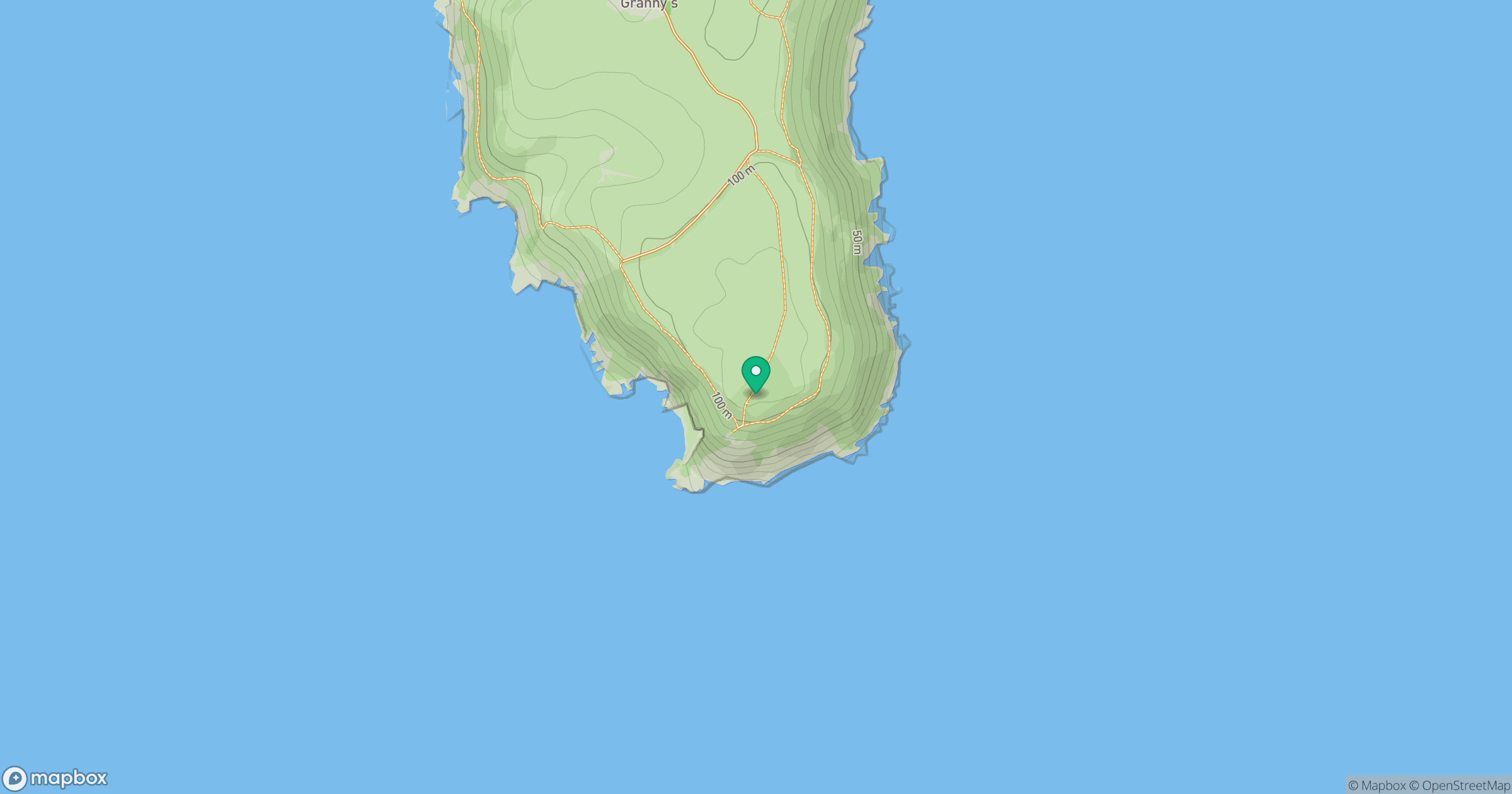
Grid reference: SX002393
View on OpenStreetMapOpens a map in a new tab, centred on the hill.
Nearby Hills
Brown Willy
420m

Brent Tor
334m

High Willhays
622m
Rhossili Down - The Beacon
193m

Dunkery Beacon
520m
No comments yet. Be the first.