
Penhale Hill
Good walks are even better shared.
Overview
Overview
Penhale Hill is a Marilyn sitting resplendently in the heart of Cornwall. At 222 meters, it may not be the highest, but it certainly packs a punch in terms of views and natural beauty.
Geology
Composed primarily of granite, this hill is part of the Carn Brea complex. The granite lends itself well to the ruggedness of the terrain, providing a unique landscape that is both charming and challenging.
Hiking Routes
The Penhale Point Trail is the go-to route for many hikers. It's about 3.5 km long and a moderate challenge, making it suitable for both seasoned walkers and families looking for an adventure. Expect a mix of grass and rocky paths that may make you wish you’d opted for sturdier footwear.
Summit Features
Reaching the summit, you'll find a quaint cairn and a trig point, both excellent spots to pause, take in the surrounding views, and snap a selfie or two. Don’t forget to take a moment to appreciate the landscape around you before making your descent.
Terrain and Views
The terrain varies from grassy areas to rocky patches, which can keep your hike interesting. Keep your eyes peeled for the fantastic views of the Atlantic coastline and, if you're lucky, a glimpse of the iconic Godrevy Lighthouse in the distance. The best times to visit are during spring or autumn when nature is either blooming or bedecked in glorious golds.
Access
Accessing Penhale Hill is straightforward, with parking available at Penhale campsite. If you're relying on public transport, jump on a bus to Perranporth and you’ll be just a short walk from the trailhead.
Facilities
Nearby, you’ll find several facilities in Perranporth, from cosy cafes where you can indulge in cream teas to public toilets that ensure you're ready for your adventure.
Conclusion
In conclusion, Penhale Hill offers a perfect day out in Cornwall's incredible landscape. From historical significance to breathtaking views, it's a charming destination for hikers of all levels. So grab your boots, pack those snacks, and don’t forget your camera; this hill is waiting to charm you silly!
Happy hiking!
Explore routes near Penhale Hill
Walks starting near this hill. Open a route to check its map, distance and full itinerary.
Ropehaven Cliffs and Black Head
View route
Wadebridge to Boscarne: Camel Valley Railway Walk
View route
Padstow to Trevone coastal circular
View route
Lanhydrock: Deer Wall, River Fowey and Woodland Circuit
View route
Route planning notes
These notes describe possible approaches. Check a route's map and access information when planning your walk.
Penhale Point Trail
A scenic route starting from the nearby Penhale campsite, which meanders through heathland and follows footpaths to the summit.
Make a day of it, together
Find someone to share the walk with, or organise a day out along a route you like.
Hill facts and local notes
Classifications
Elevation
226m
741 ft
Prominence
101m
Coordinates
50.3782, -4.9302
SW917572
OS Map
200
Explorer: 106
At the Summit
The summit features a modest but proud cairn and a trig point, offering a perfect spot for a quick selfie and perhaps a cuppa.
Terrain & Geology
Primarily composed of granite, forming part of the larger Carn Brea complex, which showcases the rugged beauty typical of Cornwall’s landscape.
Views & Scenery
On a clear day, one can gaze upon the stunning views towards the Atlantic coastline, with Godrevy Lighthouse and St Ives Bay often stealing the show.
History & Heritage
Name Origin
'Penhale' derives from the Cornish language, meaning 'the head of the moor.' Given its elevation, it's the perfect spot for moorland viewpoints.
Historical Significance
This area is steeped in history, with ancient burial sites nearby that hark back to the Bronze Age, providing a glimpse into Cornwall’s rich past.
Getting There & Facilities
Parking
There's limited parking available at Penhale campsite, just a short walk from the trailhead.
Public Transport
Closest bus stop is in Perranporth, with several buses running from Truro and Newquay.
Nearby Facilities
Cafes and toilets are available in Perranporth, along with shops to stock up on snacks for your adventure.
Safety Information
Known Hazards
- Beware of sudden changes in weather, as well as uneven and rocky paths which can be tricky, especially after rain.
General Safety Tips
- Check weather conditions before setting out
- Carry appropriate clothing and equipment
- Let someone know your planned route
- Take a map, compass, and GPS device
- Carry emergency supplies: food, water, first aid kit, torch
Hills
Some common questions about the hills answered
Are there group walks up Penhale Hill?
Many walkers use Walkmates to join or organise walks with others. You can check for group walks around Penhale Hill through the maps
Are there other walkers around Penhale Hill?
Activity varies by location and time, but Walkmates lets you see whether others have shared walks or shown interest in this area. Find other people through the walking friends search walking friends for Penhale Hill search or of course create your own walk for Penhale Hill
Can I organise a walk to Penhale Hill?
Yes. If there aren’t any walks listed already, you can create a walk and make it available for others to join.
If you're signed up to Walkmates, you can create a walk to Penhale Hill.
How do I find a walk up this hill?
There are often multiple ways to walk this hill, depending on experience and route preference. Walkmates helps you explore walks and routes that others have shared.
Can I suggest a new route up Penhale Hill?
Yes. You can suggest or create routes to share with others. Walkmates focuses on the social side of walking, so routes are used to help people organise walks and explore areas together, rather than as detailed navigation tools or route libraries.
Other uses really appreciate knowledgeable walkers sharing their routes. Share your favourite route to Penhale Hill here
The is an error or something incorrect about this hill. How do I let you know?
We always strive to keep the information on Walkmates as accurate as possible. If you find an error, please let us know through the contact form and we'll aim to correct it as quickly as possible
Community Discussion
Comments
Location
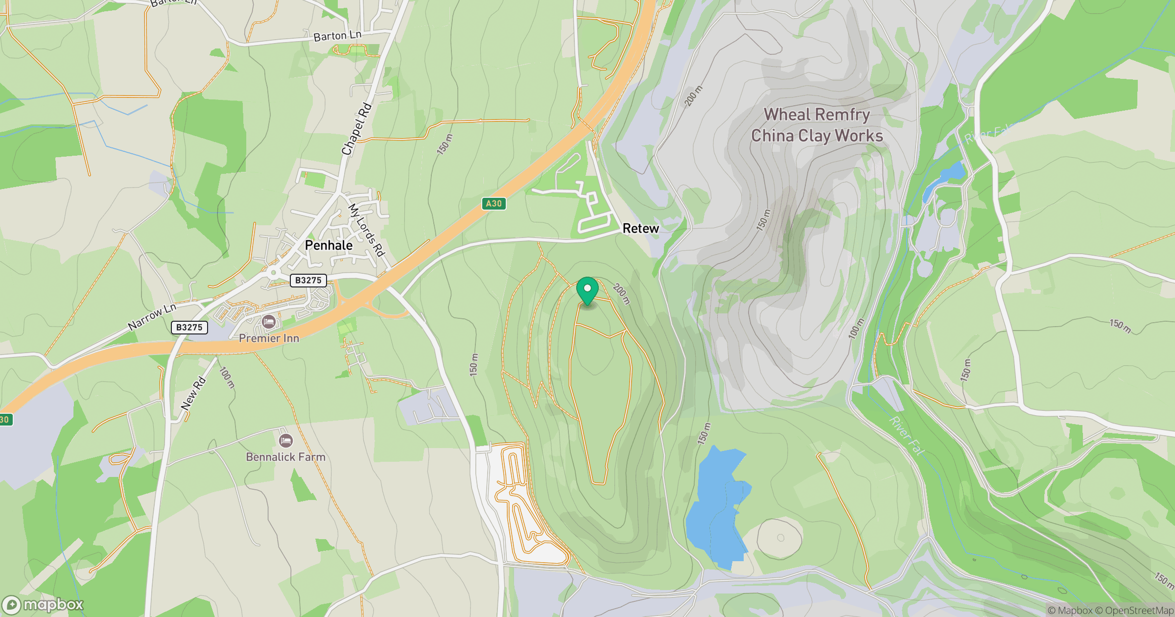
Grid reference: SW917572
View on OpenStreetMapOpens a map in a new tab, centred on the hill.
Nearby Hills
Brown Willy
420m

Brent Tor
334m

High Willhays
622m
Rhossili Down - The Beacon
193m

Dunkery Beacon
520m
No comments yet. Be the first.