

Hensbarrow Downs
Good walks are even better shared.
SX0057 : View North from Hensbarrow Downs
Gary Rogers Photo source
Overview
Hensbarrow Downs
Hensbarrow Downs is a charming Marilyn in Cornwall, standing proud at an elevation of 214 meters. This granite hill offers not just stunning views, but also a slice of history and nature combined.
Geology
The landscape here is imbued with granite, resulting from the significant geological events of the past. As you trek through its undulating terrain, you'll notice remnants of mining activity that speaks to Cornwall's rich heritage in tin and copper production. Just keep your eyes peeled for the occasional shiny rock—they're not gold, I promise!
Access
You can easily access Hensbarrow Downs from various starting points, with Carwynnen being the most popular for a circular walk. If you fancy a quick stroll, the route from the A391 is straightforward and relatively flat. Parking at Carwynnen is convenient, with space for a few cars.
Views
On a clear day, the vistas from the top are simply breathtaking. You'll see the rolling hills of Cornwall and might catch a glimpse of St. Austell Bay. Spring and autumn offer the best conditions for photography—imagine autumn leaves against that cerulean sky!
Facilities
While enjoying Hensbarrow Downs, note that facilities are sparse. Your best bet for a toilet break or a caffeine fix will be in the bustle of St. Austell, about 6 km away. Just think of it as a warm-up walk before your hike!
Hazards
As with many outdoor pursuits, there are minor hazards to consider. Watch out for unexpected rabbit holes and those cheeky sods known as bogs—these can catch you off guard if your head is in the clouds.
History
Hensbarrow's name nods to its ancient significance, likely tied to burial mounds from prehistory. Its landscape is etched with the stories of workers who toiled in the mines, and it stands as a testament to Cornwall’s rich and rugged history.
So pack your rucksacks, lace up your boots, and get ready to explore this delightful corner of Cornwall! Don’t forget your camera, and maybe a snack or two—hiking can be a hungry business!
Explore routes near Hensbarrow Downs
Walks starting near this hill. Open a route to check its map, distance and full itinerary.
Ropehaven Cliffs and Black Head
View route
Lanhydrock: Deer Wall, River Fowey and Woodland Circuit
View route
Wadebridge to Boscarne: Camel Valley Railway Walk
View route
Padstow to Trevone coastal circular
View route
Route planning notes
These notes describe possible approaches. Check a route's map and access information when planning your walk.
Hensbarrow Downs Circular Walk
A leisurely circular route starting from the village of Carwynnen that will take you through scenic landscapes and historical remnants.
Access from the A391
An accessible route directly from the roadside with minimal ascent, perfect for a quick jaunt or family outing.
Make a day of it, together
Find someone to share the walk with, or organise a day out along a route you like.
Photo Gallery
View all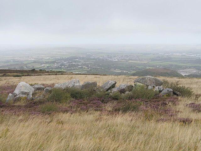 Photo could not load
SX0057 : View North from Hensbarrow Downs
Gary Rogers
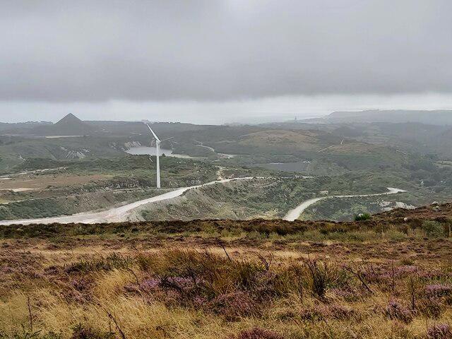 Photo could not load
SX0057 : View West from Hensbarrow Downs
Gary Rogers
Hill facts and local notes
Classifications
Elevation
365m
1,196 ft
Prominence
250m
Coordinates
50.3831, -4.8128
SX001574
OS Map
200
Explorer: 106 107
At the Summit
The summit boasts a large granite outcrop, often mistaken for a seat at the pub if viewed from a distance. There are remnants of ancient field systems nearby and a breathtaking view over the surrounding rolling hills.
Terrain & Geology
Hensbarrow Downs is primarily composed of granite, a robust and ancient rock type formed during the Variscan orogeny. The area is dotted with fascinating geological features, including mine workings from the region's notable tin and copper mining history.
Views & Scenery
From the summit, you can gaze upon the distant coast, the mighty moors, and possibly even spot St. Austell Bay on a clear day.
History & Heritage
Name Origin
The name 'Hensbarrow' derives from the Cornish 'Hens' meaning 'head' or 'fore', and 'barrow' which refers to a tumulus or mound, possibly indicating ancient burial sites.
Historical Significance
The area has a rich mining heritage, particularly for tin and copper. Hensbarrow Downs is also known for its prehistoric sites and ancient field systems.
Getting There & Facilities
Parking
Parking is available at Carwynnen, where you’ll find a small layby suitable for a couple of cars.
Public Transport
Buses run from St. Austell to nearby villages. Check local timetables for service availability.
Nearby Facilities
There are no facilities directly on Hensbarrow Downs, but St. Austell offers a range of cafes, shops, and public toilets.
Safety Information
Known Hazards
- Watch out for hidden rabbit holes and the occasional bog; these can become ankle traps if you're not paying attention!
General Safety Tips
- Check weather conditions before setting out
- Carry appropriate clothing and equipment
- Let someone know your planned route
- Take a map, compass, and GPS device
- Carry emergency supplies: food, water, first aid kit, torch
Hills
Some common questions about the hills answered
Are there group walks up Hensbarrow Downs?
Many walkers use Walkmates to join or organise walks with others. You can check for group walks around Hensbarrow Downs through the maps
Are there other walkers around Hensbarrow Downs?
Activity varies by location and time, but Walkmates lets you see whether others have shared walks or shown interest in this area. Find other people through the walking friends search walking friends for Hensbarrow Downs search or of course create your own walk for Hensbarrow Downs
Can I organise a walk to Hensbarrow Downs?
Yes. If there aren’t any walks listed already, you can create a walk and make it available for others to join.
If you're signed up to Walkmates, you can create a walk to Hensbarrow Downs.
How do I find a walk up this hill?
There are often multiple ways to walk this hill, depending on experience and route preference. Walkmates helps you explore walks and routes that others have shared.
Can I suggest a new route up Hensbarrow Downs?
Yes. You can suggest or create routes to share with others. Walkmates focuses on the social side of walking, so routes are used to help people organise walks and explore areas together, rather than as detailed navigation tools or route libraries.
Other uses really appreciate knowledgeable walkers sharing their routes. Share your favourite route to Hensbarrow Downs here
The is an error or something incorrect about this hill. How do I let you know?
We always strive to keep the information on Walkmates as accurate as possible. If you find an error, please let us know through the contact form and we'll aim to correct it as quickly as possible
Community Discussion
Comments
Location

Grid reference: SX001574
View on OpenStreetMapOpens a map in a new tab, centred on the hill.
Nearby Hills
Brown Willy
420m

Brent Tor
334m

High Willhays
622m
Rhossili Down - The Beacon
193m

Dunkery Beacon
520m
No comments yet. Be the first.