

Croghan Mountain
Good walks are even better shared.
T1372 : Trig Point on Croghan - view south
Colin Park Photo source
Overview
Croghan Mountain: A Hiker's Delight
Introduction
Croghan Mountain, standing tall at 1,721 meters, is a striking feature of the Sligo and Leitrim Mountains. It is classified as a Marilyn, highlighting its rugged beauty and prominence. Nestled close to the charming village of Dromahair, it offers an accessible yet thrilling experience for hikers of varying abilities.
Geology
The geological composition of Croghan Mountain primarily consists of sedimentary sandstone laid down during the Carboniferous period. This ancient rock tells the tale of our planet's history and can be explored through its fascinating formations along the trails.
Hiking Routes
The most popular route is the Croghan Mountain Trail, which meanders from Dromahair. Stretching 8.2 km, it takes about 3.5 hours to complete. Although it poses a moderate challenge, it rewards hikers with stunning vistas along the way. Just remember to mind the boggy patches – they have been known to swallow the unsuspecting!
Summit Features
Upon reaching the summit, you will be greeted by a mound of stones, perfect for picnic breaks. Here, you have the chance to strike a pose among nature’s finest backdrops.
Terrain
Expect a mix of grassy expanses peppered with rocky outcrops. The combination can be charming yet treacherous, particularly during wet weather. Make sure your boots can handle wet socks!
Views
The views from Croghan Mountain are absolutely worth the trek. On a clear day, you’ll spot the iconic Benbulben and the shimmering Atlantic Ocean in the distance. Late spring and early autumn tend to provide the best visibility with vibrant colours that will leave you giddy.
Hazards
Hikers should be wary of possible rapid weather changes, which can catch even the most seasoned adventurers off guard. Slippery paths, particularly in boggy sections, can be tricky – take it slow and enjoy the view rather than rush to fall over!
Nearby Summits
Benbulben, standing at 497 meters, is a notable neighbour that adds to the stunning landscape.
Access
Parking can be found in Dromahair village, where you can stow your gear and begin your adventure. Public transport options are more limited, so it’s worth planning your journey carefully. Dromahair itself offers delightful cafes, ensuring you're fuelled and ready to challenge the peak.
Conclusion
In sum, Croghan Mountain is not just another hill; it’s a delightful adventure waiting to be explored. With its stunning views, historical charm, and a hint of challenge, it’s a hike you won’t forget. So grab your hiking boots, pack your sense of humour, and get ready for an unforgettable day in the great outdoors!
Explore routes near Croghan Mountain
Walks starting near this hill. Open a route to check its map, distance and full itinerary.
Route planning notes
These notes describe possible approaches. Check a route's map and access information when planning your walk.
Croghan Mountain Trail
A well-marked path leading from the small village of Dromahair up to the summit. Expect some boggy patches in the initial stages.
Make a day of it, together
Find someone to share the walk with, or organise a day out along a route you like.
Photo Gallery
View all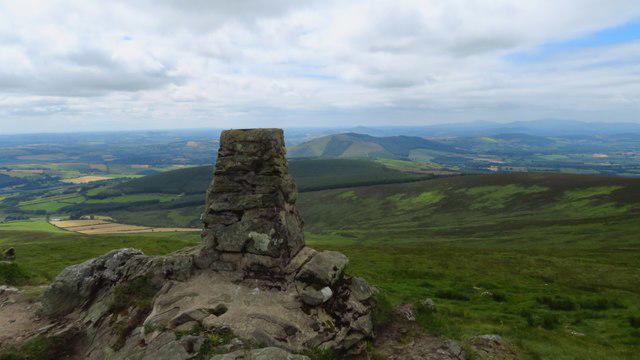 Photo could not load
T1372 : Trig Point on Croghan - view south
Colin Park
Hill facts and local notes
Classifications
Elevation
606m
1,988 ft
Prominence
522m
Coordinates
52.7955, -6.3242
T130728
OS Map
62
At the Summit
The summit boasts a large mound of stones and a few scattered rocks, providing an ideal spot for weary hikers to rest and take in the views.
Terrain & Geology
Croghan Mountain primarily consists of sandstone and reflects the ancient geological processes that shaped this area, including layers of sedimentary rock from the Carboniferous period.
Views & Scenery
From the summit, you can see the iconic Benbulben Mountain and, on a clear day, the expansive Atlantic Ocean in the distance.
History & Heritage
Name Origin
The name 'Croghan' is believed to derive from the Irish 'Cruachán', meaning 'little round hill'.
Historical Significance
Croghan Mountain is steeped in mythology, often associated with ancient Irish legends and lore, making it more than just a pretty face.
Getting There & Facilities
Parking
Parking is available at Dromahair village, where you can find a small car park suitable for a few vehicles.
Public Transport
Bus services operate from nearby towns such as Sligo, but be sure to check schedules as they are infrequent.
Nearby Facilities
Dromahair has a couple of cafes where you can fuel up before your climb, and public toilets are available near the village centre.
Safety Information
Known Hazards
- Beware of sudden weather changes and slippery paths, especially in wet conditions. A tendency to lose your footing on the boggy bits is common!
General Safety Tips
- Check weather conditions before setting out
- Carry appropriate clothing and equipment
- Let someone know your planned route
- Take a map, compass, and GPS device
- Carry emergency supplies: food, water, first aid kit, torch
Hills
Some common questions about the hills answered
Are there group walks up Croghan Mountain?
Many walkers use Walkmates to join or organise walks with others. You can check for group walks around Croghan Mountain through the maps
Are there other walkers around Croghan Mountain?
Activity varies by location and time, but Walkmates lets you see whether others have shared walks or shown interest in this area. Find other people through the walking friends search walking friends for Croghan Mountain search or of course create your own walk for Croghan Mountain
Can I organise a walk to Croghan Mountain?
Yes. If there aren’t any walks listed already, you can create a walk and make it available for others to join.
If you're signed up to Walkmates, you can create a walk to Croghan Mountain.
How do I find a walk up this hill?
There are often multiple ways to walk this hill, depending on experience and route preference. Walkmates helps you explore walks and routes that others have shared.
Can I suggest a new route up Croghan Mountain?
Yes. You can suggest or create routes to share with others. Walkmates focuses on the social side of walking, so routes are used to help people organise walks and explore areas together, rather than as detailed navigation tools or route libraries.
Other uses really appreciate knowledgeable walkers sharing their routes. Share your favourite route to Croghan Mountain here
The is an error or something incorrect about this hill. How do I let you know?
We always strive to keep the information on Walkmates as accurate as possible. If you find an error, please let us know through the contact form and we'll aim to correct it as quickly as possible
Community Discussion
Comments
Location
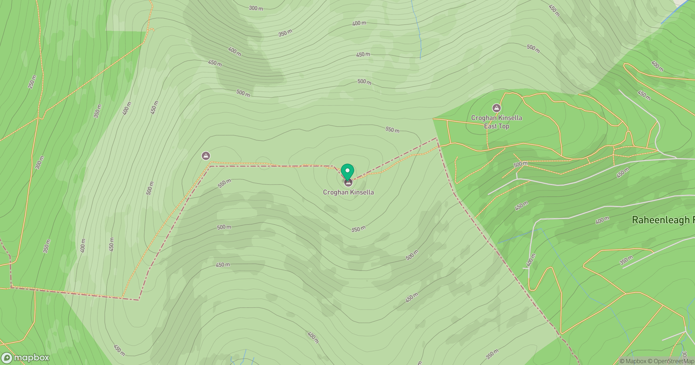
Grid reference: T130728
View on OpenStreetMapOpens a map in a new tab, centred on the hill.
No comments yet. Be the first.