
Muskeagh Hill
Good walks are even better shared.
Overview
Muskeagh Hill
Muskeagh Hill, standing tall at an elevation of 357 meters, is a stunning Marilyn that offers a delightful escape into the natural beauty of County Down. Not only does it provide a rewarding hike, but it also boasts some of the finest views in the area.
Geology
Muskeagh Hill is predominantly composed of basalt and sandstone, a reminder of the volcanic activity that once shaped this landscape. These geological features create a diverse range of habitats, supporting a rich array of flora and fauna.
Access
Getting to Muskeagh Hill is a breeze. Parking is conveniently located at the entrance to the trail off the B8 road, where you'll find ample space for your chariot. If you're relying on public transport, be aware that there's a limited bus service from Newcastle, so plan accordingly to avoid a long wait.
Routes
One of the popular routes is 'The Ridge Route'. This moderately challenging path spans approximately 5.5 km and typically takes around 2.5 hours to complete, depending on your pace and how many times you stop to admire the view (and let’s be honest, you'll want to stop—it's stunning!).
Summit Features
Upon reaching the summit, hikers are greeted by a proud trig point, a reliable sight for any intrepid adventurer. This point offers a fantastic opportunity for photographs and a well-deserved break.
Terrain
The terrain on Muskeagh Hill is predominantly grassy with rocky patches that challenge your footing in the most satisfying way. Just enough variety to keep things interesting without threatening to roll your ankle.
Views
From the summit, the vistas are nothing short of breathtaking. The Mourne Mountains and the shimmering expanse of the Irish Sea can be seen on clear days, making it the perfect spot for some quality time with nature. Spring and early autumn are ideal seasons to visit for the best views, thanks to the crisp air that clears the haze away.
Hazards
While the trek is achievable for most, do keep an eye on the weather as it can change rapidly at higher elevations. The paths can also get quite slippery when wet, so sensible footwear is advisable.
Nearby Summits
For those looking to tick off another peak, Slieve Donard is nearby, towering above at 850 meters. A smaller hill may send shivers down your spine, but rest assured, Muskeagh is no less majestic!
Facilities
After exploring, head back to Newcastle where you'll find friendly cafes, restaurants, and public toilets—a perfect spot to refuel and share tales of your adventure.
History
Muskeagh Hill's name hints at its origins, deriving from the Irish 'Múscaigh', signifying 'the place of the marsh'. This historical significance adds another layer to your hike, connecting you with the ancient traditions of the land.
In conclusion, Muskeagh Hill is a must-visit for hikers seeking a mix of challenge, beauty, and a dash of history. Grab your boots and get out there!
Happy hiking!
Explore routes near Muskeagh Hill
Public walks starting within 80 km of this hill. Nearby does not mean a route reaches the summit; check its map and access before setting out.
No public routes are currently listed within 80 km of Muskeagh Hill on Walkmates. This does not mean there are no paths here. Explore the map and check local access information before planning a walk.
Route planning notes
These notes describe possible approaches, not verified navigable routes or permission to cross land. Check current paths, local access rules and conditions before setting out.
The Ridge Route
A scenic route starting from the nearby road junction, this trail offers a steady ascent with panoramic views across the countryside.
Make a day of it, together
Find someone to share the walk with, or organise a day out along a route you like.
Hill facts and local notes
Classifications
Elevation
398m
1,306 ft
Prominence
246m
Coordinates
52.7985, -6.5011
T011729
OS Map
62
At the Summit
The summit boasts a distinctive trig point, providing a perfect backdrop for those Instagram shots and a well-deserved rest after the climb.
Terrain & Geology
Muskeagh Hill primarily consists of basalt and sandstone formations, typical of the region's volcanic past. The unique geology contributes to the rich biodiversity that can be observed in the area.
Views & Scenery
On a clear day, one can see the Mourne Mountains and, in the distance, the sparkling waters of the Irish Sea.
History & Heritage
Name Origin
The name 'Muskeagh' is thought to derive from the Irish 'Múscaigh', meaning 'the place of the marsh' or 'a boggy area'.
Historical Significance
The hill has been a popular spot for local hikers and nature enthusiasts, also providing a historical context tied to the ancient pathways of the region.
Getting There & Facilities
Check current local access restrictions, parking rules and transport timetables before travelling. These notes do not confirm public access to the summit.
Parking
Parking is available at the entrance to the trail on the B8 road, with ample space for several vehicles.
Public Transport
Limited bus service available from Newcastle; check local schedules for arrangements.
Nearby Facilities
In Newcastle, there are several cafes and restaurants, as well as public toilets. A perfect place to grab a cake and coffee after your hike.
Safety Information
Known Hazards
- Beware of sudden changes in weather, especially at higher elevations. Also, be mindful of wet and slippery paths.
General Safety Tips
- Check weather conditions before setting out
- Carry appropriate clothing and equipment
- Let someone know your planned route
- Take a map, compass, and GPS device
- Carry emergency supplies: food, water, first aid kit, torch
Hills
Some common questions about the hills answered
Are there group walks up Muskeagh Hill?
Many walkers use Walkmates to join or organise walks with others. You can check for group walks around Muskeagh Hill through the maps
Are there other walkers around Muskeagh Hill?
Activity varies by location and time, but Walkmates lets you see whether others have shared walks or shown interest in this area. Find other people through the walking friends search walking friends for Muskeagh Hill search or of course create your own walk for Muskeagh Hill
Can I organise a walk to Muskeagh Hill?
Yes. If there aren’t any walks listed already, you can create a walk and make it available for others to join.
If you're signed up to Walkmates, you can create a walk to Muskeagh Hill.
How do I find a walk up this hill?
There are often multiple ways to walk this hill, depending on experience and route preference. Walkmates helps you explore walks and routes that others have shared.
Can I suggest a new route up Muskeagh Hill?
Yes. You can suggest or create routes to share with others. Walkmates focuses on the social side of walking, so routes are used to help people organise walks and explore areas together, rather than as detailed navigation tools or route libraries.
Other uses really appreciate knowledgeable walkers sharing their routes. Share your favourite route to Muskeagh Hill here
The is an error or something incorrect about this hill. How do I let you know?
We always strive to keep the information on Walkmates as accurate as possible. If you find an error, please let us know through the contact form and we'll aim to correct it as quickly as possible
Community Discussion
Comments
Location
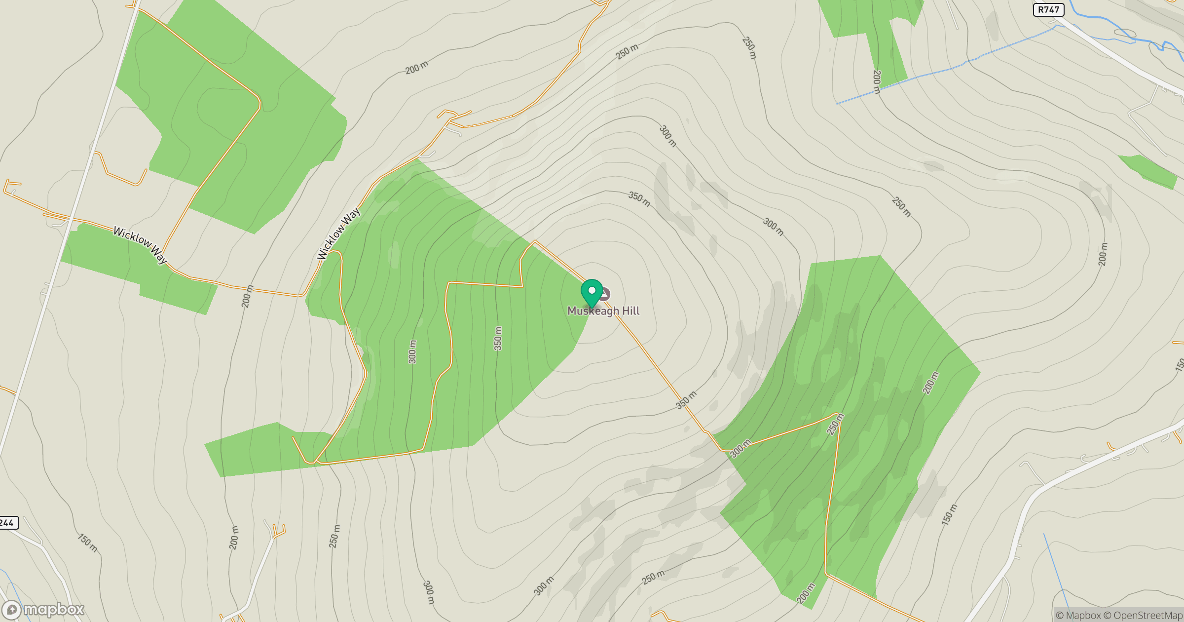
Grid reference: T011729
View on OpenStreetMapOpens a map in a new tab, centred on the hill.
Hills within 30 km
Straight-line distance, not a walking route or confirmation of access.
Lugnaquilla [Log na Coille]
925m
Lakeen [Cronelea Hill] [Leaicin]
357m
Seskin [An Seisceann]
344m
Annagh Hill [Cnoc an Eanaigh]
454m
Slieveboy [An Sliabh Bui]
422m
No comments yet. Be the first.