
Crockavishane
Good walks are even better shared.
Overview
Crockavishane: A Hidden Gem in Northern Ireland
If you’re looking for a hike that’s off the beaten path yet rewarding, look no further than Crockavishane. Standing at an elevation of 687 meters, this Marilyn offers a refreshing escape into nature. So lace up your hiking boots, and let’s dive into what makes this mountain special.
Geology
Crockavishane is primarily composed of sandstone overlaying layers of shale, representing a dynamic geological history. The ancient seabeds and volcanic activity that have shaped this landscape add to its rugged charm. You might even spot some fascinating rock formations that give it character!
Routes
The recommended route to the summit is the Crockavishane Loop. Covering approximately 6.5 km, this moderate trail allows you to experience diverse scenery and wildlife. Expect about 3 hours of adventuring, perfect for a leisurely day out.
Summit Features
Upon reaching the summit, you’ll find a small stone cairn. It's the perfect spot to catch your breath and snap a few photos to make your friends envious. Just be cautious of that selfie stick; you don’t want to knock down the cairn!
Terrain Type
Crockavishane isn’t all smooth hiking; you’ll encounter grassy fields and rocky outcrops, especially near the summit. This variety adds an element of excitement to your hike—just watch your step!
Views
The panoramic views from the top are nothing short of spectacular. Gaze out over the Sperrin Mountains and, if visibility permits, you might even spot the Mourne Mountains lurking in the distance. Spring and early autumn present the best conditions for these views, although winter brings a whimsical snow-covered beauty.
Hazards
While the hike is thoroughly enjoyable, do be aware of the uneven terrain that could lead to tripping if you’re not paying attention. The weather can change faster than a cat on a hot tin roof, especially in the winter months, so it's wise to check forecasts before heading out.
Nearby Summits
After conquering Crockavishane, you may want to tackle some of its neighbors. Notable nearby peaks include:
- Slieve Gallion (573 m)
- Loughermore (432 m)
Access
To access the trail, you can park near the road entrance to the Crockavishane Loop. There’s enough space for several cars, but it might fill up quickly on sunny weekends. While public transport isn’t the most viable option, you can find a bus stop in Draperstown, located about 8 km away. Draperstown serves as the nearest town, complete with cafes to refuel after your hike.
Facilities
The nearest facilities, including cafes and toilets, can be found in Draperstown. So, if you can’t function without your coffee fix, you know where to go!
History
The name Crockavishane translates to 'Maisin's hill' from the Irish Cnoc Mhaisín, hinting at its cultural significance. The local area is rich in history with trails once used by ancient travelers winding their way through the hills.
Whether you’re a seasoned hiker or a weekend warrior, Crockavishane awaits your exploration. Don’t forget your map and a good sense of humour—you might need both on your journey!
Explore routes near Crockavishane
Public walks starting within 80 km of this hill. Nearby does not mean a route reaches the summit; check its map and access before setting out.
Derry~Londonderry City Walls Circuit
View route
Banagher Glen and Forest: complete higher-return circuit
View route
Portballintrae to Giant's Causeway: railway path and Blue Trail return
View route
Route planning notes
These notes describe possible approaches, not verified navigable routes or permission to cross land. Check current paths, local access rules and conditions before setting out.
Crockavishane Loop
A circuitous route starting from the nearest public road, offering scenic views and a moderate ascent.
Make a day of it, together
Find someone to share the walk with, or organise a day out along a route you like.
Hill facts and local notes
Classifications
Elevation
322m
1,056 ft
Prominence
116m
Coordinates
55.2011, -7.1103
C567397
OS Map
03
At the Summit
The summit is marked by a small stone cairn, providing a great photo opportunity—so don’t forget your camera!
Terrain & Geology
Crockavishane is primarily composed of sandstone with layers of shale, resulting in a fascinating blend of rock types that tell a geological story of ancient seabeds and volcanic activity.
Views & Scenery
From the summit, you can enjoy sweeping views of the Sperrin Mountains and, on a clear day, even catch a glimpse of the distant Mourne Mountains.
History & Heritage
Name Origin
The name Crockavishane is derived from the Irish 'Cnoc Mhaisín', meaning 'Maisin's hill'.
Historical Significance
The area around Crockavishane has historical significance, with ancient trails that were once used by local communities.
Getting There & Facilities
Check current local access restrictions, parking rules and transport timetables before travelling. These notes do not confirm public access to the summit.
Parking
Parking is available at the road entrance to the Crockavishane Loop, accommodating several vehicles.
Public Transport
Public transport options are limited; car travel is recommended. Nearest bus stop is in the village of Draperstown about 8 km away.
Nearby Facilities
The nearest facilities, including cafes and toilets, are located in Draperstown.
Safety Information
Known Hazards
- Uneven terrain can pose tripping hazards, and conditions can change rapidly, especially in winter months.
General Safety Tips
- Check weather conditions before setting out
- Carry appropriate clothing and equipment
- Let someone know your planned route
- Take a map, compass, and GPS device
- Carry emergency supplies: food, water, first aid kit, torch
Hills
Some common questions about the hills answered
Are there group walks up Crockavishane?
Many walkers use Walkmates to join or organise walks with others. You can check for group walks around Crockavishane through the maps
Are there other walkers around Crockavishane?
Activity varies by location and time, but Walkmates lets you see whether others have shared walks or shown interest in this area. Find other people through the walking friends search walking friends for Crockavishane search or of course create your own walk for Crockavishane
Can I organise a walk to Crockavishane?
Yes. If there aren’t any walks listed already, you can create a walk and make it available for others to join.
If you're signed up to Walkmates, you can create a walk to Crockavishane.
How do I find a walk up this hill?
There are often multiple ways to walk this hill, depending on experience and route preference. Walkmates helps you explore walks and routes that others have shared.
Can I suggest a new route up Crockavishane?
Yes. You can suggest or create routes to share with others. Walkmates focuses on the social side of walking, so routes are used to help people organise walks and explore areas together, rather than as detailed navigation tools or route libraries.
Other uses really appreciate knowledgeable walkers sharing their routes. Share your favourite route to Crockavishane here
The is an error or something incorrect about this hill. How do I let you know?
We always strive to keep the information on Walkmates as accurate as possible. If you find an error, please let us know through the contact form and we'll aim to correct it as quickly as possible
Community Discussion
Comments
Location
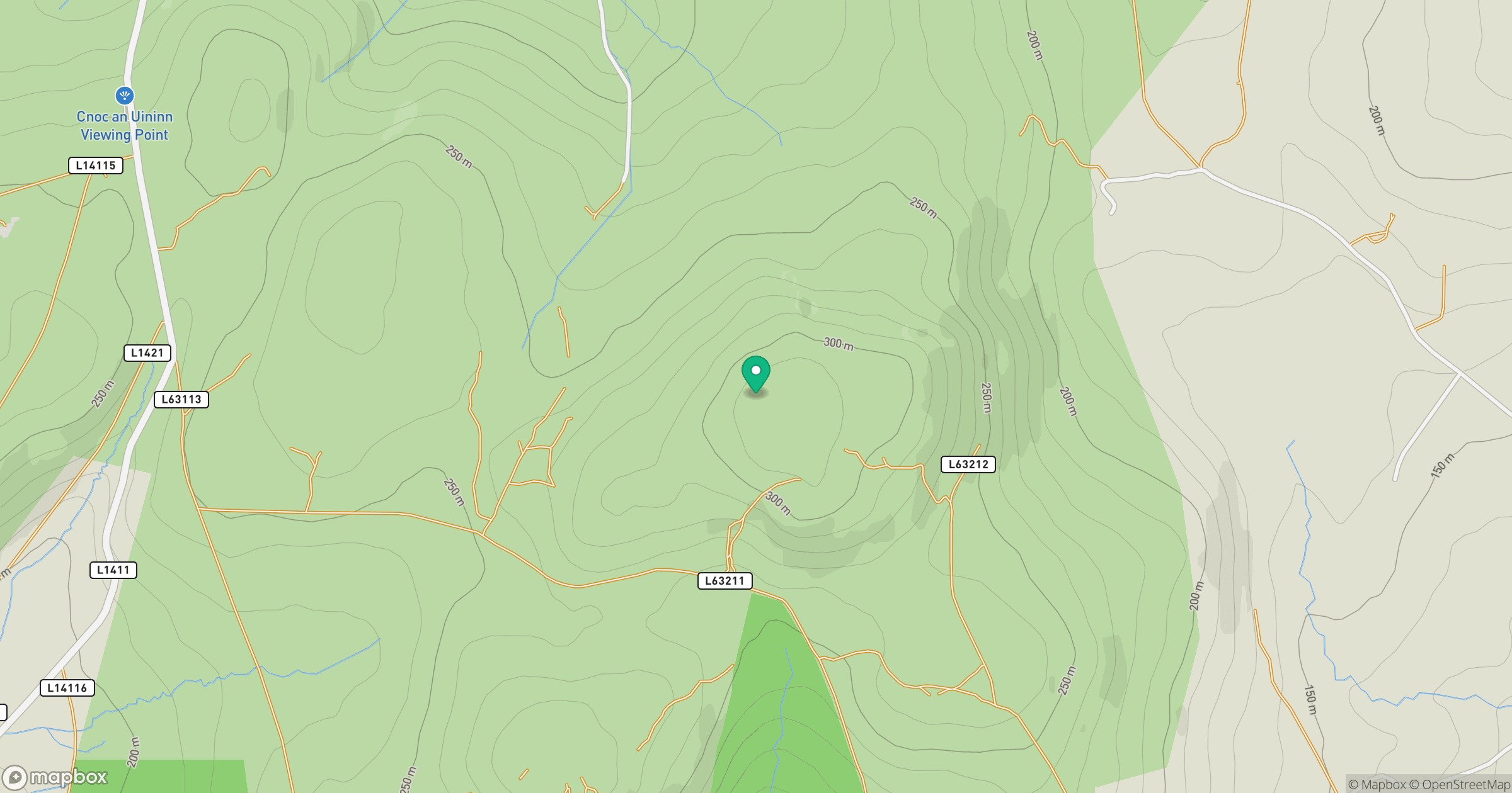
Grid reference: C567397
View on OpenStreetMapOpens a map in a new tab, centred on the hill.
Hills within 30 km
Straight-line distance, not a walking route or confirmation of access.
Binevenagh
385m
Grinlieve [Cruinnshliabh]
371m
Crocknasmug
328m
Eskaheen Mountain [Sliabh Uisce Chaoin]
420m
Slieve Snaght [Sliabh Sneachta]
615m
No comments yet. Be the first.