
Cloghnagaune
Good walks are even better shared.
Overview
Cloghnagaune: A Hidden Gem in the Caha Mountains
Cloghnagaune, standing tall at 661 meters, is a splendid peak nestled in the Caha Mountains of County Kerry. Known for its striking vistas and diverse terrain, this Hewitt offers both a moderate challenge and a rewarding experience.
Geology
The geology of Cloghnagaune showcases an intricate mix of schist and granite. Picture the earth being pushed, pulled, and sculpted over millions of years, leaving us with these fascinating rock formations. You might even spot some distinct lichens adorning the rocks, which could be the mountain's way of saying, “Don’t forget to appreciate nature!”
Routes
The Cloghnagaune Trail is arguably the most popular way to the summit, starting from Castletownbere. Spanning 8.5 kilometres, this route takes approximately 3.5 hours to complete, making it a perfect half-day adventure. Expect a few ups and downs as you tread through rocky areas intertwined with lush grassy patches.
Summit Features
As you reach the summit, you're greeted by a prominent rock outcrop that stands like a tiny fortress. Alongside it, a small cairn beckons weary hikers to take a moment and enjoy the view—after all, you’ve earned it!
Terrain Type
The terrain is predominantly rocky, coupled with sections of soft grass ideal for taking a breather or a cheeky snack break. Just be mindful of those annoyingly loose stones underfoot—they’ve been known to attempt a tango with unsteady feet!
Views
The highlight from the top has to be the panoramic vista watching over the majestic Sheep's Head Peninsula, the distant contours of the Beara Peninsula, and the twinkling waters of Bantry Bay. For the best views, aim for the spring and autumn when the weather likes to cooperate.
Hazards
No mountain is without its perils! Loose rocks can trip the unwary, and the weather in this region likes to be a bit of a drama queen, changing at a moment’s notice. Always check the forecast, and maybe bring a brolly just in case.
Nearby Summits
For the keen summit-bagger, nearby peaks like Knocknagree and others in the Caha Range will be calling your name, promising additional adventures.
Access
The nearest parking is conveniently located in Castletownbere—just a hop, skip, and a jump from the trailhead. And if you plan on using public transport, check those schedules; they might just make you feel like a wandering minstrel at times!
Facilities
Castletownbere has everything from quaint cafes for a caffeine fix to pubs for a post-hike pint, as well as public toilets to freshen up after your trek.
History
The name Cloghnagaune means 'the stone of the cofin' in Irish, a reminder of the mountain's connection to more solemn pastimes. This region is steeped in folklore, giving every step on the trail an added layer of richness.
So lace up your boots, grab your walking stick, and set forth to Cloghnagaune. An adventure awaits, promising both stunning views and a hearty dose of Irish charm!
Explore routes near Cloghnagaune
Public walks starting within 80 km of this hill. Nearby does not mean a route reaches the summit; check its map and access before setting out.
No public routes are currently listed within 80 km of Cloghnagaune on Walkmates. This does not mean there are no paths here. Explore the map and check local access information before planning a walk.
Route planning notes
These notes describe possible approaches, not verified navigable routes or permission to cross land. Check current paths, local access rules and conditions before setting out.
Cloghnagaune Trail
A well-defined route starting from the village of Castletownbere, leading you up through lush landscapes and rocky terrains to the summit.
Make a day of it, together
Find someone to share the walk with, or organise a day out along a route you like.
Hill facts and local notes
Classifications
Elevation
380m
1,247 ft
Prominence
113m
Coordinates
52.9433, -6.6248
S925889
OS Map
62
At the Summit
At the summit, you will find a prominent rock outcrop and a small cairn, both often mistaken for a miniature mountain. On a clear day, you can see the surrounding peaks and the wild Atlantic Ocean stretching out in the distance.
Terrain & Geology
Cloghnagaune primarily features schist and granite, giving rise to some interesting rock formations and splendid scenic views. This geological combination is a classic example of Ireland's tumultuous geological history, marked by ancient tectonic activities.
Views & Scenery
From the summit, you can spot the majestic Sheep's Head Peninsula, the distant Beara Peninsula, and even the shimmering waters of Bantry Bay on a clear day.
History & Heritage
Name Origin
The name 'Cloghnagaune' derives from the Irish 'Cloch na gCuain', meaning 'the stone of the cofin,' hinting at its historical significance during past funerary rites.
Historical Significance
Historically, this area is rich with tales of folklore and ancient rituals, making it a route that connects hikers not just to nature but also to the echoes of history.
Getting There & Facilities
Check current local access restrictions, parking rules and transport timetables before travelling. These notes do not confirm public access to the summit.
Parking
Parking is available in Castletownbere, along the main street with easy access to the trailhead.
Public Transport
Buses run from larger towns in County Cork, but it's advisable to check the latest schedules as they can be infrequent.
Nearby Facilities
In Castletownbere, you'll find cafes, pubs, and public toilets. It's the perfect spot to grab a pre-hike coffee or a post-hike pint!
Safety Information
Known Hazards
- Be wary of loose rocks, especially on the steeper sections. The weather can change quickly; be prepared for sudden showers.
General Safety Tips
- Check weather conditions before setting out
- Carry appropriate clothing and equipment
- Let someone know your planned route
- Take a map, compass, and GPS device
- Carry emergency supplies: food, water, first aid kit, torch
Hills
Some common questions about the hills answered
Are there group walks up Cloghnagaune?
Many walkers use Walkmates to join or organise walks with others. You can check for group walks around Cloghnagaune through the maps
Are there other walkers around Cloghnagaune?
Activity varies by location and time, but Walkmates lets you see whether others have shared walks or shown interest in this area. Find other people through the walking friends search walking friends for Cloghnagaune search or of course create your own walk for Cloghnagaune
Can I organise a walk to Cloghnagaune?
Yes. If there aren’t any walks listed already, you can create a walk and make it available for others to join.
If you're signed up to Walkmates, you can create a walk to Cloghnagaune.
How do I find a walk up this hill?
There are often multiple ways to walk this hill, depending on experience and route preference. Walkmates helps you explore walks and routes that others have shared.
Can I suggest a new route up Cloghnagaune?
Yes. You can suggest or create routes to share with others. Walkmates focuses on the social side of walking, so routes are used to help people organise walks and explore areas together, rather than as detailed navigation tools or route libraries.
Other uses really appreciate knowledgeable walkers sharing their routes. Share your favourite route to Cloghnagaune here
The is an error or something incorrect about this hill. How do I let you know?
We always strive to keep the information on Walkmates as accurate as possible. If you find an error, please let us know through the contact form and we'll aim to correct it as quickly as possible
Community Discussion
Comments
Location
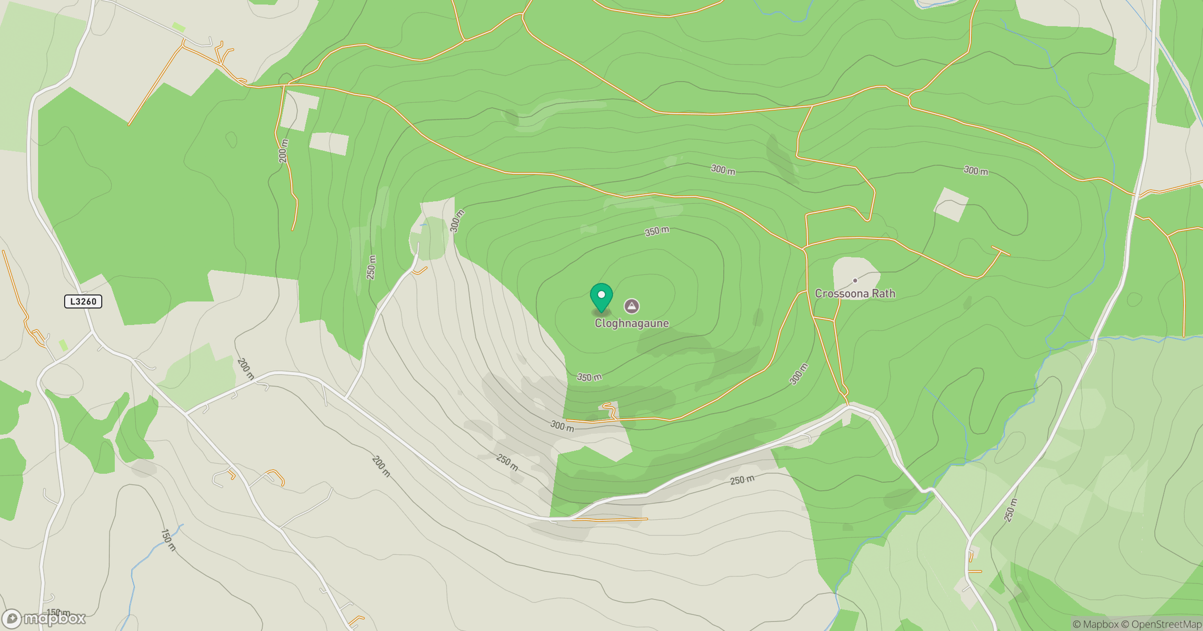
Grid reference: S925889
View on OpenStreetMapOpens a map in a new tab, centred on the hill.
Hills within 30 km
Straight-line distance, not a walking route or confirmation of access.
Lugnaquilla [Log na Coille]
925m
Mullaghcleevaun
847m
Spinans Hill [Eadestown Hill] [Cnoc na Spionan]
408m
Keadeen Mountain
653m
Baltinglass Hill [Pinnacle]
382m
No comments yet. Be the first.