
Clatto Hill
Good walks are even better shared.
Overview
Clatto Hill: An Outdoor Delight
Nestled in the region of Fife, Clatto Hill stands at 169 meters above sea level. Dubbed a 'Marilyn' — a classification for hills with a prominence of at least 150 meters — Clatto Hill offers not just a climb but a slice of Scottish landscape right at your feet.
Geology
With stunning Old Red Sandstone, the hill's geology is both interesting and educational. Dating back to the Devonian era, these rocks tell the tale of a far-off desert landscape and contribute to the unique beauty of the terrain.
Routes
For those looking to lace up their boots, the Clatto Hill Circular route is simply the bee's knees. It’s about 3.5 kilometres long, takes roughly 1.5 hours to complete, and is suitable for all ages — even those reminiscent of a sloth on a Sunday stroll!
Summit Features
At the top, you'll be greeted by a stone trig point and a cheerful cairn — both perfect for a bit of a brag on social media. Who doesn’t like posting views that make their friends green with envy?
Terrain Type
The terrain is mainly grassy, punctuated by rocky sections. The paths are well-defined, making it easy to find your way while avoiding the occasional squish of muddy sections after a downpour.
Views
Prepare for some jaw-dropping views! From the summit, you can feast your eyes upon the stunning Firth of Forth and the distant Scottish Highlands. Late spring and autumn are perfect for catching the best sights. So grab your camera and make sure it's charged — it’s going to be a view to remember!
Hazards
The main hazards include potential mud and, of course, the surprise sheep you might encounter grazing. They’re cute but feisty, so watch your step!
Nearby Summits
If you're feeling adventurous, Balgonie Hill is just a stone's throw away, offering a delightful addition to your hiking itinerary.
Access
Finding Clatto Hill is straightforward. There’s a car park at Clatto Park, with bus services available from Cupar for those without wheels. You'll be just a hop, skip, and a jump away from this glorious ascent!
Facilities
Facilities include public toilets and picnic spots at Clatto Park. If you're in need of snacks post-hike, Cupar has plenty of cafes to quench your appetite.
History
Etymologically, 'Clatto' means 'bank' or 'shore' — indeed, a fitting descriptor for this beloved hill. Historically, it has been a cherished spot for Fife locals, who have long flocked to its heights for exercise, family time, or simply to feign grandiosity while standing atop a hill.
In summary, Clatto Hill is ideal for those seeking a leisurely hike enriched by beautiful landscapes, while also offering a pinch of Scottish charm. So grab your gear, don your comfiest boots, and let Clatto Hill welcome you into its gentle embrace of nature!
Finish strong, and don't forget to take a leap for that summit selfie!
Explore routes near Clatto Hill
Walks starting near this hill. Open a route to check its map, distance and full itinerary.
Tentsmuir Forest: Ice House Trail
View route
Loch Leven: Kinross Pier to RSPB Loch Leven Heritage Trail
View route
Club outing: Crianlarich and West Highland Way (coach departure)
View route
Club outing: Glen Ogle and Killin (coach departure)
View route
Route planning notes
These notes describe possible approaches. Check a route's map and access information when planning your walk.
Clatto Hill Circular
A well-marked circular route starting from the car park near the entrance to Clatto Park. It offers a gentle ascent and is suitable for all ages.
Make a day of it, together
Find someone to share the walk with, or organise a day out along a route you like.
Hill facts and local notes
Classifications
Elevation
248m
814 ft
Prominence
92m
Coordinates
56.2468, -3.0413
NO355065
OS Map
59
Explorer: 370
At the Summit
The summit features a distinctive trig point and a stone cairn that offers a perfect Instagram moment — just don’t forget to turn your phone sideways!
Terrain & Geology
Clatto Hill is primarily composed of Old Red Sandstone, characterised by its reddish colours. The rock formations date back to the Devonian period and provide a window into a time when this area was covered by an ancient desert.
Views & Scenery
On a clear day, you can see the Firth of Forth, the Lomond Hills, and even the towering peaks of the Scottish Highlands off in the distance.
History & Heritage
Name Origin
The name 'Clatto' is thought to derive from the Gaelic word 'cladach,' meaning 'bank' or 'shore,' referencing the hill's position.
Historical Significance
Clatto Hill has been a popular local spot for generations, serving as a reminder of the natural beauty of Fife and a favourite for weekend explorers.
Getting There & Facilities
Parking
There is a small car park at Clatto Park (NO355070), where you can find ample space for your car and perhaps even a picnic.
Public Transport
The closest bus stop is in the village of Cupar, with regular services connecting to larger towns. A bit of a walk to reach Clatto Hill, but nothing to shake a walking stick at!
Nearby Facilities
Public toilets and picnic tables can be found at Clatto Park, while the nearby town of Cupar offers shops and cafes for post-hike treats.
Safety Information
Known Hazards
- Occasional muddy sections after rainfall; it's advisable to wear sturdy footwear. Keep an eye out for the sheep that roam the area — they might think they own the place!
General Safety Tips
- Check weather conditions before setting out
- Carry appropriate clothing and equipment
- Let someone know your planned route
- Take a map, compass, and GPS device
- Carry emergency supplies: food, water, first aid kit, torch
Hills
Some common questions about the hills answered
Are there group walks up Clatto Hill?
Many walkers use Walkmates to join or organise walks with others. You can check for group walks around Clatto Hill through the maps
Are there other walkers around Clatto Hill?
Activity varies by location and time, but Walkmates lets you see whether others have shared walks or shown interest in this area. Find other people through the walking friends search walking friends for Clatto Hill search or of course create your own walk for Clatto Hill
Can I organise a walk to Clatto Hill?
Yes. If there aren’t any walks listed already, you can create a walk and make it available for others to join.
If you're signed up to Walkmates, you can create a walk to Clatto Hill.
How do I find a walk up this hill?
There are often multiple ways to walk this hill, depending on experience and route preference. Walkmates helps you explore walks and routes that others have shared.
Can I suggest a new route up Clatto Hill?
Yes. You can suggest or create routes to share with others. Walkmates focuses on the social side of walking, so routes are used to help people organise walks and explore areas together, rather than as detailed navigation tools or route libraries.
Other uses really appreciate knowledgeable walkers sharing their routes. Share your favourite route to Clatto Hill here
The is an error or something incorrect about this hill. How do I let you know?
We always strive to keep the information on Walkmates as accurate as possible. If you find an error, please let us know through the contact form and we'll aim to correct it as quickly as possible
Community Discussion
Comments
Location
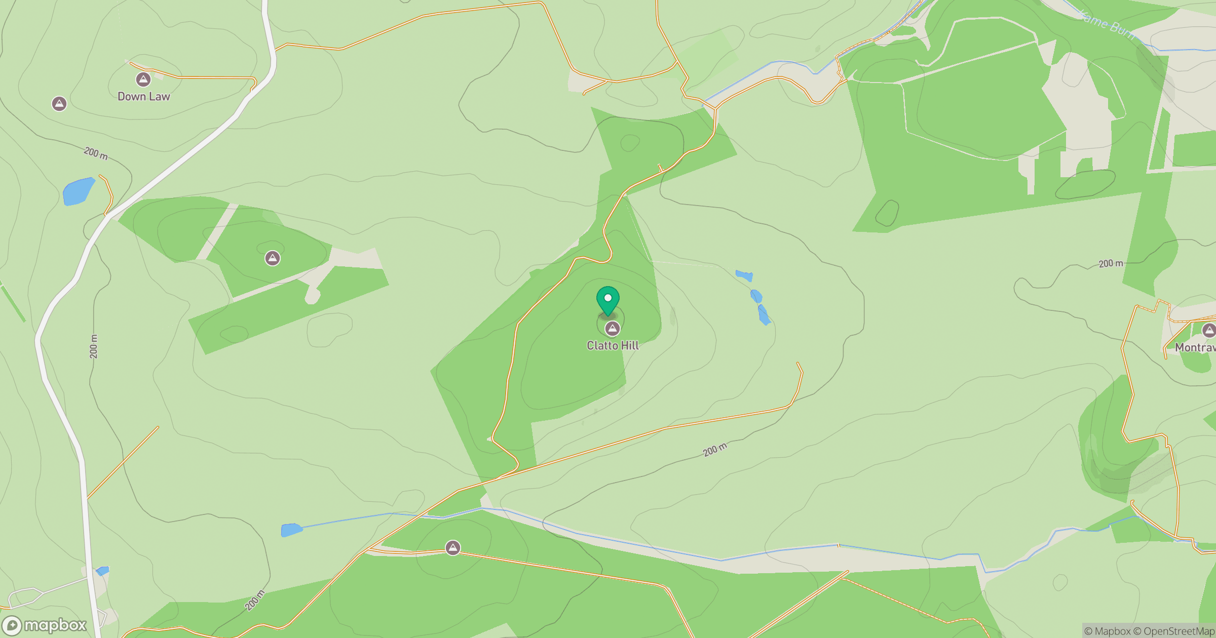
Grid reference: NO355065
View on OpenStreetMapOpens a map in a new tab, centred on the hill.



No comments yet. Be the first.