

Chrishall Common
Good walks are even better shared.
Overview
Chrishall Common
Nestled in the heart of Essex, Chrishall Common is a delightful spot for those looking to escape the bustling urban terrain. Although it's not a mountain in the true sense — more of a flat patch of grassland — it serves as a peaceful retreat brimming with potential.
Geology
The geology of Chrishall Common consists primarily of clay and gravel soils. This combination creates a rich environment for diverse flora and fauna, making it a haven for nature lovers. The lush greenery and picturesque landscape are a delight, especially in the warmer months when wildflowers splash colour against the charming backdrop.
Routes
One of the best ways to experience Chrishall Common is to take the Circular Walk from Chrishall. This easy-going hike stretches around 4.5 km and takes approximately 1.5 hours to complete. You’ll meander through lush fields, greet the occasional sheep, and possibly spot a rabbit or two poking their heads out!
Summit Features
While you won’t find a strict summit per se, the highest points offer beautiful grassy expanses that are perfect for a relaxing picnic. The true charm lies in the entirety of the common’s scenic offerings rather than any towering heights.
Terrain
The terrain is predominantly grassy and flat, interspersed with sandy patches. Ideal for families or those looking for a gentle wander, it's perfect for a leisurely afternoon with loved ones — or simply a spot for solitude and reflection.
Views
From the common, you can enjoy sweeping views over the surrounding fields and quaint countryside. Pay attention to rural life bustling below, as the idyllic English countryside lays out before you like a well-kept garden. The spring and early summer months are undoubtedly the best times to visit, with nature dressed in its finest attire.
Hazards
While it’s generally safe to roam, do be mindful of occasional muddy patches, particularly after rain. Just remember, a well-timed hop could save you from wet socks and a less than graceful descent!
Access
Getting to Chrishall Common is relatively straightforward. The nearest parking can be found on the village outskirts. Public transport options include a train to Bishops Stortford, followed by a short bus ride to the village. Keep in mind the local charm — make sure to park considerately to avoid ruffling feathers!
Nearby Facilities
For refreshments, Chrishall boasts local cafes and a friendly pub. However, be sure to plan as toilet facilities might not be immediately available.
History
The name 'Chrishall' has Old English roots, possibly translating to 'the hall of Christopher' or 'the place of the cross.' Historically, the common has served as a gathering point for locals over the years, used for grazing and community events.
In summary, while Chrishall Common may not offer rugged climbs or steep ascents, it provides a lovely slice of the Essex countryside that definitely shouldn’t be overlooked. Enjoy your visit, and perhaps even pack a lighthearted book for a relaxing afternoon among nature's beauties!
Explore routes near Chrishall Common
Public walks starting within 80 km of this hill. Nearby does not mean a route reaches the summit; check its map and access before setting out.
Bishops Stortford with Men Walking & Talking
View route
Wimpole Estate: Parkland and Farmland Multi-use Circuit
View route
Wandlebury and the Roman Road: Gog Magog woodland and chalk ridge
View route
Hatfield Forest, Takeley Hill and Flitch Way Walk
View route
Route planning notes
These notes describe possible approaches, not verified navigable routes or permission to cross land. Check current paths, local access rules and conditions before setting out.
Circular Walk from Chrishall
A leisurely circular route starting from the quaint village of Chrishall, meandering through scenic countryside and grassy areas.
Make a day of it, together
Find someone to share the walk with, or organise a day out along a route you like.
Photo Gallery
View all Photo could not load
TL4435 : Path towards Oldfield Grove
Roger Cornfoot
 Photo could not load
TL4435 : Wood Anemones, Oldfield Grove
Rob Noble
 Photo could not load
TL4436 : Track between field and wood
Duncan Grey
 Photo could not load
TL4436 : Skirting a snowy field north of Langley
Peter S
 Photo could not load
TL4436 : Edge of Oldfield Grove
Roger Cornfoot
 Photo could not load
TL4436 : Field path by Oldfield Grove, (Essex County top)
Colin Park
 Photo could not load
TL4436 : Track between field and wood
Duncan Grey
 Photo could not load
TL4436 : Oldfield Grove
Roger Cornfoot
 Photo could not load
TL4436 : Footpath Near To Oldfield Grove
Keith Evans

TL4436 : Bluebells in High Wood
Alan Kent
Hill facts and local notes
Classifications
Elevation
147m
482 ft
Prominence
15m
Coordinates
52.0055, 0.1010
TL443361
OS Map
154
Explorer: 194
At the Summit
The common features beautiful grassy landscapes dotted with wildflowers and ancient hedgerows, offering a peaceful picnic spot.
Terrain & Geology
The area is primarily composed of clay and gravel soils, typical of the Essex landscape. This geology contributes to the lush vegetation and diverse habitats found on the common.
Views & Scenery
Views of the surrounding countryside, including fields and farms, ideal for spotting traditional English rural life.
History & Heritage
Name Origin
The name 'Chrishall' is derived from Old English, possibly meaning 'the hall of Christopher' or 'the place of the cross.'
Historical Significance
The common has been a gathering place for locals for centuries, used for grazing livestock and community events.
Getting There & Facilities
Check current local access restrictions, parking rules and transport timetables before travelling. These notes do not confirm public access to the summit.
Parking
Parking is available on the outskirts of Chrishall village, with spaces for a few cars. Please be considerate of locals when parking.
Public Transport
The nearest train station is in Bishops Stortford, followed by a short bus or taxi ride to Chrishall.
Nearby Facilities
There are local cafes and a pub in Chrishall offering refreshments. Toilets may not be available immediately, so plan ahead!
Safety Information
Known Hazards
- Occasional muddy patches after rainfall; keep an eye out for the odd rabbit hole!
General Safety Tips
- Check weather conditions before setting out
- Carry appropriate clothing and equipment
- Let someone know your planned route
- Take a map, compass, and GPS device
- Carry emergency supplies: food, water, first aid kit, torch
Hills
Some common questions about the hills answered
Are there group walks up Chrishall Common?
Many walkers use Walkmates to join or organise walks with others. You can check for group walks around Chrishall Common through the maps
Are there other walkers around Chrishall Common?
Activity varies by location and time, but Walkmates lets you see whether others have shared walks or shown interest in this area. Find other people through the walking friends search walking friends for Chrishall Common search or of course create your own walk for Chrishall Common
Can I organise a walk to Chrishall Common?
Yes. If there aren’t any walks listed already, you can create a walk and make it available for others to join.
If you're signed up to Walkmates, you can create a walk to Chrishall Common.
How do I find a walk up this hill?
There are often multiple ways to walk this hill, depending on experience and route preference. Walkmates helps you explore walks and routes that others have shared.
Can I suggest a new route up Chrishall Common?
Yes. You can suggest or create routes to share with others. Walkmates focuses on the social side of walking, so routes are used to help people organise walks and explore areas together, rather than as detailed navigation tools or route libraries.
Other uses really appreciate knowledgeable walkers sharing their routes. Share your favourite route to Chrishall Common here
The is an error or something incorrect about this hill. How do I let you know?
We always strive to keep the information on Walkmates as accurate as possible. If you find an error, please let us know through the contact form and we'll aim to correct it as quickly as possible
Community Discussion
Comments
Location
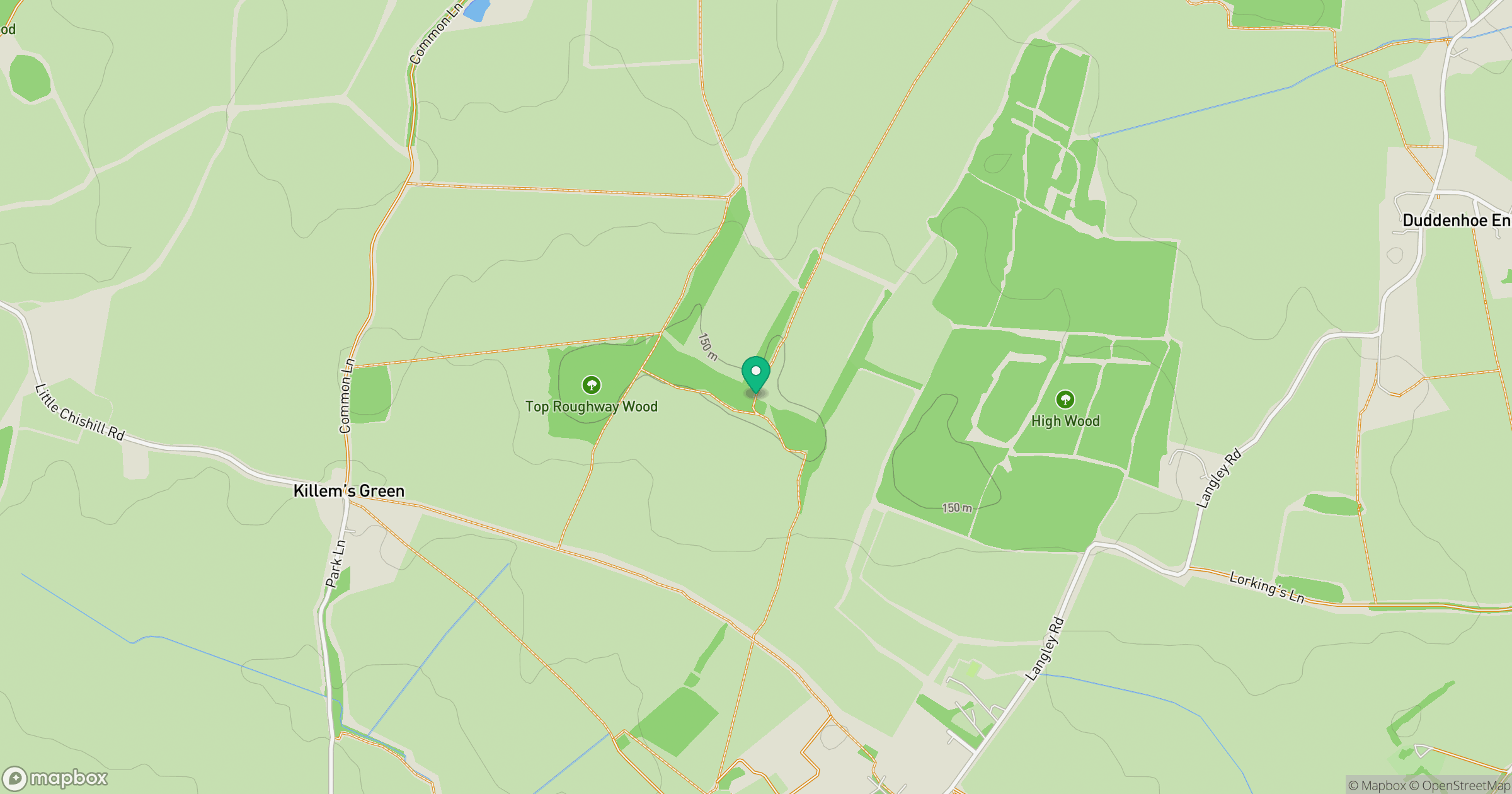
Grid reference: TL443361
View on OpenStreetMapOpens a map in a new tab, centred on the hill.
Hills within 30 km
No other hills are currently listed in this nearby selection. Explore the map for other places to walk.
Explore this area on the map
No comments yet. Be the first.