

Sranndabhal
Good walks are even better shared.
Overview
Sranndabhal: A Hidden Gem in the Outer Hebrides
Sranndabhal, perched grandly in the Outer Hebrides, may not be the tallest mountain in the Hebrides, but it certainly holds its own with stunning views and access to a wide variety of landscapes.
Geology
Sranndabhal is primarily formed from ancient Lewisian Gneiss. This intriguing rock type dates back over 3 billion years, making it a witness to geological events that shaped our planet. The mountain's formation by glacial activity has produced unique features and captivating scenery.
Routes
One of the most popular routes starts from the B8011 road and covers a distance of approximately 3.5 km. The path, while generally well-defined, contains a few challenging steeper sections. It's ideal for those with a moderate level of experience but do bring your spirit of adventure!
Summit Features
Upon reaching the summit, hikers are greeted by a sturdy stone cairn—perfect for your post-hike selfies. Be sure to take a moment to appreciate stunning views that make the climb worthwhile.
Terrain
Expect a thrilling mix of rocky outcrops and grassy slopes. Some areas may be boggy, which could prove a bit tricky. Hence, good boots are essential!
Views
Sranndabhal's summit provides breathtaking panoramas of the Harris Hills and, on a clear day, the Isle of Skye appears in the distance. The best time for these views? Late spring and early autumn, when the skies are most cooperative and the landscape puts on its finest show.
Hazards
Weather can change from sunny to stormy quicker than you can say 'Scottish weather.' Ensure you're equipped to deal with shifting conditions. Be cautious as some paths can be slippery.
Nearby Summits
If you're in the mood for more mountain adventures, consider Clisham and Beinn na h-Aire, both of which provide an excellent challenge and more incredible views.
Access
The nearest parking is a small layby along the B8011. Public transport is limited but runs occasionally from Tarbet to the Isle of Harris. Tarbet, about 8 km away, offers cafes and shops to stock up on essentials.
Facilities
A stop in Tarbet is a treat with several local cafes serving coffee, cakes, and hearty meals to refuel your energy after tackling Sranndabhal.
History
The name 'Sranndabhal' means 'the mound of the village,' reflecting its historical importance. This region is steeped in Gaelic culture, with tales of its past echoing through its hills.
In conclusion, Sranndabhal might be just a Marilyn, but it’s a splendid journey for any outdoor enthusiast. Make sure to bring a camera, good boots, and a sense of adventure—it’s bound to be a real cracker of a hike!
Happy hiking!
Explore routes near Sranndabhal
Public walks starting within 80 km of this hill. Nearby does not mean a route reaches the summit; check its map and access before setting out.
Berneray Community Hall to the beautiful beach
View route
Beautiful private beach walk Isle of Harris
View route
Dun Mhulan Broch Quick Walk
View route
Fairy Lochs Liberator Wreckage Circuit
View route
Route planning notes
These notes describe possible approaches, not verified navigable routes or permission to cross land. Check current paths, local access rules and conditions before setting out.
From the B8011 Road
A well-trodden path starts from the B8011 road, leading hikers gently uphill before tackling a few steeper sections. The path is mostly clear, with occasional boulders to navigate.
Make a day of it, together
Find someone to share the walk with, or organise a day out along a route you like.
Photo Gallery
View all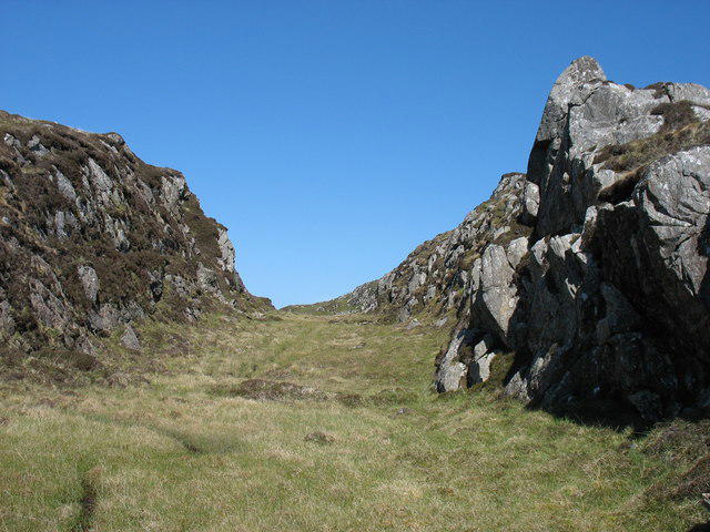 Photo could not load
NG0384 : Gully on Sranndaval
David Purchase
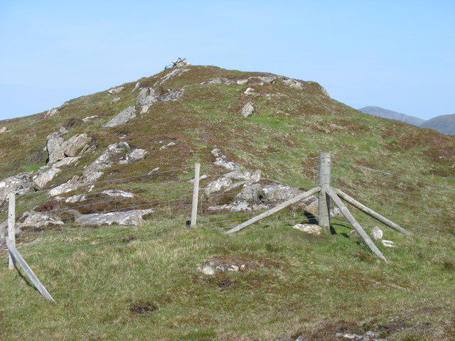 Photo could not load
NG0384 : The summit cairn on Sranndaval
David Purchase
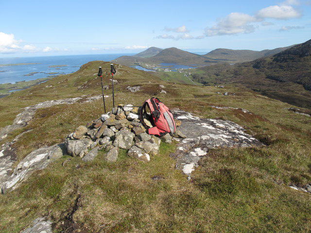 Photo could not load
NG0384 : Sranndabhal Summit View
Rude Health
Hill facts and local notes
Classifications
Elevation
211m
692 ft
Prominence
143m
Coordinates
57.7513, -6.9833
NG036844
OS Map
18
Explorer: 455
At the Summit
At the summit, you'll find a sturdy stone cairn marking the highest point, a perfect backdrop for a celebratory selfie. Don’t forget to check for the signature view of the surrounding islands before you leave!
Terrain & Geology
Sranndabhal is primarily composed of Lewisian Gneiss, one of the oldest rock types in the UK, giving it a unique rugged texture. The mountain’s landscape is shaped by glacial activity, contributing to its striking features and beautiful vistas.
Views & Scenery
From Sranndabhal's summit, you can admire panoramic views of the Harris Hills, the vast Atlantic Ocean, and if you squint just right, the Isle of Skye in the distance.
History & Heritage
Name Origin
Sranndabhal's name is derived from the Gaelic 'Sran na Baile,' which translates to 'the mound of the village,' hinting at its historical importance to the local community.
Historical Significance
The area is rich in Scottish Gaelic culture and history, with stories of shepherds and wildlife that have roamed these hills for centuries.
Getting There & Facilities
Check current local access restrictions, parking rules and transport timetables before travelling. These notes do not confirm public access to the summit.
Parking
There is a small layby located along the B8011 road which can accommodate several cars, but be sure to arrive early to secure a spot.
Public Transport
The nearest bus service runs from Tarbet to Isle of Harris, with a bus stop near the B8011, though infrequent. Be sure to check the schedule in advance!
Nearby Facilities
Tarbet has several cafes and a small shop for anything you may need before or after your hike, including the essentials like coffee and cake!
Safety Information
Known Hazards
- Be cautious of sudden weather changes; conditions can shift quickly in the Outer Hebrides. Additionally, some paths may be slippery, especially in wet conditions.
General Safety Tips
- Check weather conditions before setting out
- Carry appropriate clothing and equipment
- Let someone know your planned route
- Take a map, compass, and GPS device
- Carry emergency supplies: food, water, first aid kit, torch
Hills
Some common questions about the hills answered
Are there group walks up Sranndabhal?
Many walkers use Walkmates to join or organise walks with others. You can check for group walks around Sranndabhal through the maps
Are there other walkers around Sranndabhal?
Activity varies by location and time, but Walkmates lets you see whether others have shared walks or shown interest in this area. Find other people through the walking friends search walking friends for Sranndabhal search or of course create your own walk for Sranndabhal
Can I organise a walk to Sranndabhal?
Yes. If there aren’t any walks listed already, you can create a walk and make it available for others to join.
If you're signed up to Walkmates, you can create a walk to Sranndabhal.
How do I find a walk up this hill?
There are often multiple ways to walk this hill, depending on experience and route preference. Walkmates helps you explore walks and routes that others have shared.
Can I suggest a new route up Sranndabhal?
Yes. You can suggest or create routes to share with others. Walkmates focuses on the social side of walking, so routes are used to help people organise walks and explore areas together, rather than as detailed navigation tools or route libraries.
Other uses really appreciate knowledgeable walkers sharing their routes. Share your favourite route to Sranndabhal here
The is an error or something incorrect about this hill. How do I let you know?
We always strive to keep the information on Walkmates as accurate as possible. If you find an error, please let us know through the contact form and we'll aim to correct it as quickly as possible
Community Discussion
Comments
Location
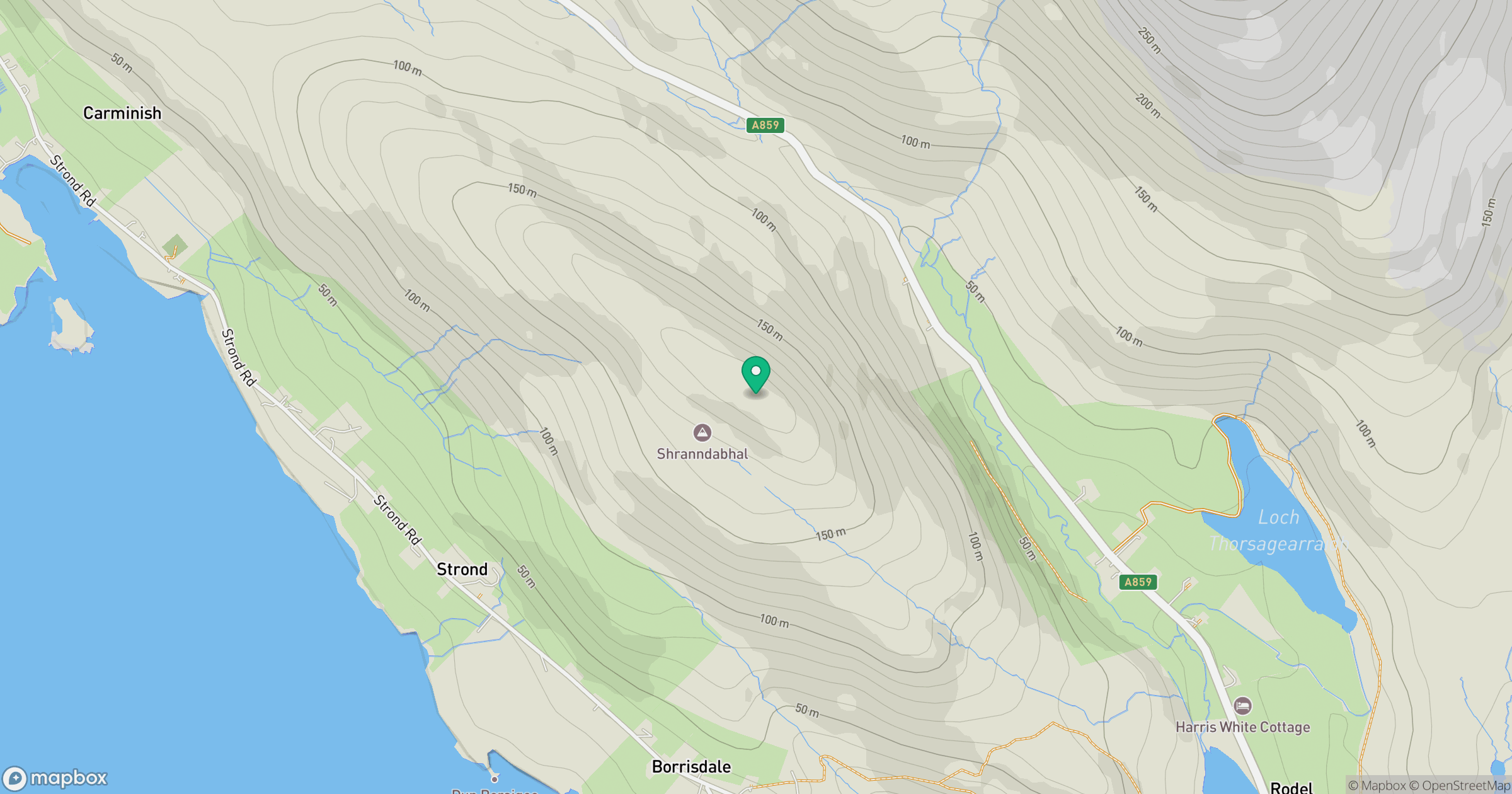
Grid reference: NG036844
View on OpenStreetMapOpens a map in a new tab, centred on the hill.
Hills within 30 km
Straight-line distance, not a walking route or confirmation of access.
No comments yet. Be the first.