

Castle Camps airfield
Good walks are even better shared.
TL6341 : Old Runway
Keith Evans Photo source
Overview
Castle Camps Airfield
Introduction
Castle Camps airfield, located in East Anglia, is a fascinating historical location that served as a military airfield during World War II. While it doesn’t quite soar to mountain heights, it certainly hovers above fascinating history!
Geology
The geology around Castle Camps features clay and sandstone. If you enjoy soil study or simply appreciate a good squelch, this area will not disappoint. The fertile lands have supported agriculture through the years, producing a lush green landscape that is pleasant for wandering.
Walking Routes
For a gentle stroll, the Castle Camps Loop offers a perfect opportunity. This 5 km route is an easy walk that encapsulates the beauty of the surroundings. You’ll find the path well-marked and suitable for all hiking abilities.
Summit Features
Now, let’s be clear, there aren’t any conventional summit features here; no lofty peaks or daunting climbs. However, remnants of its WWII past can be spotted, and that’s certainly a conversation starter! The wide-open spaces provide some lovely views of the landscape, making it a delight for casual outings.
Terrain
The terrain is primarily grass and dirt paths, with a bit of gravel here and there. It's a pleasant walk that beckons you to explore further.
Views
From the airfield, you can soak in the picturesque rolling hills of East Anglia. Look out for the pretty villages dotting the landscape—perfect for those postcard moments. The best months to enjoy the scenery are spring and early autumn when the fields are alive with colour.
Hazards
Be cautious of the odd farm vehicle that may cross your path, and keep an eye on the weather, as rains can turn paths muddy.
Access
Getting to Castle Camps is fairly straightforward. There’s ample parking available at the airfield, and you can conveniently reach it via public transport from Cambridge. The village of Castle Camps is just a stone's throw away if you need refreshments or a friendly chat.
Facilities
Facilities nearby are limited, with a few cosy cafes and pubs in Castle Camps. Don't count on finding toilets directly on-site, so do your business before you wander!
History
The name Castle Camps hints at its historical significance, as 'caester' implies it was once a fort. The airfield’s role during WWII gives it a special place in the local narrative, adding layers of significance for history enthusiasts and all who visit.
Conclusion While Castle Camps airfield may not boast the rugged heights of famous mountains, it offers a delightful mix of history, scenic beauty, and easy-going trails for hikers and outdoor lovers alike. So lace up your boots, grab your walking stick, and don’t forget the snacks—adventure awaits!
Happy hiking!
Explore routes near Castle Camps airfield
Walks starting near this hill. Open a route to check its map, distance and full itinerary.
Clare and Chilton Street: Upper Common, Sheepgate Lane and streamside circuit
View route
Fulbourn Fen and Fleam Dyke: chalk ridge to Mutlow Hill
View route
Wandlebury and the Roman Road: Gog Magog woodland and chalk ridge
View route
Dalham: Brick Kiln Wood, Desning Hall Barn and Leipsic Wood
View route
Route planning notes
These notes describe possible approaches. Check a route's map and access information when planning your walk.
Castle Camps Loop
A gentle loop walking route around the airfield, offering lovely views of the surrounding countryside.
Make a day of it, together
Find someone to share the walk with, or organise a day out along a route you like.
Photo Gallery
View all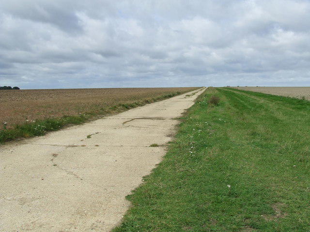 Photo could not load
TL6341 : Old Runway
Keith Evans
Hill facts and local notes
Classifications
Elevation
128m
420 ft
Prominence
21m
Coordinates
52.0511, 0.3797
TL632418
OS Map
154
Explorer: 210
At the Summit
The airfield itself doesn't have traditional summit features, but remains a fascinating historical site with several remnants of WWII architecture. From the vantage points, you can spot the landing strips that date back to its operational days.
Terrain & Geology
The area around Castle Camps is primarily made up of clay and sandstone, with fertile soils that have been used for agriculture over the centuries. The landscape has gently undulating hills, typical of the Cambs and Essex region.
Views & Scenery
The rolling hills of East Anglia and the quaint countryside, with glimpses of nearby villages and farmlands.
History & Heritage
Name Origin
Castle Camps is derived from the Old English 'caester' for fort, indicating its historical importance.
Historical Significance
The airfield played a significant role during World War II, serving as a base for various military operations. Today, it stands as a reminder of the area's rich aviation history.
Getting There & Facilities
Parking
There is a designated parking area at the entrance of Castle Camps. It's quite spacious, but gets busy on weekends.
Public Transport
The nearest train station is in Cambridge, from where you can take a bus that stops near the airfield.
Nearby Facilities
There are limited local facilities in Castle Camps, with a couple of small cafes and pubs. Toilets may not be available directly at the airfield, so plan accordingly.
Safety Information
Known Hazards
- Occasional farm vehicles on access roads; be mindful of weather conditions that can make paths muddy.
General Safety Tips
- Check weather conditions before setting out
- Carry appropriate clothing and equipment
- Let someone know your planned route
- Take a map, compass, and GPS device
- Carry emergency supplies: food, water, first aid kit, torch
Hills
Some common questions about the hills answered
Are there group walks up Castle Camps airfield?
Many walkers use Walkmates to join or organise walks with others. You can check for group walks around Castle Camps airfield through the maps
Are there other walkers around Castle Camps airfield?
Activity varies by location and time, but Walkmates lets you see whether others have shared walks or shown interest in this area. Find other people through the walking friends search walking friends for Castle Camps airfield search or of course create your own walk for Castle Camps airfield
Can I organise a walk to Castle Camps airfield?
Yes. If there aren’t any walks listed already, you can create a walk and make it available for others to join.
If you're signed up to Walkmates, you can create a walk to Castle Camps airfield.
How do I find a walk up this hill?
There are often multiple ways to walk this hill, depending on experience and route preference. Walkmates helps you explore walks and routes that others have shared.
Can I suggest a new route up Castle Camps airfield?
Yes. You can suggest or create routes to share with others. Walkmates focuses on the social side of walking, so routes are used to help people organise walks and explore areas together, rather than as detailed navigation tools or route libraries.
Other uses really appreciate knowledgeable walkers sharing their routes. Share your favourite route to Castle Camps airfield here
The is an error or something incorrect about this hill. How do I let you know?
We always strive to keep the information on Walkmates as accurate as possible. If you find an error, please let us know through the contact form and we'll aim to correct it as quickly as possible
Community Discussion
Comments
Location
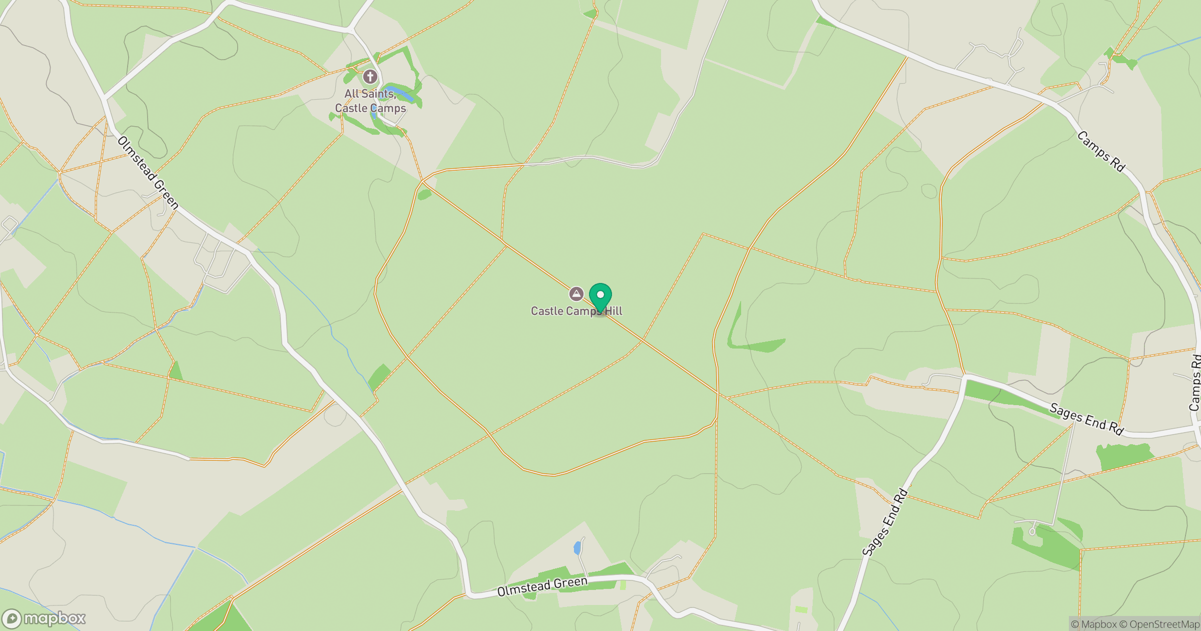
Grid reference: TL632418
View on OpenStreetMapOpens a map in a new tab, centred on the hill.

No comments yet. Be the first.