

Broad Moss
Good walks are even better shared.
Overview
Broad Moss: A Hidden Gem of the Southern Uplands
Broad Moss may not be the tallest of peaks, but it encapsulates the essence of the Southern Uplands with its stunning scenery and diverse wildlife.
Geology
The geological tapestry of Broad Moss is woven with layers of sandstone and shale, offering a fascinating glimpse into a distant past where ancient seas once lapped at the shore. It’s a geologist's paradise, or at least it would be if they weren’t busy lugging around heavy equipment!
The Route
Starting from Glencaple, embark on the Broad Moss Circular route—an engaging hike that rewards adventurers with breathtaking views and the joy of exploring scenic moorlands. Spanning approximately 10.5 km, seasoned hikers can enjoy this moderate trek in about 3.5 hours, allowing plenty of time for those 'ooh' and 'aah' moments at the vistas.
Summit Features
Upon reaching the summit, a simple cairn awaits, marking your triumph. Take a moment to look around; you may even be greeted by the local wildlife asking for your lunch (just kidding!).
Terrain Type
Brace yourself for moorland that can be as tricky as a cat on a hot tin roof! Keep an eye out for boggy patches; they might seem inviting but are best left to the ducks.
Views
From the top, your eyes will feast upon the splendid Solway Firth and the rolling hills of the Criffel range. On clear days, squint and you might even spot the grand peaks of the Lake District in the distance.
Hazards
Beware of the bogs! It’s best to keep a keen eye on your footing. A boot full of water is not the perfect souvenir.
Access
For those driving, there's ample parking available at Glencaple, with public transport options from Dumfries—making this adventure more accessible. The nearest town to stock up on supplies is Dumfries, which is packed with charming cafes and shops to fuel your hike and reward your efforts.
Facilities
Post-hike, treat yourself at one of the local cafes back in Dumfries, where you can trade stories of your adventure over a warm cuppa and a slice of cake.
History
The name 'Broad Moss' itself is a nod to the lush heathland that adorns its slopes, steeped in local folklore and tales of the ancient grazing practices of the area.
In conclusion, Broad Moss may just be the mountain you never knew you were missing. With its charming scenery, varied terrain, and a sprinkle of local history, it’s a great option for a day out in the Southern Uplands.
Happy hiking!
Explore routes near Broad Moss
Public walks starting within 80 km of this hill. Nearby does not mean a route reaches the summit; check its map and access before setting out.
Unled club outing: Glenesk (coach departure)
View route
Unled club outing: Xmas Walk - Bankfoot - Dunkeld (coach departure)
View route
Unled club outing: Angus coastal walk (coach departure)
View route
Unled club outing: Glen Moy/Glenogil (shared-car departure)
View route
Route planning notes
These notes describe possible approaches, not verified navigable routes or permission to cross land. Check current paths, local access rules and conditions before setting out.
Broad Moss Circular
A scenic circular route that showcases the moorland beauty and wildlife, starting and ending at the nearby village of Glencaple.
Make a day of it, together
Find someone to share the walk with, or organise a day out along a route you like.
Photo Gallery
View all Photo could not load
NO1947 : Triangulation Point on Broad Moss near Rattray
Sylvia Barrow
 Photo could not load
NO1947 : Ordnance Survey Trig Pillar S7123 (Broad Moss)
Peter Wood
 Photo could not load
NO1947 : Broad Moss, Blairgowrie, from the east
Mike Pennington
 Photo could not load
NO1947 : Broad Moss Trig Pillar
Scott Cormie
Hill facts and local notes
Classifications
Elevation
299m
981 ft
Prominence
66m
Coordinates
56.6163, -3.3182
NO192479
OS Map
53
Explorer: 381
At the Summit
The summit features a modest cairn constructed from local stone, giving hikers a sense of accomplishment once they reach the top.
Terrain & Geology
Predominantly composed of sedimentary rocks, with layers of sandstone and shale that shaped the area's distinctive landforms, Broad Moss offers a glimpse into the geological history of the Southern Uplands.
Views & Scenery
Expansive views of the Solway Firth, the Criffel hills, and on clear days, the distant peaks of the Lake District can be spotted on the horizon.
History & Heritage
Name Origin
The name 'Broad Moss' derives from the characteristic mossy heathland that covers its slopes.
Historical Significance
The area around Broad Moss has been a traditional grazing ground for centuries and is rich in local folklore.
Getting There & Facilities
Check current local access restrictions, parking rules and transport timetables before travelling. These notes do not confirm public access to the summit.
Parking
Parking is available at Glencaple village, just a short walk from the trailhead.
Public Transport
Buses run from Dumfries to Glencaple, with a short walk to the trail start.
Nearby Facilities
There are local cafes and shops in Dumfries for pre-hike snacks and post-hike refreshments, and public toilets are available in the town.
Safety Information
Known Hazards
- Boggy ground can be treacherous, particularly after heavy rain. Watch your step or you might find your boots have gone for a swim!
General Safety Tips
- Check weather conditions before setting out
- Carry appropriate clothing and equipment
- Let someone know your planned route
- Take a map, compass, and GPS device
- Carry emergency supplies: food, water, first aid kit, torch
Hills
Some common questions about the hills answered
Are there group walks up Broad Moss?
Many walkers use Walkmates to join or organise walks with others. You can check for group walks around Broad Moss through the maps
Are there other walkers around Broad Moss?
Activity varies by location and time, but Walkmates lets you see whether others have shared walks or shown interest in this area. Find other people through the walking friends search walking friends for Broad Moss search or of course create your own walk for Broad Moss
Can I organise a walk to Broad Moss?
Yes. If there aren’t any walks listed already, you can create a walk and make it available for others to join.
If you're signed up to Walkmates, you can create a walk to Broad Moss.
How do I find a walk up this hill?
There are often multiple ways to walk this hill, depending on experience and route preference. Walkmates helps you explore walks and routes that others have shared.
Can I suggest a new route up Broad Moss?
Yes. You can suggest or create routes to share with others. Walkmates focuses on the social side of walking, so routes are used to help people organise walks and explore areas together, rather than as detailed navigation tools or route libraries.
Other uses really appreciate knowledgeable walkers sharing their routes. Share your favourite route to Broad Moss here
The is an error or something incorrect about this hill. How do I let you know?
We always strive to keep the information on Walkmates as accurate as possible. If you find an error, please let us know through the contact form and we'll aim to correct it as quickly as possible
Community Discussion
Comments
Location
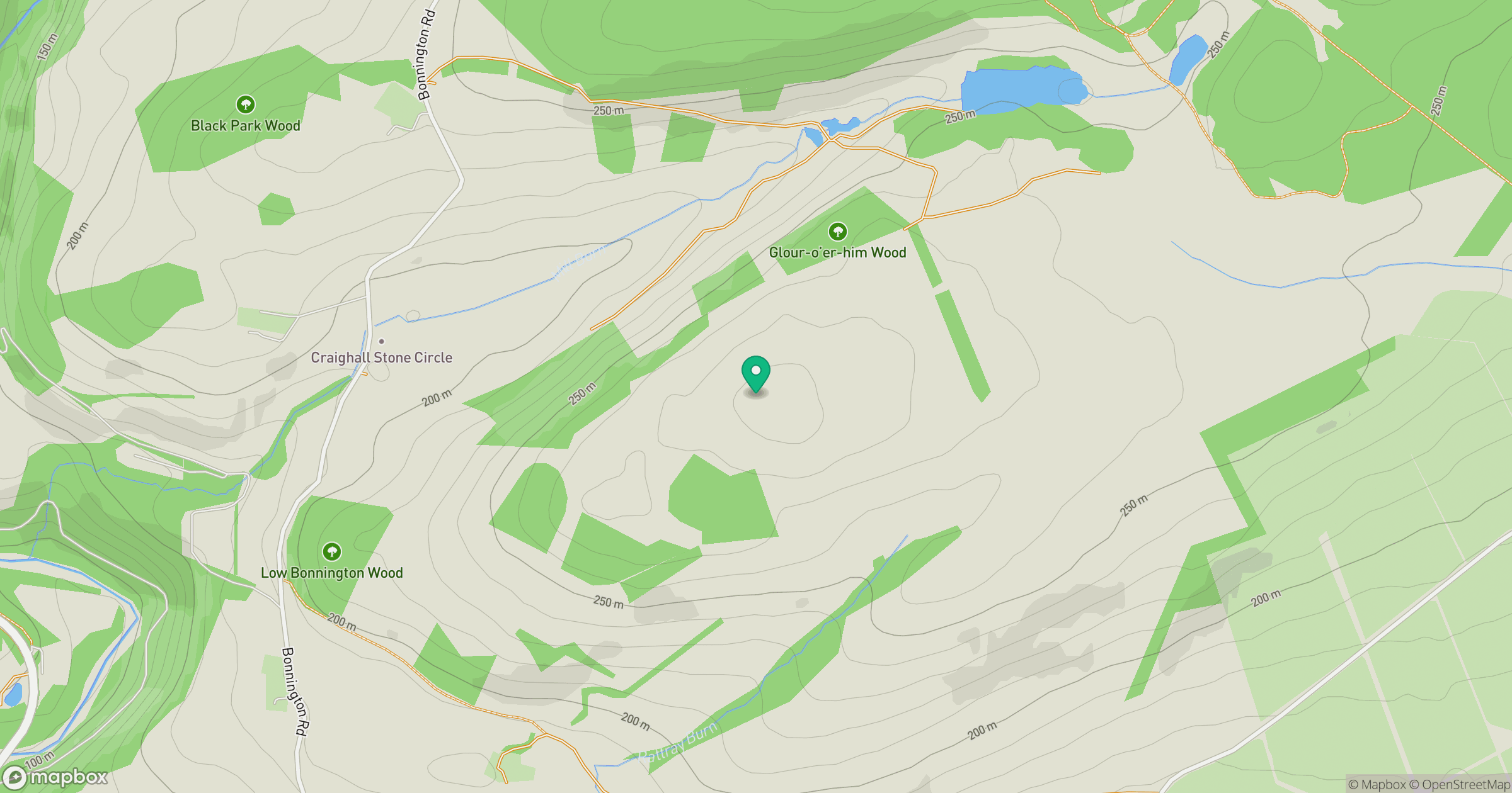
Grid reference: NO192479
View on OpenStreetMapOpens a map in a new tab, centred on the hill.
Hills within 30 km
Straight-line distance, not a walking route or confirmation of access.
No comments yet. Be the first.